Offset sailing line

The friendliest place on the web for anyone who enjoys boating.
If you have answers, please help by responding to the unanswered posts.

Pack Mule

TF Site Team
Joined
Jan 24, 2013
Messages
3,749
Location
USA
Vessel Name
Slo-Poke
Vessel Make
Jorgensen custom 44
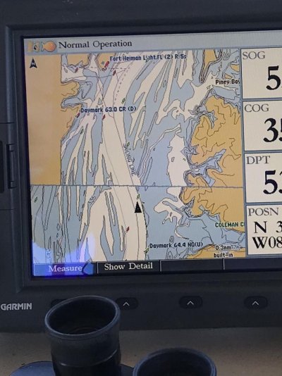
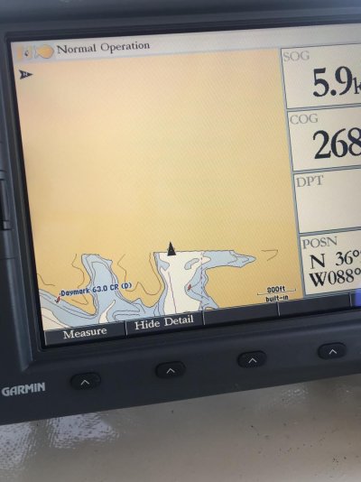
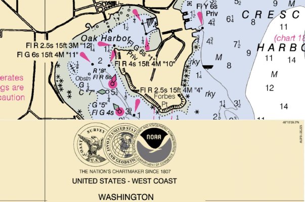
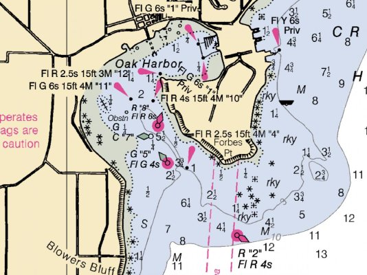
I just replaced my old Garmin 3210 with a later version and newer map . I’m getting this offset in a couple of areas. The newer version shows buoy in secondary channels. My older version does not have this weird offset. Any idea what might be happening?
 

Attachments

  • AFF9CFD0-D48F-45E1-A60E-01941F02D35A.jpg
    AFF9CFD0-D48F-45E1-A60E-01941F02D35A.jpg
    134.5 KB · Views: 59
Another issue with map just ending at a page outline. This cove extends another 3/4 mile at least .
 

Attachments

  • 9C8F9098-47D9-4DF6-AD4E-0CEA96F7FB82.jpg
    9C8F9098-47D9-4DF6-AD4E-0CEA96F7FB82.jpg
    112.5 KB · Views: 45
I'm not familiar with Garmin plotters. But I have seen issues like this in PC based software plotters. When I observe the issues you are facing I turn off chart quilting and all is good. Any single chart displayed for the area will be displayed accurately, the boat's position plotted accurately and routes and waypoints displayed accurately. It's a bit of a PIA to have to manually select charts in the troubled display area, but it works.

Here's an example from my back yard. OpenCPN displaying NOAA raster charts. With quilting enabled OpenCPN choosed a poor overlay near the entrance to Oak Harbor and some zoom scales.

Garmin should address this, but for now, if you can turn off quilting you may have a work around.
 

Attachments

  • Quilting gone wrong.jpg
    Quilting gone wrong.jpg
    134.5 KB · Views: 40
  • Quilting off.jpg
    Quilting off.jpg
    156 KB · Views: 43
Talked with Garmin today. They say it's basically a map issue and unfortunatley they donot offer an up graded map for this model. I went back with my old unit for the time being. I can deal with not have having secondary buoys. When the water level goes back up in the spring I guess could just lay tracks, spot the buoys that are there and label the route.
 
Last edited:

Latest posts

Back
Top Bottom