Canadian Charts

The friendliest place on the web for anyone who enjoys boating.
If you have answers, please help by responding to the unanswered posts.

bobc

Senior Member
Joined
Apr 6, 2011
Messages
147
Location
US
Vessel Name
Note by Note
Vessel Make
34 DeFever
What do people do for Canadian charts?

I'm trying to figure out a reasonable way to equip the boat with charts for Western Canada, San Juans to Desolation, for example.* Is there any cost-effective way to do this?*

I like using OpenCPN, but as near as I can tell, it's not supported.* It also seems that you can't have raster charts without also carrying paper charts.* Really?* If you use the BSD charts, what program do you use?

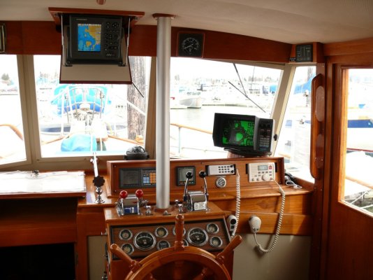
I was thinking about upgrading my chart plotter so that I can also add radar.* Does support for Canadian charts figure into which product I should select?
 
For starters, here is the official web site for the Canadian paper charts. (I thought I'd drill down a bit for you; there is a lot of other info available if you back out).

http://www.charts.gc.ca/charts-cartes/paper-papier/index-eng.asp?region=PAC&step=1&list=true&by=CatalogueList#h2

*

The ones that I have found most useful for the area that you are looking at are:

#3312 Jervis Inlet and Desolation Sound - Book of Nautical Charts. $88.00

#3313 Gulf Islands - Book of Nautical Charts. $88.00

These books are reasonably sized for use under way I find.

If you can find them, strip charts for the Gulf Islands and Sunshine Coast are very manageable at the helm. Sorry, I don't know their #s; they may not be published anymore.

I'm not at the boat at the moment so can't say for sure if these charts (the books) cover everything you need; I suspect there may be a stretch between the Gulf Island book and the Jervis book that isn't covered.

If you are looking for a plotter, any of the more popular ones will accomodate the Canadian waters you are looking at. But which plotter is best is a whole other topic!

I hope this helps.*
 
Thanks, Conrad.* This is a big help.* I didn't know about the atlas versions.
 
You should be able to find CM93 charts online that will work with OpenCPN.
 
I haven't been able to find the CM93 charts. Anyone have a copy?
 
The old strip charts of the gulf Islands and the Sunshine coast are no longer published (haven't been since the 3312 and 3313 came out years ago) but if you can find an old set, cover the coast, uninterrupted, from Victoria to Nanaimo on the west side of the Strait, and from Port moody to Desolation Sound on the east side. All in a reasonable scale. 3312 and 3313 are next best. Then the full size charts, always available in small shops as you go up the coast.
Plotters that use C-Map will use a chip of the entire coast of BC, no gaps. When I bought one, $175 for the lot in Steveston Marine.
 
Last May (2011) I was able to pick up a set of the Sunshine Coast strip charts at the Marina office in Secret Cove. They had a number of them on the shelf, so there may still be some available either there or elsewhere.

Very handy I found - so manageable at the helm.
 
We carry one of the Canadian Atlases and several large scale paper charts but we navigate using OpenCPN and the CHS electronic raster charts. I don't think the Atlas meets Canadian legal requirements - I believe we are required to have the largest scale chart available for the area or "extensive local knowledge". In short I don't think that we are legal much of the time but I don't lose any sleep over it either.
 
The "Books of Nautical Charts" are legal as far as I'm aware, since they are provided by the Canadian Hydrographic Service. There are many "Atlases" out there that are not legal however, but invariably you see the "Not to Be Used For Navigation" notations on them.
 
bobc wrote:
What do people do for Canadian charts?
*For electronic charts we use C-Map in all three of our plotters.

For paper charts we have the large spiral-bound chart books (like Maptech).* There are several of these chart books for BC.* We have the ones for the Gulf Islands, the Sunshine Coast, and Desolation Sound.* They are legal for navigation for the reason Conrad stated, as are the similar chart books for Puget Sound/San Juan Islands.

However there are "gaps" between the waters covered by the chart books, so we have the full-size CHS paper charts to cover those gaps.* The east coast of Vancouver Island between Nanaimo and Campbell River, for example, is not covered in any of the chart books, at least no in detail IIRC.* So we have the separate paper charts for that area.

The chart books are great because we can keep them at the helm station. The only thing of value we ever got at a boat show was back in 1999 when we bought MapTech's now-discontinued (I think) chart board which is designed to hold their chart books.* We have since modified it to sit next to the helm console.* We navigate with two full-size GPS chart plotters but we like having the paper charts at the helm, too, as it gives us a better immediate "big picture" than having to zoom around on the plotters.

I've posted this shot several times before but you can see the modified MapTech chart board and chart book to the left of the helm console.* Fortunately, all the chart books--- Canadian and US--- are the same size so they all fit on the board.
 

Attachments

  • helm.jpg
    helm.jpg
    177.4 KB · Views: 163
Thanks everyone for their suggestions. I'll likely get the two atlases and the Sunshine coast strip chart #3311, which is still available .

I'm still trying to figure out what to do for electronic charts. I like using OpenCPN, but that doesn't seem to be an option. I don't want to buy charts for two plotters (upper and lower helm), which is why I use a laptop for upper and lower, and a dedicated (backup) plotter for the lower.

Anyone use Coastal Explorer? It seems to work with C-Map DVD's and there appears to be a deal where the software and maps can be installed on 2 or 3 computers. I was surprised that there's a radar option as well. This could be pretty cost effective as the radar is $3k and the software is $400. You can then use the laptop of your choosing. I have a used Panasonic c-29 Toughbook that I bought just for the boat. They're rugged and can be purchased for under $400.

There really seems to have been an uptick in boat-network products this year. Still, I don't think I want to use a tablet on the boat as a piece of operational equipment, and I can't imagine why I'd want to look at an engine tack on a smart phone. Sounds dumb.
 
Bob,*

*

The CHS raster charts will work with openCPN.* Here's a link to PAC02 which covers the entire east coast of Vancouver Island.* List price $174.95 CDN

Doug Beech


-- Edited by Doug on Monday 5th of March 2012 11:35:00 PM
 
bobc wrote:
I'm still trying to figure out what to do for electronic charts. I like using OpenCPN, but that doesn't seem to be an option. I don't want to buy charts for two plotters (upper and lower helm), which is why I use a laptop for upper and lower, and a dedicated (backup) plotter for the lower.*
*
I use the CHS electronic raster*charts with OpenCPN.* You need to install the BSB4 plugin for them to work.
 
I purchased a Standard Horizon CP590 plotter yesterday, and was informed by the shop owner that you can use an ipad to operate the primary unit remotely and wirelessly, and also serve as a second unit for flybridge use. I will look into this further.

One of the reasons I chose the Standard Horizon was that it includes all US and Canadian charts.*
 
Carey wrote:
I purchased a Standard Horizon CP590 plotter yesterday, and was informed by the shop owner that you can use an ipad to operate the primary unit remotely and wirelessly, and also serve as a second unit for flybridge use. I will look into this further.

One of the reasons I chose the Standard Horizon was that it includes all US and Canadian charts.*
That looks like a nice unit.* I hope* you'll let us know how it works out.*

When I took a look at it, it wasn't clear how you would contol it with remotely.* That model doesn't seem to have WiFi like the newer units, but even with WiFi, the newer units don't seem to do anything useful with it -- unless you think that browsing the web on a chart plotter is useful.
 
Bob

I'm not so sure about the wireless remote operation from an ipad myself, having looked over the manual at some length. I will have to get with my supplier and see if I confused statements made about another model with that of my model. I'll let you know.

Never the less, the ipad connection wasn't even part of my original decision to buy this model. It was more one of economy and user friendliness. I won't recieve the actual unit until next week. Also doing my semi-annual haulout next week.
 

Latest posts

Back
Top Bottom