PNW Vacation Cruise

The friendliest place on the web for anyone who enjoys boating.
If you have answers, please help by responding to the unanswered posts.
Nice write ups Jeff. I am so happy for you guys fulfilling your dreams. How many times have you sat in PA looking out the window dreaming of being out there, Have fun.
 
Johnstone Strait

We spent the night in an unknown bay inside of Sprout Islet, Hanson Island. It is exposed to the north, but the passing cruise ships (2) and Alaska Marine Highway ferry did not cause much wake. It was VERY quiet.

Another calm day in Johnstone Strait today. Passing Havannah Channel now, headed to Port Neville with our friends on KISMET.

We had some thick fog this morning. Victoria Traffic contacted us to make us aware of some relevant traffic...very professional. It is all cleared up now and we can see 22+ miles.
 

Attachments

  • D7A2F878-108A-4715-A52C-889A1B134B0C.jpg
    D7A2F878-108A-4715-A52C-889A1B134B0C.jpg
    127.4 KB · Views: 81
Following and enjoying your write ups.
 
Thank you. We plan to visit Comox around Wednesday.
 
We spent the night in an unknown bay inside of Sprout Islet, Hanson Island. It is exposed to the north, but the passing cruise ships (2) and Alaska Marine Highway ferry did not cause much wake. It was VERY quiet.

Another calm day in Johnstone Strait today. Passing Havannah Channel now, headed to Port Neville with our friends on KISMET.

We had some thick fog this morning. Victoria Traffic contacted us to make us aware of some relevant traffic...very professional. It is all cleared up now and we can see 22+ miles.


Interesting.

We anchored there last year & were hammered by the cruise ship wakes.

-evan
 
We had some thick fog this morning. Victoria Traffic contacted us to make us aware of some relevant traffic...very professional. It is all cleared up now and we can see 22+ miles.

Do you participate in VTS?
 
IRENE, I thought that might have been you in Waddington when we passed by on our way to Lady Boot Cove. We should have stopped. Lots of rain the last few days. Dead calm this morning on the way to Drury Inlet.
 
In Comox there are two marinas side by side, public and private, if you have reciprocals you might be able to stay in the private one. My boat, if it ever gets done its refit, is moored in the private marina.

I can't vouch for it, but Maritine's Bistro was suggested as a good place to eat in Comox by Pacific Yachting in the July 2019 issue. Its suppose to be a roughly two minute walk from the marinas.
 
Sunday Update

We spent last night in Cameleon Harbor at Sonora Island. There was a bunch of rain after we arrived, but the napping went as normal. We took the Pug ashore last night, and she went in the water looking for the perfect rock to put in her mouth. There was possibly a big algae bloom in the harbor...disturbed water behind the boat was bright red. If anyone can explain further, we would appreciate it.

Today we departed on schedule to run Dent Rapids and Gillard Passage. We are now moored at Big Bay, Stuart Island.

There has been rain, but no big wind or waves. Today is the warmest as there is no wind as I write this.

Aside from snagging our anchor buoy with the port stabilizer, we have experienced no problems. I rectified that at the dock without using my mask and fins :thumb:
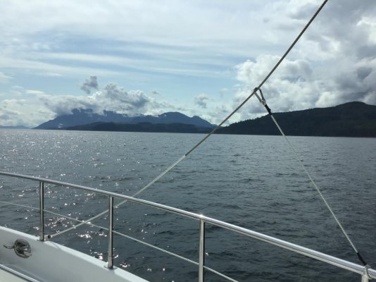
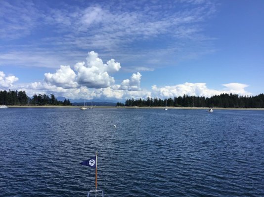
. No lines were harmed.
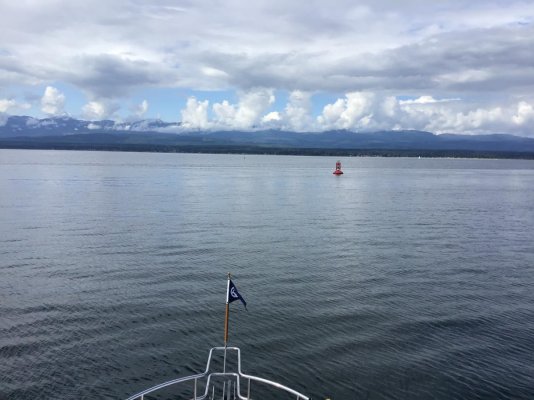
 

Attachments

  • BBC5B480-C71A-4C68-861A-30E79CF0C684.jpg
    BBC5B480-C71A-4C68-861A-30E79CF0C684.jpg
    105.7 KB · Views: 72
Port Neville and Johnstone Strait

We were in Port Neville 2 nights ago. We had a nice dinner with KISMET. Saturday morning I had a good paddle and saw another brown bear.

The run in Johnstone Strait to Nodales Channel was smooth. We saw up to 12 knots and enjoyed observing the way the flood developed as we traveled with it

Photo at the junction of Johnstone Strait and Discovery Passage off Chatham Point.
 

Attachments

  • E979E174-E60B-4922-9161-FFAAF718A053.jpg
    E979E174-E60B-4922-9161-FFAAF718A053.jpg
    147.3 KB · Views: 74
I'm wondering if the red was red tide, not a good thing. If it is red tide it might affect your pet if exposed to it too much, not sure, just conjecturing.
 
Thanks rsn48. Some sailors near us thought the same. Our on-board medical director said it is a neurotoxin and fairly quick acting. Pug has been eating and sleeping all day, so apparently she is fine.

Attached is a photo of the property at Big Bay. It is very well maintained and has beautiful views. Dave the dockmaster is great.

This afternoon we circumnavigated Stuart Island in the tender. Shortly after departure, we were greeted by 3 Dalls Porpoises playing close to our boat. The water was clear as an aquarium, so this was a treat to watch. We ran Arran Rapids on the flood, which was fun. The Bute Inlet side of the island was spectacular, complete with the glacial melt water. It was flat and there was little wind. Hopefully the boss now realizes that we need to double the horsepower on the tender. :)
 

Attachments

  • F9CB77A4-B353-4CD7-9BCB-4669AD8A1771.jpg
    F9CB77A4-B353-4CD7-9BCB-4669AD8A1771.jpg
    193.9 KB · Views: 79
Where I lived in Indian Arm (in Greater Vancouver area) in Deep Cove, every summer we would get red tide warnings posted around the beaches. But I have never seen it as red as you described it.

The general rule is that any month with an "r" in it is safe, if no "r" the water may or may not be safe.
 
Southbound

Departed Big Bay this morning. Saw lots of eagles and some Orca off in the distance. We are anchored in Drew Harbor, Quadra Island. The weather is perfect.
 

Attachments

  • 35646DB9-88C7-4238-B823-7DC481F847D8.jpg
    35646DB9-88C7-4238-B823-7DC481F847D8.jpg
    129.6 KB · Views: 65
  • 05505AB3-17B5-4745-A47D-CC05C1818273.jpg
    05505AB3-17B5-4745-A47D-CC05C1818273.jpg
    172.1 KB · Views: 64
The amazing thing to me is that after three years cruising that area, I have no idea where any of these places are except for port McNeill
 
We were out of Drew Harbor by 0530. A SE blow is predicted for later today, which aligns nicely with the compulsory Comox layover. Now it is FAC with 8 knots out of the west.
 
We were out of Drew Harbor by 0530. A SE blow is predicted for later today, which aligns nicely with the compulsory Comox layover. Now it is FAC with 8 knots out of the west.

Comox? Really? That's a good distance from Big Bay...

-evan
 
Drew Harbor to Comox is 37 NM on our route. We have slowed down several times for whales. Wind still about 240 at 7.
 
Oops.

Sorry.

I thought you were heading North

My bad.
 
TwistedTree, Quadra Island is beside Cortes Island (West Side), where Squirrel's Cove is (on the East side), I'm betting you remember Squirrel's Cove.
 
Departed Big Bay this morning. Saw lots of eagles and some Orca off in the distance. We are anchored in Drew Harbor, Quadra Island. The weather is perfect.

Your first picture? Tristan? Friends are going to do a leg of Tristan's circumnav of Vancouver Island this summer. Saw her on AIS last week in Gowland Harbour, off Campbell River. Again on AIS she is now at the mouth of Toba Inlet.
 
Last edited:
Comox

Today we will remain in Comox. The wind is officially howling. We have some more shoreside exploring planned, some logistics, and maybe a boat to wash.

Yesterday we explored Comox on foot and went up the Courtenay River in the tender. We had a fine dining experience at the Blackfish Pub - they absolutely NAILED everything. We have been eating very well on the boat, so this was not a case of “first time out” in a couple of weeks.
 
Crossing the Comox Bar

Picture headed east to west.
 

Attachments

  • B04B999D-9E69-46A3-95C7-D19FF94E4BBE.jpg
    B04B999D-9E69-46A3-95C7-D19FF94E4BBE.jpg
    127.1 KB · Views: 58
Baynes Sound

Headed south along the west side of Denman Island, approaching the cable ferry :eek:
 

Attachments

  • D686A883-411D-40DE-BECE-754FB477CE08.jpg
    D686A883-411D-40DE-BECE-754FB477CE08.jpg
    127.2 KB · Views: 56
Cable Ferry

Lights on shore (red or green) were clearly visible. Ferry displayed RAM.
 

Attachments

  • 87E33830-3DF2-4215-BC06-F7EE6FA9C67A.jpg
    87E33830-3DF2-4215-BC06-F7EE6FA9C67A.jpg
    99.1 KB · Views: 59
  • 2D4BFA2E-CE59-4115-8E86-063B019FDC3B.jpg
    2D4BFA2E-CE59-4115-8E86-063B019FDC3B.jpg
    92.3 KB · Views: 53
Jeff,
You mean that ferry drags a cable under the water?
Wonder how deep? I just watch the lights and stayed way out of the way.
What do you (or anyone else) know about that cable?
 
Jeff,
You mean that ferry drags a cable under the water?
Wonder how deep? I just watch the lights and stayed way out of the way.
What do you (or anyone else) know about that cable?


Yes, the ferry moves back and forth across via a cable. I'm not sure of the depth of the cable. I assume that the cable is just below water level between the ferry and the shore it is headed towards. It would hang much lower aft of the ferry.


It is a bit nerve wracking to be going towards the ferry with that green light in view. The last time I was pretty close to the ferry crossing when it turned to red. I immediate cut power and put the boat in reverse to stop and hold against the current as the ferry went by.
 
Hornby Island

Anchored in Tribune Bay. Paravanes deployed. Not crowded. Nice sandy beach at low tide. Will depart here at dark tomorrow and return to Sequim Bay on Saturday afternoon - about an 18 hour trip.

Squall approaching, had a gust to 18. Bring it.
 

Attachments

  • D56942AB-7CB5-4C8E-B322-643606B0D0AE.jpg
    D56942AB-7CB5-4C8E-B322-643606B0D0AE.jpg
    81.4 KB · Views: 52
Back
Top Bottom