Paper Charts

The friendliest place on the web for anyone who enjoys boating.
If you have answers, please help by responding to the unanswered posts.

xfedex

Senior Member
Joined
Apr 5, 2010
Messages
131
Location
usa
Vessel Name
Fluke
Vessel Make
Krogen 42
I use paper charts to double check my Nobletec running on a laptop. I do not update the paper IAW notice to mariners. They were accurate in 1984 but not today. *

It is true that buoys have been added and numbers on buoys have changed. I am trying to think of something changing on paper that would really be a need to know item. The substantial relocation of a marker or buoy *would be significant I think.*

My travels are in Washington and British Columbia.*Am I in the minority as far as not religiously updating paper charts?
 
Judging from my sales of paper charts I'd say you're in the minority for even having a paper chart. Your charts were not accurate in 1984. Charts have errors on them the day they are printed. You just have to be aware of that and keep your eyes open. Don't forget that electronic charts have errors also. That said, if I was going somewhere I wasn't familiar with, I'd want a fresh chart.
 
My chart porfolio for our cruising waters includes charts dated back as far as 1964, and includes charts dated 2011.

Every year we buy a select number of new paper charts to add.

Of course, it's important to understand that basically the rocks/reefs do not change, but the ATON'S might.*

So the navigation challenge is to compare all charted aids with observed aids, and then make a quick correction, if required.* What happens is that this process greatly*improve situational awareness, which has a positive effect on safety.

So, the answer is that paper charts are not kept up-to-date until used.* Our electronic charts are updated weekly (at least for US waters).
 
Jay N wrote:
My chart porfolio for our cruising waters includes charts dated back as far as 1964, and includes charts dated 2011.

Every year we buy a select number of new paper charts to add.

Of course, it's important to understand that basically the rocks/reefs do not change, but the ATON'S might.*

So the navigation challenge is to compare all charted aids with observed aids, and then make a quick correction, if required.* What happens is that this process greatly*improve situational awareness, which has a positive effect on safety.

So, the answer is that paper charts are not kept up-to-date until used.* Our electronic charts are updated weekly (at least for US waters).
*But previously uncharted rocks/reefs are still being found..........
 
xfedex wrote:

My travels are in Washington and British Columbia.*Am I in the minority as far as not religiously updating paper charts?
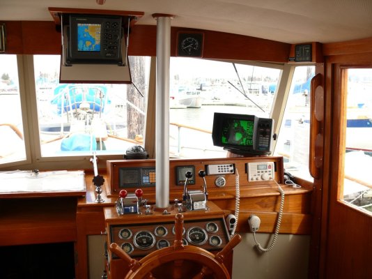
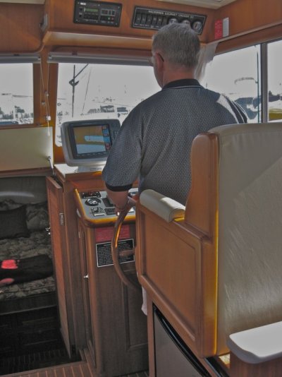
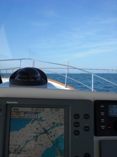
Don't know.* But we use paper charts at all times when we're cruising, along with our two large dedicated GPS chart plotters and the radar.* We do not update the charts as land masses don't move much around here and it's been our experience and observation in this area that navaids---on shore or in the water--- rarely change.

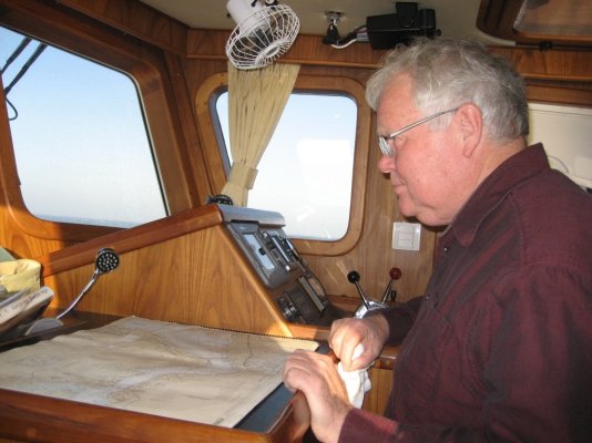
We have a chart board next to the helm that holds the big MapTech format chart books we have for Puget Sound, the Gulf Islands, Sunshine Coast, Desolation Sound, etc.* Plus we have all the full size NOAA and Canadian charts for the entire area from the San Juans up to Queen Charlotte Strait rolled up and stored in the aft cabin.* We rarely use the full-size charts unless we're in an area not covered by one of the big chartbooks.

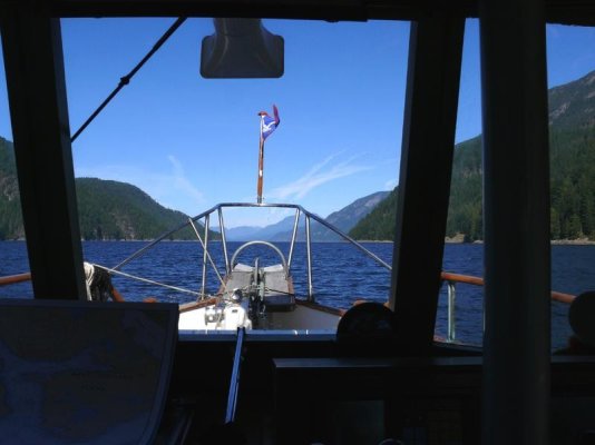
We like having the paper charts at the helm because we can get the "big picture" in an instant without having to zoom in or out, and there is less clutter on the paper charts than on the electronic charts displays simply by virtue of the size difference.*

We do not plot courses except for those that we use frequently, and we plotted them on the paper charts years ago.* But having these courses on paper is a good backup in case the electronics go down, which they never have in the 13 years we've owned the boat.

So while our primary means of navigation are the two plotters, the radar, and the compass, we do find the paper charts useful on almost every cruise.

Both my wife and I like and are very much at home with paper charts, me from flying and my wife from both flying and her stint in the Navy.* So we just like having them around.

To someone who doesn't like messing with paper charts, or doesn't like them, or doesn't believe in them, the reliability of electronics these days makes it very unlikely that a failure will leave a person blind.* So I don't have any issue with people who say they don't have any paper charts on board and use only electronics.

But 
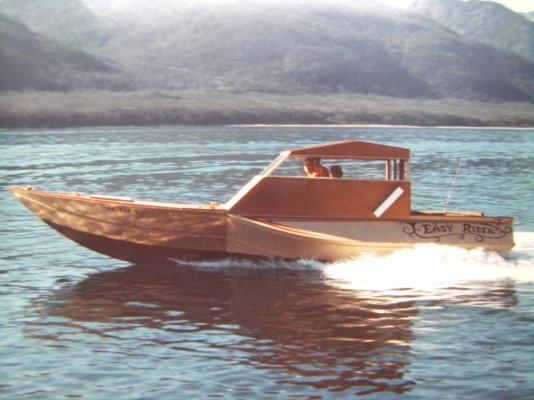
we wouldn't take the boat out--- actually either boat because we use paper on the Arima, too, along with its GPS plotter--- without having the paper charts with us.
 
In coastal areas we use the paper charts , and at displacement speeds its no bother to x the old buoy number and write in the new one.

A small hand held GPS gives position and route .

Some ICW charts from the late 60's have 5 or 6 re-numberings per location , but then we don't travel every year.
 
FWIW, there are several completely new, and much higher quality, charts for the central BC coast in the last several years.
 
What the hell?* Doesnt anyone here use Notices to Mariners??


I would assume ( I know makes an ass out of U and me ) that everyone on this thread uses* the internet once in a while.* Doesnt anyone receive CHS Notices to Mariners ? *They will email you with changes to CHS charts.


Try checking out :


http://www.notmar.gc.ca/


http://www.dfo-mpo.gc.ca/notices-avis-eng.htm


*


Fill out the email forum for personal notification of changes on the water and changes to charts:


http://www.notmar.gc.ca/search/mycharts-eng.php


*


Use the lists on the LHS of the pages above to get updates to charts you already possess.


Click on the Chart No. (underlined) on the list below, to make sure you are looking for the chart you want:


http://www.charts.gc.ca/charts-cartes/paper-papier/index-eng.asp?region=PAC&step=1&list=true&by=CatalogueList


*


For Washington and SEA boaters:


http://www.nauticalcharts.noaa.gov/staff/chartspubs.html


List of Charts to view:


http://www.charts.noaa.gov/OnLineViewer/PacificCoastViewerTable.shtml


http://www.charts.noaa.gov/OnLineViewer/AlaskaViewerTable.shtml


*


Yr Wlelcome!


Old_Surly to bed Yadda-Yadda
 
I own paper charts from Texas to Maine and will bring them with me for a delivery, they are old and do not have all the updates but I can use them for planning much easier than a plotter. Many of the boats I am moving will have newer paper charts, but I like to use my own personal charts because I have written many comments about the Intracoastal, about shoaling areas, changes of markers, good restaurants, bridge clearances and names, and more.


-- Edited by yachtbrokerguy on Friday 6th of January 2012 11:59:43 AM
 
Around the SF bay we rarely break out the paper charts.*

In the Delta last summer we always had a paper "chart" out.* I have "chart" in quotes as we notced after we started using it that it was marked "not for navigation".* This is one of those Maptech ones that folds up like a map you'd have had in your car back in the day.* I have already been shopping for NOAA CHARTS of the area for when we go back this summer.* I was looking at the Print on Demand which seem to be as up to date as anything is going to be.* Many times the GPS/CP was enough off to get us in trouble if we weren't watching the paper as well.*

If I was going somewhere new to me I would definitely want recent*paper charts to cross reference with my GPS/CP.

Depending where we are going we will check for notice to mariner info.* in particular there is a sometimes gaurded exclusionary zone on the way to the delta at the Naval Weapons depot.* We check if the zone is in force and how the alternate channel is marked (yuo have to go outside the regular channel to stay outside the zone).* Young people with large guns will come over and yell at you if you are not in the correct place.
no.gif
 
tinped wrote:
what about wrecks?
Since we're usually in water that's 200-600 feet deep, a wreck is not something we lose any sleep over.* We have boats that go up on the rocks now and then but since we don't make a habit of navigating through the same rocks, their fate is of no consequence to us.* And*most if not all of these boats are eventually recovered one way or the other.

If I recall correctly the water under our keel when I took the attached photo was some 800' deep.* And it was probably 100' deep a boat length or two from either shoreline.* So wrecks don't seem to pose any sort of navigational issue around here, at least not that I've ever heard.


*


-- Edited by Marin on Friday 6th of January 2012 03:20:36 PM
 

Attachments

  • 05-toward vondonop 1.jpg
    05-toward vondonop 1.jpg
    58.7 KB · Views: 98
Pineapple Girl wrote:
*I have "chart" in quotes as we notced after we started using it that it was marked "not for navigation".* This is one of those Maptech ones that folds up like a map you'd have had in your car back in the day.*
I would have thought with all the boating activity in SFO that there would be a large MapTech-type chartbook available for the bay, river, delta, etc.* The big chart books--- if you have the space to lay them out--- are great.* I've posted this photo before but it shows how our portable*"chart table" fits over the companionway to the forward cabin.* Very handy.
 

Attachments

  • helm station.jpg
    helm station.jpg
    174 KB · Views: 90
what about wrecks?

*

In BC, if the wreck is in a "fairway"* it has to get removed.* Almost everywhere else, as Marin points out, is either a known hazard, so you won't go there, or is so deep that the wreck is of no consequence.

If the wreck is insured, the insurance co will salvage, to determine whether it was an intentional or accidental wreck.
 
Marin wrote:I've posted this photo before but it shows how our portable*"chart table" fits over the companionway to the forward cabin.* Very handy.
* * * * Same here but mine is hinged.
 

Attachments

  • img_3857.jpg
    img_3857.jpg
    109.8 KB · Views: 92
  • img_0170.jpg
    img_0170.jpg
    94.6 KB · Views: 94
Like Marin, we have our paper charts out when we are cruising. Not so much when we are puttering around in local waters. Many, many, many times we refer to the paper charts to view and clarify things that don't show on our plotter or computer, both of which we also have running when under way. You just can't have too much information. Chuck
 
With GPS/charter and radar on, I usually have the paper chart out too.* The paper chart gives me a larger view while the electronic chart has more detail when zoomed in.
 

Attachments

  • chart.jpg
    chart.jpg
    183.8 KB · Views: 81
weebobby wrote:
*
*But previously uncharted rocks/reefs are still being found..........

Even if you have your charts updated weekly, and listen to broadcast notice to mariners (US) and regularly monitor Ch 16 for safety transmissions, you* always run the risk that you will find something that no one else has found.

But the odds are very, very slight, especially in this age of surveying with side-scan sonar, etc.

On the other hand, I am not as trusting of certain SE Alaska charts.* There are still a few that note survey information gathered by the Russians in the 1800's.
 
We use the belt, suspenders, and probably te elastic band system. *When not running radar, we use the second display to display a large area of the chart to keep up with our progress. *The first display is zoomed in to show as much detaiil as possible. *Then there is the paper chart in front of the navigator station under a Lexan cover.
 

Attachments

  • cimg0104.jpg
    cimg0104.jpg
    60 KB · Views: 87
When I designed and built this boat I made the "dashboard" large enough and slanted so I could use a large chart while underway. One can fold a chart in thirds and so you deed'nt "run" right next to a fold, fold it in half also. As for chart storage my Albin had a good recommendation. Under the bunk mattress. But they will get a little black mould on them in damp places like SEA over time.

Eric
 

Attachments

  • sth71821.jpg
    sth71821.jpg
    158.7 KB · Views: 96
Marin wrote:Pineapple Girl wrote:
*I have "chart" in quotes as we notced after we started using it that it was marked "not for navigation".* This is one of those Maptech ones that folds up like a map you'd have had in your car back in the day.*
I would have thought with all the boating activity in SFO that there would be a large MapTech-type chartbook available for the bay, river, delta, etc.* The big chart books--- if you have the space to lay them out--- are great.* I've posted this photo before but it shows how our portable*"chart table" fits over the companionway to the forward cabin.* Very handy.

*The boat came with good charts of everything in the bay except the delta itself so we didn't really need the book.* Plus we are usually on the flybridge and will fold the chart back to just show where we are.* the book seems like it might be a bit unwieldy up there but maybe not.* I am leaning toward the NOAA POD charts of the delta--think there are 3 or 4 that we need--but I will also see what "chart books" I can find of that area and how recent they are...
 
Pineapple Girl wrote:Marin wrote:*Plus we are usually on the flybridge and will fold the chart back to just show where we are.* the book seems like it might be a bit unwieldy up there but maybe not.
*When we first got our boat we tried running from the flying bridge a few times until we both decided we didn't like it.* And you are right--- the big MapTech chartbooks can be a bit of a handful in the open like that.* We bought MapTech's portable chart table (same one we later modifed for use down below) and this helped to a degree but it was still an unwieldy situation.

You are probably better off doing what you do, folding a chart to be a manageable thing.* But for down below out of the wind and weather the chartbooks are great we think.* Everything in one package, so to speak.
 
Pineapple Girl wrote:

*When we first got our boat we tried running from the flying bridge a few times until we both decided we didn't like it.**

Funny, we always run the boat from the flybridge unless it's raining or too cold.* We like the view and the sun when running and the better visibility when passing boats or docking.

As for charts, we use the plotters primarily but we have paper charts and use them for the "big picture".* Measuring progress, selecting an anchoage, etc.* We also carry all the cruising guides for the area we are in at the time.* These help us identify possible trouble spots and help with choosing anchorages, marinas, and fuel stops.
*
 
rwidman wrote:
* We also carry all the cruising guides for the area we are in at the time.* These help us identify possible trouble spots and help with choosing anchorages, marinas, and fuel stops.
*

*Great point, Ron. *We also carry the cruising guides as well. The Active Captain website database is getting very good for referring to actual cruisers experiences with marinas and anchorages. *The resources we have today are phenominal. *Fuel prices are available on the Waterway Guide website and the Cruisers net website. *
 
For reason covered earlier, we use the big Maptech SF Bay book along with our electronic plotter. *We got a see-through soft plastic zipper case to hold the book. It was made for this. It keeps the chart book on the right page and protects them from liquids and wear and tear. *It's always popular with company on board allowing them to understand the plan, see things along the way, etc. without me having to fuss with the plotter.
 
If piloting from the lower helm, I have the full size of my computer screen, displaying the CHS chart, with the boat centred in the screen. For areas that are relatively new to us, I have a complete selection of paper charts hanging nearby, folded in half. If piloting from up top (preferred, and more common, as we cruise more and more in a fair weather area), I have a crappy Humminbird 5" display, showing CMap charts, with the boat centred. Because visibility is so good, I rarely take a paper chart up top, but go below to pilot through anything tricky, with all the bigger aids handy. I also have radar below. If the weather compels me to go back outside, I have the complete chart books, which go up top more handily than full size charts, and I have the old series of Gulf Island and Sunshine Coast strip charts, that are the handiest of all. Too bad those have been discontinued. I will look after mine and use them till they wear out.

The Humminbird moves to the dinghy when moored, but there, no paper charts, as the environment is too hostile. If ever I take a chart along, the 20 knot wind and frequent salt douche will finish a paper chart in one trip.

I have been, and will continue to look for a wide screen slave display for my computer that can go up top, but all I have seen to date cost too much. With the modern technology, the aids we now treat as the minimum required are phenomenally better than what I grew up with.

At a social gathering on the weekend I was reminded of my early experience on a salmon troller, in the summer of 67. We had Radar, SSB radio, Loran C, RDF, CB radio, Autopilot, Paper recording Depth. The boat was new then, so stood out as well equipped for the time, but no GPS, Computer, daylight visible radar screen, VHF, AIS, Fishfinder, FLIR, EPIRB, etc. Some of the places we went weren't charted since Capt Vancouver in 1778. Now there are very few "white areas" on CHS charts.
 
rwidman wrote:

Funny, we always run the boat from the flybridge unless it's raining or too cold.

We also carry all the cruising guides for the area we are in at the time.
*

*Everybody has different preferences.* While the view is nice we hate the sight picutre from up there in terms of maneuvering the boat-- we both do a much better job of docking and close-in maneuvering from the lower helm.* We find it much easier to judge the positon of the boat from down below than up above.

All our "heavy duty" navigation systems are at the lower helm--- radar, GPS plotters, etc.

Also, neither of us likes being "disconnected" from the boat by operating up above.* Down below we can hear, feel, and smell what's going on in the engine room and the rest of the boat.

Deck access from down below is immediate if the person on deck needs a hand.

And finally, even if the above comments were not applicable, the day we averted a boat fire underway by being at the lower helm and smelling it from the instrument consol-- the boat's old hailer/intercom overheated so much it was starting to char the wood around it) convinced us to never run the boat from above again.* If we'd been up top, the first clue there was a problem would have most likely been the flames.

We use cruising guides as well.* The most useful in our opinion are the Dougass Guides.* Second most useful is the Waggoner Guide (now published by Fine Edge).* We also have the relevant US and Canadian sailing directions books on board and use them, too, if we are going someplace new or want to review information about someplace we haven't been in awhile.


-- Edited by Marin on Monday 9th of January 2012 01:24:36 PM
 
I'm with Marin regarding flying bridges and made it a point not to acquire a boat with one.* This is only a personal preference.
 
markpierce wrote:
I'm with Marin regarding flying bridges and made it a point not to acquire a boat with one.* This is only a personal preference.
*A far better configuration than a flying bridge, in our opinon, is a raised pilothouse.* You get the best of both worlds that way--- better visibility with connection to the boat and fast and easy access to the deck if needed.
 

Latest posts

Back
Top Bottom