ralphcramden
Veteran Member
heading south in october. anyone have a recommendation for a good intracoastal state by state guide book for ny to florida? thanks.
If you're looking for a book for navigation and Anchorage proposes, you will be better off getting more up to date information from online sources such as Active Captain and Waterway guides websites.
Ted

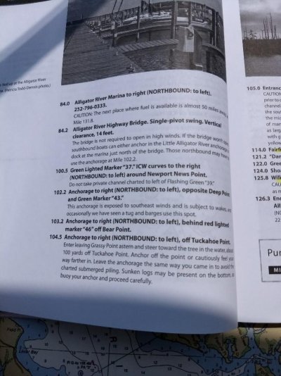
I will use a moveable pointer on the chart such as dividers or a screwdriver etc., to mark my progress every so often so I can see where I am.
On our AICW trip from Annapolis to Marco Island, FL, we relied on: 1) the Active Captain overlay on Garmin Bluechart Mobile,
2) Our Raymarine Chart plotter, and 3) An AICW chart book of smallish pages, spiral bound.
Unfortunately, Garmin has discontinued their Bluechart Mobile app. I suppose that they wanted to eliminate a low-cost alternative to their full MFD's. I'm currently looking for a good substitute, but it must be Active Captain capable.
How so?
Time from gathering, compiling info, sending to publisher, distribution, sitting on retailer's shelf. How current can it be?
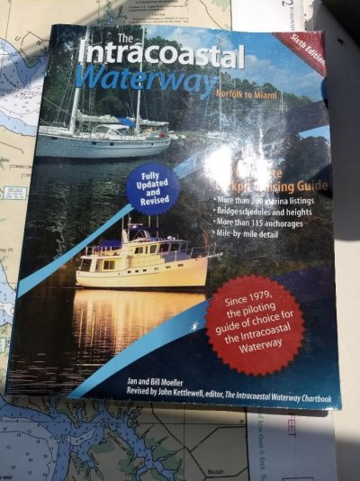
I would suggest that you look into Bob Scherers book 2018 ICW CRUISING GUIDE. It's available on Amazon at www.amazon.com/2018-ICW-Cruising-Gu...33036959&sr=8-20&keywords=2018+Cruising+Guideheading south in october. anyone have a recommendation for a good intracoastal state by state guide book for ny to florida? thanks.
Time from gathering, compiling info, sending to publisher, distribution, sitting on retailer's shelf. How current can it be?
Time from gathering, compiling info, sending to publisher, distribution, sitting on retailer's shelf. How current can it be?
But as a Prudent Mariner, you do need printed material, too. At some point, your iPad will run out of charge or you'll lose contact with shoreside Internet (probably in North Carolina). The old standby ChartKits are still my favorite for paper charts as backup now that the Kettlewell series is outdated, but the Guides to Cruising Maryland and Virginia Waters are fine for the Chesapeake. Anyway, I just like looking at paper charts. They are comfortingly familiar, somehow.
Disclosure: I am a long-time writer for SAIL, Waterway Guide and Chesapeake Bay Magazine, largely because I consider them the best.