Great Barrier Reef cruise

The friendliest place on the web for anyone who enjoys boating.
If you have answers, please help by responding to the unanswered posts.
Benn
Enjoy Europe, with luck you will be ahead of the summer crowds! I suspect you are right: Doug has so much work that if you aren't there then some others will get in the queue ahead of your job. Plus its nice to be in the vicinity to get involved with the little decisions that arise.

I'm currently at Urangan, and will leave at the end of the week after collecting the last of my deliveries. I took my daughter and a bunch of her friends out for a day trip yesterday. We went to Kingfisher Bay. The Sand Bar did look to be a nice spot to spend a bit of time at, but we had self-catered on board.

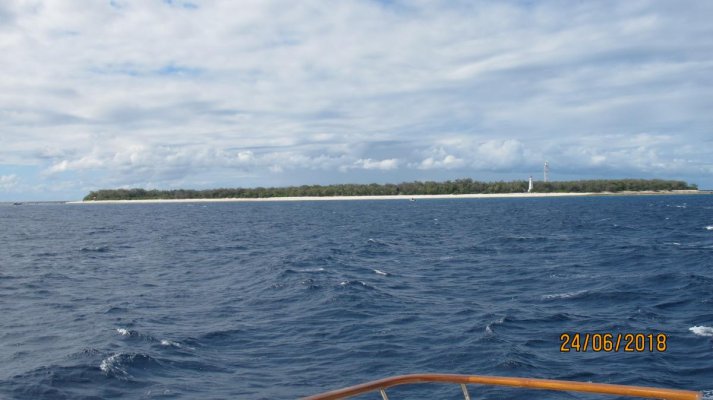
When I leave here I think I'll overnight in the river at Bundaberg and then head for Lady Musgrave early the next day. The plan is to arrive in the middle of the day, to give best visibility for dodging the bommies in the lagoon. Last time I was there I left the lagoon early in the morning, and just followed my entry track out. The only problem was the tide was lower, and I scraped some coral on the way out! Just a touch fortunately, but this time I want to set a track that I know has deep enough water for departure at any time. Like you, I prefer the northern end as not many boats go there.
 
Last edited:
Hey Brian. Just remember when you go much further north, you're into crocodile country. Just sayin'. :D
 
Hey Brian. Just remember when you go much further north, you're into crocodile country. Just sayin'. :D

Sure, along the coast in the murky water. That's why I called it a reef cruise - I want to be offshore, in clear water and well clear of the salties!
 
Brian,
Another option for going to Lady Musgrave and one I use most of the time these days is to go to Rooney Point and anchor up , either south side or north side and then depart early morning , I am a bit slower than you and also usually go to Fitzroy Reef, so I go at approx 0200 hrs. Lady Musgrave is only about 70 NM so makes it a good run.
Enjoy
 
Wathoomba Creek is worth anchoring outside of and checking out on the way to Rooney.
Spectacular waterway at high tide.
 
Brian,
Another option for going to Lady Musgrave and one I use most of the time these days is to go to Rooney Point and anchor up , either south side or north side and then depart early morning , I am a bit slower than you and also usually go to Fitzroy Reef, so I go at approx 0200 hrs. Lady Musgrave is only about 70 NM so makes it a good run.
Enjoy

Leave at 0200? That might be ok for you, but I'm old & fragile, and need my beauty sleep as well! I left from Rooney's last time, but had over 20kn against the tidal current and got tossed around a lot.

Simi, I think that Creek might have to wait until the way home. Bundaberg cuts the overall trip into two easy legs. At this point the plan is a dawn start both days so I can 'ride the ebb tide' north and have gentle tailwinds as well.
 
I have been following your notes with interest. Currently anchored in Cid harbour with time so thought I’d check out your progress. Pretty cool and overcast here. Can see nothing since the 19th.
Look forward to your next update.
Hamo
 
Hi Brian...hope you are travelling well. Curious about what weather forecasting software/services you are using and finding accurate/useful. When we did our Moreton Bay 8-week jaunt, I was surprised at the accuracy of both Windy and PredictWind. I had supposed that they were likely to be poor for the S Hemisphere given most of their users are in N America & Europe...very impressed with both.
 
I have been following your notes with interest. Currently anchored in Cid harbour with time so thought I’d check out your progress. Pretty cool and overcast here. Can see nothing since the 19th.
Look forward to your next update.
Hamo

Ah yes. I ought to have updated a week ago although I have been out of range for internet for the past week.

When leaving Urangan the weather forecast was favourable so I ended up following both Tidahapah and Simi's suggestions. I went over to Wathumba Creek on 23 June. Unfortunately the tides weren't ideal, but I managed to get inside the creek a couple of hours after low tide, and went in for a little way. Definitely a place to visit again. There were 4 seperate boat/camps even in the short section I traversed, no doubt keen fishermen!
This guy nails it:
Wathumba Creek, Fraser Island - Camping, Fishing & Exploring

I then managed to get up to the south side of Rooney's by sunset, and raised anchor at 5am the following day. I had a pretty good run up to Lady Musgrave Is. I did take a swing past Lady Elliot Is on the way. It did not add much distance, and I was curious as to whether there was phone repeater there. There wasn't! So I essentially lost internet not long after leaving Rooney's. Oddly enough, while I was 'trapped' at Lady Musgrave's lagoon for 4 nights while the 20-25kn winds were blowing, I did receive text messages about once per day, at random times. But not enough signal strength for internet or email. I had always planned for a few days there, so being 'trapped' was no hardship. Just a bit of rolling around at high tide as the winds brought a bit more water than usual across the fringing reef to the lagoon. For those wondering, the islands I refer to are generally recognised as the southern end of the Great Barrier Reef. So I finally got to the starting point in terms of the thread title!
https://www.ladyelliot.com.au/
Lady Musgrave Island | Southern Great Barrier Reef Island

Once the winds, and seas had settled a bit my next stop was the lagoon at Fitzroy Reef. As usual, I aimed for a middle of the day arrival, not necessarily because of the narrow entrance which has good buoys/beacons, but because it gives the best visibility for dodging the areas of shallow coral when finding a spot to anchor. I keep a good margin of safety when doing this so that I can confidently just follow my chartplotter track back out if I want to depart early in the day. Fitzroy Reef is also a pretty nice place!
https://www.queensland.com/en-au/attraction/fitzroy-reef-lagoon
Fitzroy Reef - GBRMPA

I left Fitzroy Reef this morning at 8am, before the sun was high enough to give good visibility into the water ahead, but had no issues. I was headed for Great Keppel Island. A longish day at 75nm, where I arrived at sunset. Once again I took a slight detour, this time past Heron Island.
It is one of the best places to go for a scuba diving holiday: its their specialty!
But for private vessels, there isn't anywhere that's good to anchor, and their jetty area is out of bounds. Lucas's guide says they don't welcome casual boaties also. They do have a phone repeater though! I picked up signal 10nm SE of the island, but it dropped out 4nm NW of the island. Special Offers & Packages : Heron Island Great Barrier Reef

En route from Heron to Great Keppel I picked up good phone reception about a third of the way along, and It got stronger the closer to shore I went. That's not surprising, but what did please me was that I was getting reception at 30nm offshore initially. I think the connection was to cell towers in Gladstone that were on hills, because I was the same distance offshore at Lady Musgrave, but only had weak/intermittent connection there. However, I think the Cel-Fi Go repeater is delivering as expected and am really happy with it. Connection was 3G, not 4G, but email and internet worked fine.

Some pics below, nothing really special, but following forum protocol: if no pics it didn't happen!

First is Lady Elliot's western shoreline.

Then a pair of humpback whales just before Lady Musgrave. One had breached a couple of times, but I missed getting those shots!

Then a view to the south within lagoon at Lady Musgrave. The cay is about 1nm away as I zoomed in a bit.

Last one is a little island just to north of my anchorage a Turkey Island in Hervey Bay. Out of date order, but it was a calm foggy morning and at high tide the little patch of mangroves looked cute!
 

Attachments

  • Lady Elliot 2.jpg
    Lady Elliot 2.jpg
    93 KB · Views: 85
  • Whale Lady Musgrave Is.jpg
    Whale Lady Musgrave Is.jpg
    138.3 KB · Views: 84
  • Lady Musgrave.jpg
    Lady Musgrave.jpg
    111.1 KB · Views: 81
  • Island in Shell Gutter.jpg
    Island in Shell Gutter.jpg
    28.2 KB · Views: 89
Last edited:
Hi Brian...hope you are travelling well. Curious about what weather forecasting software/services you are using and finding accurate/useful. When we did our Moreton Bay 8-week jaunt, I was surprised at the accuracy of both Windy and PredictWind. I had supposed that they were likely to be poor for the S Hemisphere given most of their users are in N America & Europe...very impressed with both.

I use both Windy and Predict Wind, but also Seabreeze. They are all based on the same models, and of those I suspect the ECMWF one is likely the best. Mostly they are good, but the day I left Moreton Island none of them were anywhere near the truth, nor were their infrequent updates during the day an improvement.

I also listen to the BoM forecasts as provided by the VMR/Coastguard stations. The forecast issued at 3:50pm is usually on the VHF at 4:15 (sometimes later, depends on which station is giving it) and covers both the remainder of your day plus the next 3 days. That is good for forward planning of legs/anchorages. They seem to give a better idea of conditions wide offshore, where winds/swell is typically greater than for inshore areas.

But I'm hoping they are a bit off tonight. I'm tucked in close at the NE end of Great Keppel, along with 22 other boats (mostly sail, 50% cats) although we all have plenty of room. Even with E winds at present a bit of swell wraps around the point, although it is below 1m. If the NE forecast by BoM arrives during the night I'm hoping it stays light! Meanwhile, Predict Wind says E or SE at about 10kn, and so does Windy. Right now there is 7kn E, but I'm facing S. If I get rolled around by the NE in the early hours of the morning I'll just make an early start for Island Head Creek.

AFAIK there are no military training exercise going on so the creek should be open for Rec. boaters. It and Port Clinton usually are open when there is just land based exercises, although I am not keen on being there when live firing is going on inland. The problem is, it makes for a really long day to have to bypass those anchorages. If the weather is right, Pearl Bay, just north of Port Clinton, is a fabulous alternative, and I'll make the call when I get up there tomorrow.
 
Last edited:
Thanks for the interesting posts. I’m now back in Hamilton Island. Looks like rain heading this way so will probably not venture out again for a few days. Quite a few boats have arrived here from down south in the last week or so. I know you don’t like to commit too far ahead but if you have a date and need a berth here I suggest you make a booking as early as possible. All the best for your next leg.
Hamo
 
Hamo
Yes, I know that Hamilton Island Marina gets busy, in August and September in particular, but not sure if I will visit this time. It depends on crew preferences! If I do it will be either late July or late September.

Has the Marina changed at all since Cyclone Debbie?

I left Great Keppel Is mid-morning on Saturday. Its a great spot, but I wanted to take advantage of a few days of moderate winds to get further north. Hopefully I'll spend some time there on the way back in October.

Previously I had used Port Clinton to overnight. Its well protected, and I had internet there last time. But I continued past it to look at Pearl Bay. There were 7 sailboats there already, all tucked in close to each other in the SE corner, to avoid the swell. The two sailboats behind me were going to need to spread to the west, along the beach. That gets more roll than I like, so I continued north.

Overall, it was an easy run up to Island Head Creek. As I had time before dark I cruised south into the creek about as far as you can readily go, about 7nm. Water depths vary a lot. You can go from 2m to 25m, despite the chart (CMap) indicating 5-6m all the way. The chart is very wrong at the entrance. And the Lucas Guide is now also out of date. Best is to look at a recent Google Maps satellite pic. You need to stay on the southern side of the entrance (one of Lucas's routes), but then stay clear of the sandbank further south.

There were a couple of power catamarans in Lucas's preferred anchorage near the head of the creek, one a commercial fisherman. Part of the reason went so far in was to try and find some internet coverage. No luck anywhere in the creek, but just after leaving on Sunday morning, and less than 0.5nm north I did get good coverage.

I'm now in the Duke Group, at the Hunter Island anchorage. It is somewhat protected from the SE and E wind, but more importantly it is clear of the tidal current and swells that plague many island anchorages in the region.

Marble, Hunter and Tynmouth are privately owned (long term lease) but only Marble has buildings, and they are out of sight from the anchorage. The majority of the coastal islands are national parks.

https://www.privateislandsonline.com/south-pacific/australia/the-duke-group-archipelago

I have not seen any livestock on Hunter or Tynmouth, and suspect that tourism is the avenue that a new owner would want to develop further. The lease does severely limit the amount of accommodation that can be established, so it would take some good planning and marketing to operate a niche getaway.
 
Another good post, thanks. I also prefer the Duke group for all the reasons you annunciated.
A, B, and C arms have been completely rebuilt but to the same plan as original, so effectively no changes. The fuel dock is modern 24/7 self serve with petrol and diesel inc fast flow.
All the rest of the marina has been fully repaired and the new IGA supermarket near the fuel dock is a wonderful addition.
Happy cruising.
Hamo
 
I took a walk on Hunter Island. The cattle infrastructure on this island has been disused for quite a number of decades. Not much left of an old windmill, and the waterhole it drew from (filled by rain run-off) has little water in it. A couple of old rusty tanks, a water trough in reasonable condition (but dry) and some yards that are falling apart is all there is now. I did startle about 15 deer at one point, and saw another dozen or so on a different part of the island. When they were introduced I don't know. They have plenty of grass, but water is scarce.

Pic of south end of Hunter from where I anchored, and then one of the west side of Marble. There is a flat area beyond the low hills in the photo that has the runway and buildings. There is a south-facing bay at the end of the runway that is shallow, but would be where boats are launched, an a flat bottomed barge would load/offload. I imagine it would be at half tide or better only.
 

Attachments

  • Hunter Is South.jpg
    Hunter Is South.jpg
    86.1 KB · Views: 85
  • Marble Is.jpg
    Marble Is.jpg
    109.1 KB · Views: 88
Brian,
Deer were introduced back in the 70's. When Keith Williams first started development of Hammo it was as a deer farm. A friend of mine was fencing the island for him at the time.
Just a useless bit of info.
 
Benn
Useful info for me! Fortunately for me these threads are not required to be founts of intellectual wisdom! Hammo has came a really long way since those beginnings, even in Keith's time. And the Oatley's have take it to another level. Its a special place. A pity Keith didn't live longer - he could likely have sorted Port Hinchinbrook and finished stage 2 as well. There are bunch of damaged island developments needing people like that, and few willing or able to put their hand up to do it. The Qld Government soon needs to enforce the islands lease conditions. ie fix the mess or sell/surrender the lease.

The deer, like all hard-hoofed animals, do a lot of damage to sensitive/marginally vegetated areas. Their foot-tracks become loci for erosion. I would be curious about any lease conditions regarding long-term damage from deer & cattle. IMO the deer should be culled or eradicated before that occurs.
 
Last edited:
I continue island hopping going north. There are a couple of strong southerly changes coming, so after a pleasant night at Curlew Island I am now en route to Scawfell Island. Refuge Bay there is aptly named, and a quite good hidey-hole. I may not get any internet there however.

On the beach yesterday I found a dead RIB, pics below.
 

Attachments

  • RIB_Curlew sml.jpg
    RIB_Curlew sml.jpg
    150.1 KB · Views: 84
  • RIB 2 sml.jpg
    RIB 2 sml.jpg
    82.3 KB · Views: 86
Scawfell is a great spot, wish we spent more time there.
Hunter was OK, great fishing and big oysters, we got stuck there for a few weeks many moons ago.
25knot+ southerlies and 30ft tides made tough going south on a small cat.
 
Enjoying this Brian, thanks, keep `em coming.
 
After a couple of nights at Scawfell I moved to Brampton Island. Well, Maryport Bay off the adjoining Carlisle Island to be exact.

I had only weak phone service as I neared Scawfell, and lost it completely in Refuge Bay. I tried heading around to the western side of the island in the RIB, but no signal on the phone or Nighthawk M1. When leaving, I did get a weak signal again just off the island, but I needed to get closer to St Bee's to get a couple of bars on the Cel-Fi Go. Disappointing, but it meant I needed to move. I was keen to get Predict Wind, Windy & BoM weather forecasts as there is a strong S-SE change coming. I have two more nights of typical SE Tradewinds (10-15kn) before it hits, but will then need to sit tight for a few days.

Pic shows a few sailboats already there. Most were in the eastern side where there are rudimentary National Parks camp sites on the beach. Six of the boats left early the following day. And two more arrived. Then a pic of the western beach. The fringing coral reef can be made out, and I anchored well off just in case of swinging at anchor in light wind.
 

Attachments

  • Scawfell 5 sml.jpg
    Scawfell 5 sml.jpg
    81.5 KB · Views: 81
  • Scawfell 6 sml.jpg
    Scawfell 6 sml.jpg
    124.5 KB · Views: 84
Last edited:
FWIW, Seabreeze predicts northerlies until a major WSW front and change late Saturday/early Sunday.
Happy cruising, and stay safe.
 
FWIW, Seabreeze predicts northerlies until a major WSW front and change late Saturday/early Sunday.
Happy cruising, and stay safe.

The forecasts are changing a bit. Any northerlies will be quite light, so not a concern. But early Sunday will be wild, mostly S or SE. I hate rolling when trying to sleep, so am picking anchorages with care!

Brampton Island is one of the earlier resorts, and Wikipedia gives a concise history.
https://en.wikipedia.org/wiki/Brampton_Island

With close proximity to Mackay, and a great location for easy reef snorkelling it ought to be able to work. It has a perpetual lease, so it is better positioned than some. And a little airstrip. A few islands have tried to convert from leasehold to freehold title, unsuccessfully. The leases do control and provide oversight of development, which might otherwise become 'interesting'. The title situation likely deters some potential investors. But I doubt a good plan, with sufficient funding, would be stymied on any of the islands with defunct resorts. Locals, and local government, are getting fed-up with the State government's lack of action on the dead resorts.

There is a RIB on the sand at the high tide mark, hard to see in the pic. (I'm almost 1 km from it, telephoto lens) Presumably it is a caretaker's link to a supply boat. The jetty is no longer here.
 

Attachments

  • Brampton 2 sml.jpg
    Brampton 2 sml.jpg
    98.9 KB · Views: 83
Last edited:
Again thanks for the notes. Suggest you include Cid Harbour in your list of anchorages to choose from for the forecast weather.
The southern corner of sawmill bay is very good and no rolling in the anticipated winds. I have celfi go on working here, so can access all BOM, winfinder etc.
We are anchored here now but will again be heading to into our home port of Hamilton Island tomorrow .
All the best Hamo
 
Brampton Island is one of the earlier resorts...With close proximity to Mackay, and a great location for easy reef snorkelling it ought to be able to work. It has a perpetual lease, so it is better positioned than some. And a little airstrip. A few islands have tried to convert from leasehold to freehold title, unsuccessfully. The leases do control and provide oversight of development, which might otherwise become 'interesting'. The title situation likely deters some potential investors. But I doubt a good plan, with sufficient funding, would be stymied on any of the islands with defunct resorts. Locals, and local government, are getting fed-up with the State government's lack of action on the dead resorts....
Why have resorts have fallen into disuse,sometimes not rebuilt after severe weather damage. Maybe, with our wage structure,and the logistics of supplying island resorts, resorts such as in Asia are just too competitive on price,especially in an age of cheap airfares.
Hope you get a chance to enjoy the near deserted islands.
 
Bruce
The resort story is something of a puzzle. But some factors are:
- availability and cost of tradies for repair and building
- what a small resort can offer to guests. Most are target eco-tourism, committed divers or romantic getaways. Niche markets.
- profitability was likely modest, with not a lot of upside for payback on major capital injections needed after being damaged.
- Hamilton has critical mass to make everything available, just like the SE Asia getaways that are cheap to access nowadays
 
Again thanks for the notes. Suggest you include Cid Harbour in your list of anchorages to choose from for the forecast weather.
The southern corner of sawmill bay is very good and no rolling in the anticipated winds. I have celfi go on working here, so can access all BOM, winfinder etc.
We are anchored here now but will again be heading to into our home port of Hamilton Island tomorrow .
All the best Hamo

Yes, I'll definitely take in Cid. I was planning to ride out the next bit of windy weather at Shaw Island. I only need to be in Airlie Beach for crew pickup in 10 days, so no need to rush around too much.
 
I think the resort thing could be on the rise again after the Chinese started to buy in a few years ago. Fullshare bought Sheraton , Port Douglas, Whisper Bay, Airlie Beach and Laguna Quays. They refurbished Port Douglas and completed Whisper Bay. There are great plans for Laguna and reopening the Laguna marina (used to be the best and friendliest marina in the Whits). Another Chinese Co. haqs purchased Lindeman Is. previously a Club Med but the proposal is supposed to be a 5 star resort. Repeated cyclones may have scared them a bit. The future will tell.
 
Back
Top Bottom