Dinghy Depth Sounders

The friendliest place on the web for anyone who enjoys boating.
If you have answers, please help by responding to the unanswered posts.

MurrayM

Guru
Joined
Jul 22, 2012
Messages
5,946
Location
Canada
Vessel Name
Badger
Vessel Make
30' Sundowner Tug
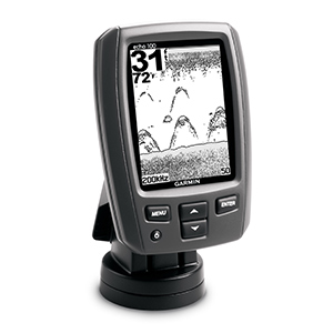
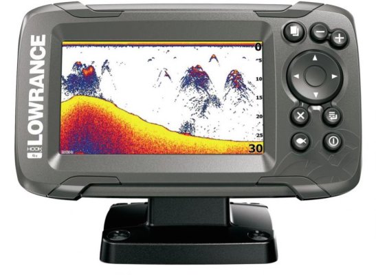
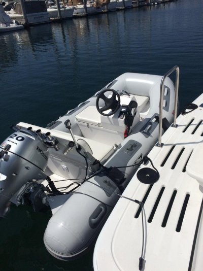
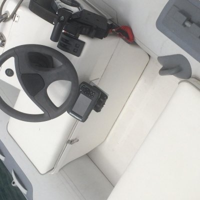
We have a small 10’ dinghy with a pull start outboard and are looking for depth sounder suggestions.

The intention is to use the dinghy for “charting” skinny entrances and uncharted water with an iPad before bringing Badger in to anchor. Would also be handy for anchoring the dinghy with our big-ish tide range and for sneaking up rivers.

Any wisdom/experience out there on these topics?
 
Also thinking the same thing. I’ll be watching this thread closely.
 
Lowrance elite 5 dsi on ours
Charts and depth.
Has a removable micro SD card that can then have tracks transfered to other devices .......apparently.

Reality has been easier to take a navionics enabled tablet as well to record the way in and then bring the big boat in using the tablet while having track enabled on the seiwa plotter and opencpn laptop for later entries.
 
Last edited:
There is always something simple like this:

https://www.westmarine.com/buy/norc...MI-8zRytqX2wIVwV6GCh021A8GEAYYASABEgIZZfD_BwE

Used it (or one of many clones) on my zodiac rib.


When an electronics retailer went belly up here a couple of years back I bought a lifetime supply (5) of these Garmin echo 100.
Got them for $20 each.
rf-lg.jpg


Still doesn't help with getting waypoints to bring the big boat into an uncharted or changing area.
 
power?

I used to run a 10 foot Brigg hard bottom inflatable and fished with it. I used a Humminbird chart plotter/sonar and used a Solar brand jumpstart pack as the power supply. The jump pack also ran a bilge pump and Nav lights.

I mention the Solar brand jump pack as I have used others that don't stand up. I have had solar brand units hold up for 5 or 6 years and other brands not hold up for 6 months.
 
There is always something simple like this:

https://www.westmarine.com/buy/norc...MI-8zRytqX2wIVwV6GCh021A8GEAYYASABEgIZZfD_BwE

Used it (or one of many clones) on my zodiac rib.

That's about as high tech as I was thinking...thanks.

I don't need anything with charts because they're all wrong in the estuaries around here anyway...there has been about 100 years of deposition from flooding mountain rivers and streams since the charts were made so things aren't what the charts say. Plan is to make waypoints with the iPad to follow with Badger.

The hand held one is cool, but I'll be adding a tiller extension to the outboard so I can stand & scout the water ahead.

Thanks everyone for your ideas so far :thumb:
 
Dinghy depthfinder

This might be too simple but I have an Achilles 10' with inflatable floor. Love it by the way. I have a Hummingbird portable depth finder I use for fishing. It has a suction cup attachable transducer off of the transom and it is run by two lantern batteries. No charting or recording capabilities but I use a hand held GPS for positioning.
 
Any wisdom/experience out there on these topics?

I just bought this Lawrence Hook 2-4 for my fishing dinghy. I haven't mounted it yet but it looks like just what I need for those San Diego Spotties! It will be mounted right under the helm wheel and it has a quick disconnect for storing inside the big boat.
 

Attachments

  • Hook 2-4.jpg
    Hook 2-4.jpg
    73.1 KB · Views: 104
  • IMG_3022.jpg
    IMG_3022.jpg
    133 KB · Views: 104
My rib has a raymarine A65 and a transom mounted transducer. There are much cheaper solutions than the A65, in my case I wanted a flush mounted chart plotter.
 
Another supporter here for Raymarine Dragonfly on the tender. Similar to the OP's intended use, we use it to chart skinny entrances before taking the larger boat in.

There are several models in the Dragonfly series to choose from, with different price points depending on how flash you want it to be.

H.
 
I don't have any specific recommendations, other than to be sure both your dinghy sounder and main boat chart plotter can both understand each others saved tracks. There are about a zillion different file formats, and of course when I set up my dinghy I picked a chart plotter that creates files that Coastal Explorer can't digest.


Also, in an ideal world it would be nice to record you track, including position and depth along the way. Recording both adds another dimension to the file format challenge since most formats record GPS points, but not GPS and Depth. And those that do record both are more proprietary than others.


There are file format conversion utilities that can solve many of the incompatibilities, but that becomes a third step in transferring the data, so undesirable.
 
Garmin echoMap

The map was made by a Garmin echoMap CHIRP 50 mounted in my 18 ft. Electracraft. The sensor is temporarily mounted on a wooden strut on the side of the boat. The contour maps are generated automatically by the sounder and the built in GPS. It has a very wide scan to either side of the path.300418_0925_01 copy.jpg
 
I have an 11' RIB with a console, and I just bought the electronics for it. I asked a similar question a few weeks ago, and then did more research, before deciding what to get.

My choice:
Garmin Echomap 64c (saltwater) with a RAM mount and a dAISy AIS receiver


I went with this solution for the following reasons:

  1. True Chartplotter capabilities. In my opinion, stay away from the Striker series of electronics made by Garmin -- they don't have any maps, but instead rely on you to "quick draw", creating your own maps.
  2. NMEA outputs and inputs for compatibility and expansion. I'll connect with the Standard Horizon fixed mount VHF, to have bi-directional DSC capability
  3. AIS (the reason I went with this model of the Dragonfly series, which was runner up for me)


I'll be spending some of this long weekend installing the electronics, and I'll let everyone know how it works.
 
For small dinghys a trip to the local kayak or canoe store may produce small inexpensive units perfect for dingys. Especially FD boats w/o transoms. REI perhaps ..
 
That's about as high tech as I was thinking...thanks.

I don't need anything with charts because they're all wrong in the estuaries around here anyway...there has been about 100 years of deposition from flooding mountain rivers and streams since the charts were made so things aren't what the charts say. Plan is to make waypoints with the iPad to follow with Badger.

The hand held one is cool, but I'll be adding a tiller extension to the outboard so I can stand & scout the water ahead.

Thanks everyone for your ideas so far :thumb:

Murray,
If your local charts are inaccurate, you could just use a hand held gps to log the contour for minimum depth required. Then it's just a matter of staying inside the line with Badger if the slope is relatively constant. If the bottom is undulating, your waypoint idea would be better.
 
Murray,
If your local charts are inaccurate, you could just use a hand held gps to log the contour for minimum depth required. Then it's just a matter of staying inside the line with Badger if the slope is relatively constant. If the bottom is undulating, your waypoint idea would be better.

Good plan, but I don’t have a hand held GPS device. (Been turned around a few times in the bush, but never enough to spend an unplanned night out).

If I can get away with about a hundred bucks for the transducer and a depth display I’d be happy.

Found information on kayak fishing sites that a 12v 7ah batteriy should be sufficient for the limited amount of time it’ll be used. Sound about right?

Now looking for a small yet robust solar panel for charging.
 
If there are transference/file format/compatibility issues....you could always just follow 50 feet behind the tender and follow it in. I know its kind of un sophisticated and.....analog....but there's nothing wrong the old school.
 
If there are transference/file format/compatibility issues....you could always just follow 50 feet behind the tender and follow it in. I know its kind of un sophisticated and.....analog....but there's nothing wrong the old school.

A few years ago we anchored in the southernmost basin of Betteridge Inlet, on Campania Island, BC. It was a very tight, twisty, kelpy, and at times shallow route getting in there. On the second night a storm was forecasted to hit the next afternoon, so we had to leave at high tide when there was but a smudge of light over the eastern hills. Thank you Navionics!

The place we want to go this summer is the "passage" on the northern shore of Dewdney Island of the Estevan Group, west of Campania Island, BC. It completely dries out for about a Kilometre at its western end, so has never been charted. If we can, we want to anchor as far west as possible and explore the western beaches for a couple weeks.

If we had to escape at high tide in the dark from there to beat a storm (or for some other reason) I'd hate to try and follow a dinghy :eek:

Plan is to take the dinghy in at low tide and mark waypoints on the iPad. Tides here probably average around 15' so if it's passable with the dinghy at low tide it'll be doable with Badger, but the path may be twisty because of drying banks, shelves, etc.
 
Last edited:
Murray,

Look at my post #16 again. The water in front of my house only had a couple of spot soundings. The bottom contour map was made entirely with the Garmin unit. It took about 15 minutes to chart. The chart remains in the Garmin and can be easily moved to the big boat and used for navigation just as with any chart plotter. Waypoints can also be added. The Garmin is about the size of a sandwich made of two slices of bread. It was on sale for about $250. For your purposes I would simply mount the sensor head on a short pole and have a passenger hold it over the side of the dinghy for the mapping. Tidal excursions are compensated for by putting in an offset obtained from the tide tables. It seems perfect for what you want.

Paul

Hi Paul,

Alas, it's been discontinued and the new & improved 6" one (the 4" model doesn't have wifi) is 550 bucks. A bit too expensive as it nibbles into monies being saved for more important things at this time. Think I'll stick with the frugal/low budget option for now, but will keep an eye on this whiz-bang stuff for when I retire.

Thanks :thumb:
 
I just bought this Lawrence Hook 2-4 for my fishing dinghy. I haven't mounted it yet but it looks like just what I need for those San Diego Spotties! It will be mounted right under the helm wheel and it has a quick disconnect for storing inside the big boat.
It's now mounted under the helm. This allows the 2 hatches to open-close, the side seat to be used & I don't have to peek through the wheel to operate the damn thing. (Not much room in my dinghy!)
 

Attachments

  • IMG_3345.jpg
    IMG_3345.jpg
    90.5 KB · Views: 68
Hi Paul,

Alas, it's been discontinued and the new & improved 6" one (the 4" model doesn't have wifi) is 550 bucks. A bit too expensive as it nibbles into monies being saved for more important things at this time. Think I'll stick with the frugal/low budget option for now, but will keep an eye on this whiz-bang stuff for when I retire.

Thanks :thumb:
There are three echomap 54cv's on ebay for less than $320 and one for less than $300.
 
.

If we had to escape at high tide in the dark from there to beat a storm (or for some other reason) I'd hate to try and follow a dinghy :eek:
Surely you would have run a track on the big boat on the way in.
 
Back
Top Bottom