West Coast to Japan via Hawaii

The friendliest place on the web for anyone who enjoys boating.
If you have answers, please help by responding to the unanswered posts.

Wxx3

Dauntless Award
Joined
Jan 10, 2013
Messages
2,820
Location
USA
Vessel Name
Dauntless
Vessel Make
Kadey Krogen 42 - 148
Since the other thread was closed , but I already wrote this, I figured I'd still publish it.

I actually looked at going to Japan via Hawaii from the PC.
Makes sense on a Mercator map, but not on a globe. Turns out the shortest GC route to Hawaii on the west coast is from San Francisco. Once I get that far, the GC route to Japan is along the Aleutians. And that's a much more enjoyable cruise with the longest passage distance of only 1200 nm if we DON'T stop in Russia.

I only tell you this because i actually have put some thought into Hawaii.
For me it came down to two maximum legs of 3000 nm each, to get to and from.
Also Hawaii is difficult cruising terrain.
So two months (RT) a sea minimum for not great options once there.

And for me to make Japan, I'd need to top up fuel on Midway and it's not clear to me if fuel is even available.

Lastly, people have crossed oceans in catamarans, but I think it's inherently more dangerous than a mono hull.

Richard on Dauntless
 
Some ships headed to Japan from the Northwest used to cut above the Aleutian Islands for their circle route when I was flying up there.

Not sure if that was to avoid the Japanese Current also or was truly just the circle route.

Either way, being up in the Bearing sea didnt bode well for some trips, ask the Russian doctor I had to medevac after he fell down a ladderway.... :eek:

Never did find out if it was because it was rough or because of vodka.... :D
 
Can you even visit Midway? This from the Noonsite.

Clearance

Midway Atoll (the Midway Wildlife refuge and the Battle of Midway National memorial) has been closed to visitors since 2013.
Update for 2017 Visitor Season
Due to budget issues U.S. Fish & Wildlife has been forced to suspend all visitor programs on Midway Atoll starting in 2013. The visitor program will not likely reopen until 2019 at the earliest.
See this US website and the FWS site for the current situation.
Previously, when visiting was allowed, advance permission was required and on arrival a USFWS official would make arrangements to meet you and your crew for a briefing.
Any visiting boat would be inspected for pests in order to preserve the ecological integrity of the islands. Strictly, no pets are allowed.
Last updated March 2017.

U.S. Fish and Wildlife Service (USFWS) Midway Atoll National Wildlife Refuge , Battle of Midway National Memorial , 1082 Makepono Street , Honolulu, Hawai‘i 96819
Tel:+1 808-954-4818 Fax:+1 808-772-5311
http://www.fws.gov/refuge/midway_atoll/ , daniel_clark@fws.gov

Docking

See information above regarding the current situation.
Below is the previous information (January 2010) which was on Noonsite when visiting the island was still possible. Officials hope that in the future visits will again be permitted.
Before leaving for Midway, you must contact the USFWS at either Honolulu or Midway to advise them of your expected arrival date and to receive special instructions. These include an undertaking not to stop at any other islands in the Hawaiian chain between Kauai and Midway, and to stand off if necessary in order to make your approach in daylight.
There are 6 moorings here for visitors for which a daily charge is made. They are located in the inner harbour on Sand Island.
There is a dinghy landing at the west end of the inner harbour.
The is also a charge per person while at the Refuge.
 
I was wondering the same thing about Midway. In 1984 we spent a day circling Midway Island but never went in. Back then there was reportedly a small contingent of contractors and military.
 
Richard,

Ken Williams, Sans Souche a 62 Nordy made this run (Northern route) with a few other Nordie’s around 8 years ago. He has several u tube video’s on it and I think he even published a book on the trip. He now has a newer 65 Nordy and parks in Rouche Harbor. Met him a few times, down to earth guy.

Good Luck!
 
Wifey B: Great write-up by someone who seriously has considered it all. We do intend to one day cruise to Hawaii, but it's way way way way way down on our list of places to cruise to. Still we want to. But those we've known who cruised to and from Japan, always took the northern route. Look at the route Nordhavn took with the 120 and they still encountered challenges where they were very glad to have somewhere to bail. We know those who have gone to Japan but from Alaska and that in a 164' boat. Sail boaters who cross the Pacific often choose the Galapagos as their route.

There's a reason a lot more talk about Atlantic crossings than Pacific. Just shorter and easier routes. NC to Bermuda to Azores to Portugal is childs play compared to San Diego to Hawaii to Japan. :ermm:
 
If I were considering a visit to Japan I would go via the Aleutians and would definitely include the Kamchatka Peninsula in Russia. We used to have an active exchange program with sailors in our sister city of Nakhodka and they were wonderful folks. I'm not sure that I'd actually want to take a boat there right now, given its proximity to North Korea, but cruising along the Kamchatka is a natural on the way over from the Aleutians.

The open ocean crossing distances are surprisingly short going this way, and on down the Kuril archipelago, but of course the weather would have to be well-considered.
 
That would be an epic trip on the KK42. I have no advice other than:

"don't forget your passport"
 
That would be an epic trip on the KK42. I have no advice other than:

"don't forget your passport"

July 2021 mark your calendar.
I read the Ken Williams saga before i bought Dauntless. We've also corresponded.

Only difference is that I'm NOT stopping in Russia and I doubt I can find anyone else to go with us.

Yes, a PS said, we will go north of Aleutians to avoid Japanese current.
Probably thru False Pass but haven't looked at our in too much detail.
Probably Kodiak, DUT, Attu, Hokkaido.

I hope I'm not wrong, but I think this will be easiest ocean crossing yet (60-40 on this bet).

I want to be in Taiwan for this Kadey Krogen's 34th birthday. I hope they give me a cake.

Richard
 
Well heck...going north of the Aleutians.... enjoy my old back yard...
 
I once worked at False Pass as a radioman.
Re this question I’d take the Alaska route too and stop in Russia.

But going north of the Aleutians may by problematic but going south of the Aleutians could be a problem too. The vicinity of the Aleutian Islands is very prone to winds and current. The tempeture of the seawater on either side being 20 degrees different. That’s just hearsay but over most of my life and from many sources. The wind more or less just howls back and forth due to the water tempeture difference.

At False Pass most all the buildings were connected by boardwalks about 3.5’ above the tundra. My radio shack was even w the boardwalk sitting on small pilings. It was windy fairly often but once it blew 100mph. That was probably the scariest night of my life in the little radioshack.

And most (I think) of the Aleutian islands are probably w/o coves or bays to anchor in during a blow. Scarce anyway. And many or most prpbably don’t have bottoms to set an anchor in.

Probably beyond Dutch Harbor I don’t think there will be any fuel.

But all of this is softened heavily by the weather predicting capabilities we now have. One could probably click on and monitor the weather for awhile as pre-trip research.

But weather over weeks of time has a lot to do w luck. During a certain period of time sometimes the weather could be worse on the Hawaii route but I suspect that would not likely happen very often.

I knew native people that would regularly cross 20 miles of the Gulf of Alaska in a light plywood skiff from Sanac Is to False Pass w a 20hp OB. Usually just for booze.
 
Last edited:
I believe Midway and all the Northwest Hawaiian Islands are permanently closed now, as it is a marine sanctuary, only accessible to scientists and native Hawaiians, by permit only, extending to a 200 mile radius around all islands.
No fisheries, no tourists, no cruisers allowed at all ever.
This was the holy of holies for fishing and cruising in bygone days, but the fisheries have been phasing out for maybe the last ten years, and our past President really sealed the deal by extending the park limits to the EEZ.
Auwe!
 
...
But all of this is softened heavily by the weather predicting capabilities we now have. One could probably click on and monitor the weather for awhile as pre-trip research.
.

Yep. Basically I plan using the Pilot Charts and climo. I did watch the daily wx about a year in advance.
Wx fcsts don't really help in a passage.
Not in a boat that only goes 7 knots.
Though i do wait for favorable conditions to leave the first day, but after that it's ALL about being prepared for the worst.
The islands provide lee shelter from winds and fetch, I'd needed.
July is the most benign month, so that's a must do.

(I only mentioned Hawaii to answer Sashimi's question in a serious manner. He had responded to all the naysayers in a serious manner so I thought he deserved a serious answer, but the thread had been closed for shine reason which escaped me.)
 
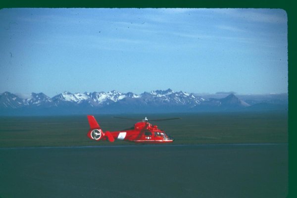
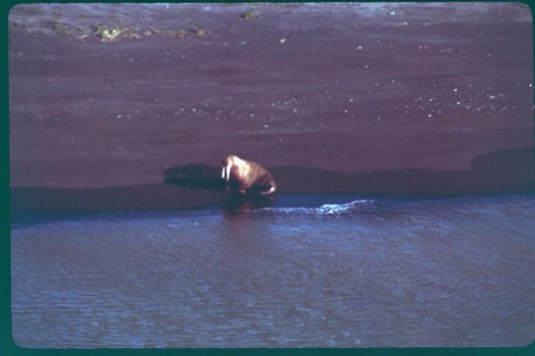
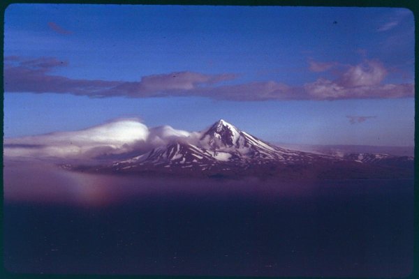
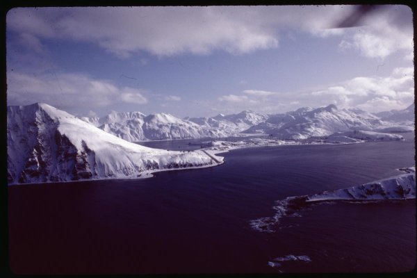
Here's a few shots of the Kodiak and Aleutians....


First shot from my hangar in Kodiak.


Third to last....North Pacific Gillnetter


Second to last....Dutch Harbor

Last shot is of a deck 20 feet above the water on a 400 foot ship...about a 100 miles south of Dutch Harbor...3 days of 45-60 degree rolls
 

Attachments

  • 11n.jpg
    11n.jpg
    139.7 KB · Views: 48
  • a29.jpg
    a29.jpg
    63 KB · Views: 57
  • 21f.jpg
    21f.jpg
    129.9 KB · Views: 57
  • a5.jpg
    a5.jpg
    77.2 KB · Views: 54
  • 177.jpg
    177.jpg
    88.5 KB · Views: 56
  • 205.jpg
    205.jpg
    76.4 KB · Views: 65
  • s3.jpg
    s3.jpg
    125 KB · Views: 57
  • a2.jpg
    a2.jpg
    76.7 KB · Views: 60
  • Real big waves.jpg
    Real big waves.jpg
    82.3 KB · Views: 81
Last edited:

Latest posts

Back
Top Bottom