7’ to 9’ seas??? That’s nothing!

The friendliest place on the web for anyone who enjoys boating.
If you have answers, please help by responding to the unanswered posts.

Bruce B

Guru
Joined
Jun 28, 2014
Messages
1,274
We are headed to Block Island in the remnants of Hurricane Maria.
Wind on our tail gusting over 20 knots, seas 6’ to 9’ with a long 12 second period. This is a cake walk!
The audio in our he video is absolutely awful. The boat is delightful at these speeds.
Bruce

https://youtu.be/yTkCJU98uUI
 
Did mention that it is a cakewalk?
Bruce
 

Attachments

  • 5B5FC1A1-D907-4EF1-93CF-323558D8031F.jpg
    5B5FC1A1-D907-4EF1-93CF-323558D8031F.jpg
    102.2 KB · Views: 236
Wow the all-glass helm is beautiful. However in the video link the seas are 6-9 inches.
 
Wow the all-glass helm is beautiful. However in the video link the seas are 6-9 inches.

The best seas were off of Point Judith where the bottom shelves a bit.
There is no question that we did not capture the seas in our video though.
We’re approaching BI now and it is beginning to flatten out...
It was fun while it lasted!
Bruce
 
The true sign aboard Esmeralde of rough seas...
Bruce
 

Attachments

  • CB66206D-16D1-4C80-A619-8541668FC94D.jpg
    CB66206D-16D1-4C80-A619-8541668FC94D.jpg
    98.2 KB · Views: 223
Looks great you guys.

What direction were the waves going compared to you? Were the waves coming from the stern as well? How was your speed compared to the speed of the waves?

I have NO experience with that kind of sea state. I never see anything as high as 6-9 feet and never see a period that long.
 
Great video Bruce. Thanks for sharing.


Cheers.


H.
 
Get enuff time between sets and its a piece of cake, now 8 footers at 7-8 seconds is a big difference.
Glad you got to experience seas like that.
Cheers
 
We are headed to Block Island in the remnants of Hurricane Maria.
Wind on our tail gusting over 20 knots, seas 6’ to 9’ with a long 12 second period. This is a cake walk!
The audio in our he video is absolutely awful. The boat is delightful at these speeds.
Bruce

https://youtu.be/yTkCJU98uUI

Bruce,

What is the size of your boat, beam, length and weight? And sounds like you had the wind about 65d off your port side. I'd think that would give a fairly rough ride....

But sure looks pretty smooth.

I don't like big waves like that but would rather take them head on. And for the most part, I'll avoid much over 6 feet head on, or 4 ft at 90d. And the admiral doesn't like them either.

Good pictures!
 
Guaranteed 6-9's on Lake Michigan will kick that tug's butt..
 
Guaranteed 6-9's on Lake Michigan will kick that tug's butt..
We 8's on Huron one day in early August.
They were coming over the rock wall that surrounds the harbour.
We knew this because the locals said 8s are when they start coming over.

There was no way in hell I was going out there, turned on a movie and prepared for a nap.
 
Here's 8-9' waves on the Columbia River.....


Not exactly a piece of cake......
 
The boat certainly rides it nicely, Bruce.

It's always tough to estimate the sea state. A long interval period always makes the swell much more tame.

I had a look through my video's for similar conditions. I never seem to think of the camera when things get really ugly. Here's a video of slightly smaller waves but with a shorter period, mostly looking out the port side window. Perhaps a 6-7 foot swell at 10 seconds

The waves were about 30 degrees off the starboard bow, so I had a reefed mainsail up to provide a bit of steadying. It did get a bit ugly later that evening when the wind and swell increased and waves started breaking.
 
Was that the forecast? (Around here they seem to over-estimate on a regular basis.) How far off the water is your wheelhouse? If it's 9' I'd expect the shore or horizon to have been disappearing once in a while behind wave crests in 9' seas...

First day of ownership we had spray over the wheelhouse :D
 
I hate to comment but 9' seas are in none of these videos. You know wave height is calculated from the 0 to the top, not from bottom to top
 
I hate to comment but 9' seas are in none of these videos. You know wave height is calculated from the 0 to the top, not from bottom to top


Not sure what you mean by zero, but wave height if from the trough to the crest.

So a 6 foot wave were superimposed over calm water, it would be 3 feet above and 3 feet below.

As defined by the NWS... good enough for me.
 

Attachments

  • Wave-height.jpg
    Wave-height.jpg
    32.9 KB · Views: 130
You know wave height is calculated from the 0 to the top, not from bottom to top

Wrong.

Now, I'll agree Bruce's video wasn't 9'. He agreed and said he didn't get video on the 9' ones. Couldn't see enough to say on the others.

Very difficult to estimate wave height. A 6' with a long period won't look anything like one with a short period.
 
Not sure what you mean by zero, but wave height if from the trough to the crest.

So a 6 foot wave were superimposed over calm water, it would be 3 feet above and 3 feet below.

As defined by the NWS... good enough for me.

:iagree:

Exactly. Trough to peak is the wave height.
 
Wrong.

Now, I'll agree Bruce's video wasn't 9'. He agreed and said he didn't get video on the 9' ones. Couldn't see enough to say on the others.

Very difficult to estimate wave height. A 6' with a long period won't look anything like one with a short period.

I also agree with BandB. I am TERRIBLE at estimating wave height from the PH. I end up comparing every wave to the freeboard outside of the PH doors. However, my freeboard at that point is very tall. This makes it much harder to estimate than it is in my sailboat where I am standing in the cockpit 18" above the water.
 
No matter what a video will always look "tamer " than the actual conditions......
 
I access various sites when out and look at the wave heights and periods versus what I think I'm seeing. I then go back and try to verify my estimates and use all kinds of methods and sometimes find out I was wrong and sometimes perhaps I had different waves than any of the sites. I have found that when I hear others, they're always talking higher waves than I saw at the exact same time. Are they growing like fish stories do? Or do people just look at it differently. I think a lot of perception depends on the boat too. A wave of x ft sure will seem taller in a 30' boat than in a 70' boat. Some is also how much one runs outside. I've found those who typically run the ICW go outside and talk about 6' waves on days we were out and thought it was decent at 4'.

Now, if you find it really important there is all sorts of equipment available for it. This ranges from buoys which are basic and can range from simple to very complex and accurate. Also, if you can fly over there's equipment great for it. You can even mount some radar equipment targeting straight down on your bow pulpit.

Here's a site with some of the available equipment.

https://www.environmental-expert.com/products/keyword-wave-height-measurement-72426

I do know an engineer who has used some of it but then if you use it only some of the time the accurate measurment may actually mislead you because your perception of a height is different.

Here's an example of a very basic piece of equipment. The principle is measuring the change in depth and the time over which that takes place.

http://rowetechinc.com/assets/seawave.pdf

Then there are various downlooking radar systems that can be extended from your boat.

I'm guessing you can get quite accurate, but don't really know what that's going to do for you.
 
Looks great you guys.

What direction were the waves going compared to you? Were the waves coming from the stern as well? How was your speed compared to the speed of the waves?

I have NO experience with that kind of sea state. I never see anything as high as 6-9 feet and never see a period that long.

OK, I’ll elaborate a little in the conditions here.

We had been suffering through a hot, humid air mass all week, with near-record highs in the high 80s with 100% humidity and dense fog. Hurricane Maria had been churning up the coast, driving up tropical moisture and large ocean swells. As of yesterday morning Maria was maybe 300 miles south of us, with Max sustained winds of 70 and TS force winds extending ~230 miles from the center.

Yesterday morning a cold front came through, clearing out the muggy air mass and driving Maria off to the east and bringing with it a building post-frontal northerly.

The marine weather forecast for the day, for our trip area (Rhode Island Sound/Block Island Sound), was for 15 kt northerlies gusting to 25, 6-9 foot swells, and a small craft advisory for seas.

So why did we make the decision to go? First, of course, we wanted a little fall excursion on the boat. Second, the forecast was generally good. Third, although there was the forecast for 6-9 ft seas, I knew they would be “old” seas with a long period, and there would be no new surface wind from the same direction (SSE) to kick them up. The forecast northerly was too new to cause any real mess, and was coming off the land with little fetch except for the approach to Block Island. There were several bail-out points along the route. Finally, we sort of wanted to see how the boat would behave in fairly large rollers in otherwise benign conditions. Also, the seas would be mostly somewhere on our port bow, which I considered optimal from a running comfort perspective.

The wind was exactly as forecast, but only gusting into the 20s for short periods of time. The sea state I’ll discuss later.

Our itinerary was a 30-mile run and started in upper Narragansett Bay, totally protected from any ocean influence, where we ran south dead downwind in generally flat water with 1-2 foot wind-driven surface chop for about 10 miles.

When we got to the entrance of the Bay between Beavertail (Jamestown) and Castle Hill (Newport) we began to feel the swell. This was open ocean, with no land mass between us and the Tropical Storm. From here our course was generally SSW towards Point Judith and Block Island. We could see impressive breakers on all the exposed shorelines and headlands, especially Brenton Point and Beavertail, both of which were shrouded in salt mist from the surf. In the last five days there had been at least three coast guard rescues of tourists swept off rocks by breaking seas.

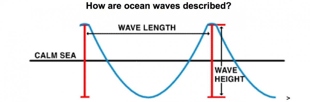
The swell built gradually as we made our way away from the bay entrance. It settled in at what I guessed was generally a six-foot swell with a long period. I started checking real-time buoy reports, and those nearest to our course were reporting 13’ seas at 12 sec (Nantucket buoy, about 70 miles SE of us), 9’ seas 12 sec (Montauk Buoy, about 50 miles SW) and 9’ seas 12 sec (Long Island Bouy, about 80 miles SW). (These distances are rough estimates - I did not measure.)

As we proceeded SW, the swell became a little more consistent and occasional large rollers appeared in the mix. They were coming in at about 45 degrees off the port bow and were very long period. The northerly was pushing our tail but the surface (wind) waves were insignificant, especially as we were running downwind. The surface waves had no impact on the southerly swells.

We were running at about 2000 rpm at 9.5 knots. The boat was VERY comfortable, rolling up and over the seas with a nice motion, doing an occasional sashay as she transitioned in the troughs.

The normal straight-line course to Block Island runs close inshore to the Point Judith, which even on a calm summer day can be uncomfortable from a confusion of tide and wind an ocean influence. As you approach the point the bottom comes up from about 90 feet to 30-40 feet. I set our course to stay about a mile and a half out, where the bottom gets as close as 50 feet. It was in this area we saw the largest and most consistent seas. They were definitely lining up in their approach to shore and pushing up higher. I would put them at a solid 7-9 feet, with the occasional “big one” that was, what, 11 feet? We were losing the horizon on a regular basis.

I’m always cautious when I estimate seas. I think everyone tends to overestimate. I have done a fair amount of offshore sailing, including two trans-Atlantic, one Pacific from Panama to New Zealand, and countless runs between New England, Bermuda and the Caribbean. I’ve seen some pretty nasty stuff so I try to put it all in perspective.

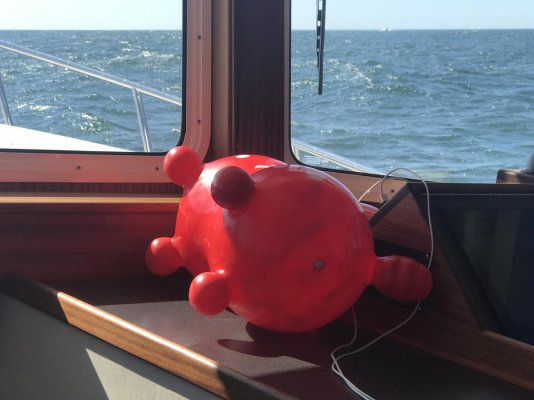
Cameras, photos and video always flatten things out, so it’s impossible to show true conditions. Having said that, I will post one clip I took as we came around Point Judith. As we came over the top of a “big one” we took a roll and I lost the phone so it missed the best of the sea, but it gives a better idea. (And in case anyone is concerned, even Rody stood firm on this roller, even if he capsized later on in the trip when we had to turn broadside for a bit.)

The bottom line here is that I do believe we were seeing six to nine foot seas, with a few that were larger than that. Conditions were in no way dangerous for this boat. We would not have gone out if I had thought they were at all dangerous. Because of the age of the seas, the long period and the otherwise spectacularly beautiful conditions, it was simply a good opportunity to get out there and experience something a little different. We would have zero interest in heading out in 6-9 foot seas with a 6 second period and the associated storm wind that drives them, so please don’t try to equate the two situations.


<iframe width="560" height="315" src="
" frameborder="0" allowfullscreen></iframe>
 
Last edited:
Another thought regarding wave height....

It's not really the wave height or period that's important, it's what the effect is on your boat. Would be interesting to have a rating based on the ride instead of the size of the wave. And this would have to be tempered with the kind and size of boat.

We could all give reports on our ride, and pick up reports from others and could have an excellent handle on what's out there.

So, a report might look like this:

at 15:30 GB32 20w of Sarasota, FL, light chop, heading 320, waves 20d off starboard....

-or-

From 9:00 to 12:00 Main40 20w of Sarasota, FL to 45nw of St. Petersburg, FL, light to occasional Moderate, heading 320, waves off starboard.....

And there would be a definition for "light chop", perhaps small 2 to 3ft waves, where walking about the boat was easy with minimal help from supports and easy to drink your coffee.

Moderate would be walking would be difficult without support and drinking coffee would be impossible without spilling.

Severe would be impossible to walk about and would be holding on significantly, and unable to even keep coffee in the cup.

The size of the boat would be used to determine how it might affect our boat.

Good idea?
 
Reading my mind SeeVee....

A video looking out windows rarely documents the conditions accirately. Unless the horizon is saying relatively calm or you visually see the pitch and roll. Again, stabilizers would negate some of the sea state.

The story is inside.

Whats moving around? Is moving around easy or hard?

Size of seas and the greatly overused "green water over the XXX" is meaningless in terms of seaworthyness or stability.

Conditions contain severable variables, not just one.

While never for certain, but a freshening wind opposing large swells can produce some dangerous conditions. I have never been able to guess that one accurately. Either I physically go and look before getting underway or get as far as I can before turning around and making sure I can (or duck in).
 
Last edited:
You guys should read this entire description and educate yourself on waves and forecast. One day you will read a wave report and say 6' seas are no big deal and you will get caught up in a life or death situation. We're I live you don't play with the weather. It's shallow and there is a huge difference between a 6' roller and 6' chop.
https://www.mxak.org/weather/pdfs/waves.pdf

We are acutely aware of the difference between 6’ sea A and 6’ sea Z. Please read post #24 above.
 
Bad , steep seas are usually found at the Start of a blow , especially if there is little fetch.

15 ft swells , 200 ft apart after a storm has matured are a delight to go with.

Its the duration , time between bumps that counts.
 
Back
Top Bottom