iPhone iPad barometric pressure sensor

The friendliest place on the web for anyone who enjoys boating.
If you have answers, please help by responding to the unanswered posts.

User915

Senior Member
Joined
Sep 14, 2015
Messages
494
For those who are using an iPhone 6 and newer, an iPad Air 2 or iPad Pro (all models) and newer, perhaps you were aware or not that there was a built-in pressure sensor into your device (working with at least IOS 10.1).

It seems that the barometric pressure sensor installed on Apple devices is the Bosch Sensortec BMP280 which is an improved version of Bosch Sensortec BMP180 used on Samsung devices and similar Android devices.

http://www.hkmjd.com/Attachments/product/201401/52e1fb718c181.pdf

With a right app, that transforms your iPhone in an actual barometer that gives readings for barometric pressure, also altitude / height (based on the QNH of the nearest airfield), and relative elevation changes, without the need of GPS assistance just in case. I leave it to the discretion of the private and professional pilots members of TF to explain the differences between elevation, altitude, height, flight level, also the difference between geometric and pressure altitude, I will just simply say that Altitude refers to the height of an object above a given point, Elevation refers to the height of a place above the mean sea level.

On the basis of my own barometric observations at the sea and in-flight on a Cessna 172 - ForeFlight Mobile can show Apple device's pressure altitude in the Instrument Panel -, this pressure sensor is sensitive, information of air pressure is accurate.
But, to avoid possible negative reactions, let it be clear that I was not stating that Apple device's pressure sensor can be an excellent and safe alternative to in-flight instruments especially geometric height from GPS, I just provided information about Apple device's function.

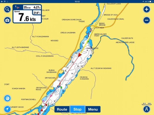
There are quite a few barometer apps available through iTunes then with the right app and if it's calibrated correctly to get an accurate reading, you can have a general sense of what’s going to happen by whether a barometer rises or falls. My favorite app is one which shows a graph with history, I consider the speed of pressure fall as a major indication at sea, in my opinion.

As well, you can download a free app called Weather Signal to report your iPhone pressure to a national data base, That would build a central and convenient virtual consultative large network on the future, still in my opinion.

The future of weather forecasting may very well be the computer in your pocket.
 
Last edited:
Interesting information. Thanks.
 
With a right app, that transforms your iPhone in an actual barometer that gives readings for barometric pressure, also altitude / height (based on the QNH of the nearest airfield), and relative elevation changes, without the need of GPS assistance just in case. I leave it to the discretion of the private and professional pilots members of TF to explain the differences between elevation, altitude, height, flight level, also the difference between geometric and pressure altitude, I will just simply say that Altitude refers to the height of an object above a given point, Elevation refers to the height of a place above the mean sea level.

.

Whew....dunno about all those altitude. We do set our altimeters to QNH below 18,000 feet in the US(and many other countries). QNH is basically the corrected pressure at a certain airport(relative to sea level). So with QNH set, your altimeter should read field elevation.
Pressure altitude is altitude is the altitude above the standard datum plane of 29.92. IOW, you set your altimeter to 29.92 and you will be reading pressure altitude off of your altimeter. We do this above 18000 feet(in the US) and that is where the "Flight Levels" begin. So FL330 iss 33000 feet above the standard datum plane of 29.92. We are flying a pressure level if you will.
Geometric altitude is the altitude derived from a GPS...I think. Accurate to within 10-20 meters.
Absolute altitude is the height above terrain.
Density altitude is altitude corrected for temperature and pressure and is used more for performance calculations and not a measurement for navigation. Denver airport is at 5200 feet. But on a hot day the airplane may "feel like" or perform like it is at 9000 feet. Hot and high airports become a challenge in aviation and lift capacity. Drag racers also are concerned about DA again as it affects their performance down the track!

Thank you Mr Baker for your very interesting and clear post.
Being myself just a tiny amateur pilot, I do admire the commercial jetliners' pilots which duties and responsibilities are tremendous. No flattery here.
 
Thank you Mr Baker for your very interesting and clear post.
Being myself just a tiny amateur pilot, I do admire the commercial jetliners' pilots which duties and responsibilities are tremendous. No flattery here.

Thank you for the kind words. It is mind boggling sometimes. And our guys are always pushing the safety envelope. I mean that in a good way....like pushing it in the right(safer) direction. Our Safety Management System(basically our safety infrastructure) and human performance people are on the cutting edge.
 
FWIW - Most of the consumer GPS apps out there that measure altitude using the Fed's birds do not factor in geoid offset (the earth is not perfectly round) can be 20-ish feet error (maybe more, I've just been looking at it in SE North America lately) I'm sure the aviation related ones do solve this...
 
fwiw - most of the consumer gps apps out there that measure altitude using the fed's birds do not factor in geoid offset (the earth is not perfectly round) can be 20-ish feet error (maybe more, i've just been looking at it in se north america lately) i'm sure the aviation related ones do solve this...

round???
 
I'm sure the aviation related ones do solve this...

Maybe they do, maybe they don't. The altimeter is still a better measurement of altitude. A GPS altitude is likely for reference only and not to be relied upon.
 
Maybe they do, maybe they don't. The altimeter is still a better measurement of altitude. A GPS altitude is likely for reference only and not to be relied upon.

Unless of course the weather changes...
 
Thank you for the kind words. It is mind boggling sometimes. And our guys are always pushing the safety envelope. I mean that in a good way....like pushing it in the right(safer) direction. Our Safety Management System(basically our safety infrastructure) and human performance people are on the cutting edge.

I wrote "commercial", sorry it was a problem of language with my English, of course I meant airline transport pilots. Definitely human performance people is vital. Not the topic here and even if I don't like to criticize one of my favorite airline companies, I trust you remember the black box recordings of flight AF 447 in 2009 which were evidence of the imperious necessity you very well mentioned in your post.
 
Does anyone have a favourite stand alone app they like for the iPad? "Barograph" looked like a good app and you can get it "ad" free for $1.99.
 
Does anyone have a favourite stand alone app they like for the iPad? "Barograph" looked like a good app and you can get it "ad" free for $1.99.

My favorite is 'Barometer for Iphone & Ipad by Steffen Bauereiss ' for both boating and flying (only as a backup for flying, just in case), this App features as well a great barometric Trend.
 

Attachments

  • IMG_2763.jpg
    IMG_2763.jpg
    98.6 KB · Views: 78
Barometer is nice. Altimeter is nice. But I would not use barometer as altimeter on a smart phone when gps is available. GPS makes a better altimeter.

Nice to have both...
 
So far, I've not felt the need for an altimeter on the boat. I'm sure Ive just been lucky so far.
 
Does anyone have a favourite stand alone app they like for the iPad? "Barograph" looked like a good app and you can get it "ad" free for $1.99.

@JDCAVE, several good Apps on Apple Store to turn the built-in pressure sensor into a barometer on your device.
It's just important to calibrate correctly to get an accurate information.

I took some screenshots of the App 'Barometer for Iphone & Ipad by Steffen Bauereiss' which is a free App.

Pic # 1 : Pressures at the station & sea level from the built-in pressure sensor, altitude from the built-in GPS.

Pic # 2 : Relative elevation & absolute altitude from the built-in pressure sensor. When using in-flight, reference pressure & reference altitude on this App can be set manually if necessary, as to be based on the QNH of a nearest airfield.

Pic #3 : History graph.
 

Attachments

  • Image6.jpg
    Image6.jpg
    62.2 KB · Views: 75
  • Image7.jpg
    Image7.jpg
    38.5 KB · Views: 88
  • Image8.jpg
    Image8.jpg
    48.4 KB · Views: 75
So far, I've not felt the need for an altimeter on the boat. I'm sure Ive just been lucky so far.


Well, I do understand that an altimeter is a very rarely device used on a boat at sea... but when boating interior waters, it may be interesting to know the altitude from sea level as just a point of information, at least for me, especially on a passage from a sea to another. This was just my opinion.

I can provide actual evidence to support it however : attached of recently boating someplace interior of the U.K.
 

Attachments

  • Image3.jpg
    Image3.jpg
    114.8 KB · Views: 84
  • Image13.jpg
    Image13.jpg
    65.5 KB · Views: 84
  • Image10.jpg
    Image10.jpg
    163.5 KB · Views: 78
I've been using barometer for the past year to calibrate our mechanical Barograph. It also can be used as an effective manometer to balance ventilation in places like engine rooms when running different machinery.
 

Latest posts

Back
Top Bottom