Jim Cooper
Senior Member
Evacuations off Andros Island begin at 0645 tomorrow morning, no Sunday morning sleep! I won't complain though, receive full pay and per diem while waiting it out in Florida.
While looking over web sites I'd wondered where I could find a good spaghetti model of Matthew. Found this site - has a lot of reference material:
Mike's Weather Page... powered by Sparks Energy!
mike
Mike:
That's a good one, thanks.
Mike
Interesting perspective:
NHC has S. Florida in 20-25% chance of TS force winds. The UKMET has a direct hit. The models are not accounting for the slower speed Matthew is moving. So until they adjust to that, there is no such thing as increasingly unlikely.
I have lived in S. Florida for 30 years. I have seen firsthand where models didn't have a grasp on a system. It's happening again with Matthew.
If there was a strong front coming and Matthew was stalled, then yes, the chances of him hitting would be getting lower and lower. But there is no such thing going on here."
Interesting hurricane trivia. No hurricane that was a 3, 4, or 5 and was within 2 degrees of Matthew has ever hit FL. They have hit LA and SC and NC. Now, there's always a first, especially with hurricanes although Matthew is highly unlikely to hit FL. It is somewhat likely to cause some rains and sea disturbance however. Now it's sort of borderline 3 vs 4 and it's likelihood to hit Haiti is especially concerning with 55,000 people living in tents.
Not sure what you're referring to with " within 2 degrees".
Ted
Looking at models this morning, outlook is getting worse for FL. Several models have done a major shift west due to the "ridge" coming in stronger than earlier indicated.
This pushes the storm towards Fl.
This guy made this statement earlier, along with a graphic, which I can't post here for some reason:
"Michael VentriceVerified account
@MJVentrice
Not good. This AM's ECMWF High probability cluster with a BIG statement. All members now track #Matthew into Florida at a Cat 4 intensity."
There is issue with his usage of "ALL members"...but still.
Well...I'm not sure what to tell you, you seem to think I'm making all of this up?
Here's a forecast map from NHC. This "cone" has shifted considerably West over the past 24hrs.
When I look at this, Miami is seems to be within the cone of probability. Is it 20%?...30%??...don't know, and really don't care. The point is just that I think folks in FL/GA/SC/NC need to be aware that the forecasts on this, especially the track, are very dynamic.
Hurricane MATTHEW
"Folks..Navy Model now has Matthew INLAND southern Florida....stay alert and ready folks.............."
This model is called NAVGEM, it's available on Levi's tropicaltidbits page:
Numerical Model Prediction - Tropical Tidbits
I really hope that's an outlier, and does not come to fruition, however...this IS the Navy, and I believe they've come to learn a few things about weather and storms.
I'm missing something going to that link. Please help. What it takes me to is a prediction of precipitation. What then to get to the hurricane forecast? I'm just missing where it shows Matthew inland in southern FL. Perhaps I just don't know where to find it on that page.
Hope it goes out to sea after Haiti but that is unlikely,. Hope for the best and pray for those in its path.
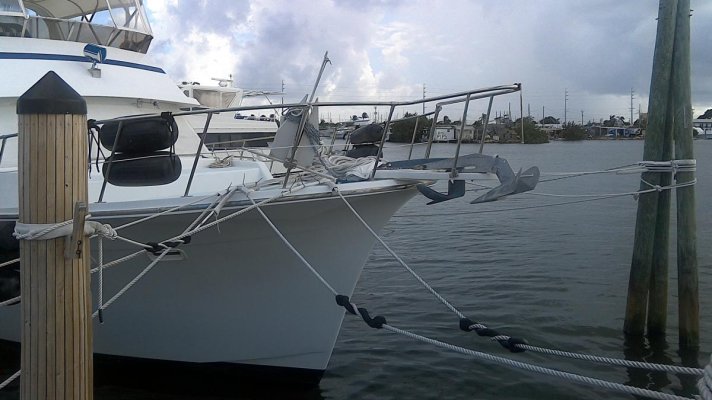
Winds here in the keys are expected to be 20-35 mph with higher gust Tuesday nite thru Friday morning. Got a mooring in boot key if it turns towards Florida and have secured boat and property here at harbour Cay club. Hope it goes out to sea after Haiti but that is unlikely,. Hope for the best and pray for those in its path.
I'm missing something going to that link. Please help. What it takes me to is a prediction of precipitation. What then to get to the hurricane forecast? I'm just missing where it shows Matthew inland in southern FL. Perhaps I just don't know where to find it on that page.
I'm scared of the loss of lives that could occur in Haiti. The monetary loss there won't sound like much in the US but lives are far more important than dollars. Also, getting reports from Haiti may be very delayed. I hope they are better prepared than I believe they are.