Anyone prepping along the Florida and Gulf coast??

The friendliest place on the web for anyone who enjoys boating.
If you have answers, please help by responding to the unanswered posts.
When Sandy hit our yacht club in CT the boats that remained at our docks (floating) sustained little to no damage beyond a few ripped canvas bits. A couple of the boats that elected to be hauled at a nearby yard sustained extensive damage as boats were blown or floated off their jack stands.
 
Cap John - I guess that depends where on the northern Gulf Coast you'r located. NOLA to Mobile has built marinas to overcapacity, in my opinion. Not a week goes by that I'm not invited to consider a move to one or another of them. Problem - they kick you out when a storm enters the Gulf. I don't know the specific criteria.

I'm fortunate in that my marina on Lake Pontchartrain is (in my inexpert opinion) is probably one of the best hurricane holes between Mobile and Houston. (I'm sure that's subject to debate and specific storm characteristics. Nonetheless, my plan is to remove tophamper, install dedicated storm lines, do the other usual stuff, and see what happens.

I look at multiple Wx sources, but I rely on the NRL Tropical Cyclone Page. They seem to weather-guess better than most, at least for this patch.
 
I am at a floating dock on the Industrial canal in New Orleans. The USCG in their wisdom has a hurricane plan for the entire area that does not allow any boats to be afloat in the canal and have to move out prior to any named storm heading our way. My plan is to head across Lake Pontchartrain to the Tchefuncta River and anchor behind Brady Island while tied up to the shore.
The USCG plan to close the industrial canal is a result of barges that got loose on the canal during Katrina and topped over a levy and in to a subdivision. There was a claim(not proven in the end) that the errant barge had busted through the sea wall and caused the flooding.

It is frustrating because the USCofE has built huge walls and gate structures and can close off all entrances to the area essentially making the area a non tidal lake and therefore a prime hurricane hole. I would rather stay at my (floating) dock on the canal.


Sent from my iPad using Trawler Forum
 
When Sandy hit our yacht club in CT the boats that remained at our docks (floating) sustained little to no damage beyond a few ripped canvas bits. A couple of the boats that elected to be hauled at a nearby yard sustained extensive damage as boats were blown or floated off their jack stands.

Properly designed and built floating docks have frequently proven to survive hurricanes and protect boats well. Having the boat on land but not well anchored or not at adequate elevation is really just an exercise but not one that protects boats like owners are led to believe.

Most of the major dock construction the past few years in the Fort Lauderdale area has been Bellingham docks and they've been designed to sustain through surge and wind as it's a fact of life here that boats will remain at those docks through hurricanes.
 
"When Sandy hit our yacht club in CT the boats that remained at our docks (floating) sustained little to no damage beyond a few ripped canvas bits. A couple of the boats that elected to be hauled at a nearby yard sustained extensive damage as boats were blown or floated off their jack stands. "


I am glad that worked for you Howard but for many places close by it was the exact opposite due to storm surge and water flow. IN one spot on the Hudson they lost all the docks and the 25+ boats left tied up and many were never seen again.
The key is to know your area and options and pick the best one for you not what someone near yo might be doing.
 
No absolutes....

But my experience from FL to NJ has shown me that if a yard isn't prepend properly for storms (most) then boats often do better in the water.

Without secure tie downs and an experiences crew...and erosion resistant storage areas....f the water is high enough to wreck floating docks, the devastation in the yard is often equal to or more severe than to the well tied boats.

Once up in the yard, blowing debris are usually a bigger threat than on the water.

The absolute best suggestion I think that can be made is to move the boat out of the dangerous semicircle, and far enough from the eye to drop the winds to CAT 1 or lower. Often it isn't that far.

For those unable to pick up and cruise their boats out of harms way... I feel for you.... all those years I couldn't caused me undue concern. Right now I am sweating this recent surge in Atlantic low pressure systems as it will be another week before I get my engine back together.
 
Last edited:
"When Sandy hit our yacht club in CT the boats that remained at our docks (floating) sustained little to no damage beyond a few ripped canvas bits. A couple of the boats that elected to be hauled at a nearby yard sustained extensive damage as boats were blown or floated off their jack stands. "


I am glad that worked for you Howard but for many places close by it was the exact opposite due to storm surge and water flow. IN one spot on the Hudson they lost all the docks and the 25+ boats left tied up and many were never seen again.
The key is to know your area and options and pick the best one for you not what someone near yo might be doing.

Some words I'd reemphasize, properly designed and built and floating docks. . Now a lot to that. Pilings driven deep and stable. Pilings tall enough to exceed any surge. Dock connectors strong. Anchor ties to shore strong and adequate.

Yes, at least one of those Hudson docks has since been replaced by Bellingham.

Know your area and options as you say and that means the design and construction of the docks, what surge they can handle, the surge history of the area. The hurricane and wind history. And by know, I mean real verified knowledge not the tales of the locals whose recollections have changed over the many years even more than the size of their fish caught.

If you choose to haul out, know what the capabilities there are too and what history they have and if any of them tell you they had no damage, move on, because it didn't happen.
 
Never went through a major hurricane while we owned Whistful up in Portsmouth, but I know the boat club had a plan in place...don't know that it ever got tested.

I think Capt. John's latest book on cruising the loop he talks about staying in the water, doubling up on setting proper anchors and getting off the boat...at least up to a certain strength storm.

As seen here, some want out, some want to hide if they can. All in all, a very interesting discussion.
 
Almost all of the 10+ marinas we have used have lift heights of 10+ feet just to reach the base of the yard over MHWL. For Sandy it did not look good so we took a more cautious approach and pulled two days ahead once the alerts were up.
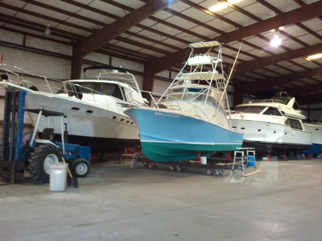
Here it is ready for Sandy.....


Almost all of the 10+ marinas we have used have lift heights of 10+ feet just to reach the base of the yard over MHWL. For Sandy it did not look good so we took a more cautious approach and pulled two days ahead once the alerts were up.
Here it is ready for Sandy.....


Curious. Any idea on the wind rating of that building? For Sandy looked great, but doesn't look so great for a CAT 3 or above hurricane, although it might be stronger than it appears.
 
The models for 99 seem to be spreading out more rather than tightening. The computer models range from one with a sharp westward turn across Cuba and two with paths that take it west to the gulf so it never hits Florida to one that has it hit the Florida east coast up about Melbourne, on both sides of but none hitting South Florida. Then the ensemble models have a mid path that comes up the west coast of FL but have various models ranging from Cuba to missing everything until Louisiana to staying off the east coast and never hitting the US. The wind speed has dropped from 45 mph to 40 mph as it's north of the Dominican Republic and Haiti. It turned west overnight.

An interesting piece of trivia. Florida has been almost 11 years since a hurricane made landfall in the state. (Wilma 10/25/05). Louisiana and NC have each had 4 since then.
 
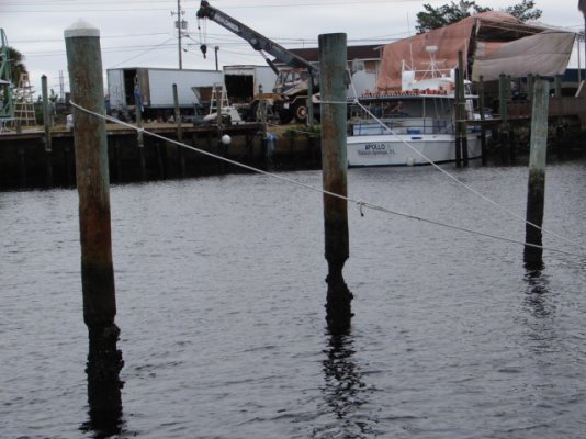
Watch out for some of those pilings. That picture was taken during a very low tide normally the worm eaten part is not visible.
 

Attachments

  • Piling.JPG
    Piling.JPG
    150.5 KB · Views: 61
Having just completed a bottom paint job, I was on the hard a few years ago when the yard started it contract haul out prior to a Cat I storm. Numerous boats were lining up for haul out. They asked what I wanted to do splash or stay on the hard. I looked around at the scrap yard next door with tin and sheet metal stacked 30' high, the lumber yard a block away and the metal building scattered around the area. It was not a hard decision to take to the water. While an insurance company may prefer a haul out it is entirely a situational decision. Some places just are not safe in or out of the water in a storm.
 
McGillicuddy - Yeah, the Industrial Canal sits entirely behind the "Great Wall" - should be the best hole on the Southshore - probably between the Gulf between Mexico and Pensacola. BUT, because entitled knucklheads "think" it was the barge that caused the 9th Ward Katrina flooding (surely not poorly designed USACE levees or the MRGO), USACE and the Coasties are beholden to hazard vessels and people in the event of a storm.

I fuel at Seabrook - they told me that the Coasties had advised them that they had demo teams, a plan, and authorization to sink ANY craft (commercial or rec) in the Industrial Canal after the storm criteria had been met.

I don't know if that posh 300 footer at old Trinity is capable of getting underway yet. Might be interesting.
 
SBU22, I know the costal area in Mississippi pretty well. Spent two years in Point Cadet and Biloxi small craft harbor. We left there back in April of this year. Actually kicked out because our lease was up. We had a month or two that they allowed us to do month to month. However as soon as they had a full time applicant they told us we had to leave. Most all of the marinas along the stretch between Biloxi and Pensacola are pretty much full to boats our size. Gulfport harbor, Bay Saint Louis harbor and Barbers in Josephine, Al are the exception. Every marina along the northern coast will force you out for any named storm.

Band B, I understand what you are saying about building marines to withstand storms. However you don't see many floating docks over our way. There are a few but they are few and far between. Reason being it's tough to build high enough for storm surge. Katrina along the western Mississippi Gulf Coast had a storm surge as high a 33' asl. Our home in Mississippi at the time was on the water inland several miles and over 35 miles from the eye of Katrina. At that location we still had 16' asl storm surge.

You can build for the wind but building against the water is almost impossible.
 
Last edited:
Cap't Jon - I stand corrected on the eastern reach. Maybe slip size plays in, as well.
 
Looks like 99 is not a big deal... I hope

CLASSIFICATION: UNCLASSIFIED

All,

Please share this information with other interested parties!

Share our social media posts on Twitter @JaxStrong and Jacksonville District, U.S. Army Corps of Engineers Facebook https://www.facebook.com/JacksonvilleDistrict/

Sign up to receive updates on Notices to Navigation at:
Jacksonville District Notices to Navigation

NTN 2016-009 Tropical Storm and Hurricane Operations at Locks
Okeechobee Waterway and Canaveral Harbor Lock Operations During Tropical Storms and Hurricanes
Read the Notice to Navigation: bit.ly/2bSczdd or http://www.saj.usace.army.mil/Porta...ropicalStormandHurricaneOperationsatLocks.pdf

Notice to Navigation Notice is given that 72 hours prior to a Tropical Storm or Hurricane making local landfall locks will be open 6 AM to 10 PM supporting vessel safe harbor passage. Lock operations will stop 8 hours prior to land fall as Railroad and drawbridges will be lowered or rotated and locked into a secure position. It's important that all vessels are at their intended destination before bridges are secured and passage across the waterway suspended.

For Lock Operator safety, the locks will:
1. Stop locking vessels or working outdoors if lightning is observed within five miles of the lock and operations will not resume until lightning has not been seen in the area for 30 minutes.
2. Stop locking vessels when winds exceed 35 MPH.

After a storm, it could be days or weeks before the waterway is reopened, depending on damage to structures and how quickly debris creating navigation hazards can be removed.

For up-to-date Lock information contact the shift operator 7 AM to 5 PM at:
Canaveral Lock 321-783-5421
St Lucie Lock & Dam 772-287-2665
Port Mayaca Lock & Dam 561-924-2858
Moore Haven Lock & Dam 863-946-0414
Ortona Lock & Dam 863-675-0616
WP Franklin Lock & Dam 239-694-5451

Thanks for helping to get the word out - be ready and be safe!
Erica

Erica Skolte
Public Affairs Specialist
Corporate Communications Office
U.S. Army Corps of Engineers, Jacksonville District
South Florida Restoration Office, West Palm Beach
Phone: 561-472-8893
Cell: 561-801-5734
erica.a.skolte@usace.army.mil
Twitter @JaxStrong
Jacksonville District Facebook:
https://www.facebook.com/JacksonvilleDistrict
Jacksonville District: A team of professionals making tomorrow better


CLASSIFICATION: UNCLASSIFIED
 
Now all of the computer models have 99 proceeding on a more western path into the Gulf of Mexico and first making landfall between Pensacola and Mexico. The ensemble models have it proceeding westerly. However, a couple have it skirting SW Florida and then even after making landfall in the Panhandle crossing land back to the Atlantic. We're still several days from it making landfall in the US. However, looks like it may hit Cuba by tomorrow night or early Saturday, or it may just skirt Cuba.
 
Now all of the computer models have 99 proceeding on a more western path into the Gulf of Mexico and first making landfall between Pensacola and Mexico. The ensemble models have it proceeding westerly. However, a couple have it skirting SW Florida and then even after making landfall in the Panhandle crossing land back to the Atlantic. We're still several days from it making landfall in the US. However, looks like it may hit Cuba by tomorrow night or early Saturday, or it may just skirt Cuba.

Definitely an interesting storm to watch...noticed the shift in models this morning, all have move further west from yesterday. Still not a good sign for northern Gulf Coast, and actually not sure anyone's out of the woods yet.

Will be interesting to see what Bastardi at Weatherbell says on his morning update.
 
Not looking like it's going to develop much at all anymore is it?

Our boat is in a pretty protected marina where people come to ride out hurricane season because of it.
So even if a big storm were to come, we wouldn't move the boat.

I'm not at all worried about this little storm except for the potential of rain it could bring to our already completely devastated area.
 
I am at a floating dock on the Industrial canal in New Orleans. The USCG in their wisdom has a hurricane plan for the entire area that does not allow any boats to be afloat in the canal and have to move out prior to any named storm heading our way. My plan is to head across Lake Pontchartrain to the Tchefuncta River and anchor behind Brady Island while tied up to the shore.
The USCG plan to close the industrial canal is a result of barges that got loose on the canal during Katrina and topped over a levy and in to a subdivision. There was a claim(not proven in the end) that the errant barge had busted through the sea wall and caused the flooding.

It is frustrating because the USCofE has built huge walls and gate structures and can close off all entrances to the area essentially making the area a non tidal lake and therefore a prime hurricane hole. I would rather stay at my (floating) dock on the canal.


Sent from my iPad using Trawler Forum

Brady island is our weekend hangout spot. We're docked in Marina Beau Chene.
If you ever do come this way, give us a shout!
 
Awoke to a report of only 20 percent development before landfall, if at all. We're relieved. The predicted likely track of the storm for the last couple of days put Sarasota barely on the NE side of the center.....not a good place to be for surge. Still, the water is so hot around here, the whole Gulf just seems like a dangerous place to live till it cools off. Ever get that feeling that the gun is cocked and pointed at you?
 
Anyone thinking of hauling out would do good to walk or drive the marina area.

Most towns have signs near the water with flooding heights., for different CAT of storms.

Look at the likely flood height . look at where you are hauling.

Makes interesting contemplating.
 
Well...I was liking yesterday's 2pm model runs much better than this mornings.
Guess I'll have to start paying closer attention.
 
I'm not at all worried about this little storm except for the potential of rain it could bring to our already completely devastated area.

Tempting fate are we? :rolleyes:

Ted
 
Awoke to a report of only 20 percent development before landfall, if at all. We're relieved. The predicted likely track of the storm for the last couple of days put Sarasota barely on the NE side of the center.....not a good place to be for surge. Still, the water is so hot around here, the whole Gulf just seems like a dangerous place to live till it cools off. Ever get that feeling that the gun is cocked and pointed at you?

Was just reading a couple of days ago how many decades since Sarasota was hit by a hurricane. Daytona Beach is in the same situation. Brunswick GA is something like 75 years.
 
Brunswick, Ga.'s protection from Hurricane hits is likely due to the distance from the Gulf Stream, sixty some odd miles if I am not mistaken.
 
It ain't over til it's over. And, down here on the third coast, that's about Halloween. Injection temperature currently around 85 F. Lots of potential energy.
 
It ain't over til it's over. And, down here on the third coast, that's about Halloween. Injection temperature currently around 85 F. Lots of potential energy.

It's amazing to look back to the year 2005 to present. In 2005, Louisiana had 3 hurricanes to make landfall and Florida (including west and east coasts) had 4. However, since 2005, Florida has not had a hurricane to make landfall and Louisiana has had 4.

Since 1851, 65% of the hurricanes to make landfall have been in August and September and 19% in October so your Halloween comment certainly makes sense. 6% in June, 9% in July and just under 2% in November. Yes it totals 101% due to rounding.
 

Latest posts

Back
Top Bottom