Another good day on the water
Today was supposed to be one of those wonderful days for boating…..very few clouds, temps in the high 80’s and light winds. We have found that one of the HUGE benefits of both of us being retired is that we can take advantage of days like this and hit the river.
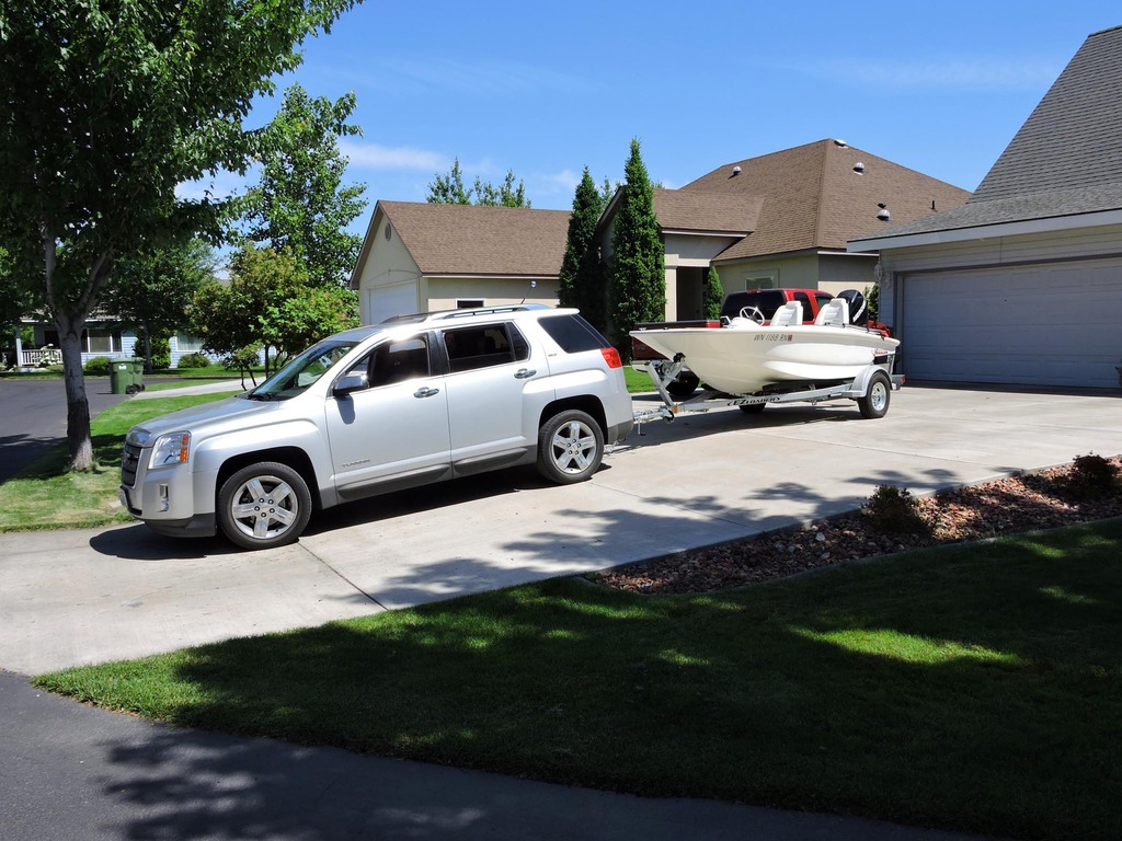
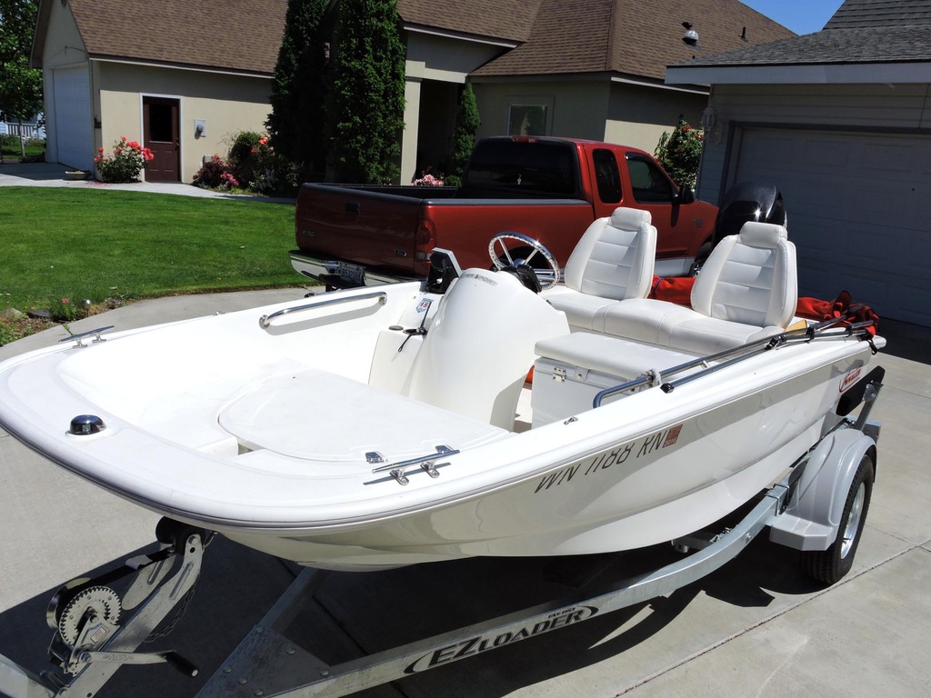
We hitched up the Whaler around 11:00, headed up to a sandwich shop to get some lunch and were on the water before 11:30. The launch ramp is only two miles from home so it’s a quick and easy trip to get there.
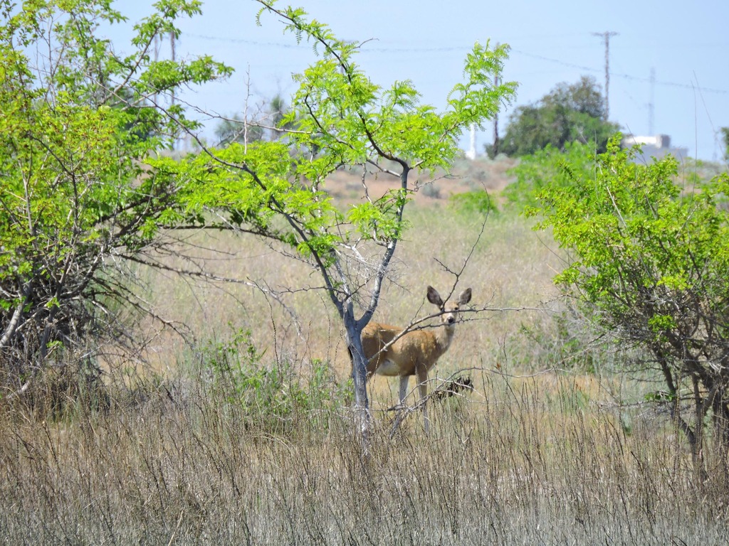
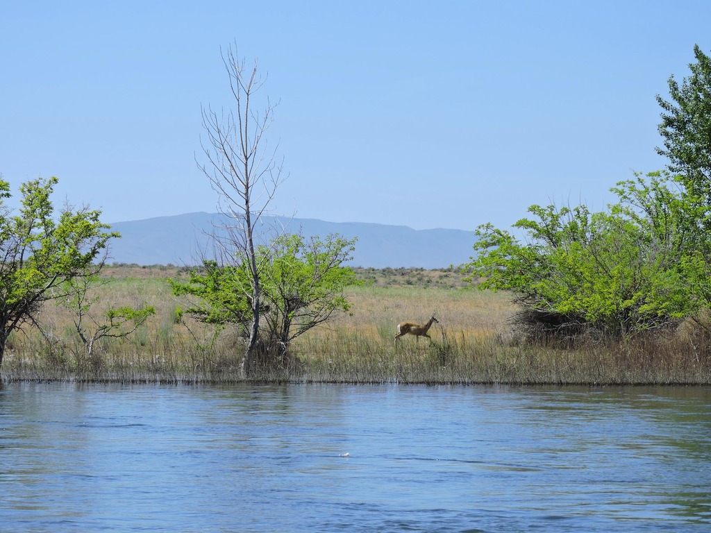
We decided to head up the Columbia to an area I had not been to for many years. We ran up about 20 miles to where a large overhead powerline crosses. Along the way we spotted several deer on one of the islands.
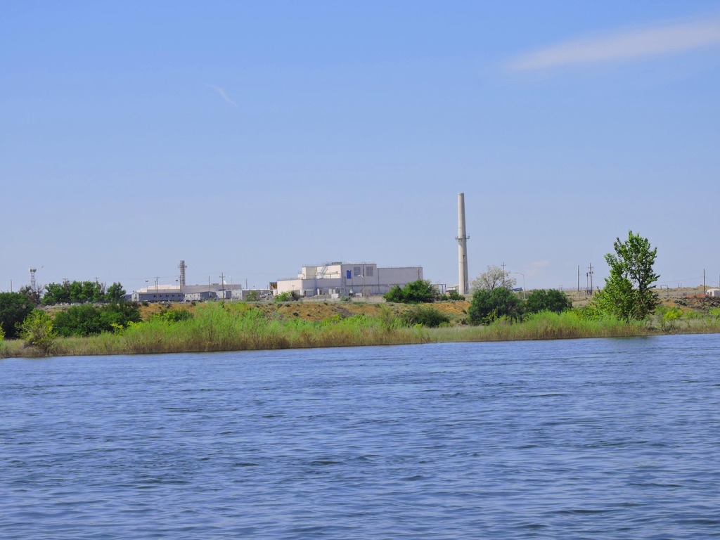
As some of you may know, that part of the Columbia provides the northern and eastern boundaries for the Hanford Nuclear Area. This is where the materials were produced that went into the bombs that were dropped on Hiroshima and Nagasaki to end WWII. Here’s a shot of part of that facility…
The wind started to really kick up (around 20-25kts) and was building so we turned around there and headed back downstream.
That’s an interesting stretch of river because it’s the last “free running” stretch of the Columbia and provides some great salmon and steelhead fishing. There are stretches of the river where the bottom is flat as a pancake and others where the bottom is a long series of holes. Most of the depth in those areas is about 20’-30’ but some of the holes go down to about 60’.
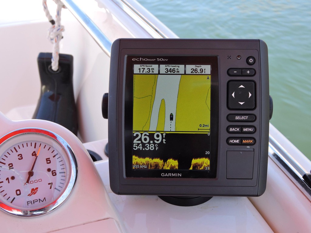
This shot gives a good picture of what the bottom looks like.
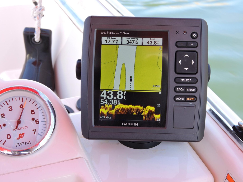
In this picture you can see that much of the bottom is at a depth of ~26’. That hole we just passed over was 62’ deep.
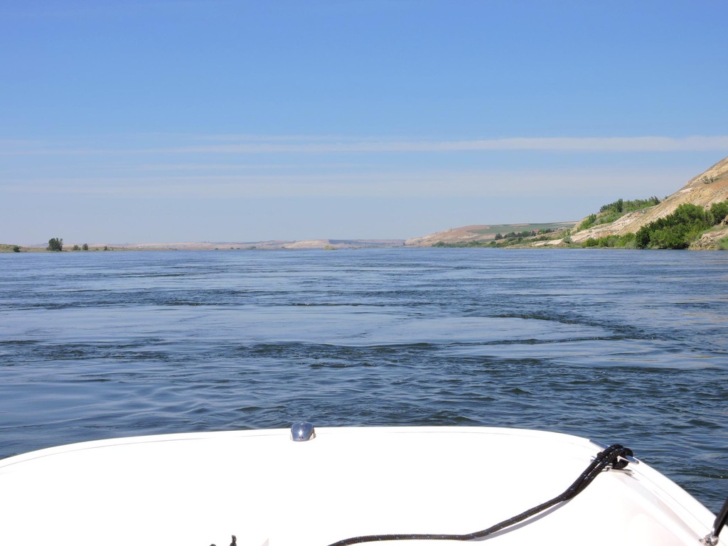
The current was running about 4kts. When we got to some of the deeper holes we could detect them by the swelling of the river surface downstream from them. As the water flows down into the holes then forces its way up as it leaves the column creates large circles on the surface. We were being tossed around a bit by those upward flows. Nothing to be concerned about but it did make for a bumpy ride at times.
Here’s a photo of the water column as it reaches the surface.
After we turned around and headed back down river the winds continued to pick up. By the time we got back to town they were blowing a good 25kts with some gusts a bit higher. Then, when we got a bit further down the river there was no wind at all. Go figure.
Oh well, it still was a fun day on the water. The temp got up to 89* and the winds died as it got closer to dark. What a great day to be retired and be able to take advantage of it.
Today was supposed to be one of those wonderful days for boating…..very few clouds, temps in the high 80’s and light winds. We have found that one of the HUGE benefits of both of us being retired is that we can take advantage of days like this and hit the river.
We hitched up the Whaler around 11:00, headed up to a sandwich shop to get some lunch and were on the water before 11:30. The launch ramp is only two miles from home so it’s a quick and easy trip to get there.
We decided to head up the Columbia to an area I had not been to for many years. We ran up about 20 miles to where a large overhead powerline crosses. Along the way we spotted several deer on one of the islands.
As some of you may know, that part of the Columbia provides the northern and eastern boundaries for the Hanford Nuclear Area. This is where the materials were produced that went into the bombs that were dropped on Hiroshima and Nagasaki to end WWII. Here’s a shot of part of that facility…
The wind started to really kick up (around 20-25kts) and was building so we turned around there and headed back downstream.
That’s an interesting stretch of river because it’s the last “free running” stretch of the Columbia and provides some great salmon and steelhead fishing. There are stretches of the river where the bottom is flat as a pancake and others where the bottom is a long series of holes. Most of the depth in those areas is about 20’-30’ but some of the holes go down to about 60’.
This shot gives a good picture of what the bottom looks like.
In this picture you can see that much of the bottom is at a depth of ~26’. That hole we just passed over was 62’ deep.
The current was running about 4kts. When we got to some of the deeper holes we could detect them by the swelling of the river surface downstream from them. As the water flows down into the holes then forces its way up as it leaves the column creates large circles on the surface. We were being tossed around a bit by those upward flows. Nothing to be concerned about but it did make for a bumpy ride at times.
Here’s a photo of the water column as it reaches the surface.
After we turned around and headed back down river the winds continued to pick up. By the time we got back to town they were blowing a good 25kts with some gusts a bit higher. Then, when we got a bit further down the river there was no wind at all. Go figure.
Oh well, it still was a fun day on the water. The temp got up to 89* and the winds died as it got closer to dark. What a great day to be retired and be able to take advantage of it.
")