You are using an out of date browser. It may not display this or other websites correctly.
You should upgrade or use an alternative browser.
You should upgrade or use an alternative browser.
Navionics screw up.
- Thread starter Hawgwash
- Start date
The friendliest place on the web for anyone who enjoys boating.
If you have answers, please help by responding to the unanswered posts.
If you have answers, please help by responding to the unanswered posts.


C lectric
Guru
It is now there. I just looked.
There was an update last night although it may have been updated some time before. There have been several updates.
But it does bring into question what else may be missing. Islets are one thing, hidden rocks , hope not.
There was an update last night although it may have been updated some time before. There have been several updates.
But it does bring into question what else may be missing. Islets are one thing, hidden rocks , hope not.
sunchaser
Guru
- Joined
- Apr 9, 2008
- Messages
- 10,197
- Location
- usa
- Vessel Name
- sunchaser V
- Vessel Make
- DeFever 48 (sold)
In the IPad post I'd mentioned missing data problems we've seen with Navionics in both AK and BC. It may be only specific to the IPad and or Apple. We have never had an issue with Nobeltec, that is our primary charting system, adequately backed up by Maxsea on NN3. From all we know CE is equally reliable.
Forgetting about the wrath I will receive, our IPad with Navionics is a useful toy and works really good on ferries, show and tell at home or in a bar when BSing about a trip.
Forgetting about the wrath I will receive, our IPad with Navionics is a useful toy and works really good on ferries, show and tell at home or in a bar when BSing about a trip.
Not the first missing exposed rock in the gulf islands. Also missing from CHS charts is a drying reef 100 yards due north of the top end of Walker Hook, Saltspring Island.
They admit it but still don't know how it happened.
Sorry for the quality. Picture is a letter in Pacific Yachting and clearly demonstrates the need for continued use of proper paper charts.
No, it really doesn't do that. Paper charts have their errors too. What it clearly demonstrates is the need for more than one set of charts to serve as a check on each other.
It may or may not also call Navionics into question as one's first choice. We have electronic "paper charts." Only difference in them and paper is they're always up to date. Also there is a system that Transas has that will keep the dates of your paper charts and give you a list of all updates since their issue.
Wxx3
Dauntless Award
- Joined
- Jan 10, 2013
- Messages
- 2,820
- Location
- USA
- Vessel Name
- Dauntless
- Vessel Make
- Kadey Krogen 42 - 148
No, it really doesn't do that. Paper charts have their errors too. What it clearly demonstrates is the need for more than one set of charts to serve as a check on each other.
It may or may not also call Navionics into question as one's first choice. We have electronic "paper charts." Only difference in them and paper is they're always up to date. Also there is a system that Transas has that will keep the dates of your paper charts and give you a list of all updates since their issue.
I always have two sets of charts running.
Have also discovered that at least on computer, some features disappear at certain zoom levels.
So, i use different charts on different platforms, always.
MurrayM
Guru
Have also discovered that at least on computer, some features disappear at certain zoom levels.
Yup...zoom in!
Our paper charts in the Douglas Channel area are notoriously incorrect for the intertidal zones near creek and river estuaries...lots of sediment has been deposited since the charts were made.
Also had a bad experience while sea kayaking the Hecate Strait side of Porcher Island. We saw a squall coming in fast but knew we had time to reach a beach out of sight around a headland. The paper chart showed the beach as a gradual slope with cobbles, but turned out to be fairly steep with dumping surf and rocks the size of Fiats.
There is a ton of information written on the waters surface about what is below...waves change shape because there is more drag to the trough as it passes over shallower water, or currents can speed up or change direction which also changes the shape of the waves.
One eye on the chart(s), one eye on the water, one eye on the depth sounder, and one eye on the radar

oscar
Guru
- Joined
- Oct 22, 2015
- Messages
- 1,098
- Location
- United States
- Vessel Name
- Lady Kay V
- Vessel Make
- 1978 Hatteras 53MY
Have also discovered that at least on computer, some features disappear at certain zoom levels.
They have to....... if you zoomed out and every buoy, marker and hazard staid on there you'd end up looking at something resembling a three year old's finger painting project.
This leads to the interesting realization that SOMEONE decides what disappears when. This is where errors can come in.
Short Captain Oscar fireside story:
Here I was heading South, a good number of miles off the coast of Georgia/Florida, well out of sight of land. Soooo, the chart plotter was on a 100+ mile scale to give me the "big picture"...... Nothing to hit within miles, right?
Fortunately, like a good little mariner I have a large scale paper chart out, and lo and behold it DID show something out there, to wit, a rather sizable tower, something to do with sneaky submarines I was told later
Sooo, back to the chart plotter. It was not on there, in fact I had to zoom to the 4 mile scale !!! to get it to show up, smack dab on my course line...
The "someone" who decided that this was OK was obviously not aware that no one has their plotter on the 4 mile scale in the middle of the ocean....
Last edited:
You're right and it is not confined to the Gulf Islands. Never recorded information is why we need not become complacent and why local knowledge is often critical. Missing or dropping already recorded data, for whatever reason, reinforces the dangers of total (and sole) reliance on electronics.Not the first missing exposed rock in the gulf islands. Also missing from CHS charts is a drying reef 100 yards due north of the top end of Walker Hook, Saltspring Island.
That was my point in saying it "demonstrates the need for continued use of proper paper charts."BandB said:No, it really doesn't do that. Paper charts have their errors too. What it clearly demonstrates is the need for more than one set of charts to serve as a check on each other.
You're right and it is not confined to the Gulf Islands. Never recorded information is why we need not become complacent and why local knowledge is often critical. Missing or dropping already recorded data, for whatever reason, reinforces the dangers of total (and sole) reliance on electronics. That was my point in saying it "demonstrates the need for continued use of proper paper charts."
But you indicated it demonstrates the need for proper paper charts and it does not do that. It simply demonstrates the need for some form of back up charts, but in no way indicates they need to be paper.
At any given time, my electronic charts are more accurate than your paper charts, unless you've completely updated all your paper charts through printing a new set today. Even if you ordered a set, they were outdated when received. Now, do you review all notices to mariners daily and update them manually? Perhaps so, but then you'd never have much time left for boating.
Now, I'd also agree many people aren't adequately trained in using electronic charts but many aren't trained in paper so that's an issue either way.
The danger is not in total reliance on electronic. The danger pointed out is in reliance on only one electronic chart and in not properly using electronic. We're crossing today from Nassau to Harbour Island. We have three sets of electronic charts available. Two are active and the other is only for backup. Also, one of us printed a paper chart last night which is not being used by anyone.
Friend of mine (very experienced and conscientious navigator) hit a rock near Fox Island early this summer. I was there later and confirmed the existence of the rock. It showed on my Cmap chart plotter and on my very old CHS strip charts, but was missing from all other CHS charts and from his Nobeltec system.
Raster charts will not lose detail as the zoom changes, but vector charts will. A well publicized case in point is a recent Volvo Ocean race, Where one of the competitors, with a pro Navigator aboard and in charge, hit a well known reef in the middle of the Indian Ocean, that was only visible at a zoom level considered too close for the long distance of that leg of the trip. Had the navigator used a closer zoom or a raster chart or a paper chart, the reef would have been obvious.
Raster charts will not lose detail as the zoom changes, but vector charts will. A well publicized case in point is a recent Volvo Ocean race, Where one of the competitors, with a pro Navigator aboard and in charge, hit a well known reef in the middle of the Indian Ocean, that was only visible at a zoom level considered too close for the long distance of that leg of the trip. Had the navigator used a closer zoom or a raster chart or a paper chart, the reef would have been obvious.
oscar
Guru
- Joined
- Oct 22, 2015
- Messages
- 1,098
- Location
- United States
- Vessel Name
- Lady Kay V
- Vessel Make
- 1978 Hatteras 53MY
at a zoom level considered too close for the long distance of that leg of the trip. Had the navigator used a closer zoom or a raster chart or a paper chart, the reef would have been obvious.
Again:"No mariner shall rely on one single source of navigation"
What you described is the exact same thing as I posted about above, except I caught it. (luckily)
Alaskan Sea-Duction
Guru
- Joined
- Jul 6, 2012
- Messages
- 8,061
- Location
- USA
- Vessel Name
- Alaskan Sea-Duction
- Vessel Make
- 1988 M/Y Camargue YachtFisher
I hope they get this all resolved before we head north. I will also be updating my navionic chips....
Yes, I said proper paper charts, I stick with that comment and I can pick word nits too. Surely you've seen what can pass for "some form of back up charts?"BandB said:But you indicated it demonstrates the need for proper paper charts and it does not do that. It simply demonstrates the need for some form of back up charts, but in no way indicates they need to be paper.
I guess I'm too old to just give up on the CHS and NOAA paper stuff.
And I'm not interested in turning this into a yes it is, no it isn't a chart/trawler/pigmy debate.
Last edited:
CPseudonym
Moderator Emeritus
I suppose you could always look out the windshield once every hour or two and visually notice there may be a problem with the chart 
Yes, I said proper paper charts, I stick with that comment and I can pick word nits too. Surely you've seen what can pass for "some form of back up charts?"
I guess I'm too old to just give up on the CHS and NOAA paper stuff.
And I'm not interested in turning this into a yes it is, no it isn't a chart/trawler/pigmy debate.
I think it's fair to just say we disagree on the subject that's been debated a million times and that is paper. I've seen what can pass as some form of charts, I've seen people who buy a boat and never update the electronic charts, thinking of them as permanent, and I've also seen some people operating sadly from paper charts they used on their trip 12 years earlier and finding out the shoal they ended up on had formed during that time. Of course these same people don't access any of the other available information such as cruisersnet.net or waterway guide or active captain.
One thing that is not new with technology or specific to charts is the need to maintain current up to date information. Another thing is the knowledge and experience to use the information you have, in whatever form you have it.
Now a paper question for you. In what form do you have paper? Full size, 36" unbound? Bound? Reduced to pamphlet or notebook size? 2/3?
Personally, don't like the 8 1/2 x 11 booklet charts although I'd see them as excellent backup and emergency use. However, I do find printing them at 2/3 size, the charts lose nothing from full size and are easier to use, especially when laying many out at one time. However, it obviously requires adjusting to a different scale.
" hope they get this all resolved before we head north. I will also be updating my navionic chips...."
By all means update. Just don't count on your up to date Navionics to have caught everything, as the update is only as good as the programmer and the source material she uses.
Extreme example: We chartered in Turkey in 2007. The boat came with a chart plotter, same as here. Also had a paper chart. Singular! The guide book cautioned that the paper chart was based upon a survey done by a guy named Beaufort and could be as much as 1 nm off what your GPS will say. Beaufort is the guy who originated the "Beaufort Scale" in 1805.
The chart plotter was based on the same survey so no better. Luckily, in that part of the Med, hazards are pretty obvious in most conditions, so the chart is less important than say BC, where you can't see much over 5 ft down.
Point is, the charts, plotter chip, CD or placemat chart is no better than the source survey, so looking out the window still needs to be your primary form of navigation.
BandB;
We do agree, you, koliver, CP, and me (I?)( Ask the teacher about that and get back to me); it's about being smart.
I've encountered people near Campbell River using a Shell Oil Highway Map and heard of others, as alluded to by koliver, with a BC Ferries place mat(don't know if the ferries still have those).
Having not yet moved to the marine digital age, I confess all I have is paper. Mostly outdated paper. Many BC Coast full size charts of various scales, the most recent, but outdated, Marine Atlas Volumes 1 & 2, current Evergreen Cruising Atlas for Northwest Waters and various local area cruising guides.
These are all for entertainment, homework purposes and keeping track of friends who have spent 4-5 months every year for the past 20, north of Cape Caution. I have flown up to spend time with them so at least know what a plotter IS.
Aside from that, all my boating was done with paper charts, a fixed and hand bearing compass, deviation, tide and current tables, a measured mile speed chart, sounder and radio. More than once I had to sit in the dark studying light characteristics to figure out where I was.
As I have said before, I am between boats; a long between and in the process of preparing for the day I will be back. However, it seems like Xi Jinping, Mr. Dow and Mrs. Jones might have other plans for me.
An afterthought...I wonder how many boaters even know how to read a paper chart, it's title block and compass rose. Aside from those here, of course.
We do agree, you, koliver, CP, and me (I?)( Ask the teacher about that and get back to me); it's about being smart.
Exactly.BandB said:I've seen what can pass as some form of charts.
I've encountered people near Campbell River using a Shell Oil Highway Map and heard of others, as alluded to by koliver, with a BC Ferries place mat(don't know if the ferries still have those).
In that scenario any boaters should know the potential for the bottom changing in any number of circumstances whether it's Toba Inlet or Tilloo Cut. Otherwise...not smart....finding out the shoal they ended up on had formed during that time.
Do Quimby's 1992 Cruising Guide and Wilensky's Cruising Guide to the Abacos and Northern Bahamas qualify?Now a paper question for you. In what form do you have paper? Full size, 36" unbound? Bound? Reduced to pamphlet or notebook size? 2/3?
Having not yet moved to the marine digital age, I confess all I have is paper. Mostly outdated paper. Many BC Coast full size charts of various scales, the most recent, but outdated, Marine Atlas Volumes 1 & 2, current Evergreen Cruising Atlas for Northwest Waters and various local area cruising guides.
These are all for entertainment, homework purposes and keeping track of friends who have spent 4-5 months every year for the past 20, north of Cape Caution. I have flown up to spend time with them so at least know what a plotter IS.
Aside from that, all my boating was done with paper charts, a fixed and hand bearing compass, deviation, tide and current tables, a measured mile speed chart, sounder and radio. More than once I had to sit in the dark studying light characteristics to figure out where I was.
As I have said before, I am between boats; a long between and in the process of preparing for the day I will be back. However, it seems like Xi Jinping, Mr. Dow and Mrs. Jones might have other plans for me.
An afterthought...I wonder how many boaters even know how to read a paper chart, it's title block and compass rose. Aside from those here, of course.
Last edited:
ranger58sb
Guru
That was my point in saying it "demonstrates the need for continued use of proper paper charts."
But you indicated it demonstrates the need for proper paper charts and it does not do that. It simply demonstrates the need for some form of back up charts, but in no way indicates they need to be paper.
At any given time, my electronic charts are more accurate than your paper charts, unless you've completely updated all your paper charts through printing a new set today. Even if you ordered a set, they were outdated when received. Now, do you review all notices to mariners daily and update them manually? Perhaps so, but then you'd never have much time left for boating.
Raster charts will not lose detail as the zoom changes, but vector charts will. A well publicized case in point is a recent Volvo Ocean race, Where one of the competitors, with a pro Navigator aboard and in charge, hit a well known reef in the middle of the Indian Ocean, that was only visible at a zoom level considered too close for the long distance of that leg of the trip. Had the navigator used a closer zoom or a raster chart or a paper chart, the reef would have been obvious.
Having not yet moved to the marine digital age, I confess all I have is paper. Mostly outdated paper.
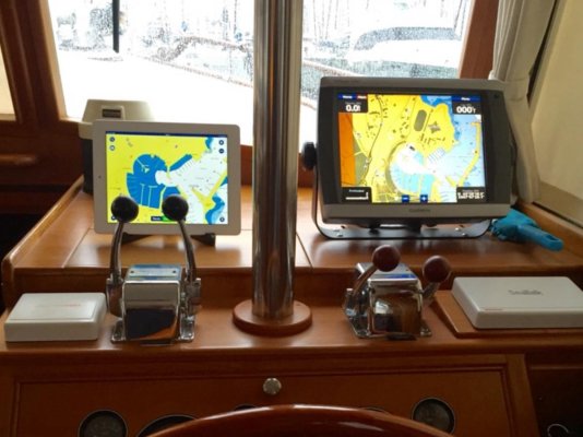
We've found it very useful to use multiple electronic charts simultaneously, and a combination of raster (NOAA, for where we boat) and vector (NOAA and C-Map). With updates. And usually at different zoom levels on each plotter or device, for a combination of context and detail.
I think the only specific discrepancy I've really noticed is about one nearby bridge clearance notation, present in raster and one vector but not the other vector... but that may have been about zoom level. It wasn't important to us at the time, so only noted as an interesting factoid. But it also suggested multiple charts -- and chart forms -- is a good thing.
While we do keep some paper on board... I tend to think "proper" charts don't have to be huge, bulky, soggy... and I like being able to easily erase soft waypoints and routes afterwards so "the chart" can be re-used without so much potential confusion afterwards. Or being able to save those for recall later... and so forth.
One of our GPS units has trouble finding a fix in one area of the lower Delaware Bay. Dunno why, but its the differential unit so I suspect it's about receiving (or not) the land-based correction signal. Even in that area, by golly, those other three GPS units on board (not even counting our phones) all seem to work fine.
So unless all the satellites all fall out of the sky at once... maybe that then means the paper might come in hand in case electricity completely disappears... but generally if that happens I'd guess we'd have other things to fix first.
Good to have paper? Yes. Mandatory? Not for us. Useful? So far, not for us. Still have it? Yes, mostly cluttering up the place...
-Chris
JDCAVE
Guru
- Joined
- Apr 3, 2011
- Messages
- 2,911
- Location
- Canada
- Vessel Name
- Phoenix Hunter
- Vessel Make
- Kadey Krogen 42 (1985)
Here's the CHS raster chart for the area in question from my iPad app iNavX. It shows a small islet, dry at all tides.

Here's the same view from the Navionics charts, same app.

The Navionics app does not show it as drying.
Apple maps, accessed from the iNavX app shows the treed islet.

The question to me is: what are the source data for Navionics charts? Probably CHS and presumably electronic. I don't have the CHS ENC charts. It would cost close to $2,000 for these. Do they show the islet in question?
Murray's point is important. There are large parts of the BC coast that are poorly charted. Paper charts are not an improvement and neither are the 3rd part charts.
They are aids to navigation. Not without
Jim
Sent from my iPad using Trawler Forum
Here's the same view from the Navionics charts, same app.
The Navionics app does not show it as drying.
Apple maps, accessed from the iNavX app shows the treed islet.
The question to me is: what are the source data for Navionics charts? Probably CHS and presumably electronic. I don't have the CHS ENC charts. It would cost close to $2,000 for these. Do they show the islet in question?
Murray's point is important. There are large parts of the BC coast that are poorly charted. Paper charts are not an improvement and neither are the 3rd part charts.
They are aids to navigation. Not without
Jim
Sent from my iPad using Trawler Forum
JDCAVE
Guru
- Joined
- Apr 3, 2011
- Messages
- 2,911
- Location
- Canada
- Vessel Name
- Phoenix Hunter
- Vessel Make
- Kadey Krogen 42 (1985)
A very long time ago Capt. George Vancouver was busy charting. How did he keep from sinking his boat in the uncharted waters he plyed? Vigilance.
Yes! I bet he also bumped into a few rocks along the way.
Jim
Sent from my iPad using Trawler Forum
Well said !
That's a good advice, I do use charts on different platforms as well : Navionics charts on IPad and Garmin charts.
I always have two sets of charts running.
Have also discovered that at least on computer, some features disappear at certain zoom levels.
So, i use different charts on different platforms, always.
That's a good advice, I do use charts on different platforms as well : Navionics charts on IPad and Garmin charts.
Attachments
It's shown as an Islet.The Navionics app does not show it as drying.
A lot of the wrecks in Nootka Sound are from mistaking it for Juan de Fuca.A very long time ago Capt. George Vancouver was busy charting. How did he keep from sinking his boat in the uncharted waters he plyed? Vigilance.
Vigilance. ��
Last edited:
rochepoint
Guru
- Joined
- Apr 4, 2009
- Messages
- 1,747
- Location
- Sidney BC, Canada
- Vessel Name
- Roche Point
- Vessel Make
- 1985 Cheer Men PT38 Sedan
Just checked Time Zero, Garmin BlueChart, both Navionics/Navionics HD, Plan2Nav all on an old Ipad. Nobeltec Odyssey, OpenCPN and Polar Navy on the boats laptops and all devices are showing the islet in question ............ 
Haha.Just checked Time Zero, Garmin BlueChart, both Navionics/Navionics HD, Plan2Nav all on an old Ipad. Nobeltec Odyssey, OpenCPN and Polar Navy on the boats laptops and all devices are showing the islet in question ............
HI Mike.
In the article, it appears as though Navionics might have been a little defensive, until they actually checked.
There was a thread a couple months ago by a well seasoned and qualified chap in the NE. Maine, maybe. Same situation, I don't remember which chart and couldn't find the thread.
Last edited:
Alaskan Sea-Duction
Guru
- Joined
- Jul 6, 2012
- Messages
- 8,061
- Location
- USA
- Vessel Name
- Alaskan Sea-Duction
- Vessel Make
- 1988 M/Y Camargue YachtFisher
A very long time ago Capt. George Vancouver was busy charting. How did he keep from sinking his boat in the uncharted waters he plyed? Vigilance.
I bet there are still places in BC and Alaska which Capt. Vancouver's charting is still the latest update!

Jim " I don't have the CHS ENC charts. It would cost close to $2,000 for these. Do they show the islet in question?"
I have an old set of CHS ENC charts. They show a rock, drying 1m.
I have an old set of CHS ENC charts. They show a rock, drying 1m.
Similar threads
- Replies
- 13
- Views
- 957
Latest posts
-
-
Fixing boats in Exotic Places - are new boats really that bad?
- Latest: Hippocampus
-
-
-
-
-
-

-

-