A nice afternoon on the water...

The friendliest place on the web for anyone who enjoys boating.
If you have answers, please help by responding to the unanswered posts.

GFC

Guru
Joined
Nov 14, 2012
Messages
4,406
Location
USA
Last Thursday GW and I decided to take the boat for a ride. It had been awhile since we’d been anywhere and even though it was a day when the skies were filled with smoke from the forest fires it was a nice day. We pulled out of the slip around 2:30 headed downstream to McNary Dam.

It’s about 36 miles each way so we slow cruised down there, running about 10.2 kts. I took several pics and will add them in here because I know the rule: If there ain’t photos it didn’t happen! The quality of a couple of these isn't up to par because I took them with my phone. Sorry, next time I'll take the camera.

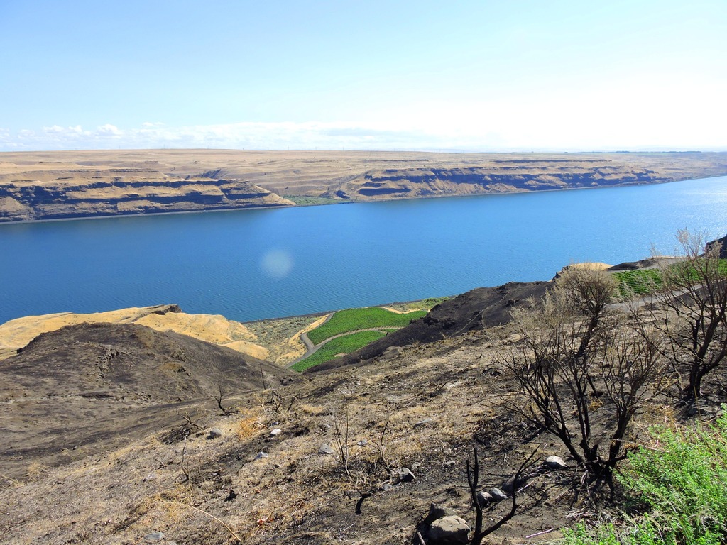
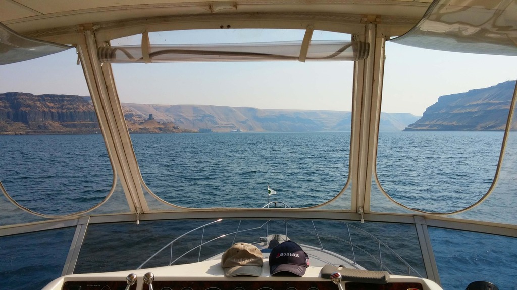
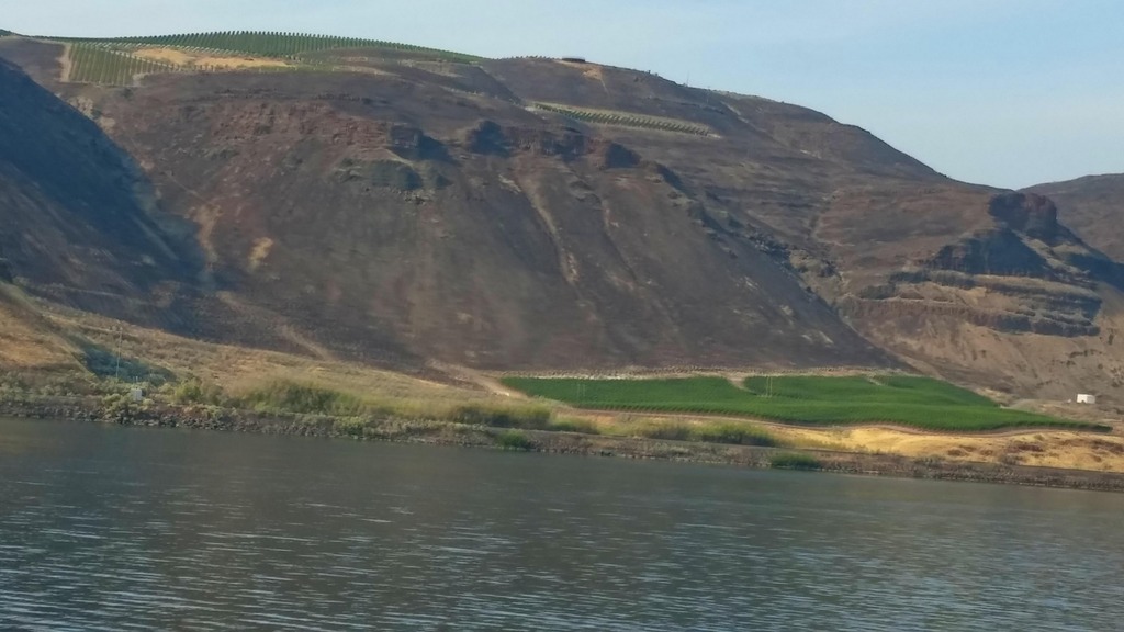
Here’s what it looked like as we entered what’s known locally as the Wallula Gap area of the river. You can see some of the smoke in the air but it’s not too bad here.
img_364232_0_ccb50f7bf889491c26502143bbfe6159.jpg


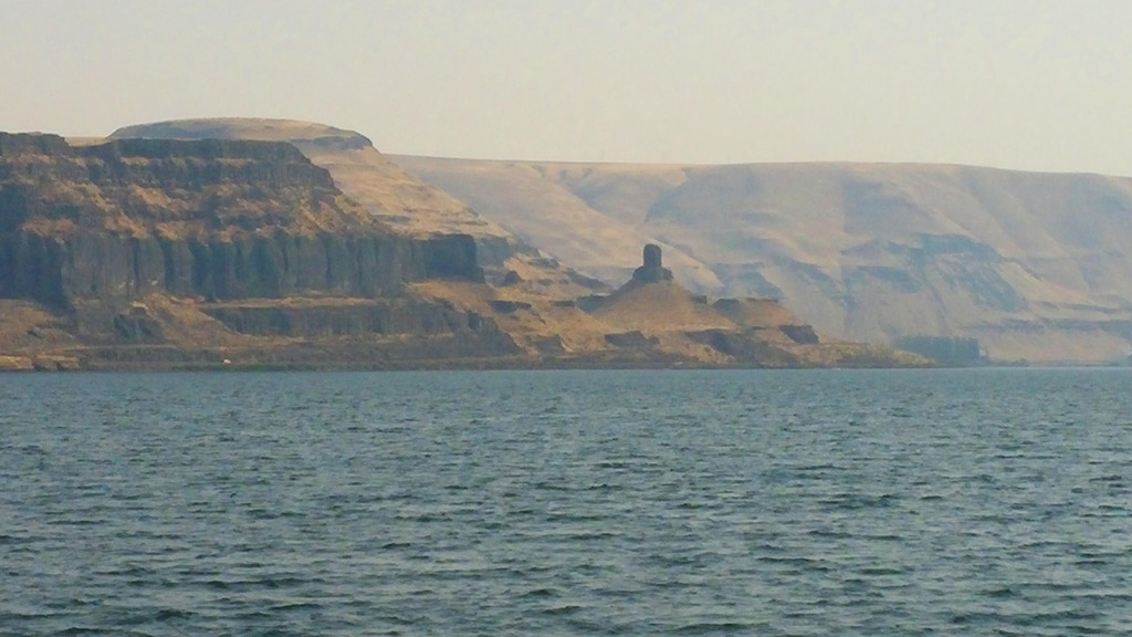
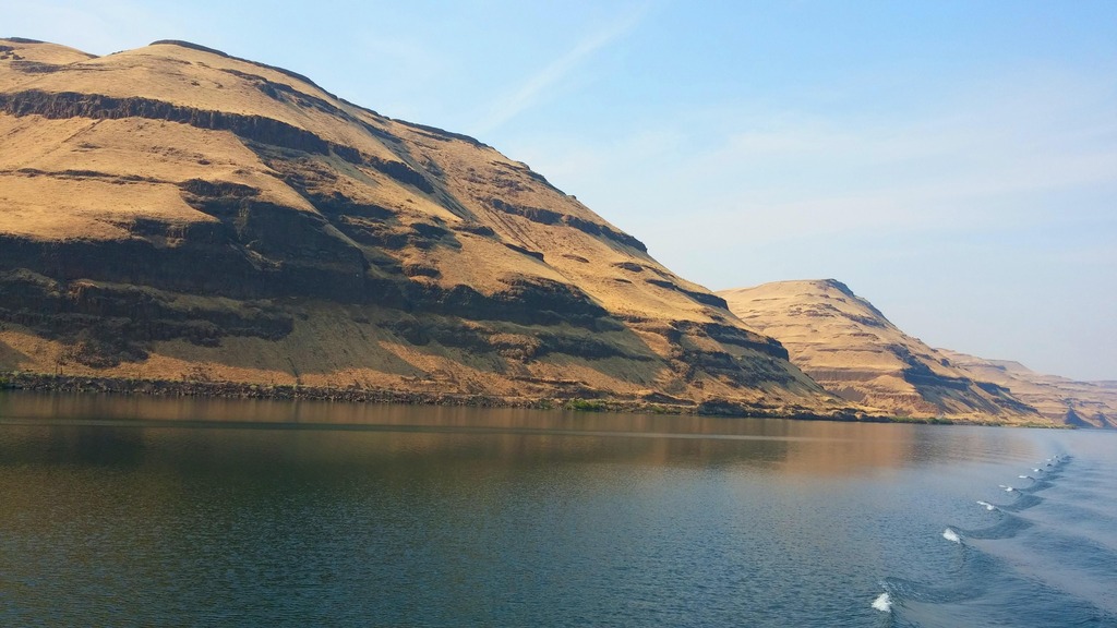
This is an area on the Oregon side of the river, right at the bend near Wallula. The two peaks sticking up are known as the “Two Sisters”.
img_364232_1_72223cedee37abffe890c980611e03c2.jpg

img_364232_2_2054cb7d61604b579106b1bfa24d6c08.jpg


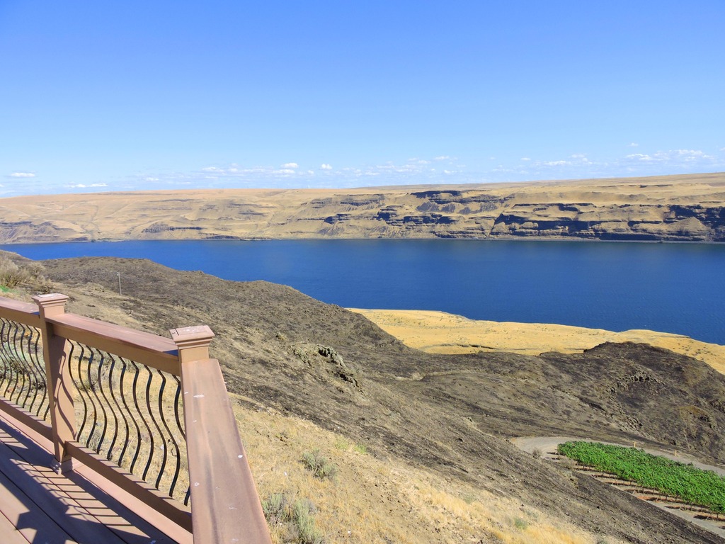
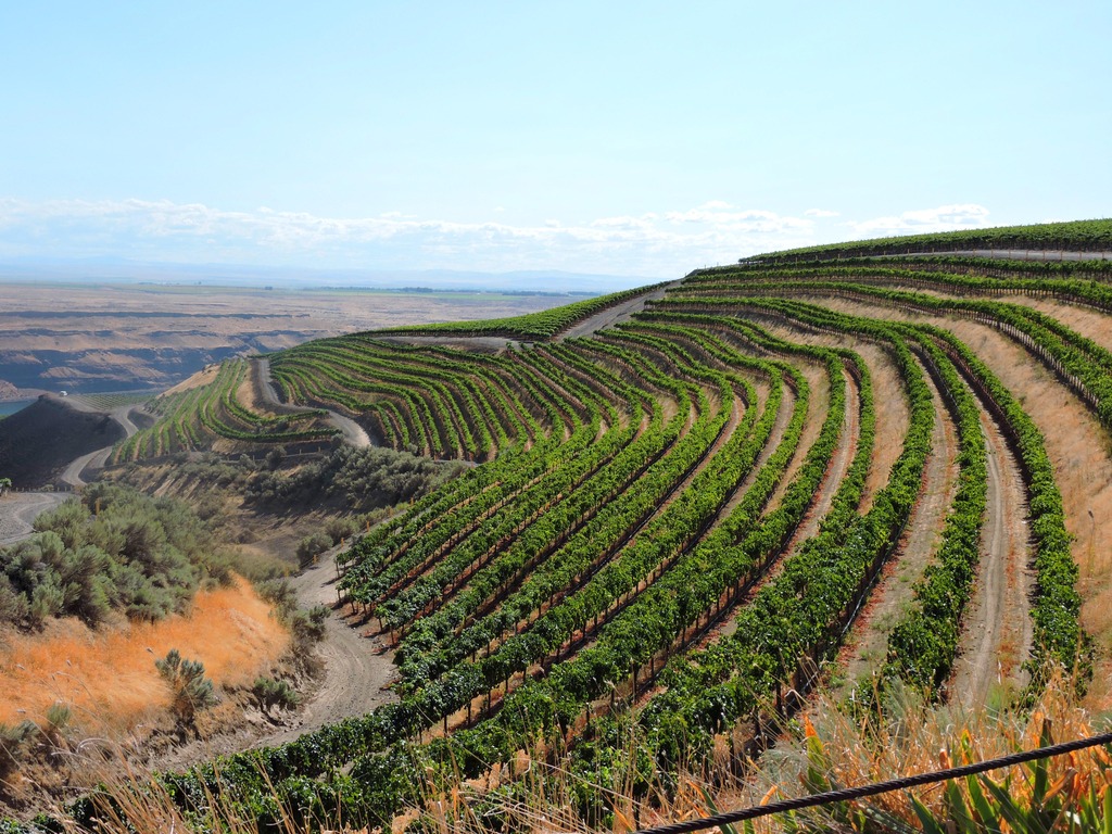
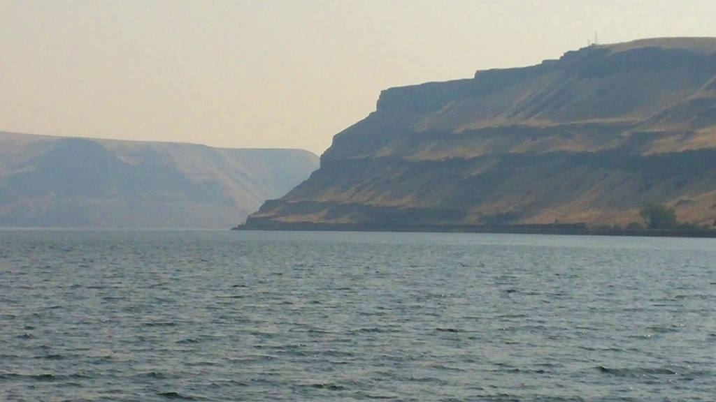
Most of the rock formations along this stretch of the river are 600-700 feet high and much of the land on top is agricultural. Lots of irrigation circles to water the crops with the water taken right out of the Columbia.
img_364232_3_4afa6d3f500446201eb2f2eaa4f0e216.jpg


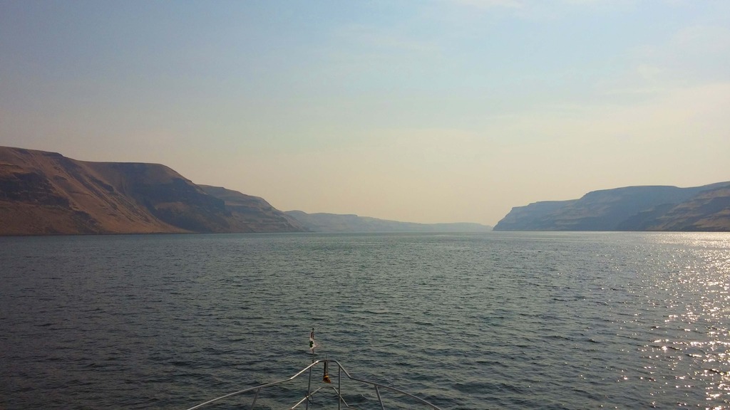
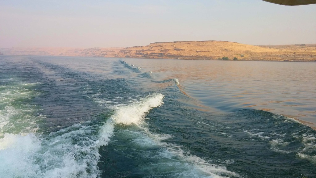
As we got further downriver the smoke started to get heavier as we ran into the smoke from fires in Oregon.
img_364232_4_b3e2d2b114459b993d1f882b12e1d575.jpg


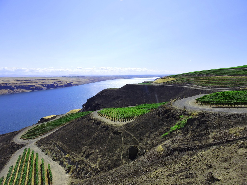
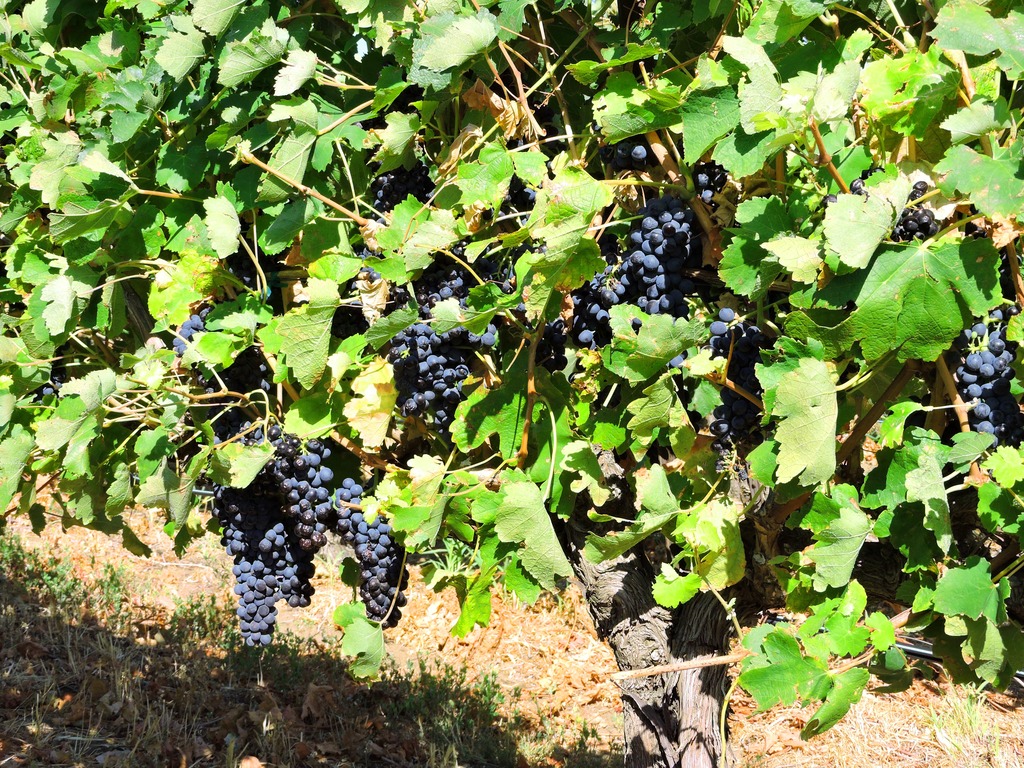
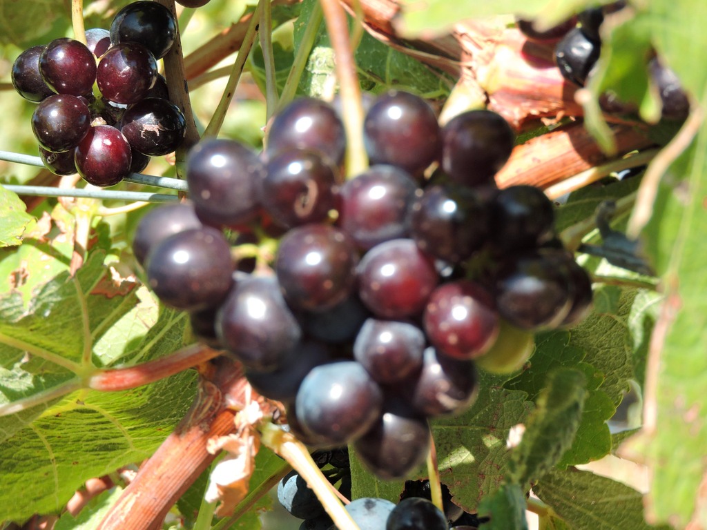
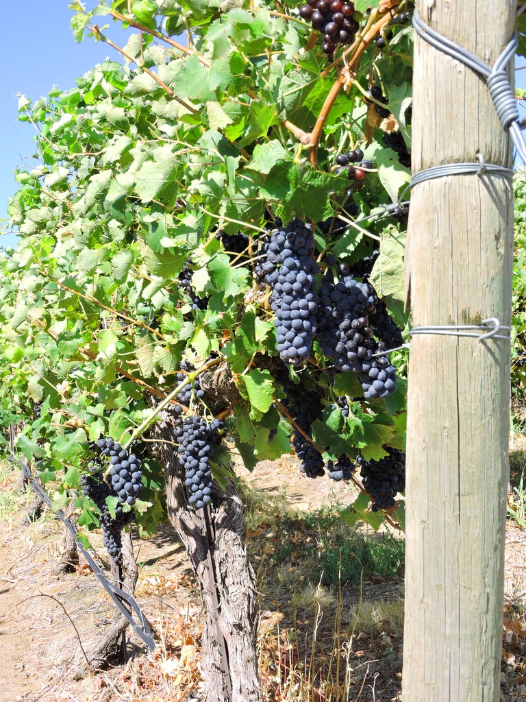
We hadn’t been down that stretch of the river in a couple of years and we were surprised to see how many vineyards had been planted. It seemed every spot where the land got even close to flat, they put in some fines.
img_364232_5_710e6e711fd791b0fd4dcd9a62dffb66.jpg

img_364232_6_522c71d8db7ec503ca36641fc9ba3665.jpg


Since no trip report is complete without at least one wake shot, here’s one at 10 kts…
img_364232_7_988c0cc9a31ae9f0a6356ea6b23d2c8b.jpg


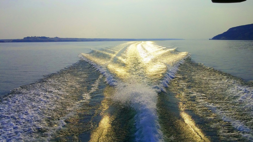
And one on the way home when we were running on plane, about 22kts.
img_364232_8_98f55e0dd21435a2a6da84d04d2e99c9.jpg


It took us about 3.5 hours to get down there at hull speed and about 1.5 hours to get home running on plane. I won’t talk about the fuel consumption difference!
 
Very nice. Cool to be able to boat without a crowd (though sometimes people watching can also be fun!).
 
Thanks for putting that up Mike.
I love the Columbia and how it changes so dramatically throughout it's travels. Parts of it remind me of Lake Powell on the Colorado, another gem.

I've ridden up or down most of the Columbia but only had minimal boat time around Portland.

I just assumed you kept the Sea Ray in Puget Sound, so that's a long haul to the coast and something that must take some planning. Wow!
 
Lake Powell you say? Hang on for a thread! ;)
 
Thanks for putting that up Mike.
I love the Columbia and how it changes so dramatically throughout it's travels. Parts of it remind me of Lake Powell on the Colorado, another gem.

I've ridden up or down most of the Columbia but only had minimal boat time around Portland.

I just assumed you kept the Sea Ray in Puget Sound, so that's a long haul to the coast and something that must take some planning. Wow!
Nope, we're river boaters, at least for now. I don't know yet when our trip up to your waters will take place. It depends on my MIL. She's going to be 100 in December and as long as she's around we won't make that trip because we don't want to be gone or out of touch for long periods.

I'm already working on the planning for that trip. At this time it looks like it'll be about 100-110 days long and encompass about 2500 miles. The logistics of planning food and supplies for that trip is quite a job but it's one I'm having fun with.

Lake Powell? I'd love to see a thread on that! Bring it on!!
 
Hmmm. While Lake Powell appears full, down river Lake Mead is at its lowest level.
 
Man, you WC guys and gals sure have some stunning scenery to take in while cruising compared to our tidal flats.

Heck I was all excited about the view from my new slip! ?

ImageUploadedByTrawler Forum1441022545.918459.jpg

One day I would like to charter a boat on the WC to see what I'm missing. Where should I charter?
 
Sigh, I'd like to see Texas where should I rent a car?


Texas is nice in the Fall. Football weather!

Fly into Austin (centrally located, great city), rent a car at the airport, and drive for days/weeks (it's big).
 
The only places I've seen up here to charter boats are located in Puget Sound. That is some VERY pretty cruising grounds over there and you would not be disappointed by the scenery.


Our area is a desert and is totally different from what you see on the west side of the state and totally different from what you see another 100 miles down the Columbia. Down in that stretch of river it's forests, big trees, everything is green....more like what people think of when they think of the PNW.


Here, we get 300 days of sunshine a year and about 8" of rain. It's a true desert in every sense of the word and makes for some great boating adventures.
 
Beautiful! Thanks for sharing. What is the current like on that part of the river?
 
Carolena, in the spring the current can run ~4kts or a bit higher. This time of year it's about 2kts. The river flow and height is completely controlled on this end of the river (and on the Snake River) by the Corps of Engineers dams. There are 4
navigable dams on each of the two rivers.


Today was a nice day so we thought we’d take a ride back down to the stretch of Columbia we photographed above, only this time we went by car and shot the photos from the top of those mesas.


As it turned out, we were both surprised by the amount of land that has been turned into vineyards. The whole area is owned (to my surprise) by a company called Easterday Farms. They’re based right here in Pasco and is a family owned farm that appears to be doing VERY well. Here’s a link to their website: Easterdayfarms.com.


As I said, it was a nice day with temps in the mid 70’s, light winds, just a very few high, thin clouds. A perfect day for a road trip.


I didn’t take any pics on the way down to where we were overlooking the river because there’s not much to see there. But once we got to the river I snapped a few. Neither of us had ever been to this area before and all it is for roads are single lane gravel roads once you get off the main drags.


So here’s what we saw from up top.
img_366067_0_3690af66d62f5b9db706d41ca79efc87.jpg


img_366067_1_e8cf4d2b5f87eb275c01cb3366de7812.jpg


img_366067_2_328f9c1a05ace3f8ef72946106231761.jpg


img_366067_3_25f154d589b7d42688db48e51aa5c029.jpg


All of the vines where we stopped were Merlot variety, but there were several others that we saw. Here’s GW as she sampled a few grapes.


img_366067_4_65d832dc46210f1c0753732562e94f86.jpg


And here’s what the Merlot grapes look like before they are picked. These vines are really ready to be picked and I would guess that in the next few days these vineyards will be swarming with pickers.


img_366067_5_e48db4872a47b506d212522c8f8d2ccd.jpg


img_366067_6_c9228d6ea34cd61f3db4e09a6f58e090.jpg


img_366067_7_c1e59fbc63045d87374082032ee60e4b.jpg


When we were on the boat and taking pics it looked as though they planted vines on just about every flat area. From the top you can see that they don’t limit themselves to the flat areas, they plant on the sides of the hills also.


img_366067_8_8c19386c8ff8d1fedb0ee8426ea34bbc.jpg


All totaled, the trip today was only 56 miles and took us about 4 hours. Needless to say, a great time was had by both of us.
 
Great photos looks so peaceful
 
Alan, peaceful would be a good term to describe that area. No boats, very few other people around (a few employees working in the vineyards), no wind, no sounds at all except GW munching on grapes!
 
I've always been impressed by the hillside farming that is common in central and eastern WA. It must be extra challenging to operate big equipment onto those terraced slopes.

Great shots!
 
Al, I suspect most of those vines on the terraced vineyards are picked and maintained by hand. If you look at that last photo you can see the tracks of a quad runner between the rows of vines. There were quite a few of those running around when we were down there.


If you want to see the specific area of the river we were above, go to Google Earth and type in McNary Dam, Or. Look just upriver from there and you'll see Van Skinner Island. That was right below where we were.

Beautiful country. Barren and stark in many areas with its own kind of beauty.
 
GFC, not far from where you were, around Walla Walla, there are hundreds of acres of onions grown on hillsides. They obviously like it...Walla Walla sweet onions are one my favorites!
 
Al, we ALL love WW Sweets! They're getting real close to harvesting those and it's a great drive to run down through those onion growing areas. The sweet smell coming off those onions is a delight to the senses.


It's sad, but they drop more WW Sweets off the trucks as they travel the roads than we could ever eat in a year. Maybe we should go on an Onion Treasure Hunt down there.
 
It's sad, but they drop more WW Sweets off the trucks as they travel the roads than we could ever eat in a year. Maybe we should go on an Onion Treasure Hunt down there.

That's similar to what we see here in SacraTomato. We have tomatoes growing on the outside bend of many routes traveled by the 'mater trucks. It's not unusual to see a dozen or so piled up in the shoulder along the bend of a freeway exit.
 
How far up the river can you take your boat, GFC?
 
Toby, we can go up the Columbia only a few miles before it becomes to shallow to navigate. We can go down the Columbia 325 miles to the Pacific. We've been downstream to Portland, OR (230 miles) twice.


A few miles downstream of our marina the Snake River dumps into the Columbia. I've boated all 155 miles from where the Snake ends up to Lewiston, ID. Pretty country that looks much like those pics of the barren hills.


Between here and Portland there are four USCOE dams and four more along the Snake River. They're fun to go through and a bit overwhelming the first couple of times.


On an unrelated note, I google mapped Hope, ID to find out where it is. I found it on the shores of Lake PO. Last summer we took our 13' Whaler up there, staying at Bayview. We took the Whaler from Bayview up to Sandpoint, had some lunch and returned to Bayview. Beautiful lake, some beautiful homes along the way, and some gorgeous scenery. Nice country you live in up there!
 
Last edited:

Latest posts

Back
Top Bottom