You are using an out of date browser. It may not display this or other websites correctly.
You should upgrade or use an alternative browser.
You should upgrade or use an alternative browser.
Laptop Marine Navigation
- Thread starter FredB
- Start date
The friendliest place on the web for anyone who enjoys boating.
If you have answers, please help by responding to the unanswered posts.
If you have answers, please help by responding to the unanswered posts.
Retriever
Senior Member
Coastal Explorer, especially if you're traveling in B.C. You can download raster and vector charts for B.C. for $99 each. Coastal Explorer is about $300 from Defender.
Excellent customer service, stable software, fully featured.
I run CE on a cheap Windows 8 laptop, I think I paid $300-400. It gets GPS and AIS over WiFi from a black box Vesper Marine AIS transceiver. The computer is used exclusively for navigation and I only connect it to the internet a few times a year to download chart updates. I did have to spend some time getting rid of all the bloatware that came on the PC.
N4712
Guru
- Joined
- Apr 22, 2013
- Messages
- 3,607
- Location
- U.S.A
- Vessel Name
- Oliver
- Vessel Make
- Nordhavn 47 Hull# 12
Coastal Explorer, especially if you're traveling in B.C. You can download raster and vector charts for B.C. for $99 each. Coastal Explorer is about $300 from Defender.
Excellent customer service, stable software, fully featured.
I run CE on a cheap Windows 8 laptop, I think I paid $300-400. It gets GPS and AIS over WiFi from a black box Vesper Marine AIS transceiver. The computer is used exclusively for navigation and I only connect it to the internet a few times a year to download chart updates. I did have to spend some time getting rid of all the bloatware that came on the PC.
I run the same exact setup for mobile around the boat use. Love my XB8000 too.
drb1025
Guru
I run CE on the boat PC, networked to Furuno NavNet2, receiving GPS, depth, temp from Furuno components and AIS from a separate unit connected directly to the PC. With a Macbook at home, I use CE running on Parallels for planning. I also save the routes, marks, etc., on dropbox from both machines so I don't have to transfer the file on a flash drive from home to the boat.
Coastal Explorer, especially if you're traveling in B.C.
Thanks for pointing out CE.
Here is a series of video tutorials.
kelbylinn
Senior Member
- Joined
- Oct 13, 2007
- Messages
- 156
- Location
- USA
- Vessel Name
- Coconuts
- Vessel Make
- 1996 49' Krogen Express
I have garmin,s blue chart vision on my mini iPad and on my iPhone 6. It's a great program and truly compliments the main garmin chart plotter. I can plan ahead for anchorages with built in active captain or look for interesting side trips and not mess with the main system.
siestakey
Guru
- Joined
- Jul 7, 2013
- Messages
- 1,815
- Location
- USA
- Vessel Name
- Steppin Stone IV
- Vessel Make
- Marine Trader Kelly Trawler 46
I have garmin,s blue chart vision on my mini iPad and on my iPhone 6. It's a great program and truly compliments the main garmin chart plotter. I can plan ahead for anchorages with built in active captain or look for interesting side trips and not mess with the main system.
I have the same but not the Vision I think I will upgrade to the Vision after watching some videos on youtube
Wxx3
Dauntless Award
- Joined
- Jan 10, 2013
- Messages
- 2,820
- Location
- USA
- Vessel Name
- Dauntless
- Vessel Make
- Kadey Krogen 42 - 148
For my laptop, Polar View worked great with GPS puck if you only need US charts. It fully integrated Active Captain and was simple to use.
I now have Coastal Explorer, which is more full featured, but also more complicated, everything else being equal.
I do like CE and I got if for the non US charts as it runs Jepp's C-maps.
I also now have it on my laptop and it too has not problem with the Amazon $25 GPS puck.
Navionics is on my tablet and smart phone.
Just in the last two days, we have had a few occasions that it is nice to have a second opinion.
I use Garmin BlueChart Mobile (to the best of my knowledge there is no Vision version of the mobile application) on my GPS enabled iPad. I use it to plan routes that I then upload via WiFi to my Garmin MFD. Active captain data is overlaid on the charts. I also use it as a follow along chart plotter to see and review Active Captain hazard information.
I also use Nobletec TimeZero on my iPad. Pretty full featured "chart plotter".
While I use the iPad apps as planning tools and backups, I would be happy to use either app for casual coastal cruising.
Arch
I also use Nobletec TimeZero on my iPad. Pretty full featured "chart plotter".
While I use the iPad apps as planning tools and backups, I would be happy to use either app for casual coastal cruising.
Arch
- Joined
- Oct 1, 2007
- Messages
- 7,331
- Location
- Texas
- Vessel Name
- Floatsome & Jetsome
- Vessel Make
- Meridian 411
This has to explain it.
John Baker I asked my son and he told me similar to above, that though my iPad does not have a SIM card(my choice) it is cellular capable and the GPS is fully functioning. I've been in Dana Point and San Diego this weekend and Navionics has worked fine without data.
Ok. That explains it. And I knew that would work. Even though you don't have a cell plan the iPad is capable and it still tracks cell towers for aGPS usability. And you/someone still paid the extra $150 for a cellular capable iPad.
Has anyone used an iPad for position fixing in the middle of the ocean??? I'm just curious how well it works when there are absolutely no cell towers in range.
We used an iPad this spring in the Bahamas when there was no cell coverage and it worked fine.
CPseudonym
Moderator Emeritus
We used an iPad this spring in the Bahamas when there was no cell coverage and it worked fine.
That iPad this weekend I used the maps GPS app to get me home from San Diego(about 7 1/2 hour drive) much of the drive had no cell coverage and the iPad never stopped tracking us.
Robster_in_edmonds
Senior Member
The chipset with cellular and GPS has a GPS antenna and all necessary GPS functionality. It works even when you are out of cell tower range because it is a true GPS receiver.
Yes, it will work if you are in the middle of the ocean. It is true GPS.
Yes, it will work if you are in the middle of the desert. It is true GPS.
Yes, it will work if you are in the mountains where there is no cell service. It is true GPS.
Ahhhh. I feel better now. ?
Yes, it will work if you are in the middle of the ocean. It is true GPS.
Yes, it will work if you are in the middle of the desert. It is true GPS.
Yes, it will work if you are in the mountains where there is no cell service. It is true GPS.
Ahhhh. I feel better now. ?
CPseudonym
Moderator Emeritus
rochepoint
Guru
- Joined
- Apr 4, 2009
- Messages
- 1,747
- Location
- Sidney BC, Canada
- Vessel Name
- Roche Point
- Vessel Make
- 1985 Cheer Men PT38 Sedan
The chipset with cellular and GPS has a GPS antenna and all necessary GPS functionality. It works even when you are out of cell tower range because it is a true GPS receiver.
Yes, it will work if you are in the middle of the ocean. It is true GPS.
Yes, it will work if you are in the middle of the desert. It is true GPS.
Yes, it will work if you are in the mountains where there is no cell service. It is true GPS.
Ahhhh. I feel better now. ?
Yes!!!!

Capt.Bill11
Guru
I'm between (functioning) boats and just entered the laptop navigation world with the under $50 purchase of PolarNavy. I'm very impressed with what it can do compared to the Garmin 3000 series chartplotter that went with my old boat. I've already downloaded free all the charts I'll ever use in the US and there is a built in manager that will help me keep them up to date.
My newfound enthusiasm for very up to date charts got a huge boost tonight with a phone call from some friends (fairly experienced ICW and Bahamas hands) who were just on a high end charter yacht in Maine with even more experienced and licensed operators. The boat went full tilt boogie into a rock with major damage. A look at the chartplotter showed no rock. They turned on the laptop with the latest NOAA charts and, there it was.
Can you find out exactly where this happened and what plotter and charts they were using? Also did the rock not show up on the ships plotter at all, or only at a certain scale?
I'd be willing to bet the ships plotter was either zoomed out to far and/or the chart detail was set incorrectly. Would not lbe the first time that had caused an issue like that one.
Last edited:
I doubt it and I suspect that your Lowrance needs an internet connection to do it. Google Earth is a mountain of data to store unless it is just spot shots of harbor entrances.
Active Captain which isn't a navigation program but is great for route planning has several options for a map view and a satellite view (same as GE) in addition to the main nav chart view.
DAvid
Active Captain which isn't a navigation program but is great for route planning has several options for a map view and a satellite view (same as GE) in addition to the main nav chart view.
DAvid
Alaskan Sea-Duction
Guru
- Joined
- Jul 6, 2012
- Messages
- 8,056
- Location
- USA
- Vessel Name
- Alaskan Sea-Duction
- Vessel Make
- 1988 M/Y Camargue YachtFisher
I just competed my laptop navigation system with CE and Active Captain. Why CE? I will be boating in BC and the cost of the charts through CE are cheap cheap when compared to the Canadian website....
drinkenbuddie
Senior Member
- Joined
- Dec 19, 2015
- Messages
- 239
- Location
- USA
- Vessel Name
- Indian Summer
- Vessel Make
- Marine trader Europa 36
I used a garmin but just bluechart. I used a ipad celluar data one with a
cheap program Isailor. works great for planning but sometime it wouldn't
give us a boat. Maybe because we were in the Bahamas. Kind of scary if we
didn't have the garmin going.
cheap program Isailor. works great for planning but sometime it wouldn't
give us a boat. Maybe because we were in the Bahamas. Kind of scary if we
didn't have the garmin going.
twistedtree
Guru
Do any of these programs have an option to display Google Earth type images as an alternative to the chart like images? I have this on a newer Lowrance GPS and I like it.
Ken
Coastal Explorer has a couple of options for aerial photos. It appears to load them on-demand as you browse and area, including different resolutions depending on how you are zoomed in. But once they are loaded, it keeps them on your computer so they can be viewed again later without internet. So if you want sat coverage of an area, you need to look at it before you set out to get them to preload
Capt.Bill11
Guru
Do any of these programs have an option to display Google Earth type images as an alternative to the chart like images? I have this on a newer Lowrance GPS and I like it.
Ken
EarthNC | Home
rochepoint
Guru
- Joined
- Apr 4, 2009
- Messages
- 1,747
- Location
- Sidney BC, Canada
- Vessel Name
- Roche Point
- Vessel Make
- 1985 Cheer Men PT38 Sedan
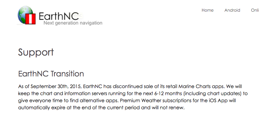
Followed your link and here is a screen shot of what I found.........

Attachments
sunchaser
Guru
- Joined
- Apr 9, 2008
- Messages
- 10,194
- Location
- usa
- Vessel Name
- sunchaser V
- Vessel Make
- DeFever 48 (sold)
Has anyone used an iPad for position fixing in the middle of the ocean??? I'm just curious how well it works when there are absolutely no cell towers in range.
Yes, in BC and Gulf of Alaska.
Thanks for info and it caused me to refresh my memory as to what I had on my Lowrance.
Satellite overlays from a Navionics Platinum chip. Reasonable assumption or bad assumption that most navigation software would work with Navionics data?
Here are 2 links:
HotMaps Platinum (US) | Navionics
Satellite overlays from a Navionics Platinum chip. Reasonable assumption or bad assumption that most navigation software would work with Navionics data?
Here are 2 links:
HotMaps Platinum (US) | Navionics
Capt.Bill11
Guru
Followed your link and here is a screen shot of what I found.........
Bummer. It was a nice program.