Don't people navigate anymore?

The friendliest place on the web for anyone who enjoys boating.
If you have answers, please help by responding to the unanswered posts.
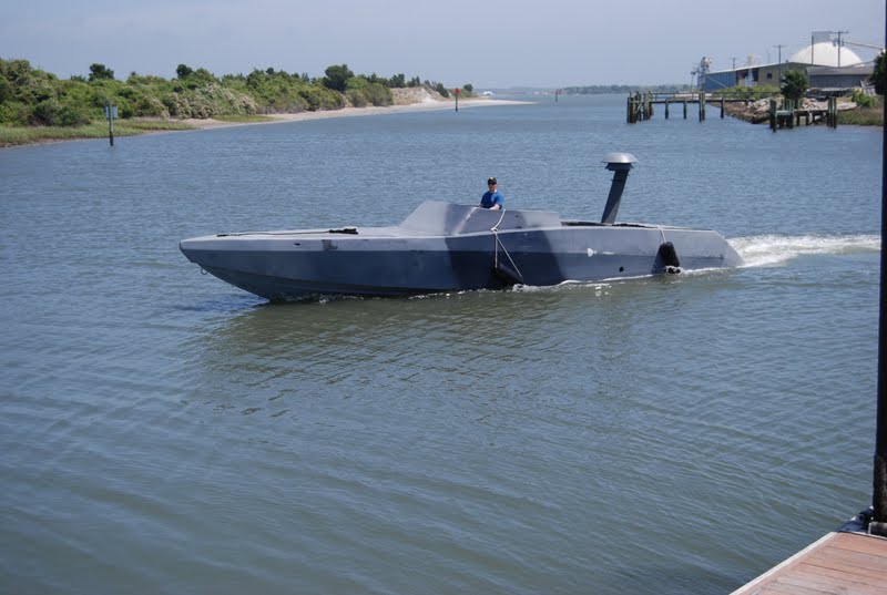
Paper chart for the area is always on the helm as the chartplotter/computer doesn't give the me the overview picture.

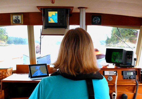
We still do this but we actually don't use the paper charts anymore even though they're there at the helm. Instead we now use an iPad with Navimiatics, which is a charting app (NOT a navigation app). This is far superior to paper for overview purposes because one can zoom in for a super-close detail look and then back out to include, in our case, all of Vancouver Island for example, with just a couple of finger swipes. Navimatics also overlays Active Captain so all the marina, anchorage, navigation, etc. information from AC is available right on the chart with just a finger tap.

And since we have a wifi/digital iPad instead of a wifi-only iPad, we need no connectivity at all to use Navimatics. Only the wifi/digital iPads have a stand-alone GPS receiver in them so need no connectivity at all, neither wifi nor digital, for positioning information. So the thing will track and show our position even if we're in the middle of the Pacific.

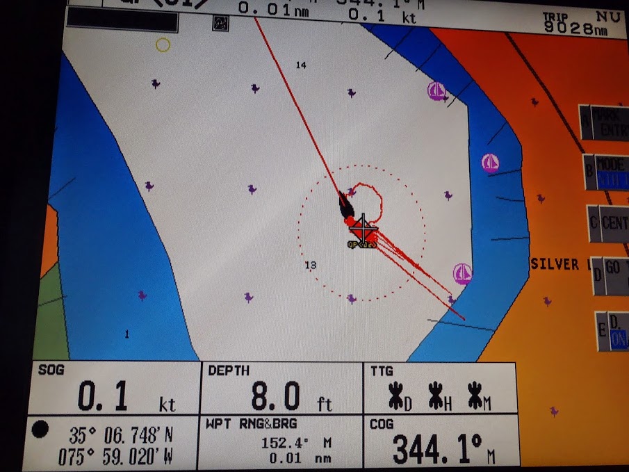
Navimatics shows the position of the vessel on the chart and also can lay a track behind it and show what we at Boeing call a "noodle," a line projected ahead of the vessel symbol showing where the vessel will be in a given time at its current speed.

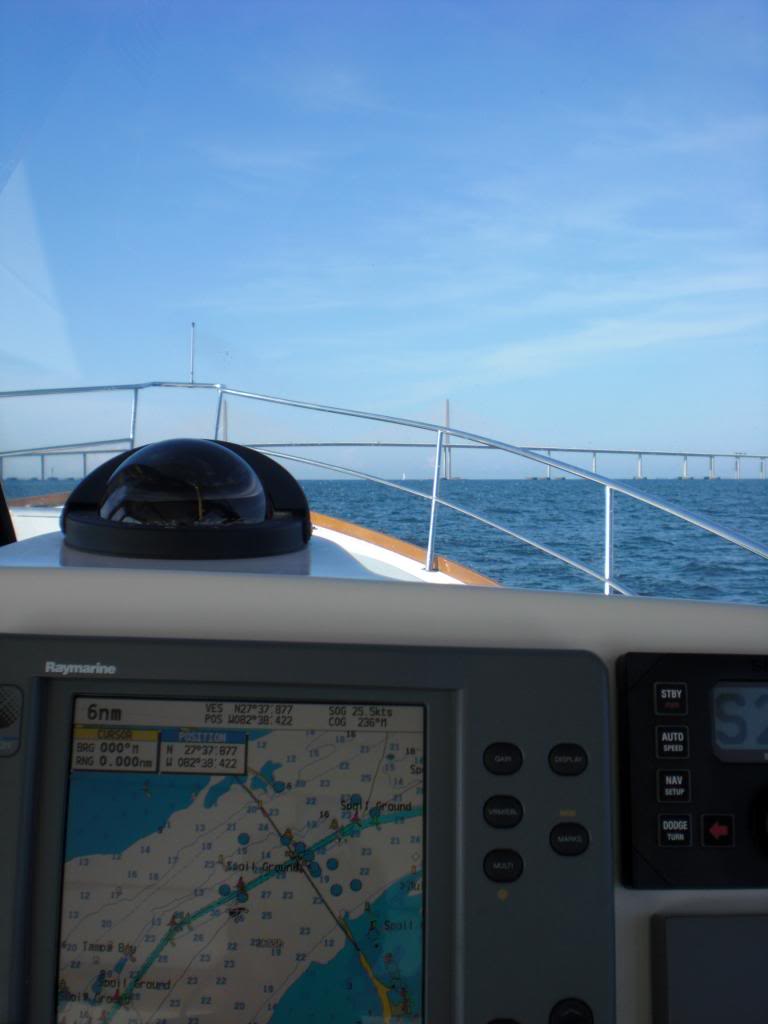
The photo shows our underway configuration. In this case we're going through a narrow pass so have both plotters in chart display mode. Most of the time we have the old Echotec in chart display and the Furuno NavNet in split screen with the radar on top and the course and steering information on the bottom. We still have our chartboard and relevant chartbook beside the helm but today get almost all our "big picture" info from the iPad.
 

Attachments

  • Skipper.jpg
    Skipper.jpg
    137.7 KB · Views: 76
Last edited:
Please enlighten us. It's probably more effective than my tinfoil hat.

yep...had similar ones on the USCG cutters I first went to sea on...

like all DR...let it get away from you one little bit every now and then...and you were better at guessing your position.
 
yep...had similar ones on the USCG cutters I first went to sea on...

like all DR...let it get away from you one little bit every now and then...and you were better at guessing your position.

Yep, that's when we broke out our special "Chart Darts" which we carefully threw at the chart. We assumed we were located in the center of the triangle formed where they landed . . . . .

This navigation method obviously works best with paper charts. I find it is hard on the screens of modern electronic MFD's and iPads.:D

We were somewhat spoiled...some cutters has the original SATNAV...got a fix 2X a day and within 5 miles or so.

The kids got to shoot celestial all the time...fortunately being with the aviation detachment for almost all of my deployments...I just had to worry about their nav if I updated via aviation nav instead of relying on my kneeboard dead-reckoning to find that little white spot in the Caribbean who was looking for a rain shower to cool off and get freshwater..
 
We were somewhat spoiled...some cutters has the original SATNAV...got a fix 2X a day and within 5 miles or so.

IIRC, both carriers I was aboard had OMEGA and NAVSAT (NNSS) systems. OMEGA was a land-based global VLF system. NAVSAT was obviously satellite-based, and I think was derived from the TRANSIT system. It was also used to correct the shipboard INS.

Sorry for the thread creep . . . . I can't believe I remember any of that stuff anymore :socool:
 
The most frequent navigational challenge in the San Francisco estuary is avoiding the many skinny waters such as the notorious "middle ground" in Suisun Bay. I make simultaneous use of the GPS/chart plotter and paper charts. Radar is helpful in tracking the next set of channel markers on the extremely narrow approach channel to Petaluma River.

 
IIRC, both carriers I was aboard had OMEGA and NAVSAT (NNSS) systems. OMEGA was a land-based global VLF system. NAVSAT was obviously satellite-based, and I think was derived from the TRANSIT system. It was also used to correct the shipboard INS.

Sorry for the thread creep . . . . I can't believe I remember any of that stuff anymore :socool:

The old C-131 Samaritan twin engine aircraft from the Korean war was the interim aircraft between the HU-16 Albatross flying boat and the HU-25 Falcon jet in the USCG....it still had LORAN-A on it and during the first 1980 Cuban refugee operation I few Navigator on them occasionally. Lining up the oscilloscope pulses was amazing after flying the more modern trainiers in NAVY flight school.

More than one of my friends using that system got in trouble for making incursions into Cuban airspace. Still have the pic of the MIG that was famous for it's clarity of the time that intercepted one of our aircraft. Seeing the white of the pilots teeth smiling really got a chuckle out of our DoD friends.


Goes to show you that navigation is really an art as much as a science as the humans in the equation are the weak link all too often.
 
I like paper charts simply because they are big, many times larger than a tablet , almost 4 times the size of our MacBook Pro, iMac or the 17 and 19" monitor screens for the two Furuno black box systems. (So it is not like we are techno-adverse.. each of those had their own GPS antenna system too) And they are fully sunlight viewable. We use the big chartbooks rather than the even bigger roll-ups.

Especially for open water cruising, I like to take a pencil and note right on the chart the time, position, course and speed as we go along, at more frequent intervals when conditions are poor. Course and speed changes trigger an entry as well, as does a change of helmsperson. Only takes a few seconds to add the same info to the log book if wanted. Very handy to note any unusual or uncharted items one observes. Another nice thing about the chart books is they are very handy when you are discussing a route with a fellow cruiser.

As for GPS, it can definitely be subject to anomalies. Some scheduled ones you get warned about through the LNM, others you don't. Two examples of the latter:

1) About a mile radius or so around our marina went GPS dark off and on (mostly off) for a couple weeks. You'd see transients coming in and they would all start looking at their gear and owner's manuals until a passerby let them know it wasn't just them. There are a variety of small military installations, on an Army reserve boat depot right by the marina, and the Navy comes into the adjacent port and conducts exercises form time to time with a variety of craft :

YYfaDdwnzOt3_8fNrlzqGFd6yNql5H838OI6w1qslBg=w800-h537-no


2) While anchored in Silverlake Harbor at Ocracoke, NC, this little dance took place. It was shown on all of the various GPS systems mentioned above:

pfD9dPotihmMVtEhk2q7m8qk2G2Xqp4-XVzC1k3xI8g=w906-h679-no


Not sure if the Reynold's Wrap would have helped or not...
 
If your point is gaining knowledge and experience in using various tools and methods to plan and navigate then I totally agree. I'm not bothered by those who use technology or methods different than what I use, but those who are ill prepared for the cruising they undertake.


That, sir, was EXACTLY my point. Thank you. I don't care what you use, but learn to at least get from A to B with the right tools and stop looking like an idiot by asking on a forum how long it takes to navigate that distance. As captain, you need to understand the basics of navigation.

And for the record, I didn't want this to become a paper-plastic thread. They both have their place no matter what anyone tries to sell you.
 
Growing up with a father whos hobby was Navigation and specifically celestial navigation he taught me a great deal I never know as much as him not even close

but when I cross open water I have my charts out and marked with time spots and alweays make note of compass headings

this being said I really rely on my Garmin plotter and Garmin charts with Active captain

What I find Intersting is when my parents come along with us my father has become a expert at using the Garmin and Active Captian

Dad will say son the ditch gets tight around that island and the red stick is down it will have a temp floater and things such as this
 
When we were told not to use the Virgin version of TVMDC anymore in public education classes, we made up our own neumonic: TeleVision Makes Dull Children, Add Wonder.
Good enough! :D
 
Not sure I see where I specifically said paper, but you can be that way if you like. .
"Don't people ever pick up a chart and navigate anymore?"

I believe you said that, Tom!Unless, of course you meant to pick up the chart plotter or computer and start navigating! :blush:
 
We always keep the paper chart on the chart table on the port side of the helm. I have come from DR plots figuring tides, winds, and currents to RDF, to single track Loran A, to Loran C, and now tow MFDs at the helm.,

With radar/chart overlay and all the depth, speed, chart position data right on the screen. It's a beautiful thing, and my electronics are a couple of generations behind state of the art. Works for me.

img_358561_0_e8bb6966ff3040ee2a070676cbcabde6.jpg


Edit: We also keep grease pencils at the nav station to mark hourly fixes on the Lexan top, and check off markers when on the ICW. It's good to have an idea where you are.
 
Last edited:
I think Ancora and his wife participate in predicted log contests. Predicted Logs are a really good test of piloting skills. That brings up another point. What we sometimes call navigation is really to me piloting. While technically it probably could be called navigation, I think of navigation as offshore type cruising.
 
Last edited:
I'm in the ICW 95% of the time, the river the rest. I have a chartplotter, and paper charts plus use my tablet if in unfamiliar water but usually I know where I'm at and nothing is needed.
 
When we were told not to use the Virgin version of TVMDC anymore in public education classes, we made up our own neumonic: TeleVision Makes Dull Children, Add Wonder.
Good enough! :D

Oh great! Now how are people supposed to deal with all these dull virgins?

Next thing you know we'll have dead men voting twice at elections!

At least we have LORAN to fall back on....
 
"I used to communicate with other vessels using Morse Code. Now I just use emoticons.":rofl::rofl::rofl::thumb:

Al-Ketchikan

Well said.

We ALL navigate, we just use different tools.

And yes, an emp would be a problem, but then if that happens, no GPS well be the least of your problems.

More likely a fire burns up your paper charts!
 
Oh great! Now how are people supposed to deal with all these dull virgins?

Next thing you know we'll have dead men voting twice at elections!

At least we have LORAN to fall back on....

I am offended, Chicago rules clearly state that the dead can only vote once in each election, unless of course the election is close.
 
I am offended, Chicago rules clearly state that the dead can only vote once in each election, unless of course the election is close.

My uncle in Chicago voted Republican his whole life. Since he died he has voted the straight Democrat ticket.
 
Back
Top Bottom