Moonstruck
Guru
- Joined
- Nov 27, 2008
- Messages
- 8,276
- Location
- USA
- Vessel Name
- Moonstruck
- Vessel Make
- Sabre 42 Hardtop Express
I sometimes think of the strange coincidence. Before GPS and even dual track LORAN A I used this chart for fishing out of Morehead City, NC. I still have the chart that I had one of the draftsmen in the office ink for me. It was carried in a protective, water proof plastic sheath on my knee while fishing.
One of our favorite fishing spots, especially during the fall king mackeral season, was the Atlas Tanker across Cape Lookout shoals. The Atlas was torpedoed in 1942 by a German sub. Many years later My sister-in-law said that her father was killed on the Atlas tanker when it was torpedoed, and thought she would like to find it someday. I was shocked to hear it. I told her exactly where it is, and that I had fished over it many times. This just reminds us of the real human stories and risks of the Merchant Marine during WWII.
On the chart the Atlas is located near the right hand side.
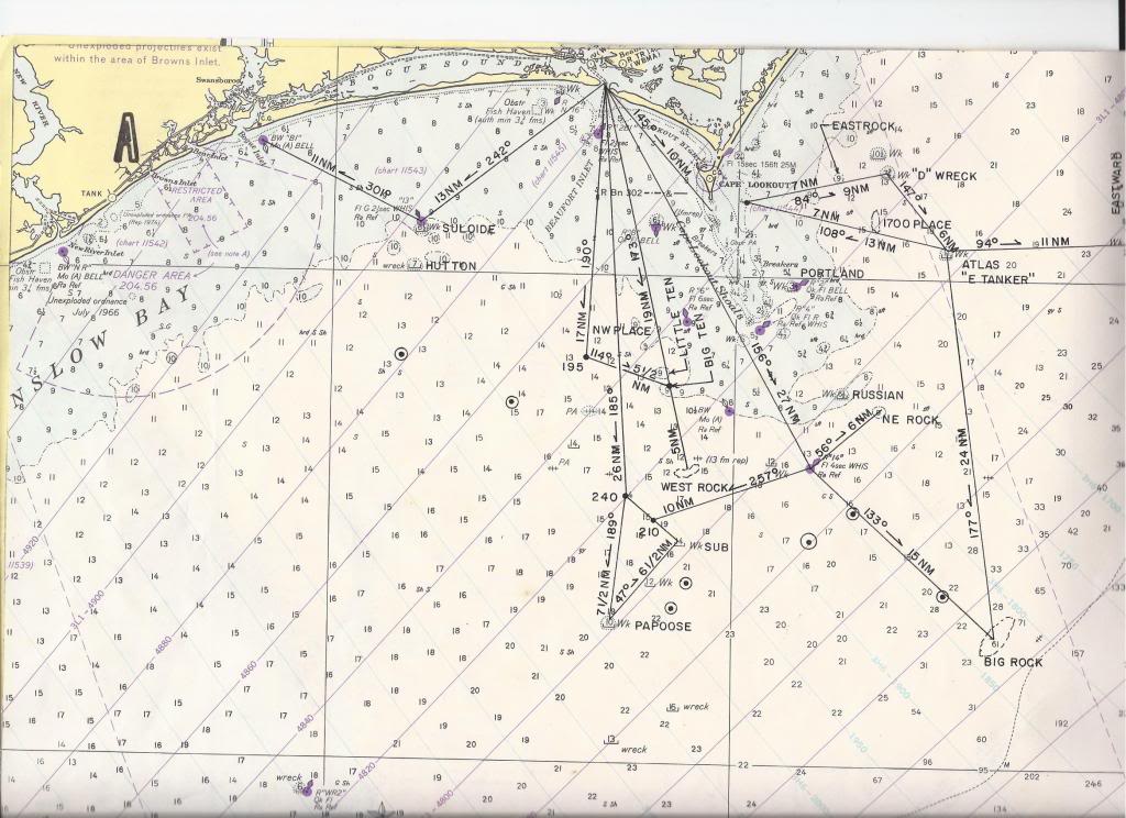
Last edited:
