laptop GPS for MAC or PC + chart software

The friendliest place on the web for anyone who enjoys boating.
If you have answers, please help by responding to the unanswered posts.

Woodsong

Guru
Joined
Oct 7, 2007
Messages
1,630
Location
USA
Vessel Make
Bayliner 4550 Pilothouse
MODERATORS- can't figure out how to move this thread to the electronics section! *Help?


Hi Again all. *
biggrin.gif


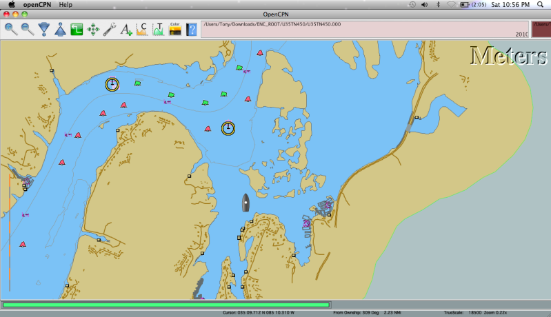
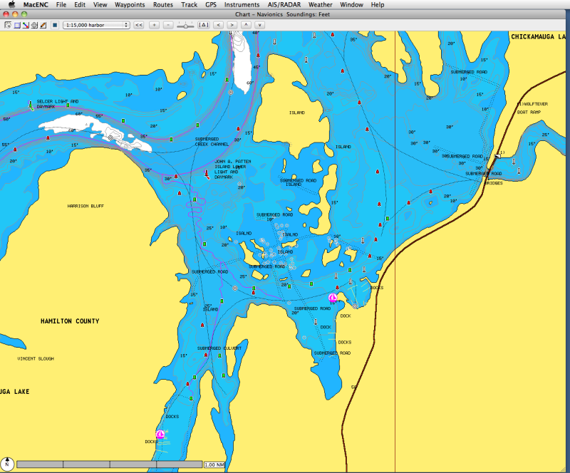
Now that our boat is on the TN River, we really want/need to get a GPS system set up. *Instead of getting a $4k fixed unit that will be outdated next season, we want to go with a laptop set up at the lower helm and run a second monitor to the bridge helm. *I have a PC laptop I can use for this but I'd really rather use my mac laptop as it is MUCH more stable than any pc laptop. *I am having difficulty finding programs geared towards mac though. *Anyone here using a mac laptop for GPS? *If so, which GPS puck are you using and which chart software are you running?


if not mac, any good recommendations for a PC system....most importantly a recommendation for software program and charts. *I believe there are several free ones you can download off the web like seaclear, etc.


Thanks in advance.


-- Edited by Woodsong on Saturday 23rd of October 2010 09:30:55 PM

-- Edited by Woodsong on Saturday 23rd of October 2010 09:31:40 PM
 
Here's post I just *made on another forum a few days ago. I'm going to put it to work next week going offshore. I can compare it with the boats Raymarine E80 on board. The free NOAA maps are easily downloaded off the net and work well on Opencpn. There's a beta version of Opencpn for MAC. You might try it.

I downloaded the latest version of Opencpn on my laptop last week. Download went slick, no problems. NOAA maps no problem easy to get off the net ..but ..after searching and reading old Cruiser Forum threads I went searching for the full set of C-maps. Bingo! Look long enough and they are out there just wanting to be downloaded. Free.
A slow (Hughes Satellite) 1.4 gb download later I have them! But... they are in an .iso file format. Being and non-geek I had no idea what that was and Opencpn didn't like it.
Back to 'google' to find the solution. WinRAR. Another free 'trial download'. Point the .iso files to WinRAR and another Bingo! They unzip and I have three folders of world wide C-maps.
Back to Opencpn. Open up the tools, click on charts, another Bingo!. The charts have landed!
Ok..now I have the software and the charts but if I'm going to use this as a back up to my chart plotter I need a GPS for the laptop. More 'googling' and I come up UB-353 usb GPS for the laptop. $39.95 on Amazon - no problem. One can't have too many toys. Okay, it arrives and I can't wait to try it. Fire up the laptop, plug the UB-353 into the USB port. Nothing...nada....zip. The computer doesn't recognize it. Maybe I should read the directions. There you go...when all else fails...read the directions. "open up mapping software". Makes sense. Another 'Bingo'. Opencpn 'help' walks me through creating a COM port out one of the USB's. It WORKS!....but look...the boats in the middle of Missouri.....landlocked. Bummer.
icon_wink.gif
" title="Wink" />
It took me several days of searching, downloading, reading (directions) to put this together. I'm really impressed with what I have so far. The Opencpn software rocks. I'll play with it some more over the next few weeks as we head offshore from Annapolis to the BVI and report back
 
13+ years ago we bought a Garmin portable GPS and ChartView, which is now Nobeltic and loaded it on a PC.* 13 years later we are still using the same portable Garmin GPS and Charview.* The PC also as Version Broad band card so the PC is mostly used for the internet, and we have used the portable GPS *for other applications. *
 
I have both Mac and PC laptops, both running Nobeltec. The Mac (a duo core) runs it in a Boot Camp partition using Window XP as an operating system. Both work great and can be moved to the command bridge and plugged in up there. My all time favorite is a Panasonic CF 29 Toughbook with built in gps, built like a tank and weatherproof. A totally portable navigation system, take it anywhere in any conditions. Just downloaded Openpcn on the Mac, pointed it at the chart folder and it works just fine.
 
rochepoint/Mike,
I am an IDIOT! I totally have my hardrive partitioned to run windows 7. I am going to load OpenCN on that side of the machine!! PROBLEM SOLVED! :) I still would like to have a chart/gps system set up on the mac side to keep things simple.
 
I downloaded the Mac version of Openpcn and just told it where the charts are located and it works fine on the Mac. You can have both versions. Have fun!
Cheers Mike
 
Well all, JUST in case someone else is trying to do this.....I ended up going with MacENC as the GPS program. I can't imagine I'm the first to go through trying to figure out how to get the best/highest level of detail for the TN River but I learned a thing or two over the last couple of days researching it. The Corps of Engineers charts are pretty darn limited in their data. Here is a jpeg of one of the pages from their charts:
http://www.lrn.usace.army.mil/opn/tnriver/charts/69.jpg
I tried getting OpenCpn to work with the level of detail I wanted but again, not enough detail. Here is a screenshot of that same chart area in the jpeg above which is right outside my marina:
img_29526_0_13653ca3c5c696f178307954382f1f63.png


I got the same level of detail initially via the demo version of MacENC so I was not happy but it was based on the same chart sorce. It's not the program's fault though- it's an issue with the base charts since they are not NOAA charts. In emailing with the folks at MacENC it came to my attention that, apparently, the only charts available with any high level of data are from Navionics which are compatible with MacENC. So- the free options off the web just didn't work for the TN River if you want the best charts. I had to go with MacENC and the Navionics charts. I also got the GlobalSat BU-353 GPS puck. All said and done, for all the above, right at about $350 since I bought the Navionics chart for my area (not the chip like a chartplotter, but the electronic downloaded set), the GPS puck, and the full version of MacENC. So not free but way less money than what a dedicated plotter with 10" screen would cost me and I can wire a monitor up to the bridge like The Other Gary did and I am sure others have done.
Here is a screenshot of same section of chart via the Navionics chart (MUCH better):
img_29526_1_fa8072bcde59c8d9468330287a531078.png

If we get down to the coast (I mean when!!) i'll be able to snag the free NOAA charts and use them with MacENC so all in all, not bad.
Now I just need to learn how to use it. :)
Running off a mac platform instead of the windows makes me much more comfortable about not having things crash. I still will carry the paper charts on the boat but it's not like we are running in 5-8' seas on the river!
 
I use the GPSNavX navigation and charting application in my Mac Book with the BU-353 USB GPS receiver. I love the software and love the support the company gives. Anytime I email them a question they respond within minutes (even after business hours) and if there are any updates they automatically send them. The application can be found at http://www.gpsnavx.com/ and cost about $60. Although GPSNavX offers the GPS receiver for about $70, I purchased it on Ebay for about $20. This charting application uses NOAA raster charts (RNC) and are available for free at http://www.nauticalcharts.noaa.gov/staff/chartspubs.html .
This company also offers vector charting software (ENC) for the Mac, iPhone and iPad.

SteveH
 
Thanks for that info Steve, I have a MacBook, and am thinking of trying out exactly what you just described.* Good to know it works well, rough costs etc.*
By the way, what is your vessel there?* It looks like what we here in Aus call the Clipper 40, but with a transom extension....?* You don't list it in you avatar or profile.
 
Hi Peter. Weve talked before, over at that other web board. But yes, its a North Pacific 36, a Clipper 34 with the integral swim platform making it a 36. With regard to the GPSNavX software, I use it mostly for trip planning around Puget Sound and the San Juan Islands, but also have it along on trips as a backup to the boats main nav system. Works for me!

SteveH


-- Edited by SteveH on Monday 1st of November 2010 08:47:16 PM
 
Ah..Steve..right. I remember now. I have seen the new Clipper 34s here are now stretched and called Heritage 36s also, at the May Sanctuary Cove Boat Show. There is no mistaking the profile. The 40 is basically the same hull stretched a bit more. They are a good hull. Why muck around with something that works, eh?
http://www.clippermotoryachts.com.au/
 

Latest posts

Back
Top Bottom