AKMary
Veteran Member
- Joined
- Nov 27, 2012
- Messages
- 75
- Location
- USA
- Vessel Name
- Kingfisher
- Vessel Make
- 1974 Meridian Yachts Pilothouse 48
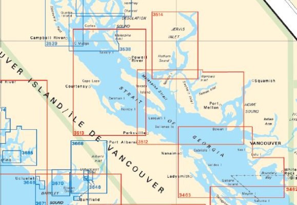
I have chart books for the San Juans & Gulf Islands and Jervis Inlet/Desolation Sound. I also have a strip chart for the Sunshine Coast.
However, the east coast of Vancouver Island between Nanaimo and Campbell River is not covered in any of my chart books. Can anyone tell me which chart(s) I need to complete my coverage? Am I missing other areas that I'm unaware of?
I'll be making my first run north to Desolation Sound in August. Can't wait!!
Thanks for the help,
Mary
")