Open Array vs Dome?

The friendliest place on the web for anyone who enjoys boating.
If you have answers, please help by responding to the unanswered posts.
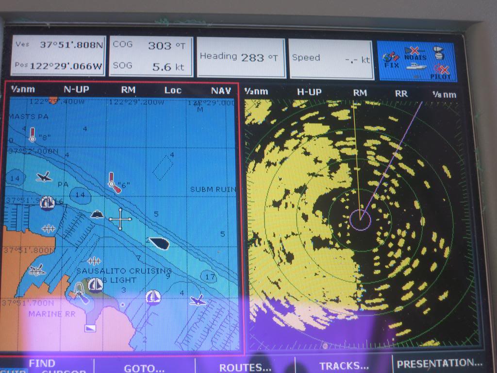
Honestly I'm new to radar my self, but storm cells will usually show up as a big blob like in the picture. At least that's what I've ran into so far. Are general range on the radar is 3-6 NM.

Those storms are showing up in red (the strongest return) on your radar at 6 mile range. I suspect you could easily pick them up at much greater distances, at least 24 nm, maybe further.

We were traveling south down the Sea of Cortez during a storm from the north. The following seas didn't bother me as much as the lightning in front of us. Between tracking the storm cells on radar (to confirm that it was moving south faster than we were), XM weather lightning strike reports (surprisingly little delay between our seeing a strike and it showing on the XM system) confirming that the strikes were moving south with the storm cells, and faster than we were moving, and confirming that all of the strikes were more than 15 nm distant, we were comfortable continuing south.
 
For the benefit of people like me who haven't had the opportunity in the areas we boat to use radar for storm cell location (I use a weather app with a radar) what range do you use? Also how can you determine the return is a storm if your in a unfamiliar area and not a land mass, is there something distinctive about the return? On the river when a storm is coming most of us head to our slips if available, I got caught in a thunderstorm on a holiday weekend a few years ago and my bimini top had some of the stitching tore out.


Yep, practice at the dock. An easy way to begin is to use your app, and when you see a storm coming on that, fire up your radar and see what you have to do for distance, gain, etc. to see roughly the same kinds of returns.

-Chris
 
We have covered slips and while installing the radar fired it up in the slip, it was confusing bunch of returns of which the road with riprap off my bow was the only recognizable part.
 
Is that a Canadian "special" reg as some are????

Not trying to be funny but based on my reading and personal interpretation is paragraph a. trumps b. by the use of the words "prevailing circumstances and conditions ". I have read expert testimony in cases where the thought was if RADAR and other devices were ALWAYS needed...they wouldn't need paragraph a. stating "prevailing circumstances and conditions ". .

Rule 7 - Risk of Collision

(a) Every vessel shall use all available means appropriate to the prevailing circumstances and conditions to determine if risk of collision exists. If there is any doubt such risk shall be deemed to exist.

(b) Proper use shall be made of radar equipment if fitted and operational, including long-range scanning to obtain early warning of risk of collision and radar plotting or equivalent systematic observation of detected objects.


I'm posting from the iPad which is tedious for lengthy entries and I'm certainly not going to get into a debate with a former USCG officer :-; but Monahan (a former Cdn CG officer) argues on pages 41-42 that if you've got radar you must use it, referencing rules 5 and 7 of the COLREGS. There are some differences in the Cdn and US regs. Cda follows the international rules except for the Great Lakes where the Cdn regs are fully consistent with the US regs.

I think if it was sunny and clear and calm out and you got into collision, you might be in a sticky situation if on questioning you said your radar was off because the weather was fine.

Jim


Jim
Sent from my iPad using Trawler Forum
 
Is that a Canadian "special" reg as some are????

Not trying to be funny but based on my reading and personal interpretation is paragraph a. trumps b. by the use of the words "prevailing circumstances and conditions ". I have read expert testimony in cases where the thought was if RADAR and other devices were ALWAYS needed...they wouldn't need paragraph a. stating "prevailing circumstances and conditions ". .

I agree with your interpretation of the rule. And expert testimony is interesting, but can you site or do you remember any case/s where a ruling was made that agreed with the experts opinion?
 
Last edited:
From the USCG Navigation Center website FAQs

11.Am I required to have Radar? Radar is not required on vessels under 1600 GT (33 CFR 164.35), however, Rule 7 states that proper use shall be made of radar equipment if fitted and operational. In other words, whoever has one must use it. The Navigation Rules are not meant to discourage the use of any device, rather they expect prudent mariners to avail themselves ofall available means appropriate...as to make full appraisal of the situation (Rule 5), e.g. the use of radar. At issue is whether the use of radar is appropriate in the prevailing circumstances and that is a determination made by the Master; and, ultimately decided by a trier of fact.

Should you be in a collision how would a judge/jury rule on your contention that the use of radar was impracticable (due to electrical drain, crew shortages, etc.)? Also, if a collision does occur, then there was obviously a risk of collisionbeforehand. Could the determination of that risk have been made sooner with the use of radar? It is difficult to answer such questions because the circumstances of each case are different.

More importantly, remember that Rule 7specifies that assumptions shall not be made on the basis of scanty information, especially scanty radar information.
 
For the benefit of people like me who haven't had the opportunity in the areas we boat to use radar for storm cell location (I use a weather app with a radar) what range do you use? Also how can you determine the return is a storm if your in a unfamiliar area and not a land mass, is there something distinctive about the return?

When storms are about I am adjusting the range fairly often from all the way out (in my case as much as 64nm)down to what I need to navigate. This is the big advantage of having two radars set to a long range for storm and fast moving ships, the other closer in for immediate navigation as necessary. Storms move, land masses don't, are typically blobs as shown above, and I know from chart and plotter where those are, and occasionally use the overlay feature momentarily to validate.

T-storms are way up in the sky, so it is very difficult for them to get blocked from the radar's view.

As far as always using it if you have it, why not? Would you leave the cover on the compass or not turn the radio and plotter on if you doing much more than maneuvering in the marina or down the fairway?
 
Last edited:
From the USCG Navigation Center website FAQs

11.Am I required to have Radar? Radar is not required on vessels under 1600 GT (33 CFR 164.35), however, Rule 7 states that proper use shall be made of radar equipment if fitted and operational. In other words, whoever has one must use it. The Navigation Rules are not meant to discourage the use of any device, rather they expect prudent mariners to avail themselves ofall available means appropriate...as to make full appraisal of the situation (Rule 5), e.g. the use of radar. At issue is whether the use of radar is appropriate in the prevailing circumstances and that is a determination made by the Master; and, ultimately decided by a trier of fact.

Should you be in a collision how would a judge/jury rule on your contention that the use of radar was impracticable (due to electrical drain, crew shortages, etc.)? Also, if a collision does occur, then there was obviously a risk of collisionbeforehand. Could the determination of that risk have been made sooner with the use of radar? It is difficult to answer such questions because the circumstances of each case are different.

More importantly, remember that Rule 7specifies that assumptions shall not be made on the basis of scanty information, especially scanty radar information.


Thanks...good to know.

Yet interesting...I think that might be fairly new.

The references I was thinking of were a few years old and were from different links provided to cases and some of the merchant reference books.

I don't have any links now...and even when I taught Captain's licensing till
about 5 years ago, the "prevailing circumstances" were often cited and the USCG approved the courses.

Now it sounds like it's a total CYA effort on their part...of course they don't pay out of pocket to replace radars like we do..suggesting you keep yours on at all times seems like a small issue to them.

They also don't understand the one watchstander issue that many of us have,...

Once again my old "friends" aren't very much in touch with the recreational boating community.
 
Being on the river I use mine on 3/4 to 1 mile most of the time. ...

I'm usually set a range of between one-half mile and one mile as the navigable waters are confined here. Lots of anchored boats to starboard here:

img_244148_0_1f122e6b41631f5b0e1055feeb2b552d.jpg
 
Last edited:
I use a Maretron NMEA2000 position sensor. The primary reason I installed it was for accurate Radar overlays when traveling very slow when one can lose GPS direction of travel or where the bow is pointed in relation to the plotter. Who else uses a position sensor aka a heading sensor? If so who's unit do you use?
Bill
 
I have a KVH 1000 that I'am getting ready to mount and wire into the system. My unit will not overlay radar on the chart without having a heading sensor, don't know that I'll need it but if I have the option I might as well make use of it.
 
I used to use a KVH 1000 if I remember correctly it wires in through the NMEA0183 network. I believe they call it a Flux Gate Auto-compass. Mine worked well but I wanted to use NMEA2000 exclusively so it was replaced with the Maretron.
Bill
 
Who else uses a position sensor aka a heading sensor? If so who's unit do you use?
Bill

I use the HS-NMEA0183 output from the Simrad AP-22 autopilot RC-25 rate compass. The Garmin GPSMAP 740S broadcasts it on both NMEA0183 and 2000 networks.

Didn't have to buy any additional equipment that way, and rock solid. :thumb:

Larry
M/V Boomarang
 
I use the HS-NMEA0183 output from the Simrad AP-22 autopilot RC-25 rate compass. The Garmin GPSMAP 740S broadcasts it on both NMEA0183 and 2000 networks.

Didn't have to buy any additional equipment that way, and rock solid. :thumb:

Larry
M/V Boomarang
Larry thanks for providing another method of getting your heading/ position data over (HS)-NMEA0183.
Thanks,
Bill
 
We have covered slips and while installing the radar fired it up in the slip, it was confusing bunch of returns of which the road with riprap off my bow was the only recognizable part.


OK, practice at anchor then,. Or while underway, with someone else at the helm. In any case, the app -- and your manual :) -- can help you learn how to tune the radar.

-Chris
 
I used to use a KVH 1000 if I remember correctly it wires in through the NMEA0183 network. I believe they call it a Flux Gate Auto-compass.
Bill


This was the setup I used to have, with the KVH connected to the NMEA0183 network through a Brookhouse multiplexer. It was the only way target plotting would work on an older Raymarine radar.

I had to run a script on the Brookhouse to slow down the amount of data the KVH would dump onto the network. With an AIS talking as well it would overwhelm some of the other instruments.
AIS and Fluxgate heading sensors are usually both high speed data or HS-NMEA0183 or if newer NMEA2000. That's why I prefer to have my GPS source, AIS output and the heading sensor traffic carried over NMEA2000.
It will work fine on many HS-NMEA0183 systems but depending on the number of high speed 0183 devices it can overwhelm them. Depending on the age of your equipment 0183 might be your only choice. I am fortunate that my devices and plotters/ MFD's are NMEA2000 compliant.
Bill
 
AIS and Fluxgate heading sensors are usually both high speed data or HS-NMEA0183 or if newer NMEA2000. That's why I prefer to have my GPS source, AIS output and the heading sensor traffic carried over NMEA2000.

Bill

Yes, I really like the current setup with the chatterboxes on the NMEA2000 backbone and the older NMEA0183 devices listening through a gateway. Much less hair-pulling involved.
 
I'm usually set a range of between one-half mile and one mile as the navigable waters are confined here. Lots of anchored boats to starboard here:

img_244468_0_1f122e6b41631f5b0e1055feeb2b552d.jpg

I see you are in Sausalito. When I was there most of those boats looked like they were barely floating....
 
I see this is an old question but I came across a short but relevant comparison table from Raymarine here so I thought I should share it.
 
I see this is an old question but I came across a short but relevant comparison table from Raymarine here so I thought I should share it.


Welcome, and thanks Hamrow. I almost missed your link. It was shortened to Here in your post.
 

Latest posts

Back
Top Bottom