Go north young man! (Heading to Alaska)

The friendliest place on the web for anyone who enjoys boating.
If you have answers, please help by responding to the unanswered posts.
The idea of not clearing customs baffles me. You can't go ashore, take on fuel, or a person, and depending on your luck anchor or fish. All so you can, what, carry more booze? And handguns?

Then it hit me - someone on that boat might have had a DUI. Game over for them clearing customs. If that's the case, then have them fly up. If it's the owner/operator, have someone deliver the boat.

If I'm in the right track, this is even a worse idea than it originally seemed (which was, as others have said, a bad idea to start with)

No, frankly not even close. The only thought on customs was food (we have some meats basically for two months and an average of ten people, other items a couple of weeks worth) and just spending the time clearing twice when we weren't going to spend any time in a location. We have no issue clearing. We've done all the advance work. We're all prepared. And we will clear later to visit Victoria and Vancouver. Just on the trip from Bellingham to Ketchikan we're basically transiting.

No one on the boat has any criminal record, dui's, we carry no guns and no drugs. The most dangerous thing aboard would be champagne. We've cleared customs at least a dozen times in the past year. And rest assured returning to Fort Lauderdale is a pain as clearing is at the airport. So we get everyone registered prior to the trip.

I think your assumptions are pretty insulting but assume you just were at a loss for reasons. Perhaps next time ask first.
 
On last years trip we were boarded three times by the RCMP.Once while at anchor and twice while tied at a marina. They were just checking to see if we had cleared customs and looked at our passports. They were very polite and everything went well. So like someone else mentioned, if you had to stop for an emergency, just be aware.
 
Might want to check out this website:Reporting Requirements for Private Boaters

Here is a copy and paste of a section:
"Not planning to "land" your vessel or did you leave Canadian waters but did not land on U.S. soil? You still need to report to the CBSA. Certain private boaters may contact the CBSA by calling the TRC at 1-888-226-7277 from their cellular telephones upon arrival in Canadian waters.
This includes:
Canadian citizens and permanent residents who have not landed on U.S. soil; and
U.S. citizens and permanent residents who do not plan on landing on Canadian soil."

Yes, a simple phone call if you don't plan to land. If we do decide to land on the trip North then we'll just go to Vancouver the day before instead of Bellingham. Nothing complicated about Canada.
 
Both Canada and US authorities can match up AIS signals/MMSI with respective customs groups. Not clearing customs if a pleasure boater is baffling to me, and authorities too. A few years ago we were crossing Dixon Entrance and listened on VHF as Canada customs called various small boats on water by lat lons from a satellite feed and asking details on vessel and itinerary. The commercial fishing and barge guys going between WA and AK non-stop report in as they approach and get fit into traffic lanes, a simple procedure but requiring customs clearance if a problem arises and they touch land.

US and Canada share data continuously as vessel movements are monitored. Good news I believe.

To the OP - as suggested by others, get out the tide and current tables, Waggoner and Douglas and do what the rest of us do, plan the trip. Weather data galore exists to chase down the Johnstone Strait, Cape Caution and Dixon Entrance gales - common this time of the year.
 
In our case, we're fully Canpass'ed going to Canada. Don't have I-68 for US. Still clearing not likely to be a big deal.

Would be interested in how many of you US to Canada and back travelers have Nexus, Canpass, I-68's?

Just a question of curiosity.
 
In our case, we're fully Canpass'ed going to Canada. Don't have I-68 for US. Still clearing not likely to be a big deal.

Would be interested in how many of you US to Canada and back travelers have Nexus, Canpass, I-68's?

Just a question of curiosity.

Why bother with the hassle of these?..
In 10+ Canadian customs stops it has never taken over 20 minutes ..most times about 10 minutes from tie up to untie.

Running a small boat North on the inside at night is just plain stupid. No amount of electronics can protect you from the deadheads..I love running at night but not up the inside.
I sometimes run a fast boat between Port Townsend and Seattle at night and I keep my fingers crossed every time..and most times we do hit something..but so far nothing too serious. North of the border I would never consider it.
Just because you can doesn't mean you should.
Hollywood
 
Why bother with the hassle of these?..
In 10+ Canadian customs stops it has never taken over 20 minutes ..most times about 10 minutes from tie up to untie.
Hollywood

Agreed, never more than 10-15 minutes (unless you're waiting to get to the dock), and I've done it probably no less than 25 times. However, U.S customs is a different story.

Voluntarily running at night there? Not no way, not no how.
 
Last edited:
Agreed, never more than 10-15 minutes, and I've done it probably no less than 25 times. However, U.S customs is a different story.

That's what we'd heard is Canadian customs easy but then Canpass easy too. US customs variable as to time but I-68's not worth fooling with for one or two trips.
 
That's what we'd heard is Canadian customs easy but then Canpass easy too. US customs variable as to time but I-68's not worth fooling with for one or two trips.

US customs in Ketchikan is as easy as it gets.

You call the number for the customs guy.

He gets some information from you and decides if he even wants to come see your boat.

If he wants to come see the boat he has no dock so you tell him where you are and he comes to you.
 
For entering the US the Boat ID Number (obtainable from US Customs in Bellingham via phone) is phoned in and away we go. No dock stops during past 4 years and maybe a dozen entries. There is one catch though, it only works this way if only my wife and I are onboard with both of us Nexus Card holders. Same deal when entering Canada, phone in only.
 
Small tides, less chance of logs. Big tides, No way at night.
We to just returned on the Bellingham ferry to Ketchikan, Tons of logs witnessed during the day and several hits during the night.
No running at night for this 65 years of boating on SE Alaska waters!!!
Lack of marine repair facilities till Prince Rupert, Ketchikan or Wrangell.
Take care at that speed. A high percentage of the logs are what we refer to as "Crocodiles" Low in the water and dark in color. but they bite quickly!!

Al-Ketchikan (Bridge to Nowhere) Alaska
 
For entering the US the Boat ID Number (obtainable from US Customs in Bellingham via phone) is phoned in and away we go. No dock stops during past 4 years and maybe a dozen entries. There is one catch though, it only works this way if only my wife and I are onboard with both of us Nexus Card holders. Same deal when entering Canada, phone in only.

We are not Nexus Card Holders. Going north we'd enter in Ketchikan. Coming back we're coming outside and would enter in Port Angeles.
 
We've done all the advance work. We're all prepared. Just on the trip from Bellingham to Ketchikan we're basically transiting.
You are going through unfamiliar waters, including some of the strongest currents on the coast, running at night when everyone has told you that's a bad idea(tm), just to save time clearing and not have to give up som meat and potatoes? You sir, have most assuredly NOT prepared for the proposed trip.


I think your assumptions are pretty insulting but assume you just were at a loss for reasons. Perhaps next time ask first.
It was a guess, and I said so. Frankly, I find your given rationale even more embarrassing.
 
You are going through unfamiliar waters, including some of the strongest currents on the coast, running at night when everyone has told you that's a bad idea(tm), just to save time clearing and not have to give up som meat and potatoes? You sir, have most assuredly NOT prepared for the proposed trip.

It was a guess, and I said so. Frankly, I find your given rationale even more embarrassing.

There was no firm plan and still isn't. But if you find a bad choice as more embarrassing than illegal activity then that is strange. In answer to the OP's initial question, even if we do stop for a few hours overnight, it's not a plan to meet the OP's needs. It is just not our desire to spend time south of Ketchikan on this trip. I've not said for a moment I'm not going to listen to the people here. Fact is I won't be making the decision personally. But I also have others providing information. Don't recall mentioning potatoes. Thanks for reminding me.

The well intended advice here is appreciated. I did speak too quickly addressing another person's question and not thinking of mine. But once involved I did ask questions. Perhaps based on one conversation in one thread you think I'm not prepared. But that doesn't give you the entire picture nor do I feel compelled to do so. You talk about unfamiliar waters. They are to me, but they aren't to the Captain joining us on Monday. I wasn't really trying to defend one of our possible choices. Going outside is still a possible option. We'll sit down and decide probably by Monday. Meanwhile enjoying Washington.

I will accept the criticism, I will accept the advice. But I will not accept any implication whatsoever that a criminal record or violating the law have anything to do with our choices.

Now to all others, thanks for the feedback. I'm now going to enjoy the very pleasant company I have with me for the remainder of the night.

And to the OP, I apologize for any hijacking of your thread.
 
Thanks for the helpful post. As to the questions about schedule and how I should not have one. I agree, not in the cards. Actually have a few back up plans. Boat is capable of 18 knots if need be. I have 10 days to get to Ketchikan but working to do it 9. If weather becomes a problem , we will speed up. I do have the books recommend and have gone through them, planning this thing for a while. Just was hoping people had a route they loved with stops they loved.

As to the I should take 60+ days....I wish I was retired but I'm not. I am not doing a delivery but rather taking my boat up there to meet up with more buddies to fish out if Craig. They have flight times so want to make sure I'm there in time. Trying to make trip up and the Craig fishing time work in the allotted vacation time.

Then hand off my boat to my father in law and buddies to take home. (Slowly)

I do question how a trip that is roughly 600 miles, you can say we won't see much taking 9-10 days to do it in. From my route planning, using a 11.5 knot speed in water (and accounting for actual SOG should average 6.5-7 hour steaming days. 9 days x 7 hours works out to 630 miles at 10knots. 12 knots and things look better. That seems like cake, and even waiting for tides should have us firmly at anchor/dock in time for catching dinner , seeing sights , pouring drinks (with likely duty paid booze), without worry... Plan B on weather delay, move it to high gear.

That being said, Thanks for the helpful links and suggestions.

I few other questions. One using deception pass on May or June large tides as a baseline. Would traveling through the narrow passages at a 4knot incoming or outgoing tide be similar? Exception being super narrow passes. Which ones to watch for other than the already mentioned ones?


Sent from my iPhone using Trawler Forum
 
But if you find a bad choice as more embarrassing than illegal activity then that is strange.
A hypothetical DUI by any member of your crew (could have been 30 years ago, doesn't matter, and it's not something that they would be eager to bring up) does not compare to an owner / operator needlessly putting their vessel and complement in peril. But that's just my opinion.:ermm:
 
For entering the US the Boat ID Number (obtainable from US Customs in Bellingham via phone) is phoned in and away we go. No dock stops during past 4 years and maybe a dozen entries. There is one catch though, it only works this way if only my wife and I are onboard with both of us Nexus Card holders. Same deal when entering Canada, phone in only.

That's interesting. I read, and was told, that in order to get the Nexus card I had to set up an in-office appointment at the Bellingham office and meet with them.

I suppose the the rules have changed recently. Has anybody else here (or do you know of anybody else) been able to get one by phone lately?
 
That's interesting. I read, and was told, that in order to get the Nexus card I had to set up an in-office appointment at the Bellingham office and meet with them.
Yes, a Nexus application involves an interview with both a US and Canadian representative. We did ours at Boeing Field where they literally have connecting offices. Note that that is NOT the Boat ID number - that is tied to the Boat, not the people. The first time (each year I believe) that the Boat re-enters the US from Canada, it must obtain that number. If you are a Nexus pass holder, you can do this with the same call you make to clear customs - they simply take your credit card over the phone and mail you the receipt (you also enter it in your log).

Of course, the Nexus card is for more than just going between US & Canada. It's also part of the GOES (Global Online Enrollment System), and it furnishes you with a "Known Traveler Number" that you can use with airlines to get cleared with TSA Pre-check. We just used this feature last week on a trip to NYC and Maine and it saved us quite a bit of time, and it allowed us to keep our shoes on. :)
 
Nautibeaver: This post is for you.

I can give you some suggestions for the first part of your route:

1. clear customs and stay at either Poet's Cove (South Pender island) or Port Sidney. Good overnight stops, good walks and sights to see at either.

2. Pender Harbour. Stay in Madiera Park or Garden Bay, at anchor. Good walking, local lakes worth a walk.

3. Octopus Islands ( north end of Quadra Island). Good hike to Newton Lake, or just across to Small Inlet.

4. Blackfish Sound. You will probably want to change your plans at this point and spend a month here. See the Indian Village ruins in several places. Mamalilaculla, Farwell harbour, Beware Cove, get fuel at Port McNeill. Seriously, a lay day here is warranted.

5. Bull Harbour, Hope Island. Good for a walk to the beaches on the windward side. Fish the Nahwitti Bar, weather permitting. Another great place to stop for a while.

After this, go around Cape Caution and find scenery in abundance, few people on the land, fewer boats. Fuel stops in Bella Bella/Clearwater, then nothing until Prince Rupert or Ketchikan. A few longer days, stopping where you can find an anchorage. Others can chime in with their favorites for this part of the trip.

As for the name of your boat: Where did it come from? Did you once own a "Beaver" motorhome?
 
Last edited:
Thanks KOliver!

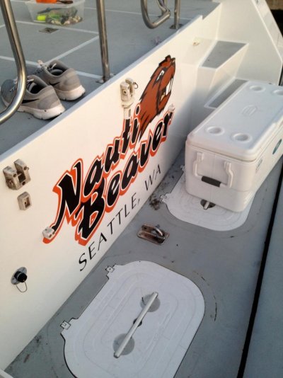
This pic probably says it all. Go beavers! ImageUploadedByTrawler Forum1402158155.032255.jpg


Sent from my iPhone using Trawler Forum
 
1. clear customs and stay at either Poet's Cove (South Pender island) or Port Sidney. Good overnight stops, good walks and sights to see at either.
Poet's Cove is great - if you decide to overnight there, then take your dinghy through Pender Canal and tie it up at Port Browning - it's about a 5 minute walk from there to a pretty good market at "Driftwood Center". And the pub at Port Browning is pretty good.

If you cross the Straits from Port Townsend (a great boating town), then another convenient place to clear is Oak Bay (actually a suburb of Victoria). It's a longer walk to "town" for supplies though.
 
Quote:
"Watch out for birds standing on the water.":banghead:

Northern Spy- Great catch!! absoulutly a visual clue!! Thanks for mentioning.
Al
 
Clarification for those I've unduly alarmed. I recognize my posts were misleading and cause for some concern. I gave quick partial comments and not full explanations. I misspoke in several areas.

Our intent: To get from Washington to Ketchikan in the fastest safe manner. With no desire to spend time at any of the towns along the way. Nothing is settled as to route or speed or day or night. When I originally responded, my intent was to tell the OP our plans weren't helpful to him as he intends to spend nine or ten days while we hope to do it in three. Hope, not definite. We would love to see every town, stop in every port, but that's not practical for the time we're spending on the trip so we've chosen those that are most important for us to spend time. Most trips only go to the Southern areas of Alaska and do take in more of British Columbia than we will. Most do not make it to Kodiak or Seward or Valdez. There is so much beauty everywhere, you have to choose what to see as you pass by and what to get out and spend a couple of days exploring. This is no different than anywhere. We have hundreds of Bahama Islands still to go.

We recognize we have no experience in this area. That is why we have an Alaska Pilot/Captain joining us on Monday. They will define the specifics. They have the local knowledge we lack. Yes, we're aware of the logs. They worry us day and night. We do intend to go inside one way, outside the other. We may well flip and go outside north but much depends on conditions. We got a lot of criticism from some in other places because we felt the need for adding a person with local experience. But we decided to do that long ago. Yes, one can go without that but Alaska is very different than any areas we've ever cruised.

We have no issues with customs in either country. The thought simply was that we had no desire to stop in the other areas. We may very well stop once or twice along the way just for the night, clearing customs as required. We all have Canpass. We don't have I-68 or Nexus. Living in South Florida, they weren't practical and probably not worth the effort for one or two uses. Canpass we only got because it was very easy to do. All our potential guests have it, even those who are likely to only fly into and out of Alaska. The only inconvenience of clearing customs on the way is we can't fully stock provisions in advance, but that can easily be handled in Alaska.

I hope this clarifies things as I do realize I stirred up quite a bit. I appreciate the local knowledge shared. We listen to it all and most shared it without resorting to insults. Many of you we consider friends although having never met. Some we hope to meet on this trip. I'd say we'd outline the trip further when finalized, but the reality is no trip is finalized until completed. Weather, conditions and other things often change even good plans. Look at those recently stranded in Mobile due to the logs and trash on the TN Tom. So our plan is Washington to Ketchikan. Route to be determined. Schedule and Route will be absolutely known when we actually reach Ketchikan.

Now, back to the regularly scheduled programming.
 
I suggest you take a look at the Ports of Entry for Canada (BC is at the bottom).

Other than Vancouver and Vancouver Island (Victoria), the options are quite limited.

We have a full list of those ports. But our likely choice would be to enter at either Victoria or Vancouver the day before and start our trips from there. Depending on which route, they make great jumping off places. Even if we were not going to stop we still have to inform so just saves a lot of potential problems by clearing first.

I would say with 14 POE's it's not that limited.
 
Last edited:
I few other questions. One using deception pass on May or June large tides as a baseline. Would traveling through the narrow passages at a 4knot incoming or outgoing tide be similar? Exception being super narrow passes. Which ones to watch for other than the already mentioned ones?
Sergius Narrows in Peril Strait, Tlevak Narrows south of Craig, Wrangell Narrows south of Petersburg (not dangerous, but watch out for traffic, and it will affect your speed), and most of the rapids near the middle of Vancouver Island between it and the BC mainland.
 
This time of year you have long days, so there is no need to push it. A few years ago we ran a boat north my first trip up at the helm. One of the first nights the water as flat the moon was out and we were making good time. "Lets just keep going" We went around a corner in Johns Stone. The moon went away, It was dark!!, everything that we thought was well tied down was banging, every other wave was washing the windshield with a ton of water. We soon saw a light on shore the first light that we had seen in two hours and somehow got behind the brake water. That ended our night travel. Be under way at 4:30 or 5 and be stopped by 10 PM.

Fred P..............
 
Back
Top Bottom