A long way home

The friendliest place on the web for anyone who enjoys boating.
If you have answers, please help by responding to the unanswered posts.
Joined
Oct 31, 2007
Messages
18,745
Location
USA
Vessel Name
Willy
Vessel Make
Willard Nomad 30'
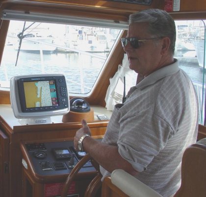
Old Salt asked me to do this so the following is an account of our trip home to SE Alaska on our 30' Willard Nomad as shown in my avitar. We left Everett Wash at o dark thirty in the morning in order to reach Provost Hbr by nightfall. We spent the majority of the day at 5.whatever knots bucking this current and that tide. We went through La Conner where we had spent last summer working on the boat. We also had a wonderful time socializing on other people's boats, going to dinner in the dinghy ect ect. At Anacortes we finaly made our normal cruise speed of 6.15 knots. There's only one way to get somwhere in a very slow boat and thats to put in hours and hours at the helm .. days and days or even weeks, depending on how far one wants to go. As it turned out we would be needing 24 days to get home. One thing I like very much about being underway in southern waters is the amazing parade of interesting boats one sees also underway. Walking the docks ( one of my favorite pastimes ) is more fun as there is no gate and the boats are more interesting. What we would see for the next 16 days or so we would see from our own boat for the last time so everything seemed a bit more special. Hours at the helm paid off and we arrived at Provost Hbr and found our friend Jim Briggs tied to the dock .. we rafted to his Albin 25 .. a very nice evening after a long nice day .. the stuff to sleep on .. and we did.
The next morning we got our first taste of choppy water crossing Harro Strait for Bedwell Hbr and customs. All of us, the cat ( ours ) and two boats passed legally into canadian waters. It seemed like the beginning of the trip again as we motored on to Maple Bay. Saw many campers and tents in the sunshine. As we entered Sansum Narrows saw much dancing water and light eddies. We were going to a gathering with the Albineers of British Columbia ( we are members ) and presumably the last we would attend. The Albineers are a wonderful group of Canadian boaters that we will miss. As we left Maple Bay I became more anxious about an unpleasant noise in the stern. Had the boat hauled and all seemed well. We proceeded north stopping short of Dodd Narrows to wait for slacker water. We noticed other boats were going thgough so we headed out and soon we were making 11.5 knots in our 6 knot boat staying to the center of the channel avoiding the whirlpools to the sides of the channel and the main bore of the current just past the gut. Moored in the exciting little city of Namiamo. It's always fun to be in Nanaimo. We had dinner at the same place we did in 03 on our first trip together ( in our Albin 25 ) to Alaska. That boat was 1.25 knots faster but the trip much longer as we had to come BACK as all of you do. We also spent some time in the Queen Charolette Islands where I taught school in the 70s. We ment some friends from the Albineers club and they gave us all the info on the Whisky Golf millitary operations area we would be traversing the next day. End of chapter one.

Eric Henning
Willard 30
Thorne Bay AK
 
We had much to do in the morning .. groceries, fuel, phone calls, Port business and showers so didn't get underway untill 11:45. The Whisky Golf millitary area was active so we were close in picking our way around the Islets, Islands and rocks when a loud rattleing noise emerged from the engine compartment. Turned out not to be a serious problem ( alternator pully came very loose ) but was adrift while fixing it and a large yacht came by at twenty some knots and ( you guessed it ) we were caught abeam to his wake. Put some lock tight on it and all seemed fine. A course to the south end of Texada Is would have but us abeam to the wind and sea so we set a course NE to the north end of Lasquetti Is. It was lumpy going out in the center of Georgia Strait. It was only a fair anchorage and several boats were already there so we had to anchor in 75 ' of water. Then a 100 ' yacht entered the bay and spent an hour going back and forth anchoring only to pull up his rode and leave .. just before dark. We ate dinner during all this enterainment out on the aft deck in the sun. The next morning .. not so great. We used the head and some went out the over flow all over the stbd deck. What a mess .. that has NOT happened again .. learning curve steep there. Then soon we were in 4 ' head seas and wind. I throttled back to 2000 rpm ( as slow as I ever go ) and were making about 4.5 knots. We did this for hours and I eventually got used to the rythum of the seas but the cat had growling eyes the whole time. My anchor chest on the foredeck came a bit loose and I feared worse things may happen so ducked behind Dick Island ( the only protection on the west side of Texada Is ). Chris held us on station untill I made things secure and out we went again. We rounded the north end of Texada Is but still too rough to have anything but fruit for lunch. After about an hour more I bumped the throttle up to our normal cruise of 2300. Soon we were in almost calm seas and with much traffic asumeably most going to Desolation Sound. Late in the day we arrived at Squrrill Cove. We went to town and the resturant for dinner as a reward for our hard earned miles. I did a strange thing and bought a mounted photograph. After dinner we went through the gut and into the anchorage of Squirrll cove. What a fantastic anchorage. Some guy on a red sail boat came in at about 3 knots, droped the anchor and rode and let it stop the boat .. never saw an anchor set like that before. The next morning we arrived at Yukulta ( pronounced Youkata ) and Dent Rapids at just the right time. Went through with a bit of extra speed ( always good in a Willard ) and fell in with several other boats going the same speed. None were displacement boats so I assume they were under loading and saving fuel. The people along the way said there was far less traffic this year on the Inside Passage. We liked Big Bay in the past and were sad that it went private ( sold ). We saw large slow moving eddys and boils from time to time in the back channel. Went through Green Point and Whirlpool rapids with some current still with 2 other boats going 6 knots when we entered Johnstone Strait. We failed to find a good place to anchor in Port Harvey so anchored behiend some small islands further up the channel ( Wallace Group .. I think ).

Eric Henning
 
Out into Johnstone Strait, trading off the helm, sitting on the aft deck, reading novel ect. A lazy day on the water. Passing Port Neville and on to Alert Bay. I like to cross Johnstone Strait diagonally, south to north and west to east. Spend the night in Miles Inlet or in the vicinity. We liked Port McNiel a lot. Small and not very classy but very friendly. Ment numerous entertaining, unusual and endearing people. Stores, resturants, laundry and even made slight use of the hospital/ health clinic. Filled water tanks in the pm and left fuel for the am. We left in the morning under a " high wind warning " report. Figured we'd probably get slamed a bit in the afternoon with 25 knot winds but was quite a nice crossing. Got a bit lumpy as we aproached the entrance to Allison Hbr with considerable ocean swell. Picked our way through the rocks and occaisional boomer with GPS, sounder and binoculars into Allison Hbr. Not much of a sight seeing place but a good anchorage. We knew the Gale would keep us anchor bound all the next day so we set the new high performance anchor backing down hard on a 7 to 8-1 rode .. shortened way up and settled in for the blow. We were yawing back and forth on the anchor with the wind whistling around the cabin. The next day ( mon July 28 ) we watched the wind, rain, fog and fast moving clouds all day. Read books and drank tea. The next day ate breakfast, decided weather still too foggy and nasty .. went back to bed. Station report reported 28 knots at Egg Is. At 0945 we went out to see what it looked like. Looked better than a 30 knot sea to me. Decided we could take 3 or 4 hrs of it so off we went at rough water throttle ( 2000 rpm ). Several big squalls here and there and dark clouds with dark seas under. The ocean swells were large now showing the horizon about 30 to*35 % of the time. Just north of Slingsby Channel the wind switched and the seas got worse fast. I suddenly wanted no part of it and turned around. I didn't want to go back to Allison Hbr so we went up Slingsby Channel on the flood tide at about 9 knots. I had just told Chris what a bad reputation Slingsby Channel had so she wasn't too pleased about going up there but she got over it when we anchored in lovely Treadwell Bay near the entrance to Nakwackto Rapids. We enjoyed the beauty of this place with two large yachts. The am forecast was not good but we wanted to look so up went the anchor and out the Bay only to hear the warning buzzer sound off. Went back in the Bay waching the insturments and droped the hook. The Murphy Switch saved us from God knows what when the engine surely would have overheated near Cape Caution in moderately heavy seas with onshore winds. I thought we were going to have to radio for help but we found the parts, finally, to fix the plumbing and make the engine 100%. We lost the hot water heater and Red Dot type heater but didn't really need that. With all ready we slid down Slingsby Channel on the ebb out into the dancing square waves at the entrance. Was a bit of a wild ride for a few minutes but out on the dying seas of the passing storm it wasn't so bad. Was'nt so good either. Soon a squall in front of us promised wind and bad visibility. Wer'e at Cape Caution. Saw tugs, barges and several grey whales. Egg Is. Dark clouds and seas but little wind and no rain .. squall fissiled. Conditions moderated as we approached Millbrook Cove .. our anchorage for the night. Fairly small anchorage and a tight and confusing entrance. One other boat that had an amazing anchor rode bridle that kept them*quite motionless .. no swinging at all.
*
Eric Henning*


-- Edited by nomadwilly at 01:06, 2008-10-20

-- Edited by nomadwilly at 01:15, 2008-10-20
 
Came out of Milbrook Cove at 0550 near Egg Is. in the south end of Fitz Hugh Sound running NNW on a fairly small head sea. The Willard is at her best. If she was not so full in the stern I think there would be more pitching considering her short length. Her mass seems to be about right. More mass would result in a wet boat or even a diver and less mass would probably produce an uncomfortably quick motion. There are no spray rails on the Willard and I assumed I would need to install same at some point but not so. The Willard don'nt go fast enough to produce spray .. even when a head sea runs clear up to the top of her stem. The deflected water is just slop and the wind dosn't blow it over the boat. We have Lexan windows and no windshield wiper but almost never seem to need anything different. I'm very prone to modify things but this boat has made me more prone to try things the way they come first. As we ran north the sky was much broken up with considerable blue and the east was dark and low status. There was no rain. Numerous Humpback whales to the west and porpoise seemingly everywhere. As we entered Lama Passage we remembered our trip in 03 here in extreemly heavy rain. Lots of whispy clouds klung to the mountian sides as we came closer to Bella Bella. WE went to Shearwater Marina next to Bella Bella where most folks go as there isn't much in the way of facilities at Bella Bella. Went to the Fuel dock and got 84 ltrs at $1.56 per ltr. We had breakfast in the resturant over looking the hbr. and did showers and laundry later. Ment an interesting couple on a large sailboat out of Vancouver BC that later stoped in Thorne Bay. We went to Bella Bella to get water as Shearwater's water was contaminated. We also went to the store in town to find a high level of junk food. We left Bella Bella with full everything execpt ice. Actually we did get some crushed ice but no block ice. Going out Seaforth Channel we were passed by a barge. Just short of Ivory Is we turned up Reid Passage. I always enjoy meeting other vessels in this narrow channel .. always seems to two or more. We were in Perceval narrows bucking considerable tide. Was planning to cross over to*Finlayson Channel through Oscar Passage but we wern't even making 4 knots. Moss passage was right to port and very narrow with rocks to avoid. Also we'd be going with the current ( probably strong ) so I was very reluctant but it looked doable on the GPS so off we went. It was tight and fast but not very threatening so this put us at the bottom end of Finlayson Channel. It was beautiful. Scattered cumulus clouds were leaving thier shadows on the mountian sides. The sea was a bit open to the ocean but calm and all the boats ( including the new BC ferry ( looks too much like a cruise ship to suite me )) were heading south. Didn't stop at Klemtu ( first time ever ) as we were on the east side of Finlayson Channel heading to Bottleneck Inlet an anchoring jewel. We spent the night with five other boats ( one was even a Willard ) in total security and pristine beauty. Under way on a proper summer day through Hiekish Narrows. We saw many Bonaparte Seagulls ( black head and red feet ). We were now back in the main inside passage route with Ferries, barges and all other boats found on the coast. In Graham Reach we swung in close by Butedale, an old cannery that has been falling into the sea for decades. Thousands of boaters have been watching it fall for years .. but it's still there. Waterfalls in this area cascade into the air at 2000' elev and many more at the waters edge. It was a long run up Frazer Reach against the tide ( about 4.5 knots ) on our way to Hartley Bay. The last time we were here several very young Indian girls were cutting peices off the head of a moose under the floats. Role playing I guess. We saw Gray Whales today and got to Hartley Bay in time to find a place to tie. Went for a long walk on the extensive boardwalks in town and talked to many young Indians ( mostly girls ).
*
Eric Henning

-- Edited by nomadwilly at 16:21, 2008-11-02
 
Day 18. I knew it would be a long run to Prince Rupert and anchorages near PR are few at best so I was up before 0500. After our experence at Queen Charlotte Sound I opened the hatches every morning and checked many things in the engine compartment. Under way at 0440. We ate one at a time and entered Grenville Channel at 0600. It was August 3 but felt like fall with a bit of chill in the air. The current I was expecting didn't materalize untill 0800 when we were making only 4.2 knots. Calculated we were 65 miles from PR and wouldn't make it at this rate. I was contemplating arriving at PR well after dark but by 0840 we were making 7 knots. Here come the flood! In ten minutes we were down to 4 knots .. must be eddies from bank to bank. A large BC ferry came by right in a narrow section of the channel. His wake was like going over ocean swells and then the aftershocks of the wake bouncing between rock wall sides of the channel produced a slightly uncomfortable motion. By the time we reached the mouth of the Skeena River our speed was back but we were in choppy white capped water very light brown from the river and whipped up by the wind into steep short seas. Slugged on for 2 1/2 hours. 2000 hrs .. arrived at the public floats amid much traffic comming and going and after several forays arround rafted to a fish boat as there were no open places to tie up. The engine was finally silent before we walked to Cow Bay to have dinner at a seafood place that has been there since the 30s .. always a joy.
Day 19. Slept in till 0830. Walked back to Cow Bay ( we really like Cow Bay ) to a hippie like place called Cowpuccino Cafe. Another favorite. I passed on the " sex in a pan " and had crunchy stuff in a pan with lots of berries and real good coffee. Under way again at 1115 hrs after getting block ice at the fuel dock. no fuel .. didn't need it. In Metlakatla Pass ( or Ven Passage ) we watched the GPS plotter attentively at low tide and made our way through the short cut (north) into Chatham Sound. Many fishermen had thier gear in the water in the shallows as we made our way north. I originally set a course for Winter Inlet ( up Pearse Canal ) but decided it was too far so changed course to Wales Harbour. After an hour or so of running Dixon Entrance looked so very nice I couldn't resist so changed course to Tree Point and Foggy Bay. Hadn't been under way for 10 minutes on our new heading when Dixon Entrance blew up*into a froth of dancing white horses and forced another course change to Brundage Inlet. I hate this place as it's the buggyest place on the coast. Good anchorage though. Brundage is a long narrow inlet and to avoid the fresh water at it's head* ( river ) I went into a nearly hidden bay on the left side of the channel and anchored in 3 fathoms. Was I ever pleased to find there was hardly any bugs. There was enough bugs so we didn't eat on the fantail however.*
Day 20. 0500. Leaving Brundage Inlet. Bueautiful sunshine but as we motored down the channel we saw fog at the far end. Thick fog. Decided to run on insturments. A course just slightly west of north took us out into the most open part of the Dixon Entrance passage. I was extreemly pleased with my compass. Without autopilot the old fashioned compass was the best way of maintaining a reasonably straight course. With so little time in this mode it took lots of attention to stay on course. We were headed toward the west side of Duke Island and could see Prince of Wales Island after the fog cleared. Running 5 or 6 miles west of*most all traffic I didn't see anything on the radar and I had everything well adjusted. There was an extreemly beaten up plastic dinghy right out in the middle. Was calm untill the fog lifted but our passage was fairly comfortable in the big open water. Went through a narrow channel on the west end of Mary Island. Usually one goes to the east end by the*" Mary Island Light " . I was tired and gave the helm to Chris to*Revillagigado Channel. I can actually pronounce that! When we arrived at Ketchikan a stiff wind blew up 3' seas right in the harbor.*Banged my knuckles getting the boat into the slip at Bar Harbor. The Willy Displaces 8 tons and draws 3.5' and we still got blown around some. Did the customs thing .. dinner and bed.****
 
Spent a whole extra day in Ketchikan. Getting showers, shopping for a larger "O" ring for the fuel filler caps, shopping, eating, playing tourist. After only a few days in the wilderness I seem to revel in getting urbanism all over me. Sat on the rail at the dock alongside a cruise ship and watched the people. Now and*then you'd*see an Alaskan in amongst them. Even though the*Alaskans were the minority the tourists stood out as foreign. The tourists looked like generally nice people. Some of our Alaskan friends don't look so nice and have some mildly rude habbits but many of them actually are the nicest people I've*known. Day 22. 1035 hrs under way from the*fuel dock with 43 gal at 4.56 a gal. Wind was comming right up Tongass Narrows so I thought we'd have a nice ride home on the following seas .. wrong. Wind and seas turned SW at Gaurd Is. Seas also came from the ENE down Behm Cannal. Every*minute or so the boat fell into a hole sideways on the stb side. The fwd cabin floor was covered with stuff and we thought we were quite secure. Another 5 min of that and we changed course that took us to the east side of Clarence Strait and Camano PT. Always the optomist I figured things would get better but*in front of Camano pt we couldn't hold our course west enough to pass the point to the west. Had to go a bit up Behm Canal, then turn west to get west of Camano pt so we could go gracefully north .. sort of . I spread my legs wide apart, got savage with the helm, swore a bit (*OK a lot ) and slowly we won our northward passage. It was a long haul up the west end of Cleavland Peninsula. In time the seas moderated a bit and we headed across Clarence Strait tward Tolstoi pt and the entrance to Thorne Bay. The long ride home was a done deal.*I was already looking forward to a long peacefull winter. The weather has delivered in that no unusally harsh stuff has*come our way. My recent stepdaughter and grandson (6) are coming to stay with us .. at least through the winter.*To make a trip like this you need to go beyond your skills, experience and judgment, or you won't make it .. the trip. After all .. how did you get to where you are now? If you come this way keep in mind that it is a wery long way and the slower you go the harder it will be to find good anchorages. You can do it in a rowboat or a very large yacht .. both have their disadvantages .. but the best size of boat is 30 to 40 feet. Learn to navigate, listen to the radio, anchor and maintian your boat. The rest is a matter of weather,*luck and good judgement. It woudd be fun to share fact, opnion or experience but keep in mind that I'm just the one talking .. there are a lot of guys that know more about this than me .. even on this site .. like Old salt. Cruising styles vary widely ( for example I never use waypoints ) and we can learn from each other, much that we can't learn ourselves. As a prize for listening to me run along at my keyboard I invite you all to my home if you come, more or less one at a time *as I'm down to one guest room. If you want to know what it's like here ask Old Salt .. He's been to Thorne Bay and he's been to many places in SE that I have not .. but I'm out to narrow the gap.

Eric F Henning
Willard 30
Thorne Bay Alaska
 
Eric:

Thank You for the narrative of your trip North from Everett to Ketchikan and Thorne Bay this summer.* I really appreciate reading all the details and having the opportunity to "ride along with you", as you brought your "new" boat home.* Heck of a trip for your break-in cruise!

Sorry I missed you on my way South, but as I expected I was West of the IP and didn't duck back in to Hartley Bay on this year's trip.* I'll check your dates and let you know where we passed.* I had much less severe weather to deal with on my trip North, making Ketchikan in 14 days from Secret Cove.* The wind blew every day, but was always worse in some other nearby location.* I got off easy compared to you.

I have a few questions and I'll put them to gether in a post in the morning.* Thanks for taking the time to lay all this info out on the forum.* I appreciate it.

OS
 
Eric:*

http://www.charts.noaa.gov/OnLineViewer/17420.shtml NOAA Chart 17420 shows your runs from Prince Rupert (Bottom right of chart) to Ketchikan (Center of chart), and from Ketchikan to Thorne Bay (Top left of chart).*

http://www.charts.noaa.gov/OnLineViewer/17423.shtml NOAA Chart 17423 (Top Center) shows a large scale of Tolstoi and Thorne bays.*I poked around in all the nooks on the way in and out 3 days later.* I will make Thorne Bay a Fuel-Water-Say Hello to Eric stop from now on.* Thorne Bay joins my list of Pelican and Craig as the friendliest places in Southeast.* Nice protected floats and anchorages in Thorne Bay as well.*

Please take a moment to help me out here.* I have you starting North from Everett on July 17, 2008 on Day 1.* Following, day by day, I have you leaving Port McNeill and arriving in Allison Harbour, on Day 8 (by my reckoning) which would be July 24, 2008.* Then on Monday, July 28, 2008 I have you at anchor at Allison Harbour (notice the u).* That would be Day 12.* Where did I lose the 3 days?*

I have you in Smith Sound at the end of the month.* That would be Millbrook Cove the night of July 30, leaving on July 31.* Day 18, Aug. 3, 2008, I have you leaving Hartley Bay in the very a.m.* Day 19, I have you swatting flies in Brundige Inlet.* Day 20, I have you in Bar Harbor (notice how I left the u out?* Good, eh?) explaining to USC&BP why you have all that Canadian beer on board.** Two days later, Aug. 7, 2008, on Day 22, I have you home in Thorne Bay.* In this thread, you said -As it turned out we would be needing 24 days to get home.-* In a previous post, in another thread, you said, -We burned 111 gallons over 22 days - and I took that to be the length of your trip to Thorne Bay, rather than to Ketchikan.* Did I lose 2 days at the end?*

OS
 
Old Salt,
During the election/campaign you seem to have learned much from the Truth Squad. First of all my wife kept the log that I used to post the story and quite a number of days were " another day with our friends in Maple Bay ". We spent two days in Port McNiel, one extra day at Allison HarboUr ect. We arrived Allison Harbour sunday July 27. We spent monday July 28 storm bound in*AH. July 29 we made it to Treadwell Bay up Slingsby Channel. I sumerized the number of days and the fuel burn to Ketchikan thinking thats what the TF guys would relate to. Aug 7th was the last day ( day 22 ) " home " to Thorne Bay. Day 21 was another day in port ( Ketchikan ). The weather wasn't that bad really .. for that time of year. Most cruisers make it a point to be south of Cape Caution by Sept 1st. If you really want good weather come north in May. In Puget Sound the best weather is in the fall. In SE Alaska it's in the spring. Have you not found it so? But every year is different. In 03 Chris and I went north in our pervious boat ( Albin 25 ) and SE weather was the warmest, driest, calmest and sunnyiest in 50 years. It was in the 80s all the way from somewhere in Canada to Juneau, and back down. I don't remember any real rain untill Butdale or Klemtu. We could have made all the open water crossings in a 14' outboard! What dumb luck. We were a new couple, just fell in love a month ago, with a very good boat and then ice cream lickin weather in SE Alaska. I'm glad your'e comming back to Thorne Bay OS. Bring your cautious lady with you. Or send her up and you bring the boat. Hey Walt, are you listening?

Eric Henning
 
Eric:

Of course I'm watching and listening but didn't want to respond until the whole saga unfolded.


I enjoyed your journal, typos and all! Your description of *places I've never heard of wetted my appetite for cruising SE Alaska again. This time in a bigger boat (not mine) and with a complete summer to spend. There's no place like it in the world.


I must say that I am envious of your fuel burn but not your cruise speeds. When I venture out into open water, I want some speed in the teens that will assure me of making the weather window. You have more guts than I do.


Walt *
smile.gif
 

Attachments

  • dsc07030.jpg
    dsc07030.jpg
    85.8 KB · Views: 156
  • dsc07030.jpg
    dsc07030.jpg
    85.8 KB · Views: 136
Eric - I wonder if you have your log at home and if so can you give me an idea of how long it took you to go from Slinsby Channel to Milbrook Cove, in other words across the "open" water?
Looking forward to being up in these waters next summer and am just curious as to the timing.
Thanks for you briefing on the trip home - very interesting reading.
John Tones MV Penta
Sidney, BC
 
Walt,
I had a hunch you might be there. I'm a poor man in a web site with a bunch of rich dudes. No problem .. I'm flexible. Truthfully my favorite speed is 10, 12 and 14 knots. My Willard is a wonderfull boat but I chose her a bit more for my needs rather than my wants. Remember the Shannon SRD 38? Now thats more like it. Your pictures don't Jive Walt. Wich dude is you?
John,
Indeed I do. The log shows 3 1/2 hours from Treadwell Bay ( up Slingsby Channel 3 or 4 miles* ) to Millbrook Cove. That was the day we worked on the cooling system. The weather numbers comming in on the radio didn't incourage one to go forth but the weather became so much nicer in Treadwell Bay I couldn't stand it and had to go out and look. Very frequently the forecasts and bouy reports are many hours old and the weather changes so fast much of the time that the numbers don't match present conditions at all. This time the conditions were ( in a word ) passable. Your question makes me wonder if you have a very slow boat as well.

Eric Henning

-- Edited by nomadwilly at 00:49, 2008-11-18

-- Edited by nomadwilly at 00:50, 2008-11-18
 
Eric:

What do you mean "which one is me?" The one in the middle!
 
Eric - thanks for the info. Well I don't consider our boat "slow" but then we only burn about 1.5 gal./ hr. !! No, really Penta is an ex commercial gill net fish boat that I converted to pleasure use about 20 years ago. We generally cruise at 1500 RPM which gives me 6 to 6.5 knots and when pushed to max RPM gives us about 7.3 knots. Mind you she will run at 15 - 1600 all day, day in and day out and really does not mind wild water in the least, it's the crew who don't like it rough. I have been caught in a blow up in the middle of the Gulf of Georgia with 4 to 5 foot seas and taken on the forward quarters she will just keep on plowing through it despite a fair bit of water coming over the bow.
Pent is currently in the back yard getting a complete re-build that I started 5 years ago. New decks, cabin tops, refastened and a whole new interior. Everything above the decks and including the decks is sheathed in epoxy and 'glass so she is sure watertight now.
Hope to have her back in the water in the early spring so that we can shake out any bugs and be ready to cruise by about the 1st of June.
Sure enjoyed you trip description - great stuff.
John Tones
MV Penta
 
Eric---

When heading north and getting ready to cross Queen Charlotte Strait and Sound, what do you base your go-no go decision on? While it will be several years before we have the time to take on this part of the Passage in the GB, I figure your decision-making process would be equally valid for the Strait of Georgia where we intend to do more boating than we have in the past.

Also, do you find that the weather on the radio generally does/doesn't/sometimes does match the actual conditions?* I ask because on our cruise to Desolation Sound the other month the conditions on the Strait of Georgia were never what the radio was reporting.* Fortunately for us, they were always much milder.* (I'm well aware it can be the other way, however.)

Thanks.

-- Edited by Marin at 16:50, 2008-11-23
 
Marin:
We like weather reports of seas less than 1 meter for the next 24hrs.* Some folks run along the 10 meter contour around Cape Caution then East of Egg Island.* Watch out for nasty swells off Slingsby Channel on the ebb - we give it a mile of offing.* Easy trip from Blunden or Allision in a slow boat.* There are numerous routes you can take south of Caution - most well explained in the cruising guides.
Tom
 
Obviously you wouldnt want to be out there in strong winds, but there's more to the analysis than just wind speed.* In our experience, one combination to be avoided is a strong ebb current (to the west or NW) with westerly winds greater than 10-15 knots.* Similarly, a flood current with a southeast wind might not be your best choice.* Small aluminum mail boats cross the Queen regularly, and they tell us that even 20 knot winds can be no great challenge, if not opposing the current.* Id stick with a max of 15.* BCs VHF marine weather gives actual conditions at key points, like Pine Island and Egg Island, which can really help you decide.
There can be a special situation along the way youll definitely want to avoid:* a west wind at the time of a strong ebb current through the Nakwakto Rapids and out Slingsby Channel, flowing huge quantities of water from Seymour and Belize Inlets.* This can set up a train of large and steep waves, starting in the mouth of Slingsby and continuing on out west for a mile or more in the open ocean.* Check the Nakwakto current tables to see if you are likely to encounter this, and if so, steer clear, further out west than you might otherwise choose to.

-- Edited by RCook at 08:11, 2008-11-24

-- Edited by RCook at 08:14, 2008-11-24
 
Hi Walt,

I'm refering to the pictures with your posts a time back that had you sitting in the aft cockpit. Maybe there was a bridge in the background. I looked for it but none seem to be left. Did you ever see the Shannon SRD 38 ? If I had the money one would be mine. Of all the beautiful boats out there there's almost none that I really lust over. Waat doo yu meen tipeos,

Eric Henning
 
Hi Marin,

I fully endorse everything RCook and Krogenguy put forth. I may have had more trouble ( sea wise ) with Georgia Strait than QC Strait or Sound. Can't say that for Dixon Entrance, however the bad time I had crossing Dixon Entrance was 35 years ago. On the go no go issue it's rarely black and white. My favorite method for getting things done when my ability or my equipments ability is in question is " one thing at a time " or perhaps " baby steps " . Obviously the later can bite you. Frequently I'll come out of an anchorage and have a look. In order to do a crossing one needs to start. Once one starts a whole new set of variables may present themselves that were not known at the point of orgin. As one goes forth one needs to keep a constant running set of evaluations on places to hide or escape. It's best to eliminate or reduce stress and it's not that hard as you will be so busy evaluating options time may not be availible to stress about ones stupidity or luck. GPS is the best thing to happen to boating since FG. When I'm underway in threatening conditions most of the time i'm very busy with the GPS chartplotter during the run, the night before and most of the time a month or so before. It's not unusual for me to surf the chartplotter on make belive cruises. The most important thing about weather reports is the outlook. I'll go forth in nasty conditions if the outlook is good bearing in mind that things in fact MAY not get better. Use your barometer, observe the rate of change and keep in mind the difference between the two. Black and white people may get some relief from the one step at a time method and seat of the pants guys may benifit from getting nose to nose with facts. A confidence booster can be looking along your routes and seeing all the places that are availible for escape. The east coast of QC Strait comes to mind. When we came out of Brundage Inlet on our run north I had no idea we would meet thick fog at the start of the crossing so had to address the go no go thing again. Is this the stuff you were looking for Marin? Sounds like I may meet you some day soon.

Eric Henning
30 Willard
Thorne Bay AK


-- Edited by nomadwilly at 12:34, 2008-11-27
 
Eric---

Thanks for your answer. It all makes sense to me, and much of it is equally applicable to floatplane flying, particularly along the inland waters from Puget Sound to SE Alaska, where you pretty much follow the same rule as the seagulls---- If you can see you can fly. If you can't see, you don't fly. But if conditions are iffy, you have to take off first to find out what they're really like.

I like the notion of taking it one step at a time. I think my wife and I do this instinctively but we've never really done it consciously. I agree that it will reduce the overall stress level if you say, "Okay, we'll leave the anchorage and see what it's like outside. If we don't like it, we'll come back." And then when you get outside you say, "Well, this isn't too bad and the weather weenies say it won't get worse (or will get better) so we'll start across and see what happens. If it gets worse we can turn around (or head to another nearby anchorage)."

Good insight, Eric, and we'll bear it in mind the next time we're in a situation like this.
 
Eric:

Thanks for straightening me out ... time-wise ... on your trip log.

With respect to the weather forecasting/reporting statements you made above:
1. Richard Cook knows the B.C. - Southeast waters.* His advice has been succinct and accurate.* He goes places, y'know?* He understands what he is doing out there.* I take him at his word.
2. The Strait of Georgia is a wonderful teacher.**You can learn most of what you need to know about boat handling, for extended trips North, right here in the SOG from Haro Strait to the tide change area at the North end.* Once you have also learned how to handle the Rapids, Johnstone Strait, and Cape Caution, you appreciate how to apply what you have learned to similar situations farther North.**

For me, the 2 parts of the CCG (and USCG in Alaskan waters) weather reports are equally important.* The forecast is updated every 6 hours, for the several large forecasting areas nearest your boat's location.* The Lighthouse reports are updated every 3 hours, and the Automated reports and Ocean Buoys reports*are updated hourly for their specific locations.

The CCG forecast for a given area covers a 24 hour period with an outlook for the following 24 hours, and now includes a 5 day extended forecast.* For the area "Strait of Georgia - North of Nanaimo" they are trying to cover an area from Northumberland Channel, just North and East of Nanaimo, all the way to the South entrance to Discovery Passage, just South of Campbell River, covering the East side of Vancouver Island, and an area from Greater Vancouver to the entrance to Desolation Sound on the Mainland shore.* They try to do this with one number or range for wind speed and direction, and another for sea conditions, which gives the worst case scenario for the entire area for that time period, so that scaredy-cats like me can stay put in our secure little anchorages, and let you brave guys go poke your noses out to see if they are lying.* <grin>* There is no way you can give one number that applies to the current weather in Northumberland Channel, Discovery Passage, Desolation Sound and the*Sunshine Coast at one point in time.* Can you imagine how long the report would be if the forecast included separate predictions for Boundary Bay, the Fraser River, Vancouver Harbour, the South Sunshine Coast, Jervis Inlet, Princess Louisa, Sechelt Inlet, the North Sunshine Coast, Malaspina Inlet, and Desolation Sound, and the several local divisions of the East shore?* The SOG reporting stations for the Mainland shore are Grief Point, Merry Island, Halibut Banks, Point Atkinson, and Sand Heads.* The Vancouver Island shore has Cape Mudge, Sentry Shoal, Cape Lazo, Chrome Island, Sister's Island, Ballenas Island, Entrance Island, and East Point.* The boater needs to know where the reporting station is located, and the weather factors that influence the report at that station.* If there were reporting stations for every nook and cranny and point on the route, neither of us would ever stay tuned for the entire broadcast.

The scale of the area covered by the forecast may be much greater than I want (and need) to know about in the next hour.* The reporting format would*not accomodate a report from more closely spaced stations that might be advantageous to me right now.* Scale and time are huge factors in interpreting the WX reports.

The individual boater has to listen to what he gets on WX and use his experience to decide what might be happening around the bend ahead of him or on the other side of the island.* He has to interpret what he hears from the reporting stations ahead of him and decide how that will affect him when he gets there in an hour or two when the tide and current will be reversing.

I think they call it "Local Knowledge".

I'm stayin' !* More coffee?

OS***

Edited for typos and memory lapses.


-- Edited by Old_Salt at 14:13, 2008-11-28
 
Thanks for your summary of the weather info that's available in the SOG area. We used these reports all the time during our three-week Desolation Sound area cruise in September. What was rather amusing, though, was to hear local area comments on the weather pertaining to areas were were either in or had just transited. For example, the day we went from Rebbecca Spit to Comox, Cape Mudge was being reported as having fog plus smoke covering the whole area. It was clear as a bell when we went through it. We encountered a few other similar discrepancies in the current conditions section of the broadcast at other times in the cruise. Your point about the general conditions and forecast being geared to the worst conditions likely to occur in the whole SOG area is well-taken, however.

For people not familiar with the Strait of Georgia area, here are three shots of the Chrome Island lightstation (one of the current weather and water conditions reporting stations) that I took as we went by it. I believe some of the stations in BC like this one are still manned. I can think of worse places to spend my days.....
 

Attachments

  • chrome 1.jpg
    chrome 1.jpg
    45.7 KB · Views: 124
  • chrome 2.jpg
    chrome 2.jpg
    89.3 KB · Views: 103
  • chrome 3.jpg
    chrome 3.jpg
    120.1 KB · Views: 125
oldfishboat guy:

I'm with you all the way, Willy!* There's nothing like a 180 degree turn, on the crest of a wave,*to send the coffee cup and/or it's contents flying!

On the bright side, you can find out quite a bit about the minimum turning radius of your boat.*
biggrin.gif


OS
 
Eric:

In your Oct. 8 post you said,"What we would see for the next 16 days or so we would see from our own boat for the last time so everything seemed a bit more special."

That could be interpreted as meaning that you aren't planning on returning to the Lower 48 by boat, ever again, and maybe not leaving Alaska again.* Then I will have to get back to Thorne Bay to see Nomadwilly.* What a shame!

OS
 
Old Salt,

Well ya got that figured out. No I don't plan on comming back. I may make a trip around the west including Flagstaf and Utah. Prolly about March. Got an old Buick ( 73 ) and I don't need it up here so maybe I'll make a last cruise with the old girl. If I do I hope the gas price stays low. Yea you guys will just have to polish up your bilges, cast off and get on up here. Late April early May is best. Hey - *we could have a rondy here and then you guys could go off to the magic places. Just a bit of fuel and time.

Eric Henning.
 
Eric:

Keep me posted on your "Western Swing" as we have a home* in Sedona, AZ. (27 miles south of Flag) Sedona is at 4500' and Flag is at 7000'. Sedona is the prettier of the two but both are nice. We could offer up a night* or two lodging and you can't beat our rates. (free!)

Walt
 

Attachments

  • sedona house - 1.jpg
    sedona house - 1.jpg
    84 KB · Views: 132
If I lived in SE Alaska, had a boat suited for my purposes, and had everything else I needed to live my life the way I wanted I'd have no reason whatsoever to come down to the lower (i.e. crappier) 48 either. Actually lower 49--- Hawaii is something of a sh*t hole, too (I'm qualified to say that having grown up and lived there from 1955 to 1979).


Why settle for less when you've got the best?
 
Hi Walt,

Thank you very much and I will keep you posted. Never did tell me about the diferent pictures. It's offically not winter yet but it's getting colder .. will be in the teens tonight. We cut three comunity Christmas trees today as a group of 7. After the trees were in the trailer we stood around for a while drinking hot chocalat with marshmellows and pepermint Sphnapps .. pretty good at 24 degrees. Marin, life here is wonderful but I do miss the " outside ". You need to be very independent to live in a place like Prince of Wales. If you came to SE you'd be better off in Juneau or Ketchikan. People walk all over town. I offer them rides and they almost never take the ride ... just too independent. I love being away from all that tacky stuff like fast food, big gas stations, parking lots, patronizing stuff like clowns on the sidewalk and music in stores. Sure wish I had covered moorage but I like the fact that mine only costs 1/6 as much.

Eric Henning
 
Back to the SOG weather for just a mo':

How about today's forecast?*

OS

Environment Canada's Official Text Forecasts
*Choose a Province or Territory
AB* |* BC* |* MB* |* NB* |* NL* |* NS* |* NT* |
* NU* |* ON* |* PE* |* QC* |* SK* |* YT*
<h2 style="margin:auto 0cm auto 112.5pt;border:medium none;padding:0cm;">Marine Forecasts for the Pacific waters</h2>
* NOTE: Corrected and/or amended bulletins are listed first *<pre style="background:#FFFFFF;margin-left:112.5pt;">*</pre><pre style="background:#FFFFFF;margin-left:112.5pt;">FQCN13 CWVR 031200</pre><pre style="background:#FFFFFF;margin-left:112.5pt;">Marine forecasts for Pacific waters issued by
Environment Canada at
4:00 a.m. PST Wednesday 3 December 2008
for today tonight and Thursday.</pre><pre style="background:#FFFFFF;margin-left:112.5pt;">The next scheduled forecasts will be issued
at 10:30 a.m.Fog implies visibility
less than 1 mile.*</pre><pre style="background:#FFFFFF;margin-left:112.5pt;">Strait of Georgia - north of Nanaimo.</pre><pre style="background:#FFFFFF;margin-left:112.5pt;">Wind light.


</pre>
 
Eric:*

My examination of our relative courses during August (when we left Port Edward for our return to Halfmoon Bay) leads me to believe we were fated to miss each other from the get-go.*

On Aug.1, you left Shearwater for Bottleneck Inlet (I agree - great anchorage - I usually take the kayak for a paddle up the creek at the end of the flood.).* We left Port Edward, south of Rupert, at 8 am and took Ogden Channel to Petrel Channel, where we pulled into Captain Cove at 2 pm after 32 nm.* We had no commitments at home until late September, so no need to hurry, and our preference, whenever time permits, is to take a different route home.*

On Aug.2, we left at 9:30 am taking Petrel Channel down towards Principe Channel.* We poked around in the Anger Islands for a couple of hours before parking in Ire Inlet at 3:30 pm about 33 nm traveled.* Nice spot.* You were traveling Bottleneck to Hartley Bay.* At this point, we were about 25 nm apart with Pitt Island between us.*

On Aug.3 at 0800 you were long gone from Hartley Bay (probably near Lowe Inlet) and doing 4.2 knots up The Ditch and dodging the B.C Ferry.* We were about 12 nm West of Lowe Inlet, firing up the beasts at 8:12 am and went 44 nm to Cameron Cove at the South end of Whale Channel by 2:30 pm.* Strangers in the night.*

That Ferry took three runs at me on the way North this year.* What a wake!*

So we blew a chance for a "Hello!" on the water, probably somewhere in The Ditch, by choosing to take the middle route South.* We will have to catch you in Thorne Bay another summer, Eric.*

OS
 
Back
Top Bottom