You are using an out of date browser. It may not display this or other websites correctly.
You should upgrade or use an alternative browser.
You should upgrade or use an alternative browser.
Compass, what stinking compass.
- Thread starter Scary
- Start date
The friendliest place on the web for anyone who enjoys boating.
If you have answers, please help by responding to the unanswered posts.
If you have answers, please help by responding to the unanswered posts.
markpierce
Master and Commander
- Joined
- Sep 25, 2010
- Messages
- 12,557
- Location
- USA
- Vessel Name
- Carquinez Coot
- Vessel Make
- penultimate Seahorse Marine Coot hull #6
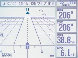
I use COG.
RT Firefly
Enigma
Greetings,
Mr. S. More to the point, how many have a magnetic compass that is accurate? When was the last time anyone had their compass adjusted or know how to correct a compass while underway? I use it for rough navigation. For highly accurate direction I defer to the Admiral.
Mr. S. More to the point, how many have a magnetic compass that is accurate? When was the last time anyone had their compass adjusted or know how to correct a compass while underway? I use it for rough navigation. For highly accurate direction I defer to the Admiral.
CPseudonym
Moderator Emeritus
My boat came equipped with one located in such a way as to be useless while operating. I scratched my head and considered an alternate location but that's as far as I've got. Find it pretty useless in the Delta.
I do however have a handy compass in my binoculars but admit to being clueless as to their accuracy.
I do however have a handy compass in my binoculars but admit to being clueless as to their accuracy.
Last edited:
psneeld
Guru
Till I put radar on the trawler...or still on my assistance towing vessel, I use a compass for turning at night or low vis. GPS often responds slowly enough in very tight quarters you can overshoot real easy in a sharp turn. A compass doesn't have to be accurate to use it in this mode...it's really just for turning the appropriate number of degrees to the new course.
I do adjust them with the GPS now...very easy...yes I've heard all the oldtimer arguments why it doesn't work...but I'm using "modern thinking" so it works just fine....
I do adjust them with the GPS now...very easy...yes I've heard all the oldtimer arguments why it doesn't work...but I'm using "modern thinking" so it works just fine....
O C Diver
Guru
- Joined
- Dec 16, 2010
- Messages
- 12,865
- Location
- USA
- Vessel Name
- Slow Hand
- Vessel Make
- Cherubini Independence 45
I use a compass for turning at night or low vis. GPS often responds slowly enough in very tight quarters you can overshoot real easy in a sharp turn. A compass doesn't have to be accurate to use it in this mode...it's really just for turning the appropriate number of degrees to the new course.
+1
Couldn't imagine being out at night, in the fog, torrential down pour, or heavy snow fall (that will never happen again anyway
 ) were visibility might be only a few boat lengths without a GOOD non electronic compass.
Ted


Steve
Guru
We have one at the lower helm, I admit I seldom even take a look at it except to dust it off. It is good to have in the unlikely event we lose electronics way, way, out in the Gulf I know we can point her North or East and run into land eventually. We do carry two handheld GPS which should take care of things barring a huge GPS blackout maybe more likely now the way foreign affairs are going.
Capt Kangeroo
Senior Member
Old habits die hard. I use mine all the time. I no longer plot manually with paper charts, rather I take the course from the GPS & steer entirely by compass. No particular reason other than it is more comfortable.
Your right about keeping correction charts & finding a pro for swinging them, it's a dying art. There used to be a fellow here that was exceptional and would do it for $50.00 but by the time you got back to the dock you had to restock your beer fridge. Quite a thirsty chap. Was a time when most surveyors offered this service.
Your right about keeping correction charts & finding a pro for swinging them, it's a dying art. There used to be a fellow here that was exceptional and would do it for $50.00 but by the time you got back to the dock you had to restock your beer fridge. Quite a thirsty chap. Was a time when most surveyors offered this service.
psneeld
Guru
A compass can only bring you back on heading....unless you are actively plotting set/drift...a course deviation indicator can tell you how far you are drifing off and what to steer to get back on your trackline instantaneously. If you use both then I can relate...but my habits have evolved to chartplotter based though I can still do much of the other in case of emergency from years of practice.
If you don't care about the extra time and distance that's OK with me...I just go slow enough both are precious, plus it saves fuel.
That's usually why I let autopilot do it for me as he's WAY more attentive than me...
If you don't care about the extra time and distance that's OK with me...I just go slow enough both are precious, plus it saves fuel.
That's usually why I let autopilot do it for me as he's WAY more attentive than me...
Last edited:
Nomad Willy
Guru
I find it much easier to steer by compass in thick fog. Crossed half of Dixon Entrance in the fog. Had the GPS on of course (and radar) but to steer a straight course the compass was a better tool. It's one of those things you've got to get the hang of too. I considered it a challenge and a good thing to know. Gotta watch it constantly though.
Whenever visibility disappears (or looks like it may) I use the compass as a reference point. If all else fails I have the ability to continue on the course that I was on. Sometimes I make a note on paper of the course so I can always return to it w the compass.
I'm fortunate enough to have a compass w just the right amount of stability. The compass I have is the only really useable compass I've used.
Last edited:
Sailing along the south coast of PR at night both GPS units lost their signal. Using the compass was the only way to continue until the signals returned. Would have been totally screwed without a compass.
Sailing in dense fog a week or so ago, a friend's chartplotter decided to do a reset. he didn't know about using the compass and ended up going in circles in some very marginal water until he got the plotter going again.
Wouldn't leave home without one,
Bob
Sailing in dense fog a week or so ago, a friend's chartplotter decided to do a reset. he didn't know about using the compass and ended up going in circles in some very marginal water until he got the plotter going again.
Wouldn't leave home without one,
Bob
psneeld
Guru
in open water a compass is OK to follow a heading you have been using...but many times in confined waters a heading will take you aground as fast as being lost unless you have accurate set and drift or are navigating by RADAR.
Radar in my operations is the next best tool after a compass for making turns in confined areas and low vis.
Radar in my operations is the next best tool after a compass for making turns in confined areas and low vis.
Tony B
Guru
- Joined
- Jul 18, 2011
- Messages
- 1,251
- Location
- Cruising/Live-Aboard USA
- Vessel Name
- Serenity
- Vessel Make
- Mainship 36 Dual Cabin -1986
I navigate with the GPS but steer by the compass, if that makes any sense as stated. I use both.
So basically, I always use my compass. Adjusting you heading with a crab angle is no different with a compass than a GPS. I do it because I am comfortable with it. I'm sure I could come up with lots of reasons to use it as not - maybe.
So basically, I always use my compass. Adjusting you heading with a crab angle is no different with a compass than a GPS. I do it because I am comfortable with it. I'm sure I could come up with lots of reasons to use it as not - maybe.
psneeld
Guru
I navigate with the GPS but steer by the compass, if that makes any sense as stated. I use both.
So basically, I always use my compass. Adjusting you heading with a crab angle is no different with a compass than a GPS. I do it because I am comfortable with it. I'm sure I could come up with lots of reasons to use it as not - maybe.
Probably the most important issue at hand...
...especially those with plenty of experience to know it works over a variety of situations.Richard W
Senior Member
- Joined
- Jan 2, 2014
- Messages
- 301
- Location
- The 3rd Rock from the Sun
- Vessel Name
- anytime
- Vessel Make
- 2007 Chaparral 270 Signature LOA 29'
This one is from a chart of my boating backyard, one of many in the area ...

Everyday I use GPS/chartplotter/iPad ... still, I would not go out without a magnetic compass and paper charts of the area.
Everyday I use GPS/chartplotter/iPad ... still, I would not go out without a magnetic compass and paper charts of the area.
- Joined
- Oct 6, 2007
- Messages
- 841
- Location
- Poulsbo, WA
- Vessel Name
- Dream Catcher
- Vessel Make
- Nordic Tug 37-065
I find it much easier to steer by compass in thick fog. Crossed half of Dixon Entrance in the fog. Had the GPS on of course (and radar) but to steer a straight course the compass was a better tool. It's one of those things you've got to get the hang of too. I considered it a challenge and a good thing to know. Gotta watch it constantly though.
Whenever visibility disappears (or looks like it may) I use the compass as a reference point. If all else fails I have the ability to continue on the course that I was on. Sometimes I make a note on paper of the course so I can always return to it w the compass.
I'm fortunate enough to have a compass w just the right amount of stability. The compass I have is the only really useable compass I've used.
Likewise. In addition, the compass shows directions even if the boat is not in motion, unlike COG provided by the chartplotter.
ancora
Guru
- Joined
- Dec 16, 2007
- Messages
- 4,022
For running a Predicted Log race according to the rules, we must use our compass. At all other times, we use GPS. As an aside, it now costs the price of a new compass to get it professionally boxed. My bridge compass is starting to stick and the company Aquameter is no longer in business so no parts are available. I'm goin' to take the compass from the lower helm and install it on the fly-bridge where we do all our pilotin'.
RT Firefly
Enigma
Greetings,
Mr. RW. couldn't help but notice "AREA OF MAGNETIC DISTURBANCE". Is the cause for this known and does it affect the compass much?
Mr. RW. couldn't help but notice "AREA OF MAGNETIC DISTURBANCE". Is the cause for this known and does it affect the compass much?
Northern Spy
Guru
- Joined
- Feb 5, 2012
- Messages
- 4,075
- Location
- Canada
- Vessel Name
- Northern Spy
- Vessel Make
- Nordic Tug 26
I use a hand-held compass and compass binoculars for bearings. I do scan the helm compass as I do other instruments, and I do report the course reading when I turn over the helm to someone. But do I actually use it for navigation? Honestly, not really, as most of the time the auto pilot is steering. Would never get rid of it as it is a fundamental of navigation, has few moving parts, and doesn't require electricity.
It is a legal requirement in Canada to have on boats over 8m. If under 8m it is not required if you are using navaids, i.e lake, river or canal boating.
It is a legal requirement in Canada to have on boats over 8m. If under 8m it is not required if you are using navaids, i.e lake, river or canal boating.
Richard W
Senior Member
- Joined
- Jan 2, 2014
- Messages
- 301
- Location
- The 3rd Rock from the Sun
- Vessel Name
- anytime
- Vessel Make
- 2007 Chaparral 270 Signature LOA 29'
Greetings,
Mr. RW. couldn't help but notice "AREA OF MAGNETIC DISTURBANCE". Is the cause for this known and does it affect the compass much?
I can only guess based on the geology of this area ... iron rich granite at the bottom of the river canyons.
It does affect the compass and the deviations are random and significant ... luckily, there is plenty of nav aids and topo points to stay on track.
psneeld
Guru
Greetings,
Mr. RW. couldn't help but notice "AREA OF MAGNETIC DISTURBANCE". Is the cause for this known and does it affect the compass much?
Don't have charts for that area loaded...unless there's something else in the chart notes...the underwater cables nearby can also set up a disturbance.
Richard W
Senior Member
- Joined
- Jan 2, 2014
- Messages
- 301
- Location
- The 3rd Rock from the Sun
- Vessel Name
- anytime
- Vessel Make
- 2007 Chaparral 270 Signature LOA 29'
Coincidental ... there is plenty of cables between various islands there and no marked disturbance, and other marked disturbance areas and no cables in sight.
psneeld
Guru
Coincidental ... there is plenty of cables between various islands there and no marked disturbance, and other marked disturbance areas and no cables in sight.
Depends what they are as I have seen anomalies from cables...but here's an interesting bit of info (probably not cables for sure)
Magnetic Anomalies - Kingston , Ontario waterfront
28) Local magnetic disturbances.-- Differences from normal variation of from about 006 W to 007 E have been observed at numerous locations throughout Lake Ontario. Differences of up to 37 have been observed in the approach to Kingston, Ont., on the N side of the head of the St. Lawrence River. The locations of these anomalies are shown on NOS chart 14500.
Another reason to either really use your compass...or NOT!!! You definitely have to plan for all these little issues...or be way off...
Last edited:
Poach
Senior Member
- Joined
- Aug 5, 2013
- Messages
- 234
- Location
- United States
- Vessel Name
- Poach
- Vessel Make
- Sabreline Trawler
Like most of us, I use my GPS, but I look at my compass as well. I always think about if GPS is taken down or significantly degraded for security purposes, or due to a failure or a hack--? I like to think my compass is pretty necessry.
RT Firefly
Enigma
Greetings,
Messrs. RW and psneeld. So what you're both saying is that there is SOMETHING down there and we shouldn't necessarily take it for granite. Bwahahahaha.....Sometimes I just knock myself out.....
Messrs. RW and psneeld. So what you're both saying is that there is SOMETHING down there and we shouldn't necessarily take it for granite. Bwahahahaha.....Sometimes I just knock myself out.....
Last edited:
Similar threads
- Replies
- 47
- Views
- 3K
- Replies
- 71
- Views
- 6K
- Replies
- 2
- Views
- 360
- Replies
- 5
- Views
- 364