Pickwick Lake to Cocoa, Knot a Yot coming home

The friendliest place on the web for anyone who enjoys boating.
If you have answers, please help by responding to the unanswered posts.
Why did you not go out Government Cut into the Gulf just south of Apalachicola, rather than take the longer route up to Carrabelle?

Probably wanted a little night life in Carrabelle before plunging off into the Gulf crossing. Night life in Carrabelle is not much, to be sure, but compared to White City it is Vegas! :)
 
Night life in Carrabelle is not much, to be sure, but compared to White City it is Vegas! :)
Indeed, we looked at all options for crossing, but decided that we wanted a good night's rest and a place with good data reception to keep an eye on the weather up to the time we head out. We had dinner at "The Fisherman's Wife" last night and we think that alone was worth the extra time to come this route.
 
Hope you have a sedate crossing. I am planning on making that crossing later this month after Christmas. Did you pick up any local information about depths in Government Cut? Most of the stuff I'm finding out so far is second hand, or out of date.
 
Did you get any local information about depths in Government Cut? I'm thinking of taking that route on the way to Clearwater later this month after Christmas. Hope you have a smooth crossing.
 
Hope you have a sedate crossing. I am planning on making that crossing later this month after Christmas. Did you pick up any local information about depths in Government Cut? Most of the stuff I'm finding out so far is second hand, or out of date.

Not sure of the depth in Government Cut. I have taken my sailboat (back when I had it) through there several times, and appeared to always have plenty of water under the keel. The big problem with using Government Cut is that there are always a lot of small boats fishing in there, and it is not very wide. Personally, I would recommend just following the ICW from Apalachicola over to Dog Island and taking that exit to the Gulf. Not going to be any real difference in the distance (a mile at most).
 
Your 1 mile difference might be right for Tarpon Springs, but my planned destination from Apalachicola is Clearwater. I make the difference in distance more like 10 NM (as measured from the turning point on the ICW at Red #2 where one would either go south to Government Cut 3.5 NM, thence SE to Clearwater 149 NM, or turn ENE to East Pass near Dog Island 17.2 NM, thence SE to Clearwater 145.3 NM). That's well over an hour's extra steaming in my boat. But I sure don't want to chance it if Government Cut is shoaling too badly.
 
Your 1 mile difference might be right for Tarpon Springs, but my planned destination from Apalachicola is Clearwater. I make the difference in distance more like 10 NM (as measured from the turning point on the ICW at Red #2 where one would either go south to Government Cut 3.5 NM, thence SE to Clearwater 149 NM, or turn ENE to East Pass near Dog Island 17.2 NM, thence SE to Clearwater 145.3 NM). That's well over an hour's extra steaming in my boat. But I sure don't want to chance it if Government Cut is shoaling too badly.

Um, you may be right. I wasn't thinking about the fact that you go back in a NE direction from Apalachicola to the East Pass, rather than a straight East direction.
 
That's what baffles me about so many folks driving up to Carrabelle. I've been thinking they know something about Government Cut I don't. Last time I was through there was late November, 2011. Been through half a dozen times before that this time of year and found it very passable in settled weather. Anyway, our intrepid travelers should be well on their way and from what I can see of it, the weather looks pretty benign for their crossing to Clearwater: south winds 5-10 kts, seas around 2'. Crab pots will likely be their only concern as they close the coast in the morning. Looking forward to their next post.
 
Just to provide an alternative view...

We're in Panama City now until after Christmas. I looked over the Government Cut/Carrabelle/Tarpon Spring issues and decided that none of it was worth it. I like deep, well-defined inlets and offshore access so I'm going to go to Port St Joe when the weather looks good after Christmas and then cross from there to Clearwater.

I talked to a few people who live in Pensacola and none of them like Government Cut. One guy touched a few times there last year and swore to never go through there again. We draw 6' so I'm not going to mess around with inlets like that.
 
Much more fun cruising with a cutesy deckhand! Congratulations on your boat purchase, your maiden voyage, and going to Florida where I hear it's actually warm in the winter. Best wishes and warm thoughts from me and my lovely deckhand (The Admiral) who are trying to stay warm on our boat in Pender Harbour, BC.
 
Just to provide an alternative view...

We're in Panama City now until after Christmas. I looked over the Government Cut/Carrabelle/Tarpon Spring issues and decided that none of it was worth it. I like deep, well-defined inlets and offshore access so I'm going to go to Port St Joe when the weather looks good after Christmas and then cross from there to Clearwater.

I talked to a few people who live in Pensacola and none of them like Government Cut. One guy touched a few times there last year and swore to never go through there again. We draw 6' so I'm not going to mess around with inlets like that.

That's a solid plan...especially with a 6' draft. The very first time I did that crossing we left from Panama City in an old wooden sailboat that drew 6'2" and made direct for Clearwater, rounding Cape San Blas. Apart from staying well offshore to avoid those shoals extending many miles to seaward from the Cape, your only real precaution would be to guard Ch 16 closely for Tyndall AFB announcements on when those Restricted Areas in the Gulf might be "hot."
 
Looking forward to hearing about your passage. It's a good thing you got out of pickwick when you did. 30deg weather and freezing rain the last couple days and more in the forecast.
 
Yes, I agree that you need to monitor that. Getting bombed could spoil your whole day!
 
That's good local knowledge - thanks!

You're welcome. We might see you down the road. Our plan is to depart south Alabama for Key West shortly after Christmas moving slowly south along Florida's west coast, thence perhaps the Bahamas for spring, early summer. Look forward to hearing from the OP whether they made it OK to Clearwater earlier today.
 
Our crossing was "bumpy" but uneventful, other than a couple of items tossed about that were not properly stowed. We departed Carrabelle at 1217 in fog at low tide. No problems at all (I draft 3'8"). Out East Pass, speed 7 knots, and set course for Clearwater. Nice sunset, beautiful sunrise with much calmer waters, well before the crab pots, the first of which we passed about 10 miles northwest of Clearwater Pass. We timed it so that the sun would be well above the horizon and it worked perfectly...pots we backlit and east to dodge.

This route took us through Danger Area 334.670 (rocket tracking splashdown area) but was not a factor as it is only hot M-F.

We are visiting Cathy's mother and will continue south later today. I would love to hear from locals or seasoned travelers on the best route passed or through Tampa Bay, along with any comments on good anchorages between Clearwater and Ft Meyers.
 

Attachments

  • image-4073647781.jpg
    image-4073647781.jpg
    30.6 KB · Views: 93
  • image-3475261596.jpg
    image-3475261596.jpg
    54.9 KB · Views: 93
  • image-3602431649.jpg
    image-3602431649.jpg
    51.1 KB · Views: 98
  • image-1386744376.jpg
    image-1386744376.jpg
    58.3 KB · Views: 105
  • image-2479925659.jpg
    image-2479925659.jpg
    59 KB · Views: 88
Looking forward to hearing about your passage. It's a good thing you got out of pickwick when you did. 30deg weather and freezing rain the last couple days and more in the forecast.
Indeed, it is good to be back in shorts and t-shirts! Hell, we went crazy and actually had the AC running yesterday afternoon! My boss back in Calgary called last week and let me know that one of my Wind Farms received 40 cm of snow, and has a wind chill of -40C. Now where did I put my suntan lotion and beer....?!
 
I would love to hear from locals or seasoned travelers on the best route passed or through Tampa Bay, along with any comments on good anchorages between Clearwater and Ft Meyers.

Glad you made the jump OK. From Clearwater southbound, with an east wind, we like to jump back outside and cruise south close along the coast so as to have a good lee. We then tuck back inside at either Pass A Grille near St. Pete Beach, crossing northern Boca Ciega Bay, thence south on the west side of the Sunshine Skyway Bridge, or continue south past Tampa Bay entrance to Longboat Pass Entrance. Favorite anchorages along this stretch are in Cortez-Bradenton area SE of the Cortez Bridge at 27degrees 28.045' N, 082degrees 41.355 W. Also near Moore's Stone Crab Restaurant in Longbeach at 27 degrees 26.389 N, 082 degrees 40.744W. In Sarasota we anchor SW of Island Park at 27 degrees 19.838'N, 082 degrees 32.855W, or take a city mooring in the same area. If you stay in the ICW southbound, there's another super anchorage near Englewood Beach at 26 degrees 55.248'N, 082 degrees 21.298'W. Farther south along the ICW near Cayo Costa is Pelican Bay anchorage at 26 degrees 41.340' N, 082 degrees, 14.608' W. A bit further south near Useppa Island just off the ICW at 26 degrees 39.563'N, 082 degrees 12.854'W. Hope that helps. Enjoy the ride!
 
:thumb:
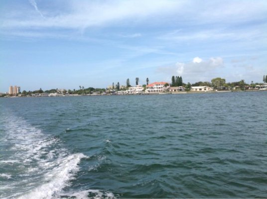
All good anchorages, Captain K. Long Beach is a great one. I will add a couple. If you are outside, Venus has a really good straight forward inlet You can do a day tie up at the city park on the beach side. I believe the Venus mooring field is active. You won't find much better restaurant than the Crow's Nest that is in walking distance. You can anchor in Charlotte Harbor off Punta Gorda with their new dinghy landing. Ft. Myers Beach has a great mooring field. Ballard Oil there has about the best fuel prices around.

If the weather is right, you can anchor off the south entrance to the Boca Grande canal. About the only place to land a dinghy would be Whiddens Marina. Funky and old Florida. You won't believe the place, but ask nicely, and the lady may agree. Walking distance to a quaint village with good restaurants. If you want to try this shoot me a PM, and I will send my super, top secret dinghy landing spot. Sworn to secrecy of course.
 
Thanks guys....we appreciate the intel! Unfortunately we are making the trip without the ability to launch our dingy due to an out of commission davit. Although we love anchoring out, on this trip we are stuck having to enjoy the scenery from on board.
 
Captain's cook'in up some Jambalaya while we swing on the hook in Longboat Pass. Our first time cruising this part of Florida and we can see why everyone loves it. Great run today, got underway late so not as much ground covered, but great scenery. Great day weather-wise too. We're looking at the Big O soon so that's the next weather challenge.
 

Attachments

  • image-3453992846.jpg
    image-3453992846.jpg
    54.8 KB · Views: 77
  • image-179645768.jpg
    image-179645768.jpg
    45.4 KB · Views: 95
  • image-239886626.jpg
    image-239886626.jpg
    41.2 KB · Views: 85
Last edited:
Glad to hear that you are there, having apparently successfully dodged K Tower and the innumerable crab traps. Not sure where you are going next, but if you plan to bop on down to the Keys I suggest that you consider going out some to Key West rather than straight in. Lots of skinny water in Florida Bay. Most likely would not be a problem, but running with zero (zero!) depth under the keel always raised my hackles something fierce!
 
Thanks JW. We're going through OK then up the Atlantic ICW to Cocoa. Won't be going to the Keys on this trip, but will definitely be planning one in the near future once we get the boat up to snuff. Thanks for the advice...we've had enough hackle-raising on this trip.
 
We're going through OK then up the Atlantic ICW to Cocoa. Won't be going to the Keys on this trip, but will definitely be planning one in the near future once we get the boat up to snuff. Thanks for the advice...we've had enough hackle-raising on this trip.

Roger that. Guess the title of the thread should have told me that. :) The OK trip is generally pretty smooth. Several locks (5?) and a few bridges. But no big deals. My advice on OK -- for what it is worth -- is to go straight across, rather than going around the edge.
 
My advice on OK -- for what it is worth -- is to go straight across, rather than going around the edge.
That's our palm, take the straight across route. We may take the rim route when we return this way. We are finding it much too beautiful here not to return!
 
Rum cove last night, lollypop anchorage just past Ortona Lock tonight. Lake O tomorrow. Still having a great time. Actually saw a Florida Panther this evening on the banks at the anchorage. A little rough in Pine Island Sound this morning, but turned in to a beautiful day. Interesting that they don't bother with equalizing valves on these locks...just crack 'em open and let the water flow! Of course it is a big difference in a lock with 80 foot lift as compared to 2 feet!
 

Attachments

  • image-134956812.jpg
    image-134956812.jpg
    58 KB · Views: 88
  • image-1139946937.jpg
    image-1139946937.jpg
    61.1 KB · Views: 88
  • image-1432068421.jpg
    image-1432068421.jpg
    56.1 KB · Views: 88
  • image-2472423984.jpg
    image-2472423984.jpg
    38 KB · Views: 99
Rough day on Okeechobee, but we are on the east side now. Hoping to make four rivers loop anchorage for the night.
 
Rough day on Okeechobee, but we are on the east side now. Hoping to make four rivers loop anchorage for the night.

Today was a bad day to cross the big O. Hope you didn't get too much mud on your boat.

The Saturday morning farmers market is at Ft. Pierce City Marina. Stop on by or give us a toot as you pass.
 
Today was a bad day to cross the big O. Hope you didn't get too much mud on your boat. The Saturday morning farmers market is at Ft. Pierce City Marina. Stop on by or give us a toot as you pass.
It was not too bad. There were a couple of legs with a little more beam sea than I would have preferred, but after all this is an extended shakedown cruise. You can't shake 'er down if you don't shake her. We may stop on tomorrow's leg for fuel somewhere. We will honk your way as we pass.
 
It was not too bad. There were a couple of legs with a little more beam sea than I would have preferred, but after all this is an extended shakedown cruise. You can't shake 'er down if you don't shake her. We may stop on tomorrow's leg for fuel somewhere. We will honk your way as we pass.

Not too bad a crossing. I've come across and the whole boat was coated with mud from the gray water.

Fort Pierce City Marina fuel prices as of today

Fuel Prices as of 12/12/2013 -
Diesel 4.169 less .10 Tenant/Boat US discount
Gas 4.399 less .10 Tenant/Boat US ***REC 90 OCTANE
 
Back
Top Bottom