Wxx3
Dauntless Award
- Joined
- Jan 10, 2013
- Messages
- 2,820
- Location
- USA
- Vessel Name
- Dauntless
- Vessel Make
- Kadey Krogen 42 - 148
Dauntless was used and abused last night.
The day started out like many, beautiful, sunny skies, a stiff northerly breeze and waiting for the train bridge to open. Since I wanted to do about 60 nm, it was frustrating to have to delay my departure until; 9 a.m., as the FFC train bridge has been feeling poorly and now has restricted opening hours. Then to make matters worse, I did not look closely at the beginning of my days route, so once IO got underway, I realized I was actually a good 45 minutes away from the train bridge anyway. Well, I was saved the ridicule of having to beat myself up in public, when the bridge was feeling particularly poorly that morning, so it actually did not open until I got there.
Good start of the day, no wasted time. But as I was motoring away at 4.5 knots, I’m wondering why there are no other boats on the water. (Someone just informed me today, that there was some big ferocious storm forecast for yesterday and that’s why nobody was allowed out to play). (maybe, I will do a thread about weather forecasting some day). OK back to the story. No, that’s not right; there was one other boat, who I was listening to as he talked to Sister’s Creek Bridge, as he did not know how much vertical clearance he needed. The too kind bridge operator,
 opened for him in any case. So at this point we are both heading for the narrow channel of the ICW as it runs south from Jacksonville (at least three free docks there by the way).
So, now I am concentrating on the charts and trying to correlate what I am seeing outside as to what the charts are telling me when all of a sudden I look up and idiot brain is aimed right for me, like 100 ft. away and aiming to “T” bone me. I call down to the engine room and ask for full astern, while I turn the wheel to aim for a point astern of him. Luckily, the squirrels in the engine room were not chasing each other as they are wont to do, but were attentive and Dauntless, quickly lost its forward speed and idiot brain passed in front of me, like I was not even there. To be kind, he was probably still trying to figure out how tall his boat was. So, at this point, I realized I had missed the ICW start and was wondering what those dashed lines meant on the chart, between me and where I wanted to go? I was wondering if I could got over them, but decided now was not the time for adventure, so I did a 270° turn to the north and realigned myself with the channel again and as there were no other boats trying to run me down, I entered the ICW. I also threw some nuts to the squirrels for their prompt response. I also took this occasion to admonish them again not to chew any cables, because the last time it happened I could not get the smell of charred squirrel out of the boat for days.
At this point, it’s already 1 p.m. and I’ve essentially just started my day. I have a stiff current against me and am resigned to just motor on. I did take a little break, actually anchoring for about 30 minutes to see if I could figure out the tides and currents. I finally do see that once I get to St. Augustine, there will be a current in my favor, and I am hoping to take advantage of that, even though it will be dark by then.
Now, the real shenanigans begin.
Just leaving the anchorage, Active Captain warned of the currents under this bridge. As the boat is becoming squirrely (they don’t mind if I use this term), I have to go full power, just to maintain steerage and about 2 knots. Yes, that means more peanuts for the squirrels (and a little extra for using their name in vain).
Ok, a slow, but steady day until dark. I’m passing St. Augustine, it’s 6:00 p.m. and I look up a realize that my favorite bridge (and the place of my only unpleasant bridge operator experience in the spring) is right before me. The Bridge of Lions has specific opening times, does not open at all between 4 and 6 p.m., but after 6 it is on demand. So, it’s 6:05, dark and I ask for an opening and I’m thru in minutes. Good omen. NOT.
Now, it’s no longer twilight, but really dark, due to thick cloud cover. I had realized that there were few good anchorages just south of St. A, but I figured, I’d find something. Well, I did, just not what I wanted. I had another chart question answered. Oh, by the way, I forgot to tell you about those dashed lines. Once I was safely ensconced on the ICW, I looked at my raster chart (I navigate with three chart systems) and that chart was the only one that told me that the dashed lines were an old jetty. That would have been on long, expensive short cut. Ok, back to the story.
Since it is now so dark, it’s becoming harder and harder to stay on course, since you know those cute, little boat docks everyone has on the ICW? Well, some are lite up light Grand Central Station, so numerous times, I panic thinking I am driving into someone living room. Then, I see these really bright lights off in the distance, almost like an airport. But there is no airport around, so I figure that it is a road with cars with bright lights. I have the whole scenario figured out. They are cars waiting at a stop sign and that why I see them come and go. So, I’m watching and watching as I am getting closer to this road and wondering why the ICW is going over a road, when all of a sudden I realize that I am looking at the red, white, green navigation lights of a tugboat coming directly at me. He turns on his searchlight, which actually made a crappy situation worse (for me at least), it that, being blinded light that, I then lost all perspective as to where he was and what I had to do to avoid him. I’m sure he was just trying to figure out what WTF I was doing and to wake me up. So, called on the squirrels again and back to WOT to do a port to port pass. It worked, I didn’t get run down, but in hindsight I did realize that I probably could have easily done a starboard to Starboard pass, instead of crossing in front of him as I did.
Then, having survived that, I am looking for the channel and seeing so many red lights flashing. So, now at this point I realize I have to find someplace to anchor. Looking at their frequency (of flashing), I am trying to correlate them with the charts. After almost heading towards them, thinking they are on the right side of the channel, I finally realize that they are navigation lights on radio towers miles away. Reminded me of the time, I was flying from SEA to FAI, on the milk run and at one point I was convinced that there was another plane a mile off our wing. He was there for so long, I couldn’t figure out why he was flying in formation with us. I finally realized I was looking at the navigation light on the stbd wind tip. Perspective at night, that’s why they give us instruments!
OK, at this point, I know I must anchor. Trying to find a place to anchor, now the chart just has a narrow channel going on and on. I decide to slowly venture off the channel to see how deep the water is, maybe I can anchor here?? As I angle off, I’m watching the depth gauge, 10.5 ft., 9.5ft, 10.0ft, and 2.5ft. Now, all of a sudden, I am driving thru mud that is getting heavier and heavier. I turn and add power to get back in the channel, after about 1 of really slow progress, the helm lightens and I know I am back in the channel, but now going 5 knots perpendicular to the channel, so what happens next boys and girls? I am now back in the 2.5 ft. range, on the other side, now going even slower. I decide to try to back up and it helps a bit, as there is a strong wind, I can then go forward to get back in the channel without overshooting this time.
I realize I will just have to motor on until I get to an anchorage that’s on AC. Thirty white knuckled minutes later, I do, and following the AC directions exactly, I was able to transition from the ICW to the Matanzas Inlet. It’s now almost 8 p.m., but no boys and girls, the adventure is not yet over. It’s dark; I can see the lights of the little dock for the park maybe a mile ahead, where I want to anchor. I check my radar and see this big blob in front of me. Full to port and I grab the searchlight and see this big ass catamaran, with no lights, other than a 1 watt light 60 feet in the air. You got a $million$ boat and a 5 cent light.
 Go figure.
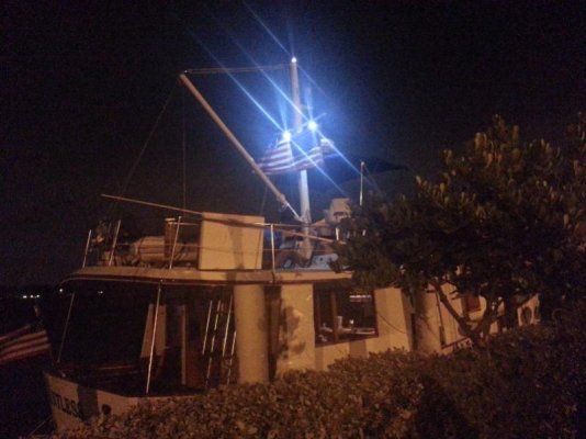
I anchor three times before I am satisfied that I won’t swing into shore or another boat when the tide turns. As I turn on my anchor light, I also, turn on my spreader lights (I had changed out the halogen bulbs for LED’s) and I even decided to leave the radar and chart plotter on, as well as my nav computer, so that when I got up periodically in the night, I could instantly see my position and the track of the boat.
I then called my wife, to ask her if I should move the boat yet again (I was only 80 feet from shore, with 100 ft. of chain out). Told her the situation and that I felt that when the current reversed, the boat would essentially pivot in a small (50ft) diameter and the strong current would keep the boat from swinging.
She told me not to worry, take Benadryl and go to sleep. I did, though I did get up every two hours, but the boat was really happy and other than changing direction, stayed within a 50ft corridor.
All’s Well that Ends Well and What you don’t know, can’t hurt you
 and other fables.

The day started out like many, beautiful, sunny skies, a stiff northerly breeze and waiting for the train bridge to open. Since I wanted to do about 60 nm, it was frustrating to have to delay my departure until; 9 a.m., as the FFC train bridge has been feeling poorly and now has restricted opening hours. Then to make matters worse, I did not look closely at the beginning of my days route, so once IO got underway, I realized I was actually a good 45 minutes away from the train bridge anyway. Well, I was saved the ridicule of having to beat myself up in public, when the bridge was feeling particularly poorly that morning, so it actually did not open until I got there.
Good start of the day, no wasted time. But as I was motoring away at 4.5 knots, I’m wondering why there are no other boats on the water. (Someone just informed me today, that there was some big ferocious storm
 opened for him in any case. So at this point we are both heading for the narrow channel of the ICW as it runs south from Jacksonville (at least three free docks there by the way).
So, now I am concentrating on the charts and trying to correlate what I am seeing outside as to what the charts are telling me when all of a sudden I look up and idiot brain is aimed right for me, like 100 ft. away and aiming to “T” bone me. I call down to the engine room and ask for full astern, while I turn the wheel to aim for a point astern of him. Luckily, the squirrels in the engine room were not chasing each other as they are wont to do, but were attentive and Dauntless, quickly lost its forward speed and idiot brain passed in front of me, like I was not even there. To be kind, he was probably still trying to figure out how tall his boat was. So, at this point, I realized I had missed the ICW start and was wondering what those dashed lines meant on the chart, between me and where I wanted to go? I was wondering if I could got over them, but decided now was not the time for adventure, so I did a 270° turn to the north and realigned myself with the channel again and as there were no other boats trying to run me down, I entered the ICW. I also threw some nuts to the squirrels for their prompt response. I also took this occasion to admonish them again not to chew any cables, because the last time it happened I could not get the smell of charred squirrel out of the boat for days.
At this point, it’s already 1 p.m. and I’ve essentially just started my day. I have a stiff current against me and am resigned to just motor on. I did take a little break, actually anchoring for about 30 minutes to see if I could figure out the tides and currents. I finally do see that once I get to St. Augustine, there will be a current in my favor, and I am hoping to take advantage of that, even though it will be dark by then.
Now, the real shenanigans begin.

Just leaving the anchorage, Active Captain warned of the currents under this bridge. As the boat is becoming squirrely (they don’t mind if I use this term), I have to go full power, just to maintain steerage and about 2 knots. Yes, that means more peanuts for the squirrels (and a little extra for using their name in vain).
Ok, a slow, but steady day until dark. I’m passing St. Augustine, it’s 6:00 p.m. and I look up a realize that my favorite bridge (and the place of my only unpleasant bridge operator experience in the spring) is right before me. The Bridge of Lions has specific opening times, does not open at all between 4 and 6 p.m., but after 6 it is on demand. So, it’s 6:05, dark and I ask for an opening and I’m thru in minutes. Good omen. NOT.

Now, it’s no longer twilight, but really dark, due to thick cloud cover. I had realized that there were few good anchorages just south of St. A, but I figured, I’d find something. Well, I did, just not what I wanted. I had another chart question answered. Oh, by the way, I forgot to tell you about those dashed lines. Once I was safely ensconced on the ICW, I looked at my raster chart (I navigate with three chart systems) and that chart was the only one that told me that the dashed lines were an old jetty. That would have been on long, expensive short cut. Ok, back to the story.
Since it is now so dark, it’s becoming harder and harder to stay on course, since you know those cute, little boat docks everyone has on the ICW? Well, some are lite up light Grand Central Station, so numerous times, I panic thinking I am driving into someone living room. Then, I see these really bright lights off in the distance, almost like an airport. But there is no airport around, so I figure that it is a road with cars with bright lights. I have the whole scenario figured out. They are cars waiting at a stop sign and that why I see them come and go. So, I’m watching and watching as I am getting closer to this road and wondering why the ICW is going over a road, when all of a sudden I realize that I am looking at the red, white, green navigation lights of a tugboat coming directly at me. He turns on his searchlight, which actually made a crappy situation worse (for me at least), it that, being blinded light that, I then lost all perspective as to where he was and what I had to do to avoid him. I’m sure he was just trying to figure out what WTF I was doing and to wake me up. So, called on the squirrels again and back to WOT to do a port to port pass. It worked, I didn’t get run down, but in hindsight I did realize that I probably could have easily done a starboard to Starboard pass, instead of crossing in front of him as I did.
Then, having survived that, I am looking for the channel and seeing so many red lights flashing. So, now at this point I realize I have to find someplace to anchor. Looking at their frequency (of flashing), I am trying to correlate them with the charts. After almost heading towards them, thinking they are on the right side of the channel, I finally realize that they are navigation lights on radio towers miles away. Reminded me of the time, I was flying from SEA to FAI, on the milk run and at one point I was convinced that there was another plane a mile off our wing. He was there for so long, I couldn’t figure out why he was flying in formation with us. I finally realized I was looking at the navigation light on the stbd wind tip. Perspective at night, that’s why they give us instruments!

OK, at this point, I know I must anchor. Trying to find a place to anchor, now the chart just has a narrow channel going on and on. I decide to slowly venture off the channel to see how deep the water is, maybe I can anchor here?? As I angle off, I’m watching the depth gauge, 10.5 ft., 9.5ft, 10.0ft, and 2.5ft. Now, all of a sudden, I am driving thru mud that is getting heavier and heavier. I turn and add power to get back in the channel, after about 1 of really slow progress, the helm lightens and I know I am back in the channel, but now going 5 knots perpendicular to the channel, so what happens next boys and girls? I am now back in the 2.5 ft. range, on the other side, now going even slower.
 I decide to try to back up and it helps a bit, as there is a strong wind, I can then go forward to get back in the channel without overshooting this time.
 I realize I will just have to motor on until I get to an anchorage that’s on AC. Thirty white knuckled minutes later, I do, and following the AC directions exactly, I was able to transition from the ICW to the Matanzas Inlet. It’s now almost 8 p.m., but no boys and girls, the adventure is not yet over. It’s dark; I can see the lights of the little dock for the park maybe a mile ahead, where I want to anchor. I check my radar and see this big blob in front of me.
I anchor three times before I am satisfied that I won’t swing into shore or another boat when the tide turns. As I turn on my anchor light, I also, turn on my spreader lights (I had changed out the halogen bulbs for LED’s) and I even decided to leave the radar and chart plotter on, as well as my nav computer, so that when I got up periodically in the night, I could instantly see my position and the track of the boat.
I then called my wife, to ask her if I should move the boat yet again (I was only 80 feet from shore, with 100 ft. of chain out). Told her the situation and that I felt that when the current reversed, the boat would essentially pivot in a small (50ft) diameter and the strong current would keep the boat from swinging.
She told me not to worry, take Benadryl and go to sleep. I did, though I did get up every two hours, but the boat was really happy and other than changing direction, stayed within a 50ft corridor.
All’s Well that Ends Well
 and What you don’t know, can’t hurt you
 and other fables.


