Got charts?

The friendliest place on the web for anyone who enjoys boating.
If you have answers, please help by responding to the unanswered posts.
"Sandra Bullock looks hot in booty shorts"

Looks like there is a bit of "Hollywood" with you after all.

But SB looks hot in anything .. or nothing. But I'm not sure about the latter.

She's almost an old lady though.
 
Last edited:
This is an interesting topic and while it seems nearly everyone is now navigating on raster or vector electronic charts, I'm wondering how many still steer by compass?
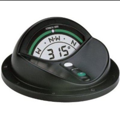
For those that still do steer by compass, the KVH Azimuth 1000 is the way to go. I've replaced my alcohol ship's compass with an Azimuth 1000 and can't believe the difference. Self calibrating, dampened read out, etc. You have to see & use one to really appreciate it. (They're not cheap, however.)

Azimuth 1000
 

Attachments

  • KVH Azimuth 1000.jpg
    KVH Azimuth 1000.jpg
    43.9 KB · Views: 59
"Sandra Bullock looks hot in booty shorts"

Looks like there is a bit of "Hollywood" with you after all.

But SB looks hot in anything .. or nothing. But I'm not sure about the latter.

She's almost an old lady though.

S. B. 49 and fine in my book!..

I got the nickname long before TF

:socool: HOLLYWOOD
 
I think Jeff always says ActiveCaptain is NOT intended for navigation... that it's more like a cruisers guide.

-Chris

I planned my recent trip on activecaptain and then downloaded it to my GPS which had a new updated map chip. Worked great...:thumb:
 
NOAA has an app that allows the charts of your area to download into a tablet and serve as a backup chartplotter. I loaded it into my Galaxy Note 8 and will give it a try. I like having vector charts on the Garmin and raster charts on the backup source (laptop or tablet)

NOAA
 

Latest posts

Back
Top Bottom