Follow me, Left marathon for Tennessee

The friendliest place on the web for anyone who enjoys boating.
If you have answers, please help by responding to the unanswered posts.
Writing all those letters to the next of kin gets old quick...

Just so's everyone knows I did recommend the wearing of pfds but you know the crew ya get taday just ain't what it used ta be. Used ta be when the captain said jump they'd say how high now all I hear is I know or why...
 
Sure is perdy
 

Attachments

  • image-1358437103.jpg
    image-1358437103.jpg
    41.6 KB · Views: 95
Just what we needed
 

Attachments

  • image-3321725626.jpg
    image-3321725626.jpg
    62.5 KB · Views: 88
What a difference going in and comin out. It was really ruff going in. I thought I was back in the ocean.
 

Attachments

  • image-2306772294.jpg
    image-2306772294.jpg
    50.2 KB · Views: 99
  • image-145235070.jpg
    image-145235070.jpg
    46.6 KB · Views: 91
They tell me Chattanooga is close as far as the water way. Guess I'm going to goose pond?
 
A lot of debrie in guntersville
 

Attachments

  • image-3394365227.jpg
    image-3394365227.jpg
    34.5 KB · Views: 97
I don't how know how they git their cars in um but these hillbillies build their garages on the water. :)
 

Attachments

  • image-1795693005.jpg
    image-1795693005.jpg
    43.6 KB · Views: 112
  • image-1875907226.jpg
    image-1875907226.jpg
    37.1 KB · Views: 94
  • image-1291675733.jpg
    image-1291675733.jpg
    35.8 KB · Views: 107
Nice ones to
 

Attachments

  • image-4168547099.jpg
    image-4168547099.jpg
    40.9 KB · Views: 102
I guess we are staying at goose pond probably a couple of days until the river opens back up. Fuel is only 3.69 for diesel.
 

Attachments

  • image-3710333627.jpg
    image-3710333627.jpg
    51.6 KB · Views: 90
  • image-3921198258.jpg
    image-3921198258.jpg
    47.4 KB · Views: 90
David, looks like Goose Pond is a good place to hold up. The river at Chattanooga went above flood stage about noon today. I walked out on the Walnut Street Bridge to check things out. Current is running 4 to 5 knots. There was one trawler at the transient dock. Both walk ways to the floating dock are under water. The river looks to have risen 5-6' in the last 24 hours. The current is moving so fast that water is piling up behind the bridge columns. That seldom happens. I don't know if power has been shut off to the docks, but I assume it has.

Unusual times indeed. The last time I remember this was in '67 and '72. Just hunker down and relax. There are a couple of marinas at Scottsboro. You might try to give them a call.
 
Unusual times indeed. The last time I remember this was in '67 and '72. Just hunker down and relax. There are a couple of marinas at Scottsboro. You might try to give them a call.

Wow, Don, if this is comparable to '72, it must be pretty bad indeed. (I'm in Chicago at the moment missing all this.). I was working at Miller Bros in Eastgate in '72 and we were flooded out. But that was before TVA built the levee. Stay safe!
 
Wow, Don, if this is comparable to '72, it must be pretty bad indeed. (I'm in Chicago at the moment missing all this.). I was working at Miller Bros in Eastgate in '72 and we were flooded out. But that was before TVA built the levee. Stay safe!

Flooding in town is not near as bad as '72. A lot of things have been done to mitigate flood damage since then. Plus we haven't had as much rain. I was referring to the water building up behind the bridge piers. They are really releasing a lot of water from the dam. There is a visible low place next to the sides of the piers where the fast water is speeding on by a foot or two off the pier. I don't see that often, and I live one block from the bridge.
 
Willaway was at our marina today Paris Landing State Park
 
Well I'm tucked away until the flood waters pass. You wouldn't know there was anything wrong from the view here.
 

Attachments

  • image-1163346168.jpg
    image-1163346168.jpg
    59.6 KB · Views: 96
Just read thru your whole thread! What A GREAT documentary of your journey!
 
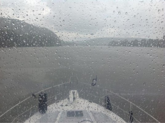
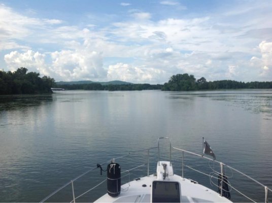
Here's the skinny as to what to expect on the Mighty Tennessee River for the next couple of weeks. Hope the video plays.

TVA Managing Tennessee River To Reduce Flooding
Wednesday, July 10, 2013

The Tennessee Valley Authority is working to move large volumes of water, as much as one million gallons per second in some places, along the Tennessee River system to reduce potentially damaging flooding from record rainfall.

TVA prepared for this event by lowering reservoir levels on the main channel of the Tennessee River beginning the last week of June, leaving some areas below normal for this time of year.

However, extreme rainfall and runoff in the middle and eastern portions of the Tennessee Valley over the past week are now forcing TVA to spill or release excess water from 10 of 20 tributary dams and all nine main channel dams along the 652-mile Tennessee River.


“TVA’s management of the river system is working,” said Chuck Bach, general manager of TVA River Operations. “TVA will spill only when all available hydroelectric-generating turbines are operating at full capacity and additional water still needs to be moved.”

Spilling along the dams is expected to last one to two weeks. As this water moves through the system, agricultural crops planted in floodplain areas along the Tennessee River in Northern Alabama and West Tennessee will be impacted by higher than normal water elevations.

“Some crop fields near the banks of the Tennessee River will see up to six to eight feet of water,” Mr. Bach said. “Crops along the Tennessee River on Kentucky Reservoir will be impacted the most.”

Because of flooding and high water flows on the Ohio and upper Mississippi rivers, water released out of the Tennessee River system into the Ohio River at Kentucky Dam have been reduced. TVA is in close contact with the U.S. Army Corps of Engineers, which manages the Ohio and Mississippi rivers, and when flood stages there drop, more will be allowed to be discharged from Kentucky Dam.

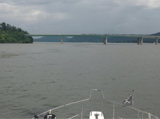
Within the Tennessee River system, there have been reports of flooding in Chattanooga; Whitesburg and Florence, AL, and Savannah, TN., near Pickwick Reservoir.

Some recreational areas along the Tennessee River have been temporarily closed because of high water. Recreation areas on Douglas and Watauga reservoirs in Tennessee and Wilson reservoir near Florence, AL, are among those most impacted.

“We advise using extreme caution when near the dams, rivers and tributaries,” Mr. Bach said. “Safety is the number one priority, and river currents and speed are unpredictable.”

Watauga Reservoir, near Elizabethton, TN, set a record lake elevation on Monday at 1,967 feet above sea level about a foot higher than the previous record set last May.

A forecast of additional rain later in the week could add one or two more inches of water into the already-flooded system.

The Tennessee River watershed has one of the highest annual rainfall totals of any watershed in the United States, averaging 51 inches a year. So far in 2013, more than 40 inches of rain has fallen in the Valley.

TVA manages the Tennessee River and its many tributaries to meet vital public needs in six key areas: navigation, flood damage reduction, power production, water quality and supply, recreation and land use.

July 9th, 2013 - TVA Dam Spilling - YouTube
 
Moonstruck: I was at Watauga Lake Monday. I've never seen it so high. The rain continues as well. I would think they'll be releasing lots of water as long as the rains continue.
David: I found this thread today. Wow, quite a trip. Maybe the captain and I will try to bring our boat up the Tennessee one day. We're still pretty new at this stuff. :) Hope the rest of your trip is smooth.
 
Last edited:
David-
Goose Pond as a good place to rest up and wait out the floods as I am sure you are already aware by now. Definitely fill up down there on diesel before you go further up river- that will be the cheapest diesel you see compared to anything around chattanooga. I took on 200 gallons or so at Shady Grove up around mile marker 485 or so (can't remember exact mile) which is up above downtown Chatt on chickamauga- they were at the bargain price of $3.90 a few weeks ago when we did that. Other marinas were $4.40 a gallon or more. I've gotten diesel @ goose pond multiple times and have never had any issues with quality of their fuel. I am going to shoot you a PM with an email contact you can send an email to for the corps of engineers to be placed on their email list for navigational notices (lock closures, etc.). It will be helpful for you.
 
Moonstruck: I was at Watauga Lake Monday. I've never seen it so high. The rain continues as well. I would think they'll be releasing lots of water as long as the rains continue.
David: I found this thread today. Wow, quite a trip. Maybe the captain and I will try to bring our boat up the Tennessee one day. We're still pretty new at this stuff. :) Hope the rest of your trip is smooth.

Thank you and if I can be of any help let me know
 

Latest posts

Back
Top Bottom