Just FYI for Northern Florida boaters

The friendliest place on the web for anyone who enjoys boating.
If you have answers, please help by responding to the unanswered posts.

jwnall

Moderator Emeritus
Joined
Sep 6, 2012
Messages
3,672
Location
US
Vessel Name
Morgan
Vessel Make
Gulfstar 36
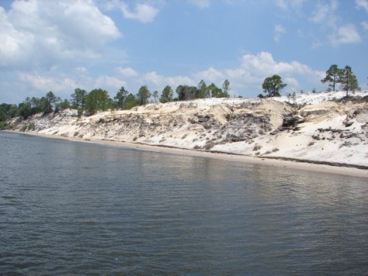
PANAMA CITY, Fla. (AP) -- The U.S. Coast Guard says a dyke break has caused a four-mile section of the Intracoastal Waterway to close between Choctawatchee Bay and West Bay.
Coast Guard officials say they received a call from boaters Thursday afternoon reporting that the dyke had given way at mile marker 263 between Panama City and Destin.
Coast Guard Station Panama City assessed the situation and deemed the channel unsafe. The waterway is now closed from mile marker 262 to mile marker 266 in Walton County.
Boaters in the region are urged to use extreme caution.
 
Thanks! I've been through there a bunch of times and nver realized there was a dyke there, it is so voergrown most of the way. I did look at a Satellite view on Active Captain and does seem to be a dyke there with dirt tracks on top of it. Too bad a realtime view isn't available. Maybe later if you hear of one please let us know.
Looks like the trip outside won't be very pleasant for the next few days.

Steve, as you know there are some pretty high banks in that stretch. I have seen a dredge in there. Probably the spoil are pumped up the top and held by a dyke. The good thing is the weather is pretty good this time of year, and it is an easy offshore run from Panama City to East Pass at Destin.
 
Unsafe? I wonder why...if it's because it is shallow...those Coasties need to run the full length of the ICW before they think shallow water is "unsafe"..:socool:
 
Unsafe? I wonder why...if it's because it is shallow...those Coasties need to run the full length of the ICW before they think shallow water is "unsafe"..:socool:

I think that more likely it is deemed "unsafe" because we currently have flooding all along there, and there are going be strong currents, logs and such washed out of the swamps, and possibly unexpected shoals built up suddenly. I am just guessing, of course.
 
I think that more likely it is deemed "unsafe" because we currently have flooding all along there, and there are going be strong currents, logs and such washed out of the swamps, and possibly unexpected shoals built up suddenly. I am just guessing, of course.

It could be deemed unsafe because the high cuts are sandy, and may be unstable. Probably subject to cave ins.
 
I here is what some of that area of the ICW looks like. a portion, not much, is protected by stone "revetment" most is not. It is often transited by big fast boats making hellacious wakes which eat away at the unprotected banks.
 

Attachments

  • Land Cut ICW.jpg
    Land Cut ICW.jpg
    151.6 KB · Views: 58
  • ICW Land Cut.jpg
    ICW Land Cut.jpg
    136.3 KB · Views: 63
That's it Steve. The banks have been eaten back from the angle they were laid back when originally dug. Probably about a 3:1. Many areas look close to a 1:1. I am going to use an engineering term to describe it. If the soil is steeper than it's angle of repose (the angle that the soil will support itself with stability) it is deemed unstable and a danger of cave in. To add to this we do not know how much dredged slurry is being held by the dykes. Wet spoil if loose could spread across the cut quickly.
 

Latest posts

Back
Top Bottom