Journey of a Lifetime

The friendliest place on the web for anyone who enjoys boating.
If you have answers, please help by responding to the unanswered posts.
Status
Not open for further replies.
AIS is showing 17.5 kts for Following Seas when you were off Westport. I trust you boys will get a good night's sleep. Best wishes.
 
When it started getting rough, I decided to get on up on the step rather than act like a bobbing cork. It decreased a lot of the bouncing, but impacts with some of the larger swells would take your breath away. We had sacrificed some headway at 10 - 11 knots so increasing our speed to 17 knots, then backing off to 13 knots brought us back on schedule and we made the Columbia River Bar in perfect position to make the bar crossing without incident.

We had an outstanding halibut dinner that GFC Mike prepared, courtesy of the Makah Indian Nation, and will get a much needed nights rest. We will stay in Ilwaco tomorrow to pass up a marginal forecast for the Oregon coast and get set up for an earl departure Wednesday morning.
 
Last edited:
What's next for you guys after this one?

It's easier breathing at sea level.

img_163446_0_ab1f00d2405c59672fcc8899b7099b6c.jpg
 
But all good things must come to an end and finally it did. As we came down the coast and got into the channel to cross the infamous Columbia River Bar, we were taking the seas on our stern. They calmed down a lot and as we crossed the bar we were in about a 2’-3’ swell with a light chop on top. We crossed the bar in the calmest seas we’d seen for hours.

Whew!
 
As it looks right now, the weather improves for a tomorrow am departure, probably to Florence, a 133 NM run (bar entrance to bar entrance).

Will spend some time today working on porthole leaks in the forward stateroom. They are fixed so we may have to pull and reseal them.​
 
Well it sure feels good to have had a good night's sleep. I went to bed some time around 10:30 and just got up at 7:30. We're stuck in Ilwaco today because the weather/wave report looks a lot like what we had yesterday. I'm not feeling a bit bad about spending the day here rather than going out.

Yesterday was not fun for me. I had breakfast some time shortly after we rounded the NW corner of WA state when we were in beautifully calm waters. Then I gave it all back around lunch time when we were getting tossed around so much. That's the first time in my 65+ years that I've ralphed due to rough seas. Yuck.

I did manage to take some photos yesterday and also some videos. The internet service here is pretty slow so I'll wait until later to load them but I'm going to post the pics and identify what they are.

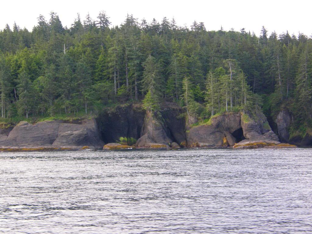
Cruising along the Straits of Juan de Fuca, the extreme northern coast of WA. Much of this land is inaccessible by road so you can only see it by air or water.
img_163512_0_8b49c5c6c4f4de44c151e3a0679aa1b7.jpg


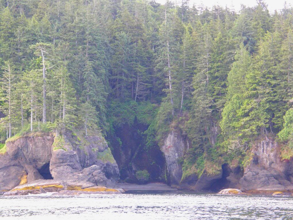
More of the same. These cliffs remind me of some of the areas along the Columbia River that I've posted pics of before.

img_163512_1_f59bb19734e4f3220aae22118e5635b3.jpg


More of the same. This area is really pretty.
img_163512_2_9748968f3a67f96ad3e30cfa2c6fa4bf.jpg


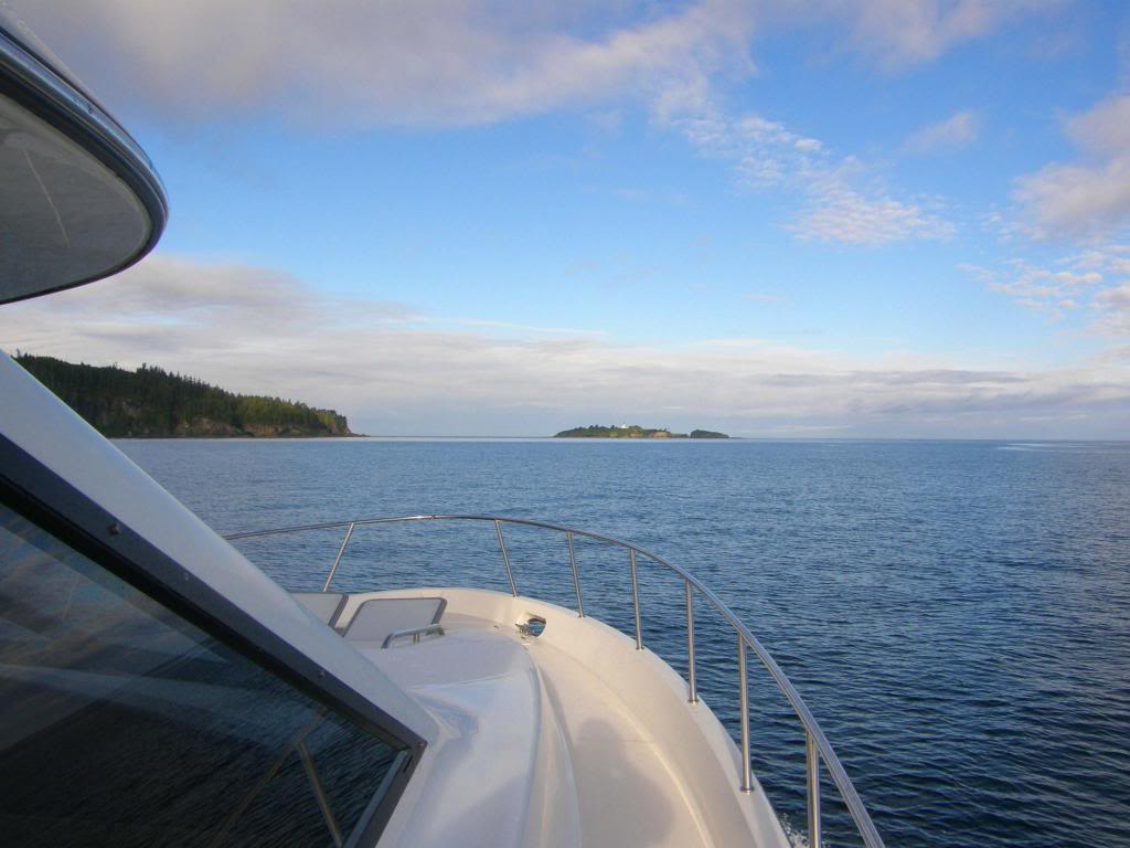
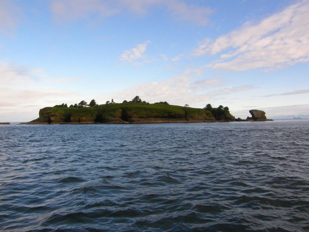
Our first real good look at Tatoosh Island. It sits right at the NW corner of the state. Most of the boats that pass through here go out and around the island. There are many underwater shallow shoals that require you go out a mile or more around the island. Rolland (the USCG guy) told us he used to take his 190' ship between the island and the mainland and showed us where the passage was. We took that and saved probably an hour of transit time. It's a relatively narrow channel but easily wide enough for us to pass through.
img_163512_3_529894a16f883d464b95f123cc2bed98.jpg


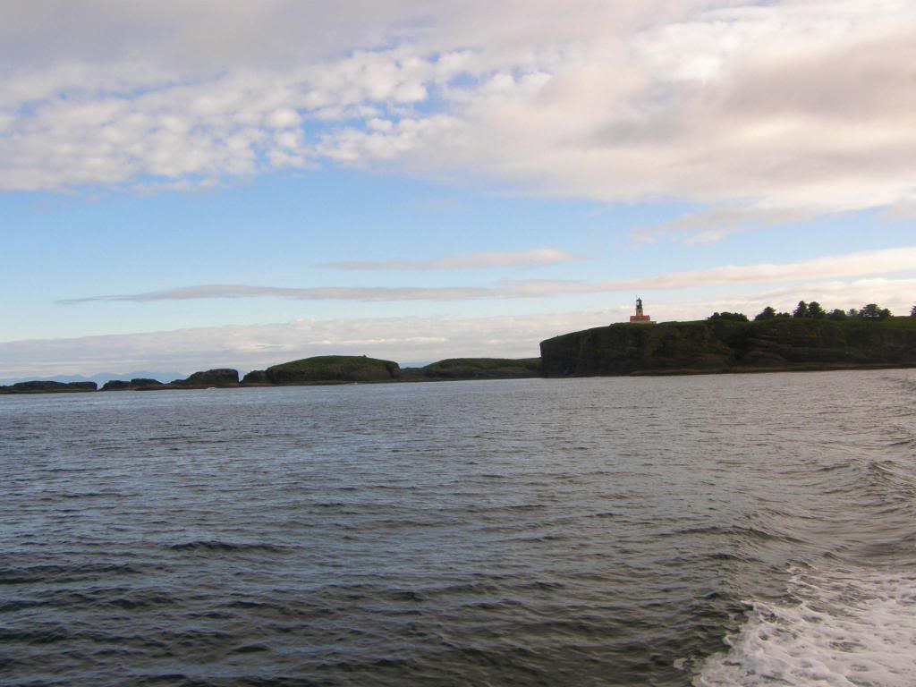
Tatoosh Island Light and some of the surrounding islands and rocks.
img_163512_4_cb763b56e5ad9fbf70935dda968ecf4b.jpg


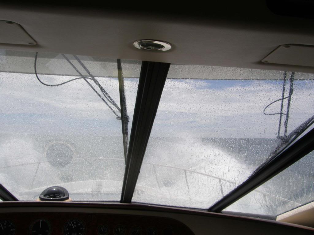
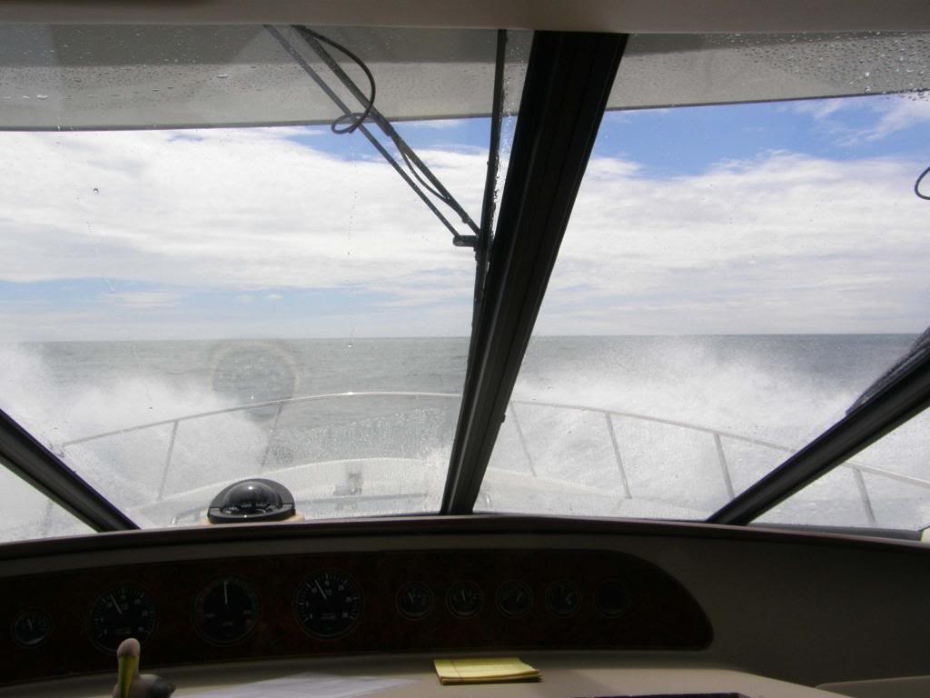
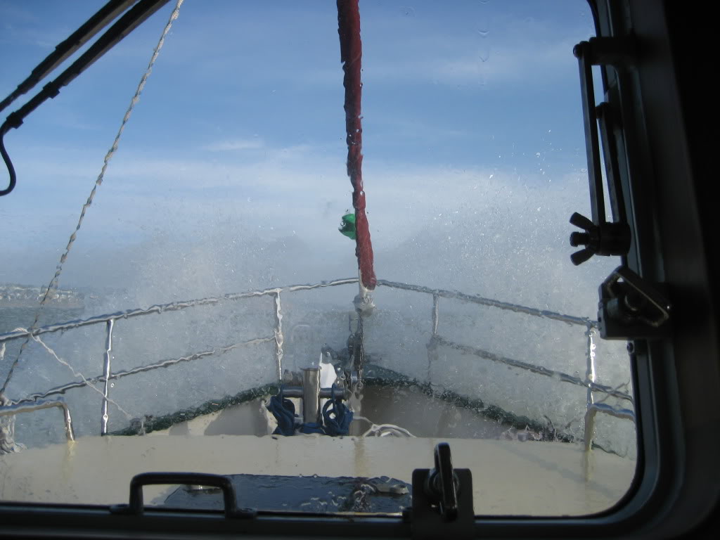
The next two shots were taken while we were rocking and rolling around. They really don't do justice to the way things really were. As I said earlier, I took some videos and will try to upload them to Youtube later today or tonight.
img_163512_5_53b6e27e8e7a8463f9a02ed115fe350d.jpg


img_163512_6_5fa03f922fa0c29dfde7ce21a6ae529b.jpg


I have a video camera that I used a few times yesterday and will try to post those videos to Youtube so I can share them. The problem we had was that when the going really got rough enough for good videos it took both hands to hold onto something. As an example of how we were rolling around, at one point Stuart was sitting on the helm seat. It's on a wide base but not mounted to the floor. The chair (and Stuart) were tipped over due to the waves. I managed to reach up and grab his arm and he got a foot down on the floor before he went all the way over or he might have bashed his head against the helm cabinets.

I'm going to get some breakfast so I'll see y'all later.

Well rested GFC
 
Great pictures. Keep em coming.
 
Great stuff, guys! No doubt many of us would be right there at the rail with you, Mike.

Enjoy your day in the harbor. And good luck sealing the portlights.
 
As we sit here in the Ilwaco marina, there are whitecaps in the inner harbor between the docks. I went up to the office a few minutes ago and almost lost my hat several time. I feel for anyone out there in a small craft right now.
 
Looks like you're probably snookered through Thursday morning:

NDBC - NWS Forecast

FZUS56 KPQR 181441 CWFPQR COASTAL WATERS FORECAST NATIONAL WEATHER SERVICE PORTLAND OREGON 741 AM PDT TUE JUN 18 2013 COASTAL WATERS FROM CAPE SHOALWATER WASHINGTON TO FLORENCE OREGON AND WESTWARD 60 NM PZZ200-182215- 741 AM PDT TUE JUN 18 2013

SYNOPSIS FOR SOUTHERN WASHINGTON AND NORTHERN OREGON COAST


A BROAD AREA OF LOW PRES 200 MI W OF ASTORIA WILL SLOWLY PUSH TOWARDS THE COAST AS IT WEAKENS. HIGH PRES WILL RETURN LATER THIS WEEK. PZZ250-255-270-275-182215- COASTAL WATERS FROM CAPE SHOALWATER WA TO CASCADE HEAD OR OUT 10 NM-COASTAL WATERS FROM CASCADE HEAD TO FLORENCE OR OUT 10 NM- WATERS FROM CAPE SHOALWATER WA TO CASCADE HEAD OR FROM 10 TO 60 NM-WATERS FROM CASCADE HEAD TO FLORENCE OR FROM 10 TO 60 NM- 741 AM PDT TUE JUN 18 2013 ...SMALL CRAFT ADVISORY FOR WINDS IN EFFECT THROUGH THIS EVENING...

TODAY S WIND 15 TO 20 KT. GUSTS AROUND 25 KT. WIND WAVES 4 FT. SW SWELL 6 FT AT 9 SECONDS. SHOWERS LIKELY. ISOLATED TSTMS.

TONIGHT SW WIND 15 TO 20 KT WITH GUSTS TO 25 KT...EASING TO 10 TO 15 KT BY MIDNIGHT. WIND WAVES 4 FT. SW SWELL 5 FT AT 10 SECONDS. SHOWERS LIKELY.

WED
W WIND 10 TO 15 KT. WIND WAVES 3 FT. SW SWELL 4 FT AT 10 SECONDS. SHOWERS LIKELY.

WED NIGHT W WIND 10 TO 15 KT...STRONGEST IN THE EVENING. WIND WAVES 2 FT. W SWELL 4 FT AT 10 SECONDS. CHANCE OF SHOWERS.

THU
W WIND 10 KT. WIND WAVES 1 FT. W SWELL 4 FT AT 10 SECONDS. CHANCE OF SHOWERS.

FRI NW WIND 10 TO 15 KT. WIND WAVES 2 FT. W SWELL 3 FT.

SAT W WIND 10 KT. WIND WAVES 2 FT. W SWELL 4 FT.
 
So here we sit in Ilwaco waiting for a weather window. We've had some time to clean up the boat a bit, do some reading and upload some videos. Doug and I walked the length of town and that took 10 minutes including some time to buy some smoked Black Cod.
It seems to take forever to upload videos here so I'm just providing the links to Youtube.


http://www.youtube.com/watch?v=ntGsJiiLV40

http://www.youtube.com/watch?v=ZSiyisOQgZ4

http://www.youtube.com/watch?v=EdFj_m01LTc

http://www.youtube.com/watch?v=u6JgZzkVXi0

http://www.youtube.com/watch?v=uKgc8DBUi8M

http://www.youtube.com/watch?v=eylZAKB2MSA

http://www.youtube.com/watch?v=ayBJYJJeQvU

http://www.youtube.com/watch?v=El1O06LyH1c

http://www.youtube.com/watch?v=PRa-W4NdhBI
 
Great video's guys. It looked like a fun trip so far and you didn't get major beat up. Can't beat that at sea. It looks cold to me though. How cold is it there?
 
I don't know why but TF's software duplicated every one of those videos. Check the number in the upper left corner of each video to watch each one only once.....unless of course you want to watch one a couple of times.
 
Capthead, it's running 55 - 60. Pretty comfortable.
 
Last edited:
That's good for inside but I like to steer from the fly bridge and down here it's usually 70's and above on the water this time of year. I saw the vids were duplicated and also noticed the numbers so I skipped every other one.
 
Thanks for the videos. Short, choppy sea-states are often encountered in the San Francisco Estuary's bays, not dissimilar to the seas you encountered. Decided not to take my boat out today because of the strong winds presently here.

img_163601_0_e826dbb0c4388dd72918b9b61b5fca8f.jpg
 
Last edited:
Really enjoying the blogs & videos....hope the seas become less lumpy for you.

-Vic
 
This is great and am enjoying the learning. Thank you for posting. This is a similar boat to what we'd seriously consider owning one day.
 
Thanks for sharing this journey with us. Us shore bound 9 to 5'ers enjoy cruising along with you in spirit.
 
If I'd have had my wits about me I would have provided an introduction for a co-worker of mine who was in Ilwaco earlier Monday at the marina. He would have loved to have met you and talked boats for a while. I would have provided a little warmup beverage for you all. He favors a single malt.
 
We ran from Brookings to Ilwaco on Sunday and had one of the nicest days on the North Pacific I have had. We were able to do 25 knots all the way. 11 hours and 30 minutes dock to dock. Are you using a weather forecaster or just sailflow and buoy reports from NOAA? A fast boat did open up new possibilities in that you could do the trip entirely in the daytime and tied to the dock at night.
 
Great videos and narration! What navigation software are you using?
 
If I'd have had my wits about me I would have provided an introduction for a co-worker of mine who was in Ilwaco earlier Monday at the marina. He would have loved to have met you and talked boats for a while. I would have provided a little warmup beverage for you all. He favors a single malt.

Ships passing and all that. Next time.
 
We ran from Brookings to Ilwaco on Sunday and had one of the nicest days on the North Pacific I have had. We were able to do 25 knots all the way. 11 hours and 30 minutes dock to dock. Are you using a weather forecaster or just sailflow and buoy reports from NOAA? A fast boat did open up new possibilities in that you could do the trip entirely in the daytime and tied to the dock at night.

Your boat should be named Rapid Transit. We will engage Omni Bob for the first time tomorrow morning at 5:30 am for a go-no-go second opinion. This will be the first time we have used a weather router. And yes, daytime only is a better deal if you can do the speed (and pay for the fuel - ouch).
 
Great videos and narration! What navigation software are you using?

We are running Nobeltec Odyssey as primary and Navionics as secondary.
 
Left Ilwaco at 6am. Doing well but now about equally rough with the other day. We are getting used to it so it doesn't seem so bad now. Sure hard to type however. Past Cannon Beach, Tillamook in hour or so.

So far Verizon continues to give us good service. Spot is on if you want to follow along.
 
Prism to you. :hide: you can run but you can't hide.
 
Status
Not open for further replies.
Back
Top Bottom