From Los Angeles to Seattle by boat?

The friendliest place on the web for anyone who enjoys boating.
If you have answers, please help by responding to the unanswered posts.
Don't know about today but having our boat trucked north was a bit cheaper than hiring a delivery captain, the trip took only three days, and our insurance company was WAY happier with the boat on a truck than slogging along up the coast.

I've known people whose run north from SFO th SEA took weeks and in one case two months as they waited out storms and rough sea conditions in the few harbors along the coast. Captains and crew members timed out and had to go home, new crews had to be found, and the voyages turned into seemingly never-ending frustrations. No problem if you've got the time. We certainly didn't and still don't.
 
Couldn't agree more. With today's electronics and the overwhelming amount of information available at hour fingertips, there's no real reason to be so fearful of long coastal transits.

Sure- things may go wrong, just as they could in your favorite cruising grounds. Deal with it!

I routinely took 23' single engined fishing boats 50+ miles offshore in search of tuna- taking a 46' trawler should not pose too much challenge. We plan to take our boat to Mexice and beyond I the coming years- it'll be her 3rd trip down the coast.

I'm planning on doing the same thing in our boat as well.

Every voyage I've ever read about, or been on that went wrong weather wise was because of the captians (me included) failure to stay in port during marginal conditions.

Traveling up and down the pacific coast can be harrowing, or it can be peaceful. The difference is the decisions we make.

I read a blog about a couple that traveled up and down the coast from Seattle to Mexico in a 42' sundeck TT for several years. They waited out weather, made short voyages early in the morning (because of afternoon breezes) and had a grand time.

I've also read stories of people in bad weather getting the snot beat out of them.

The difference between these stories boiles down to one thing...Patience
 
Last edited:
Any advice would be greatly appreciated.

There seems to be a lot of "filler up & go" advice to taking her home on her own bottom. It certainly depends on your boat experience but I can tell you there are a lot of other reasons (other than weather) to take in to consideration. If it were me (and I'm considering shipping my boat to Seattle) I'd truck it!
 
If it were me (and I'm considering shipping my boat to Seattle) I'd truck it!

I'd likely do the same with a 32 footer. But a big heavy 42 X14 footer and the agony of stripping the FB becomes a trucking and refit task.
 
Hi Isis,

I was quoted just under $5000 to truck a my 35' Roughwater from sfo to Seattle. I decided to hire a captain and my wife & I and two close friends made the trip up last October. Between outfitting, fuel, and the Capt'n I spent more than I would have on the trucking company, but not much. We had a great time and gained much experience. The weather was absolutely perfect, but we were VERY lucky to have such a weather window. We covered over 900 miles in 6 days. Stopped the engine (intentionally) only twice. Had a fun 30min. changing a fuel filter and bleeding air off the coast of Neah Bay.:eek:

If you don't have the time or inclination for making the trip yourself, you can still hire a delivery captain. I know 2 that are top notch, PM me and I'll pass their contact details to you.
 
I'd likely do the same with a 32 footer. But a big heavy 42 X14 footer and the agony of stripping the FB becomes a trucking and refit task.

Point taken. :blush:
 
If I were going to hire a delivery captain I'd made darn sure I was on board the boat during the trip for a number of reasons. The biggest is probably that you would learn the boat and its systems and how everything works.

The second is something that was addressed above, and that is making the decision to go vs staying in port due to weather conditions.

A friend of mine hired a delivery captain to bring his McKenna from CA to the Columbia River. The captain was in a harbor in OR and was advised by the USCG not to leave the port due to weather conditions. The captain chose to ignore the CG and headed out.

Doing that, and likely running on plane caused major damage to the boat. The owner's insurance company ended up having to spend around $85,000 to have broken frame members and stringers replaced, interior cabin paneling replaced, etc.

Essentially the captain broke the back of the boat because he was in such a hurry to get the boat up north.

BTW, there is almost no liability on the part of the captain. The insurance company that paid the bills was going to try to go after him for the loss but they didn't feel their chances were very good of collecting anything.
 
A newbie here... How did this story end up? Did you transport a boat? Buy one up here?
 
I would NEVER consider trucking my boat somewhere that I could drive her to. Bringing a boat home is a learning adventure. Its something to enjoy.

Spoken like a true Alaskan!!!:thumb:
 
Less then 40-45 ft vessel you better truck it,will be cheeper than delivery on her own bottom with Captain on board.

For that run you need boat that can cover at least 300 nm. non stop against 15-25 kn. wind and 10-15 ft swell/wind chop. Do NOT hire professional Captain if you want to run the boat on your way, the trip can be fun if you are not on hurry.

San Francisco to Neah Bay - 700 nm. Speed 7.5 kn.

First run - San Francisco to Coos Bay 270 nm and 36 hours
Second - Coos Bay to Newport Oregon 180 nm and 24 hours
Third - Newport to Neah Bay 250 nm. and 33 hours

Do NOT plan to stop in Eureka or Astoria.

LA to SF is easy run - Santa Barbara refuel,Point Conception early morning on less then 20 kn. of wind and hug the coast to SF or Bodega Bay. Distance 305 nm / 41 hours to Bodega
 
Last edited:
Less then 40-45 ft vessel you better truck it,will be cheeper than delivery on her own bottom with Captain on board.

For that run you need boat that can cover at least 300 nm. non stop against 15-25 kn. wind and 10-15 ft swell/wind chop. Do NOT hire professional Captain if you want to run the boat on your way, the trip can be fun if you are not on hurry.

San Francisco to Neah Bay - 700 nm. Speed 7.5 kn.

First run - San Francisco to Coos Bay 270 nm and 36 hours
Second - Coos Bay to Newport Oregon 180 nm and 24 hours
Third - Newport to Neah Bay 250 nm. and 33 hours

Do NOT plan to stop in Eureka or Astoria.

LA to SF is easy run - Santa Barbara refuel,Point Conception early morning on less then 20 kn. of wind and hug the coast to SF or Bodega Bay. Distance 305 nm / 41 hours to Bodega

You can still stop in Crescent City CA or Brookings OR. If I get a trawler from San Diego to Astoria, entering the Columbia River will be the pucker factor. But hearing from those who have done it many many times state you just have to be patient and enter/exit at the right time.
 
You can still stop in Crescent City CA or Brookings OR. If I get a trawler from San Diego to Astoria, entering the Columbia River will be the pucker factor. But hearing from those who have done it many many times state you just have to be patient and enter/exit at the right time.

Crescent City is all weather stop but the fuel dock can be tricky for small boat on 20+ knots cross wind, I love the marina there.
 
Less then 40-45 ft vessel you better truck it,will be cheeper than delivery on her own bottom with Captain on board.

For that run you need boat that can cover at least 300 nm. non stop against 15-25 kn. wind and 10-15 ft swell/wind chop. Do NOT hire professional Captain if you want to run the boat on your way, the trip can be fun if you are not on hurry.

San Francisco to Neah Bay - 700 nm. Speed 7.5 kn.

First run - San Francisco to Coos Bay 270 nm and 36 hours
Second - Coos Bay to Newport Oregon 180 nm and 24 hours
Third - Newport to Neah Bay 250 nm. and 33 hours

Do NOT plan to stop in Eureka or Astoria.

LA to SF is easy run - Santa Barbara refuel,Point Conception early morning on less then 20 kn. of wind and hug the coast to SF or Bodega Bay. Distance 305 nm / 41 hours to Bodega

When you say to not stop in Eureka, is that because of the marina facilities?

I've stopped there twice - for fuel only though.
 
I did this trip last week, and it was great. Granted, we had good weather and a fast boat, but if you have the time and are willing to wait for a proper weather window you have a good chance of really enjoying yourself. Still, there is something to be said for going directly to windward at 60kts (on the freeway that is)...........Arctic Traveller
 
When you say to not stop in Eureka, is that because of the marina facilities?

I've stopped there twice - for fuel only though.


Eureka and Columbia River are the two worst bar crossings on the coast and IF the weather is OK you can stop there but if I can avoid stopping in Eureka and Columbia I will.

Planing is really important on the way up North, USCG can close the bar and you can get stuck there for weeks.


Eureka bar, 15 ft. swell

Coast Guard in 18 foot waves... (raw video to Hazardous Seas ) - YouTube
 
Yes, weather and timing are critical. One of the times we went in the USCG requested we all don lifejackets before entering. Fortunately, it ended up not being that bad.
 
if you have the time and are willing to wait for a proper weather window you have a good chance of really enjoying yourself.

This is the key to any long trip.

When people have to travel based on a time table they get into truble.

Thats why many of the horror stories you hear about are on boat deliveries. A couple of guys on a time table bringing a new to one of them boat home is a recipe for problems.
 
Well our plans during retirement (in 2 years) is to cruise the west coast from PWS in Alaska to Mexico. It looks like the Admiral is eyeing a boat in San Diego, so I may have to make the trip sooner rather than later.

AT I heard the water was like a bath tub last week......
 
So for those who have travelled the west coast, weather is a big issue. So a few questions:

1. What do you use to check weather? Rely soley on NOAA brodcasts or something else.
2. What is a "go" situation for you?
3. What is a "no-go" situation for you?
4. How far out from the coast do you travel?
 
1
Sailing Weather - Marine Weather Forecasts for Sailors and Adventurers - PassageWeather
http://www.buoyweather.com
SailFlow
NOAA National Weather Service
http://www.sailwx.info/shiptrack/shiplocations.phtml
Grundig G3 SSB radio and IPAD for weather charts
Sat. phone text messages and SPOT Messenger

2 Vessel size?On strong boat mmmmm less then 35-40 kn. wind and 15-20 swell
3 Vessel size?
5 From 1 to 20 nm


Thanks

So vessel size: 48-60ft (Still looking)
 
62 Selene - 40 knots and 20 ft. swell
55 Selene - 35 kn. and 15 to 20

1 or 2 nm from shore and 10 nm from Columbia River, Point Conception 1 nm or less,Cape Mendocino 3 nm.
 
Guidebooks such as Charlie's Charts of the U.S. Pacific Coast are handy references and advice.
 
Great stuff, SDCapts! Great having you onboard and contributing.

Thanks for the info.
 
So for those who have travelled the west coast, weather is a big issue. So a few questions:

1. What do you use to check weather? Rely soley on NOAA brodcasts or something else.
2. What is a "go" situation for you?
3. What is a "no-go" situation for you?
4. How far out from the coast do you travel?

I just did that trip in a 42' trawler. Here's some of what I learned:

NOAA, the Navy site and buoy reports are good sources but not infallible.

One day, as I sat in Ft Bragg waiting for good weather, I stumbled into an old timer commercial fisherman, a been-there-forever-small-town-icon with an amazing boat and a great record of success and safety.

After we talked for an hour he looked up at the sky for about 30 seconds and told be I'd better get going to my next stop, Shelter Cove, about 60 nm north.

***Broadcast conditions were Small Craft Warning coastal, Gale Warning 10 miles out - I couldn't believe what he was suggesting***

He said if I waited for weather on a day like that I might be there forever. Watching the clouds above he liked what he saw (they weren't moving very fast); "It's a beautiful day, just go for it but remember - you can always turn around and come right back".

Despite the Small craft/ Gale warnings I followed his suggestion and left the harbor. The seas to Shelter Cove were almost glassy all the way... it was one of the nicest calmest days of the trip.

All that said; the real trick is to turn around if things do get bad. Don't wait too long to make that decision. Surfing back to the last port is a lot calmer than going up but spinning the boat around if the waves are huge is no fun at all. And obviously, don't go if the radio and your eyes agree it's just a plain bad day.

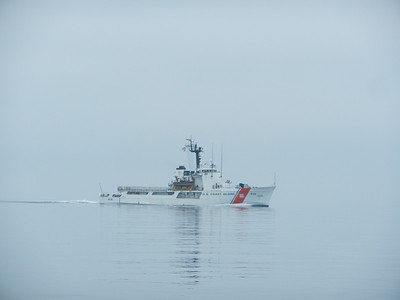
How far out is easy: Close in, period. Take a Coast Pilot with you and navigate from one point to another, including the Capes. I know that goes against popular online thought (and I can't speak to the sailors in the room) but I consider my sources very very carefully before taking advice. Staying 2 to 5 nautical mikes came from a Foss Maritime Master that's been making the trip over 30 years. He's pulled fuel barges 1.5 miles off shore to avoid rough sea. And that advice was echoed all the way home from every Coast Guard person I spoke with - including 2 offshore instructors.

Fun trip - Good Luck!
 
Back
Top Bottom