Navigation Basics

The friendliest place on the web for anyone who enjoys boating.
If you have answers, please help by responding to the unanswered posts.

Captain K

Senior Member
Joined
Mar 19, 2012
Messages
315
Location
USA
Vessel Name
GITANA
Vessel Make
Sea Ranger 47 Pilothouse
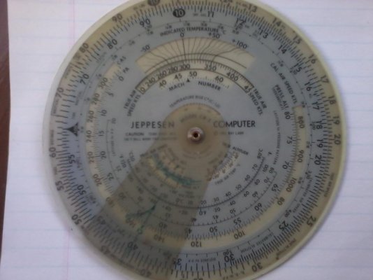
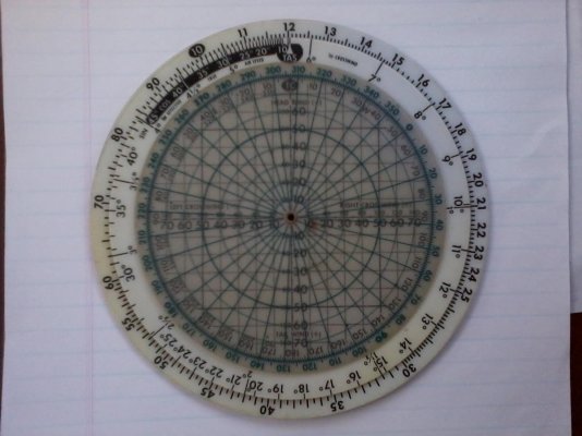
Dear Friends--Vigorous philosophical discussion stimulated on another thread suggested to me it might be a hoot to start another related thread on navigation basics. Out of simple curiosity, I'm wondering how many of us know how to (1) Plot a position on a chart using latitude and longitude, (2) Plot a course from point A to point B, (3) Convert navigation information from True to Compass and from Compass back to True by applying variation and deviation, (4) Fix our position using aids other than GPS, (5) Fix our position using aids other than Radar, (6) Apply projected current set and drift to calculate heading and speed to a given point. Lastly I'd be interested in knowing your thoughts/opinions on whether any of these skills are still useful in the context of modern technology. Very much look forward to your comments!
 
Greetings,
Mr. Captain K. I wish to preclude my responses with the admission that I "graduated" from a Power Squadron basic boating course back in...oh, I'd say about 1987.
1) Pretty sure I could.
2) Using compass headings and dead reckoning? Yes.
3) Tender Virgins Make Dull Company...Weellllll, Maybe.
4) Relative bearings? During the final exam (practice cruise) I found my vessel to be 3 miles inland. Um.....So I back plotted FROM my destination to where I got lost in the first place...well not really to WHERE I got lost but sort of close. Time was running out so I circled the "lost" area and put a ? in the middle. I passed overall.
5) Don't understand the question. Aren't #4 and #5 asking basically the same thing?
6) Vectors? Yes.
In spite of my limited navigational knowledge I think everyone should know how to read both a chart and compass.
Good topic. Thanks
 
Me too...me too!!!!
USCG certified instructor up through 100 ton master.

Useful after you have those skills so pat in your head you can do them on the fly with finger measuring, squints, eyeballing, educates guesses...etc..etc..

To do "true plotting" well...you need a decent chart table...a couple lookouts with pelorisus and a helmseman in addition to you the plotter. Otherwise it's all just an adaptation based on the situation. I've logged tens of thousands of miles on the water and in the air with a guess by golly (pre-electronic nav) that is good enough for what we do. Even if you know how to do it in the classroom...in tight quarters with a couple knots of tide and zero visability...most of that "chapman's plotting' goes right out the window.

Other than that...it's a great skill to hone and understand...:D:thumb:
 
We got into boating in boats we owned in the mid-1980s when Loran-C was still considered the epitome of electronic navigation for small boats. GPS was just starting to make an appearance but it had not become "serious" for boats yet, at least not recreational boats.

I learned the basics of navigation from pilot training, not boating. My wife learned it courtesy of the US Navy. When we bought our GB in 1998 immediately we added a large CRT GPS plotter (state of the art at the time) but we also at the same time went out and bought all the tools necessary for "old style" navigation--- the big charbooks and individual NOAA and Canadian charts for here and BC, dividers, parallel rule, circular "slide rule" calculator, hand bearing compass, etc., etc., etc. Everything necessary for manual course plotting and navigation except a sextant.

And we have plotted the courses to the destinations we frequent on the charts in the chartbooks and have on occasion navigated our boat to these destinations using these plotted courses and the magnetic compass and taking fixes along the way just as an exercise.

So we have all the tools needed for this sort of navigation (minus the sextant) and we know how to use them, but in practice we don't use them. We do always have the relevant chartbook page or individual chart open at the helm when we're underway to use as a reference although we've recently taken to setting our iPad on top of the charts on the chartboard and using the Navimatics app for the same purpose.
 
Last edited:
Knew how to do all that ages ago. Now, very, very rusty. Electronics make one lazy.
 
Knew how to do all that ages ago. Now, very, very rusty. Electronics make one lazy.

Ditto but am loving the electronics!
 
My navigational skills are limited to piloting as I'm always in sight of land or navigation markers. My first twenty years of boating was limited to binoculars, compass, and paper charts. Life is much easier now since getting a trawler in 2011 equipped also with radar, gps, electronic charts, and depthometer. Always got to where I wanted to get to, weather permitting.
 
When on an extended cruise, I like doing it for sport. Plus you never know when the electronics might go down, and low and behold I had my screens go down once in a bad situation... much less bad because we were ready to go back to paper and pencil in an instant. Have the charts always open and the tools at hand. I took a really excellent US Sailing course several year ago and still keep the book and coursework ready. Again, mostly for sport because we have independent back up upon back ups electronically. I also think it is valuable to know what your electronics are doing, and I haven't seen one that does current vector adjustments yet. There are I believe a majority of boaters who don't know that their boat has been going one direction while pointed in another. Or if they do, why.
 
When on an extended cruise, I like doing it for sport. Plus you never know when the electronics might go down, and low and behold I had my screens go down once in a bad situation... much less bad because we were ready to go back to paper and pencil in an instant. Have the charts always open and the tools at hand. I took a really excellent US Sailing course several year ago and still keep the book and coursework ready. Again, mostly for sport because we have independent back up upon back ups electronically. I also think it is valuable to know what your electronics are doing, and I haven't seen one that does current vector adjustments yet. There are I believe a majority of boaters who don't know that their boat has been going one direction while pointed in another. Or if they do, why.

Not exactly sure what you mean but if you want a quickie for current vector...just point your head along a plotted course on the chartplotter and then adjust your course over ground plot vector to a convenient time length and also place a waypoint along your course for your speed/time, see what the COG is and you should be able to guess the set/drift pretty accurately.
 
Wifey and I passed the USCG AUX Advanced Coastal Navigation course in the early 90's.

She got a higher mark than me but I still get to drive the boat.
 
To the OP: 1-6, yes I do. Yes it is still useful.

Northern Spy,

How do you do that underwater?:D

Capt. K,

Yes, I can do all that. Yes, all the plotting tools are on the boat. Yes, we run with paper charts paralleling our electronics. When I started boating that is all we had. Then it was RDF. Then Loran A single track. Then Loran C. Then chart plotters. We did them all, but still keep up on paper charts.
 
Last edited:
I've done it all in the power squadron class and felt comfortable with it. Haven't had to do in real life. I think it's good to understand even in the age of electronics.

It amazes me how many people have no idea where they are. As learned from hearing crazy calls on ch 16 and the professional skipper who ran aground outside our old marina because he thought he was at another marina several miles north.
 
I haven't done any maritime navigation courses, but still know most of the list from land based activities. (backcountry skiing and hiking)
I'm still learning how to predict the effect of our local current when crossing Investigator Strait. , but I don't think there are any courses which will teach me that. Its just a matter of talking to the local fishermen and applying it to personal experience.
 
1,2,3 yes the others no, I do have my Grandfathers 1969 Dutton's Navigation and Piloting book so I could probably learn it if I wanted to (I don't). The bulk of my cruising is done in the ICW or within sight of land except for a 20 hr. crossing from Apalachicola, Fl to the mouth of Tampa Bay or Anclote Key. I use GPS and autopilot on that crossing and keep track of our position on a paper chart so if I lost all electronic nav. gear I can use the compass to head to the coast, North or East of me. I do admire those who have learned and practice that art.
Steve W
 
1-6 yes, and I've done it for 40 years in the air and on the water. But it's now more second nature time/speed/distance stuff than intense thinking and plotting. If I'm traveling 7.5 Kts, that's 1/8 mile per minute....or one mile in 8 minutes....or 4 miles in 32 minutes...etc. If I need to verify my SOG, it's easy enough to do with landmarks or navigation aids. I have no dividers onboard, but I do have paper charts. Need a bearing to a landmark? No problem with binocs with an internal compass.

I've gotta admit, with channel markers every mile, this ain't rocket science. But I have no doubt I can keep up in open water without markers. I will admit that I'm spoiled by modern electronics and well-marked waters.
 
Yes, after a more than a couple of decades (mostly the 60's and 80's) of sailing in the "bay-half" (west of Pittsburg) of the San Francisco estuary, it has largely remained "seat-of-the-pants" navigation avoiding shallow waters and ship traffic.

img_125811_0_e1c46bb984d1fd628439191da005dcfd.jpg


By the way, I'm looking for a buddy-boat to go with us to the the Farallon Islands and Drake's Bay next fall.
 
Last edited:
It amazes me how many people have no idea where they are. As learned from hearing crazy calls on ch 16 and the professional skipper who ran aground outside our old marina because he thought he was at another marina several miles north.

Only a few miles. Last summer while waiting for the draw bridge in Beaufort NC I was having an early morning (5:30 AM) chat with the Bridge Tender. The subject came up of folks not knowing where they were and she swears that eariler in the spring she had a boat that was headed south that thought they were in Beaufort all right but Beaufort SC. That's several hundred miles off.:banghead:
 
The true test of navigation is being able to do a "drive bye" on a super secret fishing hole going about 50mph in 2-3' chop and snaking the position not using the radar and finding the hole on the way back in and catching a boat load of 20# snap-snaps
 
Coming down the ICW a couple weeks back...a guy in an 80-footer called Coinjock marina and said he's be there in a couple minutes...well I knew where I was and this guy had never passed me so I grinned and waited.

The dockmaster at Coinjock responded after the guys radio call that if he was at red maker "xx" and had a bridge in sight...it sure wasn't Coinjock!

Turned out the guy was back at Pungo Ferry which I think is at least 20 some miles back...:eek:

I can't imagine how anyone could be that confused on that part of the intracoastal...it's like being on a highway with exit signs that match the mile marks and mile marks too boot!!!!:rofl:

Beaufort NC or Beaufort SC, not even the same state and what set the bridge tender off was the boat kept hailing her as Beaufort pronounced as if they were in SC. Hence the question from her asking the boat where they thought they were.

They drive cars at 70 MPH and vote as well.
 
Beaufort NC or Beaufort SC, not even the same state and what set the bridge tender off was the boat kept hailing her as Beaufort pronounced as if they were in SC. Hence the question from her asking the boat where they thought they were.

They drive cars at 70 MPH and vote as well.
wish I was on the radio for that one! :rofl:
 
Got my navigation basics from Navy OCS in '64, but the celestial nav skills are moribund, the Loran's extinct, and all that remains from those days is the ability to plot a course, position and DR on a chart (yes, I have them, even though my ICW environs rarely require it). I have chart-plotters on both helms, so I haven't gotten lost yet.
I recall a few years back a couple of commercial airline pilots landed at the wrong field, so I suppose there is no end to the stories that can be told about navigation fubars.
 
Only a few miles. Last summer while waiting for the draw bridge in Beaufort NC I was having an early morning (5:30 AM) chat with the Bridge Tender. The subject came up of folks not knowing where they were and she swears that eariler in the spring she had a boat that was headed south that thought they were in Beaufort all right but Beaufort SC. That's several hundred miles off.:banghead:

I've woken up before and not known where I was, but I always knew what state I was in.

The state of Confusion. :rofl:

I've listened to conversations where someone was talking about Beaufort and got confused about what state they were talking about. Again, that confusion thing.
 
Some guys just never know where they are and likely don't use either their charts or their electronics. I use both but have to admit I rely a lot on my electronics. In the Great Lakes however we don't have tides and current usually only in rivers and not usually out of site of land for more than an hour or two. Do use my compass religiously though as a back up.


GetInline.aspx
 
Yup to all. The Navy taught me well :)

Nothing like having to calculate set & drift, compensating and correcting courses WHILE having to calculate true wind and Fox Corpen (course and speed to steer the ship to get the wind at the correct direction and speed for flight ops)....

Anybody able to use a moboard? At multiple ranges at the same time?
 
Yes, all the plotting tools are on the boat. Yes, we run with paper charts paralleling our electronics. When I started boating that is all we had. Then it was RDF. Then Loran A single track. Then Loran C. Then chart plotters. We did them all, but still keep up on paper charts.

Ditto.
 
Greetings,
One item we use is a Post-it type flag on the paper charts in conjunction with the plotter. It's a quick "you are here" reference if one just wants to glance at a chart and can be moved to indicate your last known position. I usually keep the plotter/depth finder in the 1/2 to 1 mile range to take best advantage of the immediate and immediately approaching depth readings. A glance at the chart tends to give me the bigger picture.
 Post-it® Arrow Flags, Bright Colors, 1/2 in Wide, 100/On-the-Go Dispenser
While basically a "magenta line cruiser" I have no problem deviating from the "suggested" course to minimize groundings. In spite of the newest software, boating on the east coast is still a crap shoot considering the shifting sand bars and tidal rivers/sounds wrt the "line".
 
Yup to all. The Navy taught me well :)

Nothing like having to calculate set & drift, compensating and correcting courses WHILE having to calculate true wind and Fox Corpen (course and speed to steer the ship to get the wind at the correct direction and speed for flight ops)....

Anybody able to use a moboard? At multiple ranges at the same time?

how about using one of these to be even quicker....:D
 

Attachments

  • Photo727.jpg
    Photo727.jpg
    80.2 KB · Views: 80
  • Photo728.jpg
    Photo728.jpg
    96.5 KB · Views: 73
I recall a few years back a couple of commercial airline pilots landed at the wrong field, so I suppose there is no end to the stories that can be told about navigation fubars.

That would have been at Opa Locka FL. Eastern Airlines or American 727 I believe. Came out of the clouds at night declared they had a visual of Miami 9 and in fact they were looking at Opa Locka 9. They landed without any problems but when they taxied about a bit they couldn't find a real terminal. The passengers were off loaded to a bus and taken to MIA.
 
Back
Top Bottom