iPad for navigation?

The friendliest place on the web for anyone who enjoys boating.
If you have answers, please help by responding to the unanswered posts.
I think the above has confirmed that what the birdie whispered I'll be getting will be sufficient to my needs. For a start I will not be having movies, or much, if any, music on it, and one good nav app is all I will need. I still have the Lowrance after all.
Now, how many sleeps until...you know...that bloke in the red suit comes...is it again...?
 
Peter---- ActiveCaptain has a clever anchor watch app called Drag Queen. We haven't used it yet but will in the not-too-distant future. Since the iPad has to remain on when you're using Drag Queen I suggest you get a power cord that will work on your boat. We have a 12vdc outlet (cigarette lighter) cable for the iPad so we can plug it into the outlet in the aft cabin. You have to have the 3G/4G iPad for Drag Queen to work because it uses the built-in GPS.

There is also a very handy app called Night Stand. It's just an alarm clock but if you travel around a lot it is much easier to use than the clocks a lot of hotels put in their rooms, and it's much more reliable than a wake-up call. The iPad goes to sleep until the alarm clock wakes it up and activates the alarm. So battery draw-down at night is not an issue. You can select from a wide variety of alarms. We use "Church Bells" which is a very nice sound to be woken up by.
 
Last edited:
Sounds good Marin. Yes, definitely getting the GPS version, and the 12v adaptor/charger is an absolute gottahave for sure...
I'll drop you a message from it once I've worked out how to drive it. The latter shouldn't be hard as I always read instructions, and even if it does not have a manual, no 2 son has had iPad from day one, as well as iPhone.
 
Hey gang,

I'm curious if iPad is replacing navigational, AIS, GPS systems onboard. Buying a boat from 1986 and want to streamline the electronics. The radar & GPS plotter seem fine, but was going to add an AIS system, but trying to avoid the $550.

I'm going to be in the SF Bay mostly so cell service should be pretty dependable.

Please recommend any app that is helpful.

Thanks!

The BEST app for the iPad is the new Garmin BLUE CHART just came our a few weeks ago.
One ting that it does which none foe other iAd navigation apps do is total integration of ACTIVE CAPTIAN. You o not hav to be on line to use it.

The app is free, ZUS CHARTS ARE $29 and US&CANADIAN is $44

It has weather, GRIB, ides and currents...if you he a iPad download an look at it fo free...IT ONLY RUNS ON IOS6
 
One thing that it does which none of the other iOS navigation apps do is total integration of ACTIVE CAPTIAN. You do not have to be on line to use it. (typo edited)

There are 5 iOS apps that integrate with ActiveCaptain today: Navimatics Charts & Tides, eSeaCharts (currently has an iOS 6 bug), SailTimer (2 versions), SEAiq (2 versions), and Garmin BlueChart Mobile. All keep the data offline and synchronize to get the latest data.

SEAiq is about to release a free version with ActiveCaptain integrated - I just received my test version yesterday. Navimatics Charts & Tides has been around for almost 3 years and is the most mature. SailTimer is most appropriate for sailing vessels. Garmin's product is the best for a variety of reasons but has a higher price.

For my own real use in my trawler I used to primarily use Navimatics' product. Now I mainly use Garmin's product on my iPads. All of the apps have their place and there are even a couple more iOS apps on their way out with ActiveCaptain support including an augmented reality one that uses the camera to view what's on the horizon with ActiveCaptain markers overlaid to show where they're actually located. Its quite cool.
 
ActiveCaptain, what's the deal re the above for we poor upsidedownderians..? Does this Garmin BlueChart work with whatever charts we can get to cover say Australian East coast or is it only compatible with Northern Hemisphere charts at present? Really keen to find out what would be the best for me to go for, as you might have seen above, I believe, (fairly reliably, if my eaves-dropping is correct), that I have a GPS capable iPad on the way...in the sleigh....so to speak...
 
ActiveCaptain, what's the deal re the above for we poor upsidedownderians..?

Why wouldn't we show some love to the southern hemisphere?

Yeah, it's totally supported in Garmin's BlueChart Mobile. We have the beginning of some good data too.

I have all of the Garmin charts on my iPhone. I snapped a couple of screen shots showing an area just outside of Sydney and attached them to this posting so you'll see exactly what it looks like. Obviously, the display is much larger on an iPad which is also fully supported.
 

Attachments

  • 1.jpg
    1.jpg
    115.9 KB · Views: 92
  • 2.jpg
    2.jpg
    114.5 KB · Views: 103
  • 3.PNG
    3.PNG
    152.8 KB · Views: 116
Active ---- -We have been using Navimatics with Active Captain for awhile now, and really like it. Any comparison comments between Navimatics and Garmin Blue Chart Mobile you feel comfortable making?
 
Active ---- -We have been using Navimatics with Active Captain for awhile now, and really like it. Any comparison comments between Navimatics and Garmin Blue Chart Mobile you feel comfortable making?

I don't mind saying what I really think about these apps.

Outside of my software work, on my trawler, I used Navimatics for 3 years (it came out 2 years, 10 months ago and I tested it a few months earlier). It has the best support for ActiveCaptain today and allows all data to be updated today. When we're underway and pass a marina, we'll often look up their fuel price in Navimatics and if it isn't current, we'll update it right there. Navimatics is fast and the absolute quickest at searching.

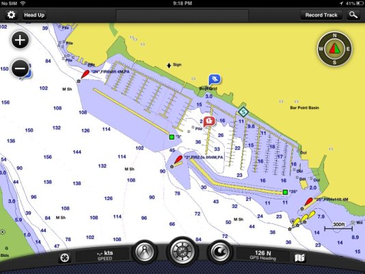
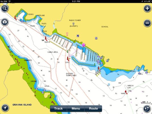
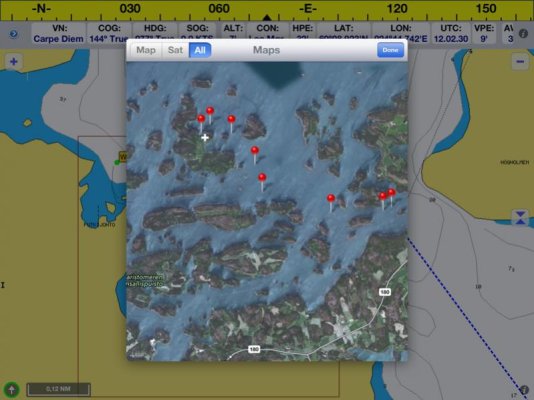
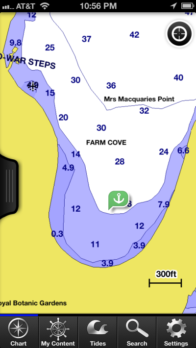
The problem with Navimatics is the charts. It uses NOAA's S-57 ENC data and optionally Canadian CHS S-57 data. The Canadian data is all pretty good. The NOAA vector data doesn't exist for many places even along the ICW. The area just north of St Augustine is a good example. NOAA has concentrated on the more commercial areas and has been slow to finish digitizing all of their charts. I like Navimatics tide and current display and still sometimes use it for that. There is nothing that beats Navionics tide/current display and I occasionally even use that.

The thing with Garmin is the chart data. First, it's worldwide and it's as complete as it can get. When there is missing data or in much of the world outside the US, they digitize it themselves. I've been outside Kansas City in their headquarters where it's done and it is a huge operation.

Garmin also integrates weather in a wonderful way. They are the best product that exists at creating routes by touch. I'm going to steal some of their ideas - they're just brilliant. Other parts of their user-interface are elegant with new ideas that make great sense for boating. They've gone a step further in many ways of usability. iNavX could learn a thing or two from a study of BCM and the use of touch and control on a glass surface.

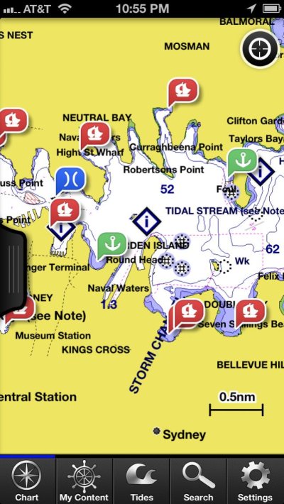
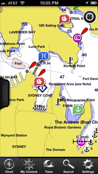
Garmin does another step with all of this though - data presentation - that no one else does. For the other products, it's almost just enough that they display the nautical charts. Garmin does it with quality. My comparison with Navionics shows that:
[FONT=monospace, courier]https://activecaptain.com/BCM-Navionics.php[/FONT]

Some content changes with zoom so it's hard to make a perfect comparison. I tried to show the quality of the graphic design mostly in those shots.

And it's not just the design and quality of the display. It's also the data itself. Garmin licenses the best data available when there is data available. For the Bahamas, it's the Explorer set of data and it's included with the US region (I'm not sure why they provided licensed data like that for the US but they did). The screenshot comparison from the Bahamas above makes that issue quite clear. The Garmin data is just better.

What I also see with Garmin is a big effort in place to continue the development and enhancement of the product. To be fair, this is true with SEAiq and SailTimer too - both are still in obvious development. But what I like about the Garmin product is that they're the only one pushing me (except for Coastal Explorer who pushes too). They don't wait for me to release a feature - they're coming to me bothering me about "when can we do XYZ". I know my part of what's coming in the next Garmin release because it was completed 2 months ago. What's really cool is that this month I provided them the API for their 3rd version of capabilities. They were the first company who sent me weekly emails asking for a date when it would be available.

The bottom line is that Garmin is totally committed to this product as a new generation of planning tool and underway plotting tool. They're somewhat late to the party of charting software for iOS and had no choice but to make their product a step above the others. Their product does a lot for the money - and it's hard to imagine not getting it because the cost is so low. I spent more in 2-day shipping to get old C-Map chips years ago for just the east coast than the whole US/Bahamas dataset with software running on all my iPads/iPhones costs here with BCM.

The standard product in this space has been Navionics. Garmin eclipsed them in a number of ways. That's good for all of us because it'll spark more innovation and make all of this better with more choices for everyone. Marketing-wise, my perception is that Garmin is pushing Navionics against the wall and exposing some of the issues they have with even having a chartplotter product. It will be fascinating to watch what develops from this and what Raymarine might do.

Who needs TV drama when real life is so much more interesting!
 
I use inavx with Navionics gold charts on my two ipads. I have a gps plotter from Garmin as well but i really dont use that too much.

Paper charts are still and will be the main navigation tools followed by the ipad. The ability to zoom instantly and take bearings / distances just by clicking and dragging is so intuitive. It is also so much simpler to build your own route database and write notes about the harbours for future reference.

Oh, did i mention the ability to have google maps satellite layouts where you can quickly check where the rocks are..
 
So I checked out the new Garmin Blue Chart Mobile and so far have not been motivated to get it.

User reviews are not always the most reliable means of judging a product since the comments are based on an individual's experience with the product and there is usually no way to know if this is an knowledgeable or experienced user or a fellow who has a tough time with a light switch. So I always take user reviews with a big grain of salt.

The user reviews for the Garmin app were split between those who liked the program and those who thought it was a waste of money or it had a long way to go before it would be worthwhile.

The people who liked it seemed to be most interested in its ability to interface with other Garmin products like dedicated plotters and such.

The people who didn't like it were mostly negative for two reasons. One, they didn't like the fact that in order to use it you have to buy $30 to $50 worth of charts and Garmin didn't tell them this up front. Two, some users felt the app was slow to use. One reviewer complained of the inability to mark one's position on a chart.

The charts themselves got high marks from some users for clarity although some felt the screen got too cluttered at certain zoom ranges.

Of course Navimatics is not free, either. IIRC it cost us about $25 to get the version covering the west coast from the Mexican border on up through all of Alaska.

The Navimatics charts for the PNW, BC, and SE Alaska seem excellent to me. Our only complaint is that the names of bodies of water do not appear until is one is zoomed WAY in which means you have to search around for them, sometimes for a long time. I recently e-mailed the head of the company asking that since the names of islands, harbors, etc. appeared at a fairly zoomed out scale why they can't do the same thing with the body of water names. He wrote back and thanked me for the input and said he's added it to the list of improvements for the next version. We'll see.

But since the Navimatics chart coverage seems so good for this area, as opposed to the issues Jeff mentioned with their ICW charts, I think we'll stick with the Navimatics product until we have a chance to learn more about the Garmin product.

And the Active Captain overlay with Navimatics is excellent and very user friendly. We used it most recently to learn about and then make reservations at a tiny marina on Whidbey Island.
 
Last edited:
How antiquated am I! I have an older Lowrance chart unit that has a very slow rotation cycle. The Navonics (sp) is a schedule 1 or something, it is not common anymore I know that. What I miss from my last boat which had a Interphase unit and really only use, is speed over ground, & "go to". neither are on this machine.
I am interested in the discussion of using an ipad with GPS. Sure enough, when I spoke with the very young sales rep, I, as usual, glazed over eyes and ears that don't comperhend the technical speak. Convinced that a 16 'gig'(?) will suffice. Yet, as I am android with my phone and home computer, it sounds like I am treading towards Apple with the ipad.
Simple inquire: Is there a android pad? Could I obtain a couple of suggestions on programs that will give me both 'speed over ground' and "Go To"? To, I'd like normal NOAA chart presentation, not the mickey mouse screen as the Interphase used.

Forgive me for being as far behind as it appears. Just a simple boater who still references paper charts, dividers, and compass rose spread bars.
Just want to see from where to there and how long.
A.M.Johnson
27 Marben pocket trawler
 
Just to clarify regarding chart apps for the iPad. There are two with very similar names.

The one we use and that my posts have been about is Navimatics. This is an excellent chart program and it will show and track the position of your boat on the charts but it is NOT a chart plotter. You can create ONE straight line course between two points and the application has a steering display to keep you on that course. But you cannot create or store multiple-leg courses.

The other app is Navionics. Navionics is a functioning chart plotter you can use for navigation. It is also more than twice as expensive as Navimatics and I don't know if the app price includes the charts it uses.

So if all you want is, in essence, an iPad version of charts (plus an Active Captain overlay) Navimatics will do the job for you.

If what you want is a full-up chart plotter for navigational use, Navionics is the program you'll want to check out.

Here are two screen shots from Navimatics. The first shows our track in Bellingham Bay from the 2 hour run we made yesterday to check out some newly installed electronics. The track line starts out in the bay because that's where I turned the iPad on. The other is a destination we frequent in the San Juan's. the colored squares are Active Captain data points.


image-1785848127.jpg


image-2515911881.jpg
 
Last edited:
Forgive me for being as far behind as it appears. Just a simple boater who still references paper charts, dividers, and compass rose spread bars.
Just want to see from where to there and how long.
A.M.Johnson
27 Marben pocket trawler

Al not to worry there is a lot of stuff out there that makes us all feel falling behind. It wasn't so long ago a family near us gave a camera to their parents who never owned a camera before plus a trip to Florida for their anniversary. They gave the old fellow instructions on how to load the film and change it out when it wouldn't roll anymore. After two weeks away they returned home with 6 rolls of 36 filled so the family placed it in the developers to see some of the great scenery shots in Florida. Once they were developed every picture was the same i.e. the old fellows eye. Nobody never told him how to point the camera. Now the family gave them a digital and a trip back to Florida and all was well with the pictures although the misses didn't realize that all the pictures he took was T&A. The good thing was if he had a digital the first time they went, he would have been divorced for he took the same kind of shots the first time.

The best thing ( I would suggest ) for you to do is find someone who has an iPad and uses it for a Navigation back-up tool in Ketchikan. Marin and a few others wrote a lot of info here on the different programs used as well as there's lots on the internet not to mention the geeks that work in the various stores. It is hard to figure it all out unless you have someone who has one and can show you 'hands on' just how to get the best use out of it.
 
Last edited:
Is there a android pad?

Yes there are. I have 2 of them. I would strongly suggest getting an iPad instead. There are more boating apps for the iPad and those apps are much better with more capabilities.


So if all you want is, in essence, an iPad version of charts (plus an Active Captain overlay) Navimatics will do the job for you.

If what you want is a full-up chart plotter for navigational use, Navionics is the program you'll want to check out.

This ignores Garmin's app which is far and away the best one out there combining the best of multiple other apps. This is especially true if you have any need for Bahamas charts or want to combine other chart regions into a single app.

I also have Navimatics, Navionics, and about a dozen other chart apps. The only one I have now in real use on my helm while underway is the Garmin one. And Garmin BlueChart Mobile, unlike Navionics, allows you to run the exact same software for no additional cost on your iPhone - that's a nice advantage saving the cost of buying another app with a different user-interface which is what Navionics offers..

To be honest, I hate the Navionics app while underway because it only displays the charts as north up on the iPad. I don't think that constitutes a "full-up chart plotter" - sorry Marin. The Garmin displays the much more desirable course up.
 
I don't use Navionics, Jeff, only Navimatics. And underway Navimatics will display either heading up or north up. I've never played with Navionics so don't know what its displays are like.

We don't use computer-based navigation on the boat at all, only dedicated plotters.

My only reason for including only Navimatics and Navionics in that last post was to try to eliminate confusion between their very similar names.
 
Thanks Ocean Breeze, You are correct. the water here is too deep. I will move on.
A M Johnson
27' Marben-pocket trawler
 
How antiquated am I! I have an older Lowrance chart unit that has a very slow rotation cycle. The Navonics (sp) is a schedule 1 or something, it is not common anymore I know that. What I miss from my last boat which had a Interphase unit and really only use, is speed over ground, & "go to". neither are on this machine.
I am interested in the discussion of using an ipad with GPS. Sure enough, when I spoke with the very young sales rep, I, as usual, glazed over eyes and ears that don't comperhend the technical speak. Convinced that a 16 'gig'(?) will suffice. Yet, as I am android with my phone and home computer, it sounds like I am treading towards Apple with the ipad.
Simple inquire: Is there a android pad? Could I obtain a couple of suggestions on programs that will give me both 'speed over ground' and "Go To"? To, I'd like normal NOAA chart presentation, not the mickey mouse screen as the Interphase used.

Forgive me for being as far behind as it appears. Just a simple boater who still references paper charts, dividers, and compass rose spread bars.
Just want to see from where to there and how long.
A.M.Johnson
27 Marben pocket trawler

AL...THERE ARE tablets that run on android, BUT the Garmin APP is only designed for the iPad

You say you are android with you computer..what computer? Maybe Microsoft?
You may find the iPad is a very useful tool and love it

I am not sure what you are really asking

Larry
 
You say you are android with you computer..what computer? Maybe Microsoft?
You may find the iPad is a very useful tool and love it

I am not sure what you are really asking

Larry

Larry- While I have a pc at home, and a Motorola phone. purchasing a ipad makes the mix.
I was asking if some would recommend a navigation program with NOAA map texture, "speed over ground" and "go to" features
I don't want to muck up the forum conversation.
Thanks
A.M.Johnson
27'Marben pocket trawler

user_offline.gif
 
Al
Here are two screen capture photos, one from Garmin and the other from Navionics (see name of photos). I think maybe these are waters you now:). Hope this helps.
 

Attachments

  • Garmin.jpg
    Garmin.jpg
    105.4 KB · Views: 127
  • Navionics.jpg
    Navionics.jpg
    101.4 KB · Views: 119
Here are some screenshots from my ipad running inavx with navionics gold charts, I think you guys can use the free US charts so for you it is cheaper.

In our waters where rocks are in abundance and my favorite harbours being the ones on inhabitant small island i really like the ablitys to check satellite images. (If you look at the pics I'm sure you see why its useful).

Routes can be seen in satellite ovelays as pins and I can even export the routes I have made to google maps and show the routes as flyovers to friends on the bigscreen back at home.

For the coming season I'm planning on hooking the Ipad to my autopilot and using go to's and ready routes by just tapping the screen anywhere in the boat. Of course this is just my backup system, paper charts still rule.
 

Attachments

  • image-3617110273.jpg
    image-3617110273.jpg
    114.2 KB · Views: 107
  • image-3292178557.jpg
    image-3292178557.jpg
    65.5 KB · Views: 105
  • image-89713617.jpg
    image-89713617.jpg
    57.3 KB · Views: 101
Here are some screenshots from my ipad running inavx with navionics gold charts, I think you guys can use the free US charts so for you it is cheaper.

The Garmin app is free. The Garmin North America region is about $45 (I have it so I can't see the current price - it might be $49 now). That's about the price of just the iNavX software. Then you have to purchase the US and Canadaian Navionics Gold charts for iNavX - which are even more expensive than the iNavX app - how much were they for the US and Canada for just the charts?

The Garmin North America region includes all the US, Bahamas, Canada, Mexico, the entire Caribbean and even parts of Central America. I'd love a comparison price between that and the comperable Navionics charts for the iPad.

The Navimatics app is $25 for US and Western Canada and includes the charts. That's about half the price of iNavX without any Canadian charts (the expensive part).

iNavX is the most expensive way to go charting on the iPad. I've owned iNavX since the day it was first released and to be honest, I never use it. I find it difficult to use with annoying side effects like snapping back to your position automatically when you delay for a second while panning around and planning (or you can turn that feature off but then have to go through a couple of menus to turn it back on). My dislike for iNavX isn't totally about lack of ActiveCaptain support either although that hurts it for my personal use too. There are other apps I use without ActiveCaptain support like the Navionics app itself.

And not to be argumentative but I totally gave up paper charts in December 2010. My wife finally threw them off the boat last spring when she demanded the space beneath our stateroom bed. It was one of the best things I did and I believe has made the navigation and operation of my trawler significantly safer. It's actually an easy claim to substantiate especially when we all have so many backup devices, computers, pads, and phones (watches next?).

In April 2011 while offshore at night, all the Raymarine equipment on my boat blinked and went black (all of that was replaced last spring). The autopilot stopped as we approached a tricky offshore channel called the Frying Pan Shoals Slue. After going through that experience I'm even more convinced that paper chart's time is gone. The paper would have provided nothing but a potential waste of time and added danger. I blogged about it right after it happened:
http://www.takingpaws.com/2011/04/electronics-meltdown-at-sea.html

Spoiler alert - we made it.
 
Sorry my bad, had not checked the pricing scheme... Personally I consider the Inavx + charts to be really really cheap when compared to what you get for the price. I like it and found it useful for my purposes.

I did quite a lot of reading when making the desicion this or navionics own app and went this way since i tried the other and it felt like a toy, at least for me.

As stated I still rely on paper charts but they dont have AIS receiver, which I have running on ipad while underway (through 3g).

First and foremost I like the ability to create routes during the wintertime and then running them through google and checking what the views are like, kinda like having a boating simulator...
 
We still keep paper charts on board, partly because we both simply like paper charts and partly because we use them as fast "big picture" references to the area around us. The iPad with Navimatics has picked up some of the "big picture" reference role but we still keep the relevant chartbook open beside the helm. (As I've mentioned earlier Navimatics is a charting tool only, it is not a navigation tool in the sense of a full-function plotter.)

And when navigating narrow and/or tricky bits of water we use the paper charts, particularly when the water we're in has a small scale paper chart or insert associated with it, as a check on the electronic charts. While we have not yet found any glaring discrepancies between the electronics and reality they do exist in various places depending on which electronic chart package is being used.

But we have not reached the stage where we would feel confident heading out on a longer cruise with no paper charts on board at all. We do not have an electrical system with multiple, redundant paths. American Marine put very simple (KISS) electrical systems in their boats with house and start batteries and one 12vdc system. We do have a generator with its own start battery, but there is only the one DC system on the boat.

If we were to lose that for some reason we would have no electronic navigation capabilities despite the multiple full-function plotters, radar, etc. The iPad would run until its battery gave out, and we don't have a full-up plotter app on it anyway as we have so far not seen one we would want to use and rely on.

So we keep our paper charts. They take up very little space, particularly the four chartbooks, so it's no inconvenience at all. And, as I said at the outset, we just like paper charts. Me from decades of flying and my wife from both her flying and her stint in the Navy. They're fun to look at and study and plan trips on and draw on and so forth. We like the tactile nature of paper in this regard. We don't get the same experience from a glowing piece of glass.
 
Last edited:
Yes there are. I have 2 of them. I would strongly suggest getting an iPad instead. There are more boating apps for the iPad and those apps are much better with more capabilities.
This ignores Garmin's app which is far and away the best one out there combining the best of multiple other apps. This is especially true if you have any need for Bahamas charts or want to combine other chart regions into a single app.

I also have Navimatics, Navionics, and about a dozen other chart apps. The only one I have now in real use on my helm while underway is the Garmin one. And Garmin BlueChart Mobile, unlike Navionics, allows you to run the exact same software for no additional cost on your iPhone - that's a nice advantage saving the cost of buying another app with a different user-interface which is what Navionics offers..

To be honest, I hate the Navionics app while underway because it only displays the charts as north up on the iPad. I don't think that constitutes a "full-up chart plotter" - sorry Marin. The Garmin displays the much more desirable course up.
Actually Active C the latest Navionics V 4.1 does allow for either north up or course up. I just 'discovered this by accident today. on our way back to our berth I tapped on the arrow icon at bottom left of screen and it suddenly swung the screen around to a course up presentation. To that point I had also resigned myself to the fact it was going to be only north up. The strange thing is the arrow icon has the word Legal above it - not what one would expect as the heading for course direction icon I would have thought...? Because of that weird label, it was a couple of days out before I even found that one tap on this arrow icon made it start the moving chart operation....two taps turns the arrow around and gives course up. I only downloaded the app two days before we set out when I got the iPad for Xmas, so I plead insuff time rather than crass ignorance. It was just as backup to my trusty Lowrance anyway. Fortunately it appears that I also mis-read Marin's post, and bought the Navionics, not the Navimatics. It only cost $40, as opposed to $321 for the Garmin Bluechart, and does serve as a full nav system, and to Al I would just say I certainly can recommend it. If I learnt to use it in two days, anyone can.
 
Last edited:
Actually Active C the latest Navionics V 4.1 does allow for either north up or course up
....
It only cost $40, as opposed to $321 for the Garmin Bluechart,

You're right about the course up. For some reason, my iPad's Navionics app is on 5.0.4 - it never was given the 4.1 update to the latest version (4.1 is actually ahead of 5.0.4 in some odd developer's mind somewhere). I guess they expected me to spend another $49.99 on it and it's odd that I was never asked. But you're right - course up is now supported on the iPad.

But you're wrong about prices. First, Navionics US is $49.99. Second, you'd have a difficult time spending $300 on Garmin BlueChart Mobile for the entire world's charts (make sure you're looking at their iOS products). I'm pretty sure Garmin is $29.99 for the US and $49.99 for all of North America (Canada/Mexico included). With Garmin you can add any region of charts into the single app so you can add Europe to the singe app with all your other charts, routes, etc.

Navionics US & Canada for iPad is $54.99 (won't run on iPhone). There's no way to just add Canada. And if you want Mexico, you have to buy Caribbean & S America for another $54.99 and it'll be a separate app and not integrated to the others.

Also with Navionics, their apps only work on the iPad or the iPhone, not both. If you want to run their apps on the iPhone, you'll have to buy them again although the iPhone licenses are much less expensive. When you purchase charts for Garmin's app they'll run on both the iPad and iPhone without purchasing anything else. In fact, it'll also work on my wife's iPhone and iPad without any additional purchases. And since I do have the European charts too, so does she.

Hey, I've said more than enough on all of these topics. I'm unsubscribing from the thread - happy new year and may whatever app you use keep you safe!
 
Navionics US & Canada for iPad is $54.99 (won't run on iPhone).

Also with Navionics, their apps only work on the iPad or the iPhone, not both.


Not so, I run Navionics on both iPad and iPhone. Last week I went for a ride in the country and here is the track via iPhone.


image-2930148759.jpg

Sent from my iPhone using Trawler
 

Attachments

  • IMG_1452.jpg
    IMG_1452.jpg
    88.2 KB · Views: 101
Not so, I run Navionics on both iPad and iPhone. Last week I went for a ride in the country and here is the track via iPhone.

I think what he is saying is that if you buy Navionics for an iPad you cannot put the same purchased app on your iPhone and visa versa. You have to buy it again for the other platform. Whether this is correct or not I don't know.
 
The applications are different, and an I-pad application won't work on a i-phone and vice-versa, or so I'm told. That's why you see "now available for i-pad download" and such nonsense. Don't know if the one subscription is valid over multiple platforms or not. It should be, but my opinion wasn't consulted.
 

Latest posts

Back
Top Bottom