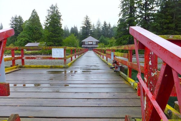
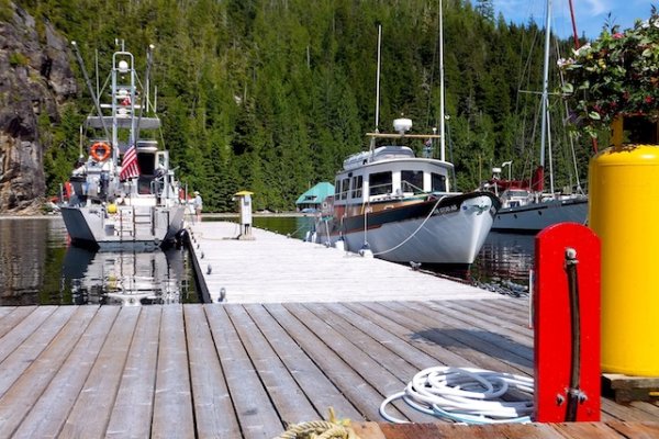
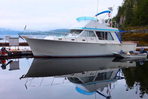
A Long Way Home II

The friendliest place on the web for anyone who enjoys boating.
If you have answers, please help by responding to the unanswered posts.
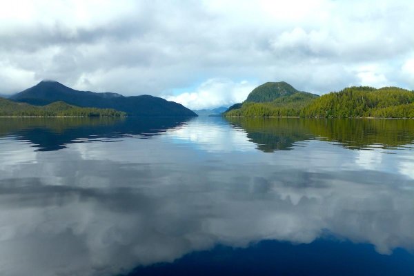
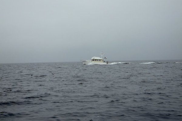
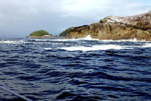
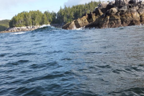
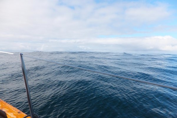
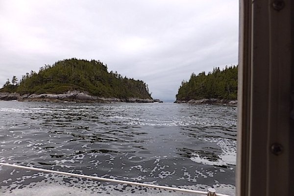
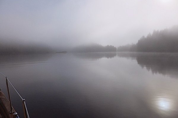
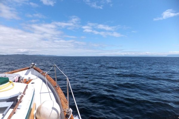
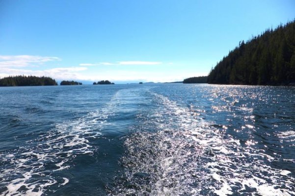
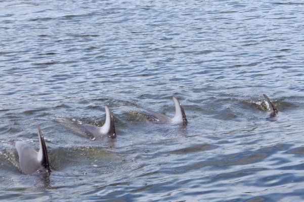
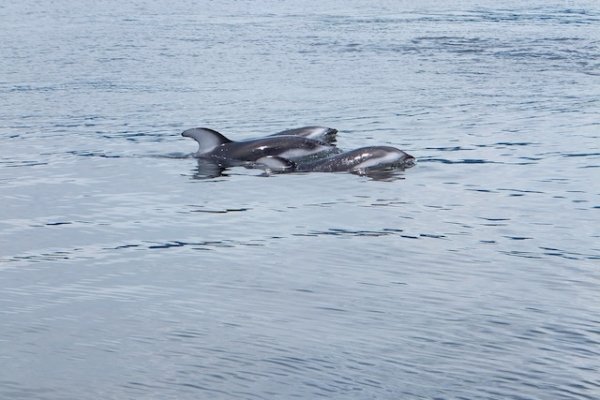
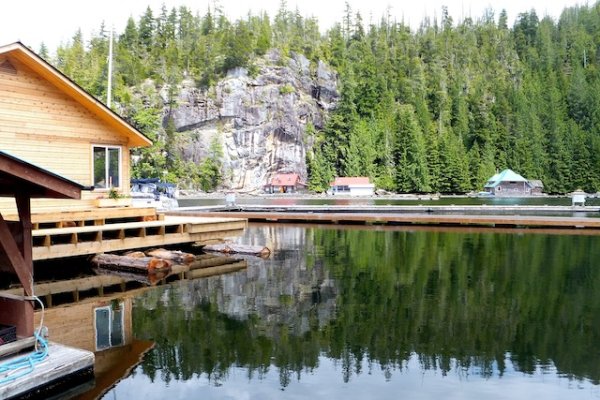
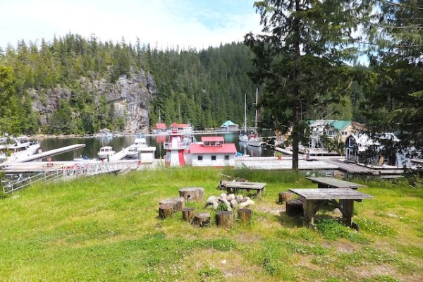
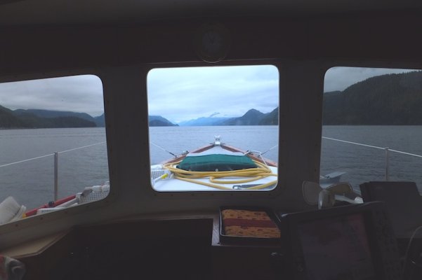
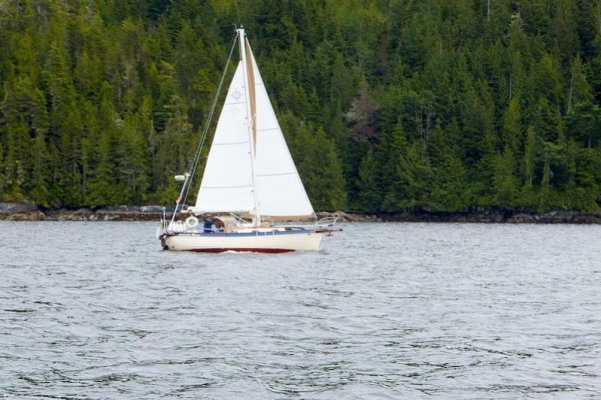
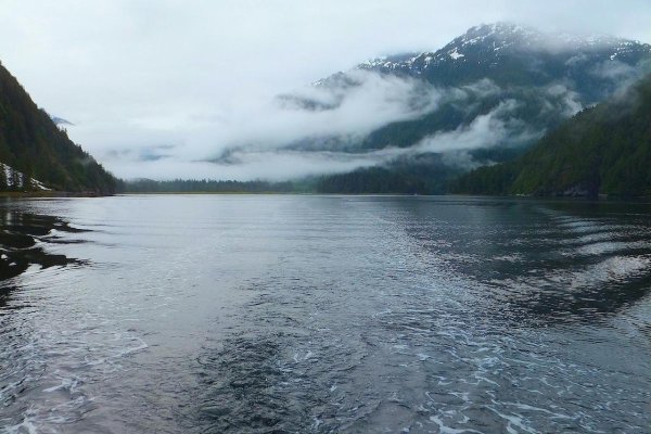
Looking east in the morning underway once again. On a good computer you should be able to see the sailboat still in his original position on the right. Perhaps we should have taken his lead and stayed a few days hiking and exploring w the dink. Probably lots of Bears up that river though however it may have been early enough so the fish weren't running?? This is one look back that I took w me.
 

Attachments

  • DSCF0441 copy.jpg
    DSCF0441 copy.jpg
    142.7 KB · Views: 141
Last edited:
After Kynoch Inlet we had a long run down Mathieson Channel. I took this picture at the bottom of Mathieson Ch just north of Reid Passage and Oliver Cove.
 

Attachments

  • DSCF0442 copy.jpg
    DSCF0442 copy.jpg
    64.6 KB · Views: 127
Pic #1: I've seen lots of home made anchors up north but never a Claw untill now. This guy made a Claw by welding steel plate. A common way to make an anchor but I don't think this was well executed as there is no twist in the side flukes. I think the Claws are significantly dependent on the twisted outer flukes for their holding power and it may contribute greatly to their ability to set as well. Anyway this was unusual.

Pic #2: We passed a very nice trawler and a barge. I really liked the trawler and wonder if it's layout provided a full headroom engine room. Lots of room in any case. The barge reminds me of how all the stuff in our house (that I'm currently packing up) will come down the coast to our new house in Washington State.

Pic #3: Sloppy going down Fisher Channel. Don't be fooled by my many pics of sunny times as there is usually lots of sloppy stuff. At times it's all sloppy and on very rare occasions it's sunny and very warm almost all the time. On our trip in 03 it was in the 80s frequently and only rained slightly once or twice ... at least until we got down to Kelsey Bay on the way so. Many people are very disappointed when it rains but most of the rain in the summer is just a pleasant drizzle.

Pic #4: Here is a typical trawler plowing along that I think looks good w the FB. He passed in front of us (well ahead) and went on in to Namu. Much of the time on the coast folks spend their time reading books, drinking tea/coffee, napping, studying charts and cruise guides and other ho-hum activities. When the weather pins you down skills at these activities are a plus and frequently an aid to safety. Knowing how to pass the time in bad weather w a smile can keep you safe. I'm not very good at it. I always want to poke my nose out and have a look. One can guess where that leads.
 

Attachments

  • DSCF0444 copy.JPG
    DSCF0444 copy.JPG
    92.1 KB · Views: 118
  • DSCF0447 copy.JPG
    DSCF0447 copy.JPG
    76.2 KB · Views: 134
  • DSCF0449 copy.JPG
    DSCF0449 copy.JPG
    75.8 KB · Views: 129
  • DSCF0451 copy.JPG
    DSCF0451 copy.JPG
    55.3 KB · Views: 132
Marin,
Never heard of a midden.

Eric- A midden is the white beach composed of broken clam and oyster shells that mark the site of a coast native village or fishing camp. Some sites were used for generations and the midden can be 15 or 20 feet deep.

Whenever you see a small, almost pure white beach along the PNW, BC, or SE AK shorelines it is almost always a midden. They are often backed by a grove of deciduous trees because the spruce, hemlock, fir, or cedar trees were cut down by the natives for firewood, canoes or structures.
 
Marin you mean like this?

We call this Picnic Island as it has no name. We went down Karheen Passage north of Craig on the west side of POW Is. Near Garden Is is Picnic Is. It's basically in east Sea Otter Sound.
 

Attachments

  • all to 12-15-09 001 copy.jpg
    all to 12-15-09 001 copy.jpg
    190.1 KB · Views: 123
Pic #1: Entering Frypan Bay on the north end of Penrose Is. This was the moment of peace before entering the big QC Sound.

Pic #2: Frypan bay looks about like this all the way around. We were alone and anchored right in the middle.
 

Attachments

  • DSCF0458 copy.jpg
    DSCF0458 copy.jpg
    82.5 KB · Views: 110
  • DSCF0457 copy.JPG
    DSCF0457 copy.JPG
    182.2 KB · Views: 118
Pic #1: Frypan Bay

Pic #2: Passing the small islands and islets just so of Penrose Is before entering Queen Charlotte Sound. A popular anchorage behind Fury Is is very close to here.
 

Attachments

  • DSCF0453 copy.JPG
    DSCF0453 copy.JPG
    121.2 KB · Views: 121
  • DSCF0459 copy.JPG
    DSCF0459 copy.JPG
    72.1 KB · Views: 104
Ooooh..wow...spectacular...what can I say..?
 
Marin you mean like this?

.

That probably is, Eric. They can range from something like your photo to pure white beaches. These shots are off the web but I'm sure you've seen this sort of thing in your travels. We've seen lots of them from the plane between here and SE Alaska.


View attachment 12771

image-3720289532.jpg
 

Attachments

  • image-4107565828.jpg
    image-4107565828.jpg
    148.8 KB · Views: 113
Last edited:
Okay, here's one for the administrators. The last photo I attached to my post is being attached to the bottom of every post in this thread, at least on my iPad. Have any idea why? I didn't do anything.

PS- Never mind. Reboot fixed it. Nothing to do with the forum.
 
Last edited:
Marin thanks for posting such nice pics on my thread. Just see that you don't post anything better than mine .. Ops did that already happen?

Yes I see them from time to time and I recall one at Montague Harbour just north of the floats.

This picture is entering Queen Charlotte Sound from the Islets just so of Penrose Is. The ocean motion is very present.
 

Attachments

  • DSCF0462 copy.jpg
    DSCF0462 copy.jpg
    126.8 KB · Views: 114
Last edited:
I keep hearing this little voice far off in the distance saying,"Go north west my son.":D
 
Eric- You are correct. There is a large midden on the little peninsula that forms the northwest corner of Montegue.
 
Here's the power of the ocean working on the rocky coast. I took this shot while passing between two small islets en-route to Queen Charlotte Sound.
 

Attachments

  • DSCF0463 copy.jpg
    DSCF0463 copy.jpg
    125.7 KB · Views: 132
Willy goes to sea.
Frequently Queen Charlotte Sound is like this.
A big lumpy swell.
Big today.
 

Attachments

  • DSCF0465 copy.JPG
    DSCF0465 copy.JPG
    124.9 KB · Views: 123
  • DSCF0475 copy.JPG
    DSCF0475 copy.JPG
    104.6 KB · Views: 112
Last edited:
While rounding Cape Caution our engine slowed down and eventually reached an idle but wouldn't do more. I'd like to say I was cool calm and collected but I wasn't. Forget the images of me screaming and weeping but I was definitely stressed. Why meeeee ... why here!! After much looking and even feeling around I opened the valves for both supply and return and after a few minutes the engine gradually reved back up to cruising speed.
I put out a pan pan call. There were several boats going north and another going south. I announced our resumption of headway and we continued on worried it wasn't going to last ... but it did.
We passed Slingsby Channel, Miles Inlet, numerous islands, islets and rocks and entered Allison Harbour. I felt safe there as we had weathered a 50 knot gale there a few years back. Great anchorage and no other boats.
I changed all filters and did everything I could to insure good running. Even did quite a few near full throttle runs up and down the channel.

The pics are of small islands in the entrance fairway to Allison Harbour and where we anchored. Fog burn't off quickly.
 

Attachments

  • DSCF0477 copy.JPG
    DSCF0477 copy.JPG
    100.3 KB · Views: 117
  • DSCF0478 copy.JPG
    DSCF0478 copy.JPG
    101.1 KB · Views: 124
  • DSCF0482 copy.JPG
    DSCF0482 copy.JPG
    40.8 KB · Views: 124
The weather seemed good and the engine seemed good to we set forth southbound from the north end of Queen Charlotte Strait. It's a long days run to the south end in a 6 knot boat but we were headed for the Broughton Islands anticipating more peace and tranquility. We ran half way down Queen Charlotte Strait and entered Well's Passage ... entering the Broughton Group.
 

Attachments

  • DSCF0483 copy.jpg
    DSCF0483 copy.jpg
    84.7 KB · Views: 116
No doubt: losing power is scary. Had to switch to the second primary filter recently, and the next immediate maintenance item is to replace the worn-out filter.

img_101982_0_236d797982e17bd454377608a75f8310.jpg
 
Last edited:
Pic #1: Running down the east side of Queen Charlotte Strait.

Pic #2: Heading for our anchorage. The old Dreadnought anchor provided the fastest and most solid anchor setting I have ever experienced. It's 34 lbs.
 

Attachments

  • DSCF0485 copy.jpg
    DSCF0485 copy.jpg
    86.1 KB · Views: 112
  • DSCF0488 copy.JPG
    DSCF0488 copy.JPG
    103.4 KB · Views: 127
Pic #2: Heading for our anchorage. The old Dreadnought anchor provided the fastest and most solid anchor setting I have ever experienced. It's 34 lbs.

Perhaps we can learn from PNW fishermen about anchors.
 
Perhaps we can learn from PNW fishermen about anchors.

Yes. What you'll learn is that they use really big, heavy, cheap ones and dump them and a half a ton of chain or cable on the bottom in a big pile and call it good. Then they use a great whacking hydraulic drum winch to haul it all back aboard. Most of the time it works great.
 
Marin, Your boat's even older than mine!

Yea, doze fishermen sure do believe in heavy and big is best. Works to about 60 knots. Don't usually have trouble except in the winter gales. If you had a fisherman mentality you'd have gotten an 80lb Claw w 5/8ths, 1/2" and 3/8ths chain on a drum winch. Prolly w 200' of nylon too. Some use all chain though.

Pic #1: Boat arriving at Shawl Bay Marina. The big man (Steve I believe) in blue serves up pancakes every morning for everyone. The guy arriving w the boat was a very nice fellow and had many interesting features on his boat. Probably had many skills we'd all like to emulate too. The boat on the right belongs to Larry H here on TF. He had been there for at least a month at this point and he may yet be still there.

Pic #2: Not many but most Canadian fishermen have home made Northill anchors like this one. This one's SS and most are mild steel. I don't know how faithful the copy is but they must work very well. I think we only have one member w a Northill.
 

Attachments

  • DSCF0491 copy.jpg
    DSCF0491 copy.jpg
    169.4 KB · Views: 134
  • DSCF0492 copy.jpg
    DSCF0492 copy.jpg
    137.8 KB · Views: 133
Last edited:
I never seem to be able to get pics of Dolphins or Porpoises but I seem to gotten the drop on these guys. They were like dancers in unison. Found them on the way from Shawl Bay to Eco Cove.
 

Attachments

  • DSCF0498 copy.JPG
    DSCF0498 copy.JPG
    176.2 KB · Views: 125
  • DSCF0501 copy.JPG
    DSCF0501 copy.JPG
    90.8 KB · Views: 133
The first two pics show basic Eco Cove.

Pic #3: Willy and the "Mini Iron Horse" Sarah Sarah.

Pic #4: I never tire of looking at Tollies and this one, like so many, are in great shape probably say'in more about the owners than the boat. One of the wonderful things about this boat is the fact that visually unburdened buy the usual crap that many to most boat owners pile up on their boat. This Tolly hasn't been visually ruined by a dinghy, tents, excessive antennas, odd paint or a big bow pulpit. Just beautiful boat.
 

Attachments

  • DSCF0503 copy.JPG
    DSCF0503 copy.JPG
    148.1 KB · Views: 125
  • DSCF0506 copy.JPG
    DSCF0506 copy.JPG
    161 KB · Views: 124
  • DSCF0510 copy.JPG
    DSCF0510 copy.JPG
    148.6 KB · Views: 146
  • DSCF0511 copy.JPG
    DSCF0511 copy.JPG
    84.9 KB · Views: 131
I appreciate the warmth and beauty of the green swamp that most of us Floridians see everywhere around us, but real cruising grounds like you've got up there with one amazing vistas after another......well, I sure hope that I'm able to cruise it myself someday. Thanks for the terrific photography, Eric.
 
You of all people are very welcome. I'm a fair photographer but most of these pics are good because of the subject matter. How can I fail? I know lots of guys are watch'in as I see the # of views.

Pic #1: Typical Broughton Islsnds scene.

Pic #2: The long run down Knight Inlet most of the time under 3 knots and frequently about 2.

Pic #3: A very nice sailboat doing some serious sailing. Old lapstrake Clinker built boat. Probably quite old and going strong.
 

Attachments

  • DSCF0514 copy.JPG
    DSCF0514 copy.JPG
    90.4 KB · Views: 131
  • DSCF0516 copy.JPG
    DSCF0516 copy.JPG
    65 KB · Views: 129
  • DSCF0518 copy.jpg
    DSCF0518 copy.jpg
    83.9 KB · Views: 144
Pic #1: While we were making 2 to 3 knots Chris worked away on her pine needle basket. She usually makes tea, reads books or woman's the helm. We haven't missed the autopilot on this boat. If the water's still Willy will go where you point her for several minutes at a time.

Pic #2: Going down Knight Inlet.

Pic #3: We had a great ride going down Chatham Channel just SE of Minstrel Is. This sailboat was barely making way (OG) bucking the current and we (luckily as we didn't plan it (didn't even know there was current here)) were making 10 knots at times. Judging from her wake the sailboat was about maxed out. It was a fun run. The sailboat is yellow.

On my 27" i-mac these pics are 5.5" X 7.5" and I wonder how big or small they are on other computers. My I-mac is big (got it for pics) but I sometimes wonder if you guys get smaller pictures. Of course before I downsize them they are full screen and about 6MB.
 

Attachments

  • DSCF0519 copy.JPG
    DSCF0519 copy.JPG
    118.8 KB · Views: 147
  • DSCF0520 copy.JPG
    DSCF0520 copy.JPG
    121.7 KB · Views: 130
  • DSCF0521 copy.JPG
    DSCF0521 copy.JPG
    146.5 KB · Views: 159
Last edited:
I see 8 are "viewing" so I better put up more to see.

Port Nevile is a place I've been meaning to stop at for a long time and finally did. The history here is extensive and my recollection is sketchy so I'll not attempt it but I believe a lady and her daughter lived here for a long time and were very popular w visitors. And the place had a long history before they came.
The BC government used to maintain countless docks and floats and they always painted the railings red. Some are still left .. but barely.
 

Attachments

  • DSCF0522 copy.jpg
    DSCF0522 copy.jpg
    172 KB · Views: 133

Latest posts

Back
Top Bottom