A Long Way Home II

The friendliest place on the web for anyone who enjoys boating.
If you have answers, please help by responding to the unanswered posts.
Joined
Oct 31, 2007
Messages
18,745
Location
USA
Vessel Name
Willy
Vessel Make
Willard Nomad 30'
I'm going to post numerous pics I took on the way down to Washington from Thorne Bay Alaska. We bought a house in Wa and decided to take the boat south first and avoid doing it in the fall. The fall in SE is usually nasty. For this year we left a bit early I think.

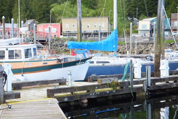
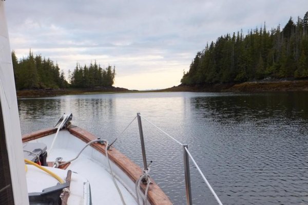
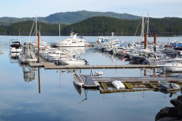
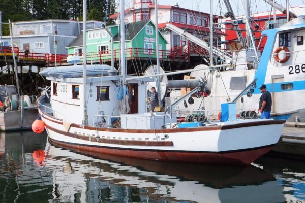
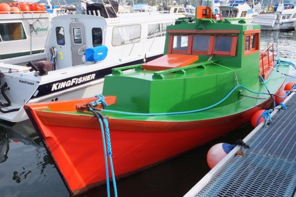
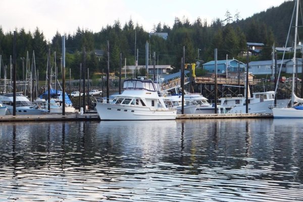
First picture is of the Thorne Bay harbor, however it looks like a pic of Tom White's DeFever. It IS Tom White's boat. He dropped in before we left and we had a little visit. It's always a pleasure to see Tom. This has been home for 7 years and Willy's leaving for the last time.

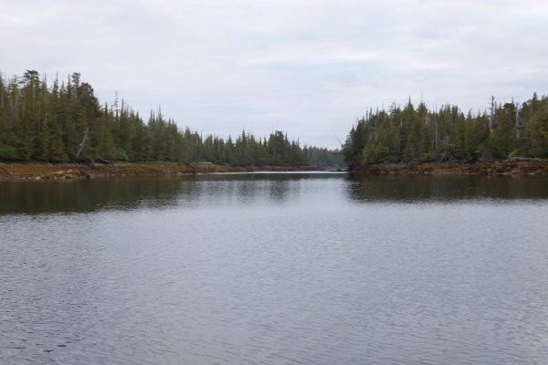
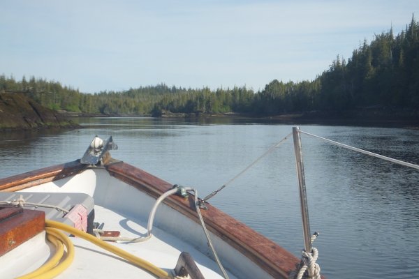
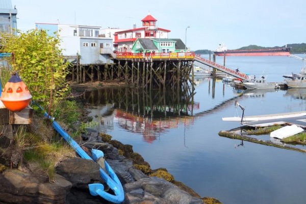
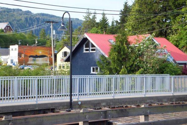
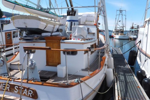
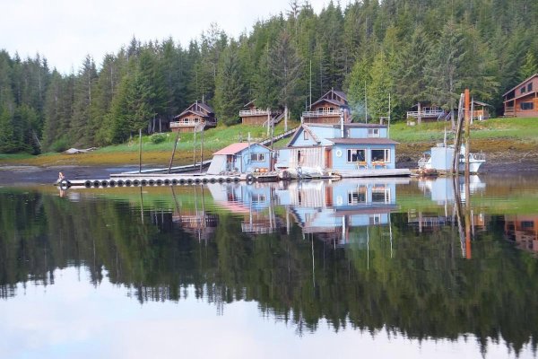
Second pic is of the McFarland's Flotel south of town in the center of The Bay. Jim McFarland rents those cabins on the shore. You can find an ad for the Flotel in Alaska Magazine. We'll miss Jim, Jeanie and all the fun at the Flotel.

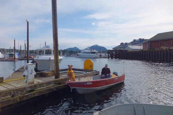
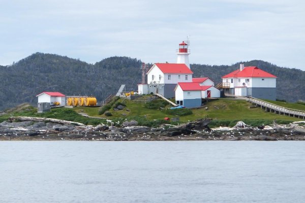
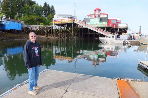
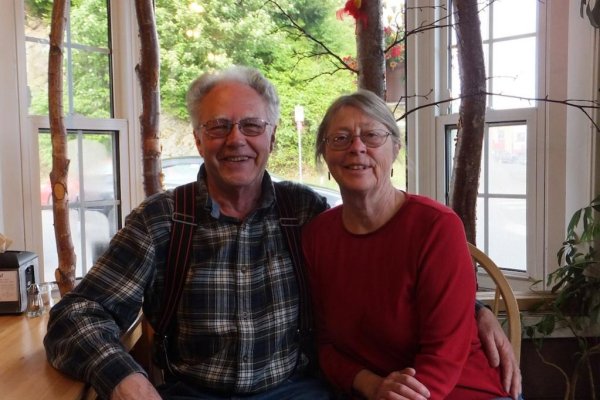
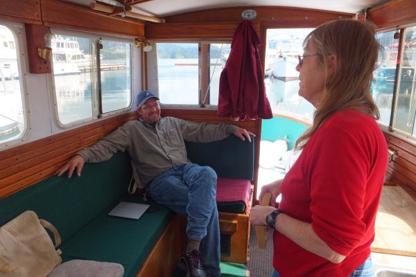
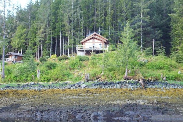
The third pic is of our very good friends Jim and Judy Moffit watching us leave. Jim and Judy are selling this beautiful mini-home and 8 acres. They have another house in town.

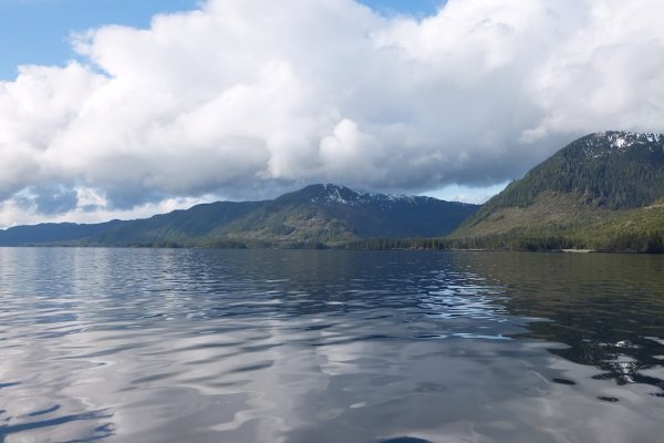
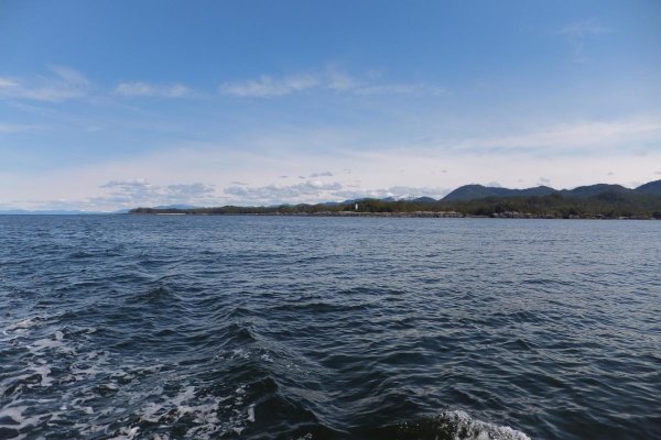
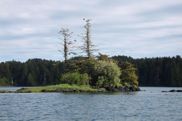
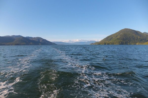
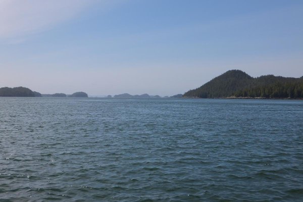
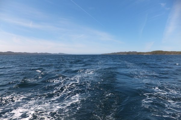
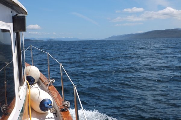
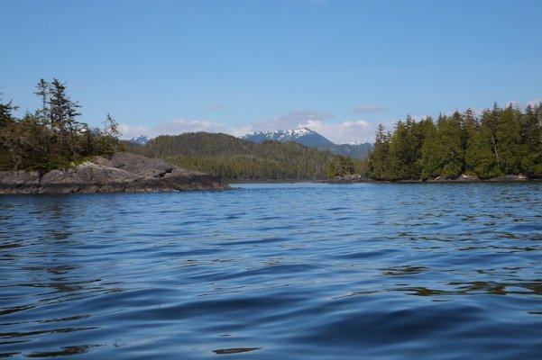
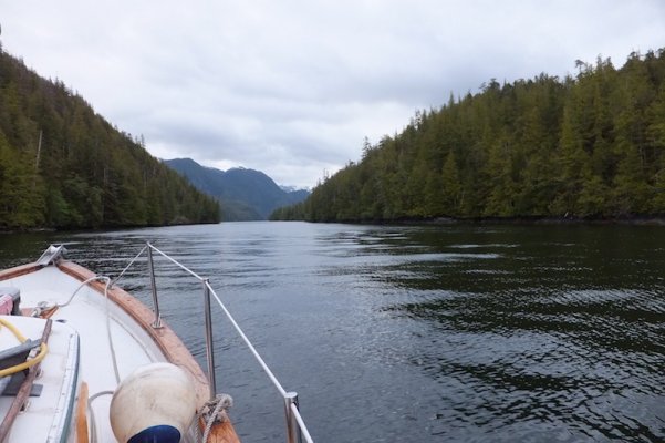
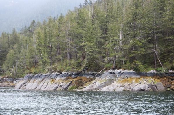
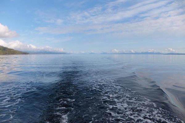
Fourth pic: We're on the inside passage southbound in Clarence Strait on our way to Ketchikan. We've made this run quite a few times in the 7 years we were in Thorne Bay. Not often in weather like this.
 

Attachments

  • DSCF0268 copy.jpg
    DSCF0268 copy.jpg
    140.1 KB · Views: 267
  • DSCF0275 copy.jpg
    DSCF0275 copy.jpg
    148.7 KB · Views: 307
  • DSCF0276 copy.jpg
    DSCF0276 copy.jpg
    172.2 KB · Views: 290
  • DSCF0280 copy.jpg
    DSCF0280 copy.jpg
    112.1 KB · Views: 283
Last edited:
Gotcha Eric - keep em coming...
 
Super cool thread. Keep posting and enjoy your journey!
 
You are right, Eric looks just like the Sound.

Outstanding Keep'em coming.

SD
 
great pictures, does the wind ever blow up there?
 
Yo There's an island just north of Shearwater in northern BC called Yeo Island. A very excellent anchorage called Wigham Cove is at it's south end. I discovered it after becoming lost quite by accident. Two of the next few pics are of Clarence Strait. You can go to some website and get the weather anytime including the wind. The weather station is on Lincoln Rock in the north end of Clarence Strait. One of our TF members looked at it when it was showing wind of 100 knots. He PMed me to see if I was alright. It was only blow'in about 50 here in Thorne Bay. I have lots of pics but I don't have any of it blow'in 100 knots.

I was thinking of Mark last night as my computer just would not connect w the internet. I wanted to make this post but was dead in the water. This morning I searched and pecked around a bit and presto I'm connected ?????

1st pic is of Clarence Strait looking north. Prince of Wales Is on the left and Etolin Is in the distance. Bye Bye to my stomp'in grounds.

2nd pic is looking SW at the shore of Prince of Wales Island.

3rd pic is in Ketchikan at Thomas Basin. Willy in the foreground and the New York Hotel (muddy yellow) in the background on shore where hotels are supposed to be. We came here often even in winter during fairly mild weather. In bad weather we stayed at the New York Hotel and came across on the ferry. Regardless we liked to eat at the New York Cafe at the bottom of the hotel. Great food and interesting people to watch.

4th pic is of a man and his dog on the end of the yacht club float. He and many others live on Pennock Is in the SW part of the harbor in Ketchikan. It's a life of skiffs, weather and solitude on the island.
 

Attachments

  • DSCF0280 copy.jpg
    DSCF0280 copy.jpg
    112.1 KB · Views: 240
  • DSCF0282 copy.JPG
    DSCF0282 copy.JPG
    151.4 KB · Views: 236
  • DSCF0283 copy.jpg
    DSCF0283 copy.jpg
    140.5 KB · Views: 261
  • DSCF0287 copy.jpg
    DSCF0287 copy.jpg
    87.8 KB · Views: 243
Beautiful Eric! I would love love love to cruise those waters if even just for a few days.
 
1st pic: At anchor in Very Inlet just north of Tree Point at the east end of Dixon Entrance behind Foggy Bay. I got trapped here in 1975 for three days. The anchorage is small and for it's good short scope performance I used my Claw.

2nd pic: At anchor looking west over the saddle. In 75 I came over this saddle in heavy seas surfing on top of a wave. Ran out of water and got stuck in my dink by the tide. Wife was very worried as I was away for 5 hours. It was quite lumpy at high tide this time when the waves from the westerly came right in. Not a great anchorage but we stayed relatively secure.

3rd pic: Leaving in the morning going back through the entrance.
 

Attachments

  • DSCF0291 copy.JPG
    DSCF0291 copy.JPG
    171.5 KB · Views: 224
  • DSCF0292 copy.jpg
    DSCF0292 copy.jpg
    92.2 KB · Views: 217
  • DSCF0293 copy.JPG
    DSCF0293 copy.JPG
    167.9 KB · Views: 236
Thank's Woodsong.
Just getting started though.
There are ways to get on cruising boats or a brand name cruise w a dozen boats or so. Could fly up and meet in Shearwater, Ketchikan Juneau or wherever. Check yacht clubs, Brand forums or the docks in Seattle. Rent a Nordic Tug out of Juneau. Marin may have ideas or anybody else in the Puget Sound area or the Lower Mainland BC not to mention Vancouver Is. Lots of possibilities. Meet someone on the Forum somewhere. There are 10 or 12 TF members that go north every year. I'll try and put a few pics up every day until I need to pack up my computer.
 
1st pic: Everybody that has gone to Alaska on a small boat knows Three Tree Point. Usually called just Tree Point. It's at the east end of Dixon Entrance not far south of Foggy Bay/Very Inlet. If you make it past Tree Point you've got it made as there is no further exposed crossings. At least that's what people think but of course there are lots of other "protected" waters to get bogged down in heavy seas. Clarence Strait and Chatham Strait come to mind. Tree point is also a gateway to SE Alaska. I've never seen a beautiful picture of Tree Point but I'll bet it's very often photographed. The point is actually where the lighthouse is.

2nd pic: Just east of Dundas Is is another lesser "mile post" called Green Island Light. Basically all marine traffic bound for Alaska goes right by Green Is light.

3rd pic; Metlakatla (Venn) Pass. A good shortcut going north from Prince Rupert w another shortcut going across the flats to Chatham Sound south of Dundas Is and Green Is Light. Very pretty in places the original village of Metlakatla is about mid way along the pass. I like going along the channel and across the flats past all the cans and buoys.
 

Attachments

  • DSCF0298.jpg
    DSCF0298.jpg
    121.5 KB · Views: 215
  • DSCF0307 copy.jpg
    DSCF0307 copy.jpg
    99.6 KB · Views: 209
  • DSCF0310 copy.jpg
    DSCF0310 copy.jpg
    122.1 KB · Views: 211
Eric-- Great shots. I'm hoping you have some on Grenville and Tolmie channels. Those are my favorite parts of the Passage from a flying aspect. When you're up 1000 feet or so you see all the lakes up above the salt water that the waterfalls come from.
 
Good morning Marin,
We went down Principe Channel on the west side of Pitt Is. Didn't do Grenville at all. I think Tolmie Channel is on the NE side of Princess Royal Is where Butedale is. Yes did go there. Later.

Pic #1: PRRYC ... Prince Rupert Rowing and Yacht Club. Always packed in the summer like most places up the coast. I love Prince Rupert and Cow Bay. It seems that everybody running up or down the coast winds up here. I've seen boats from practically anywhere in the Pacific and that's half the world. Canada is a very international place and PRRYC is even more so. There are always many people on their first trip up the coast and people that have many trips under their keels And all are excited to be there. The only alternative to the yacht club for moorage is the City Floats. It's so packed there that every time I've tied there it was to the side of a fishing boat ... rafting as we call it. I believe rafting is the law of the land/sea in Canada. Your'e required to allow other boats to raft to yours. In Canada other people are more like family and more inclined to share. In The US we are more inclined to Private space.

Pic #2: Tourist places next door to the YC. Restaurants, Kayaking, chartering, motels/hotels and other such stuff. This place in Cow Bay has a rather unique charm that I find fetching. "Smiles" is a Fish & Chips Restaurant that was established in 1938. Great historical pics inside and great food.

Pic #3: Taken from the YC floats deer are often seen in and among the pilings at low tide.
 

Attachments

  • DSCF0311 copy.jpg
    DSCF0311 copy.jpg
    132.3 KB · Views: 205
  • DSCF0319 copy.jpg
    DSCF0319 copy.jpg
    110.5 KB · Views: 202
  • DSCF0320 copy.jpg
    DSCF0320 copy.jpg
    152.7 KB · Views: 215
Tolmie Channel is between Klemtu and Cone Island. Butedale Reach is what's in front of Butedale. Fraser Reach is the same channel northwest of Butedale. I guess the whole deal is called Princess Royal.

Curious why you went west of Pitt instead of the more direct route down Grenville?
 
Many Boats

beautifull places on a even more beautifull trip...Congrats

Portuguese
 
Seems it's difficult to take a photo in the PNW that isn't scenic/dramatic.

232323232%7Ffp73439%3Enu%3D3363%3E33%3A%3E57%3B%3EWSNRCG%3D3832993999336nu0mrj
 
Mark you sure have taken a lot of pics of Ketchikan. Good. So you're say'in it's possible? It IS possible. And next to Randy Kerr I'm definitely 2nd rate. He's a professional photographer (see Randy Kerr.com) and the PO of Willy. I'm not a good photographer? Well I know beyond a doubt you don't think that but when I see really good pictures I know I'm 2nd rate. If you really want to see more great pictures search ( Our World ). Over 500 really super amazing photographs from all over the world. It's an excellent geography lesson too. Try it.

Thanks Portugese.

Marin I've done way too much of point A to point B on the inside passage. This time it was a compromise but still saw some new places and re-visited some very special old places. Grenville and Princess Royal Reach are beautiful ditches. Lots of barges, ferries, cruisers like us and cruise ships. Just on the other side of Pitt Is is the wilderness. A wild place w very few boats.

On my narration to this thread I'm at a disadvantage in that all my books and maps and charts are packed. Even my log book is in Wash. So I'm relying on memory alone and at 72 that's questionable as well. I've got the i-pad w the Nav App but it's not forthcoming w many names. Pictures need to be IN the i-pad to be able to post them ... right? Soon I'll be back to the i-pad only and will need Starbucks or some other wifi to even post. This thread will stop then being a photo thread. For new guys here that do'nt know about "A Long Way Home I" it's still here in Voyagers ..., but it's text w/o pics but I put more effort into the text then. I found out on Face Book how much people like pictures.
 
Last edited:
Mark you sure have taken a lot of pics of Ketchikan. Good. So you're say'in it's possible?

Ketchikan seems to be the most interesting location for observing recreational boats in Alaska (visited most SE Alaskan ports up to five times in the last eight or nine years). After all, my 2010 visit to Ketchikan was the final "shove" needed for me to purchase a "trawler."

232323232%7Ffp63634%3Enu%3D3363%3E33%3A%3E57%3B%3EWSNRCG%3D38329939%3B3336nu0mrj
 
Last edited:
My biggest complaint about the Navimatics charts is they don't show the names of many of the channels and passes unless you zoom way in. And even then some are not shown.

The route up the west side of Pitt looks very intriguing. If or when we get to make this run in the boat we'll definitely think about it. Thanks for pointing it out.
 
Mark,
Too bad you are'nt riding the cruise ships when they came to downtown Jueeau. You'd forget all about Ketchikan but Ketchikan has a small town flavor that Juneau lacks. Sitka has plenty of charm though.

Marin,
You present a too positive opinion of Navamatics and names. Even if the name is on there and you zoomed in (way in as you say) you'll only be looking at about 1/50th of Grenville Channel and you'll have a 1 in 50 chance of seeing the name. Bahh. But I still really like having it.
The west side of Pitt ... I don't know if it's a good place to go for most people. We went there for wild wilderness that makes one feel like an explorer. Another person might say "but there's nothing there". One anchorage there I won't recommend .. you'll see.


Pic #1: Inside the Cowpachino on a rather quiet day or quiet time. Excellent coffee, pastries w lots of berries inside, special but regular breakfasts and sex in a pan ... a chocolate thing. We like the people that flock to this place. Again very international. The cafe Smiles is across the street w good seafood and beyond.

Pic #2: Manyboats and one wife Henning in Cowpachino.
 

Attachments

  • DSCF0313 copy.jpg
    DSCF0313 copy.jpg
    102.3 KB · Views: 175
  • DSCF0317 copy.jpg
    DSCF0317 copy.jpg
    104.4 KB · Views: 177
Last edited:
Mark,
Too bad you aren't riding the cruise ships when they came to downtown Jueeau. You'd forget all about Ketchikan but Ketchikan has a small town flavor that Juneau lacks. Sitka has plenty of charm though.

No, no. JUNEAU, Ketchikan and Victoria are always on the cruise-ship route; Sitka, Haines, and Skagway are less often. The last two cruises we got off only once each: Haines because we had never been there before, and Skagway to ride the train again. Juneau, Ketchikan, and Victoria have become pedestrian. Next time we'll look for an itinerary includeing Sitka (been there only once).

232323232%7Ffp537%3B7%3Enu%3D3363%3E33%3A%3E57%3B%3EWSNRCG%3D34%3B29%3A%3B892336nu0mrj


232323232%7Ffp63577%3Enu%3D3363%3E33%3A%3E57%3B%3EWSNRCG%3D3832993994336nu0mrj
 
Last edited:
Mark,
I must have been thinking about the ferries. They did dock in downtown Juneau but for years have been docking (anchoring I think) at Auke Bay. Your wife looks like a happy lady in the picture heading out. I was on a cruise ship once. I flirted w a girl in Juneau, took her to see the glacier and she took me aboard her cruise ship for dinner. It was the Fair Sea. It looked like a real ship. More like the Titanic. Had magnificent teak decks and many bars. Mostly east indian food. I had to pose as a passenger. I did good.

Pic #1: Here's the Cowpachino Cafe w the red roof. Notice the building up the street w the big mural.

Pic #2: A refitted fish boat floating high in the stern w/o any load. Hull looks very Krogen-like. Has a home made Northill anchor like most Canadian fish boats. Exhaust looks a bit flimsy though.

Pic #3 Interesting homebuilt at the yacht club. Note the overboard plumbing, chafing and lines, hand rails, fwd cleat, galv pipe hand rails and running lights. Nice balanced lines. No comment on the colors.

pic #4: An interesting and well found trawler from Victoria. I'd like to read her log book. From the lower helm it looks like visibility is poor and aft it's almost nonexistent.

pic #5 Chris w a wonderful local guy that I very much would like to see again. I'd like to say who he is but I'm not sure he wants his picture plastered up here. So he'll just have to be nameless for now.
 

Attachments

  • DSCF0312 copy.jpg
    DSCF0312 copy.jpg
    148.2 KB · Views: 150
  • DSCF0323 copy.jpg
    DSCF0323 copy.jpg
    138.6 KB · Views: 157
  • DSCF0324 copy.jpg
    DSCF0324 copy.jpg
    116.3 KB · Views: 171
  • DSCF0329 copy.jpg
    DSCF0329 copy.jpg
    121.5 KB · Views: 158
  • DSCF0330 copy.jpg
    DSCF0330 copy.jpg
    110.8 KB · Views: 175
Best town in SE Alaska is Petersburg, precisely because the cruise ships can't get in there.
 
According to Wikipedia: "Small cruise-ships (up to 250 passengers) and private yachts visit [Petersburg] from May through September."
 
"Best town in SE Alaska is Petersburg, precisely because the cruise ships can't get in there."

Well that's the cutest town in SE of any size but you have'nt seen Point Baker, Elfin Cove, Myers Chuck, Port Alexander or Port Protection. The small boardwalk communities are the jewels of SE. Elfin Cove is largely ruined since they put in high buck lodges and ran the fishermen out.

"the cruise ships can't get in there."

That's one of the main reasons we went to Prince of Wales Island to live.

Pic #1: This is the channel between Pitt Is and Porcher Is. In the distance you can see the foot waters of the great Skeena river. Behind and around to the right is Greenville Channel. I wanted to go into Oona River on Porcher Is as they are reported to be a basic community doing a lot of boat building but it's over very shallow water and the tide was quite low.

Pic #2: These islands are in the large inland body of water on the west side of Porcher Is. The Billy Islands you see in the picture. We went through most of the islands you can see and anchored (to the right) in Billy Bay. Very good anchorage.

Pic #3: This is on the NW end of Pitt Is. I took the picture and posted it because I like the green and blue.
 

Attachments

  • DSCF0331 copy.jpg
    DSCF0331 copy.jpg
    136.8 KB · Views: 148
  • DSCF0333 copy.jpg
    DSCF0333 copy.jpg
    97.4 KB · Views: 150
  • DSCF0332 copy.jpg
    DSCF0332 copy.jpg
    154.2 KB · Views: 155
Pic #1: On the SW corner of Porcher Is facing Hecate Strait and the ocean. After a drive by of the indian village of Kitkatla and going through a little passage there are a few islets and nothing west but the Queen Charlotte Islands.

Pic #2 We are entering waters seen by almost none of the boaters that go up and down the coast. It could be said that it's less populated than most or even all of SE Alaska.

Pic #3 Looking no Banks Is is on the left and McCauley Is is on the right. We are just entering Principe Channel.

Pic #4 Starting down Principe Channel. The sailboat was to be at anchor w us later in a gale.
 

Attachments

  • DSCF0335 copy.JPG
    DSCF0335 copy.JPG
    75.3 KB · Views: 144
  • DSCF0338 copy.JPG
    DSCF0338 copy.JPG
    123.6 KB · Views: 142
  • DSCF0339 copy.JPG
    DSCF0339 copy.JPG
    145.2 KB · Views: 145
  • DSCF0340 copy.JPG
    DSCF0340 copy.JPG
    139.2 KB · Views: 165
Sail boat - what sail boat - are me eyes that bad Eric...?
 
Pic #1 & 2 Coming around the south end of Anger Is.

Pic #3: Approaching the entrance to Ire Inlet. This is one of the strangest places I've been w what I think has the narrowest entrance of any. The Hemingway cruise guide thinks this place is an OK anchorage .. but I do'nt. They even anchored in the same place as we did but for different reasons.
 

Attachments

  • DSCF0346 copy.JPG
    DSCF0346 copy.JPG
    130.5 KB · Views: 136
  • DSCF0347 copy.JPG
    DSCF0347 copy.JPG
    146.1 KB · Views: 137
  • DSCF0343 copy.JPG
    DSCF0343 copy.JPG
    120.5 KB · Views: 141
Last edited:
Pic #1,2 & 3 All inside Ire Inlet. The widest place was not that wide w an even smaller cove on the right. The cruise guide said the best place to anchor was beyond the big smooth rock. That was even smaller but all the rest of the inlet had a mass of return on the fish finder as if it was plugged w weed. Whatever it was it filled the inlet except the small western end beyond the big exposed rock. We anchored there too. There was to be some wind that night so I gave out a bit more scope than I usually do in such a small place. Mistake. At 1400hrs we swung into a submerged rock where the high tide had lengthened our scope even more. A bit too much as we hit that rock. We came out of our bunks like battlestations in an old movie. It was not a little bump but more of a crash w we hit that rock. I thought in a moment that we had already high centered on a rock and fallen off to the side. But we were floating just fine. I went out in my shorts and pulled up some scope so we would'nt hit that rock again. We stood 2 hour watches till morning.
 

Attachments

  • DSCF0350 copy.jpg
    DSCF0350 copy.jpg
    91.2 KB · Views: 136
  • DSCF0352 copy.JPG
    DSCF0352 copy.JPG
    167.8 KB · Views: 137
  • DSCF0355 copy.JPG
    DSCF0355 copy.JPG
    172.9 KB · Views: 144
Pic #1 Anybody ever seen one of these? Tube fish, eel or what? It was swimming alongside the boat after we anchored. Weird place.

Pic #2: Sailor's warning? YES. Took this pic on my early morning watch. The gale was coming and here was the red flag. You can see the big exposed rock toward the west end of the inlet. We were swinging at anchor over the shallows to the extreme west end. The anchor would be less than half of the way to the rock. The east wind that would become a gale was just starting.
 

Attachments

  • DSCF0359 copy.JPG
    DSCF0359 copy.JPG
    82.8 KB · Views: 136
  • DSCF0361 copy.JPG
    DSCF0361 copy.JPG
    104.5 KB · Views: 153
Pic #1: We had anchored here 7 or so years ago w our Albin. Here's the entrance to Patterson Inlet (the north arm) and it's nice and wide and deep.

Pic #2: This is how we started out before the gale got really going. The Krogen ahead and to the left dragged slowly across the bay toward us. The sailboat got nervous and moved ahead. We couldn't move back as the rocks were too close so in the end we moved fwd too. Since the bay was smaller at the head where the Krogen started out the we and the sailboat were quite close during the night. The winds were the strongest I've ever experienced and w wicked loud roaring gusts. The XYZ held fast as we swung wildly back and forth. This is the 2nd gale of this strength we've weathered w an XYZ. Again we stood 2 hour watches. It was really hard to stay awake this time despite the roaring wind.

Pic #3: Here are the rocks we and eventually the Krogen had just aft of our sterns.
 

Attachments

  • DSCF0362 copy.JPG
    DSCF0362 copy.JPG
    132.7 KB · Views: 137
  • DSCF0363 copy.JPG
    DSCF0363 copy.JPG
    96.1 KB · Views: 140
  • DSCF0364 copy.jpg
    DSCF0364 copy.jpg
    95.7 KB · Views: 137

Latest posts

Back
Top Bottom