Soldack
Newbie
I am new to boating. I'm trying to find the bridge clearance of a particular bridge. How do I go about it?
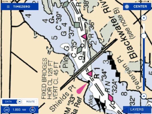
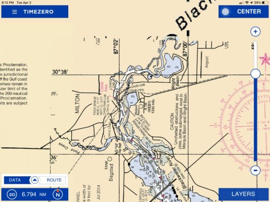
The specific bridge I need is near Pensacola, Florida. From Pensacola Bay, travel into East Bay, then north into Blackwater Bay, then take a left onto Pond Creek. Just as you start on Pond Creek, there is a bridge which is either Canal Street or Forsyth Street.
What is the boating clearance for that bridge?
Thank you for helping me and I apologize if this is a dumb question, I promise I am new to boating.
")