Last fall I had a Garmin Down Vu Plotter/Sonar installed on the Whaler we keep down in AZ. I mentioned it in a couple of threads and several people expressed an interest and wanted to know what I thought of it after I’d had a chance to use it.
I was out about 2 weeks ago and got familiar with it but the photos I took that day didn’t come out well. The screen wasn’t clean and the sun was shining real bright. I could see the screen OK in the sunlight but the photos didn’t come out well because of the dirty screen.
So today I hit Lake Pleasant again to take some better photos, and yes, I cleaned the screen. The day was just about perfect—high 70’s, just a slight breeze, a high, thin overcast but lots of boats on the water.
I did some fast runs to see how the Down Vu was able to keep up with my boat speed, and it did well. Most of the photos I took were done at slow speed o keep the boat and camera from bouncing too much. I also used a sweatshirt as a sun screen. I could see the screen OK in the sun but it didn’t photograph well, hence the sweatshirt over the unit to block the sun.
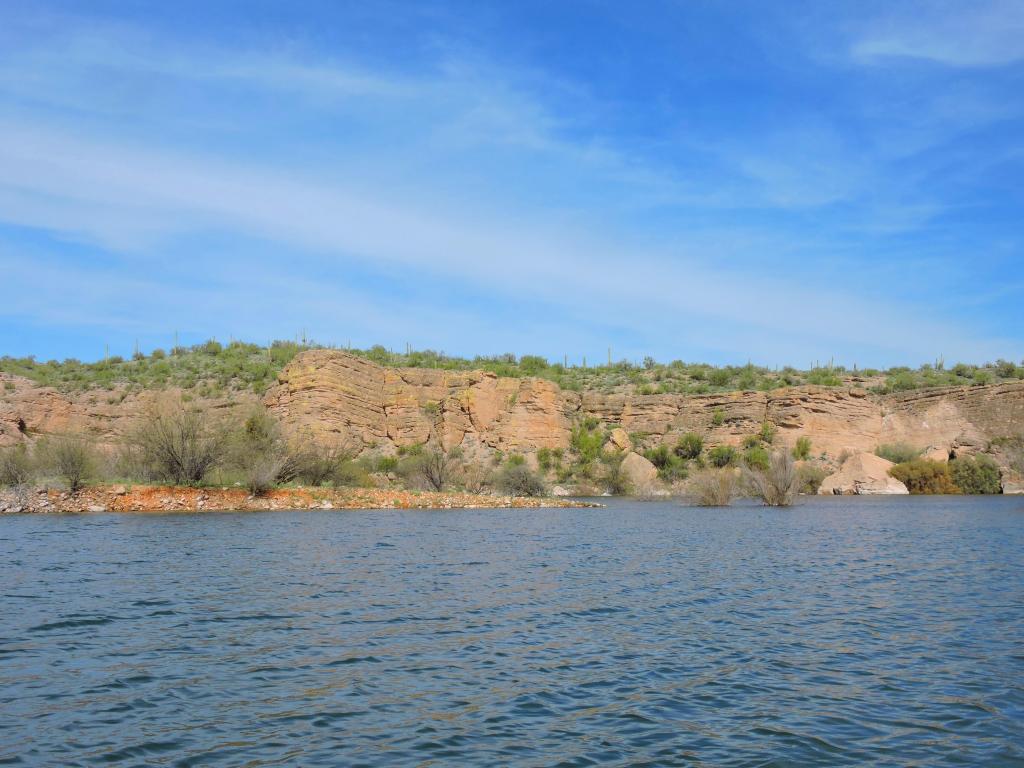
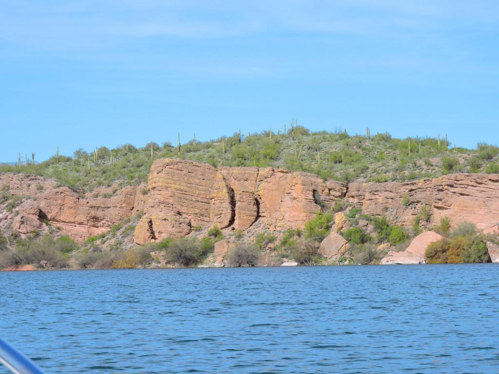
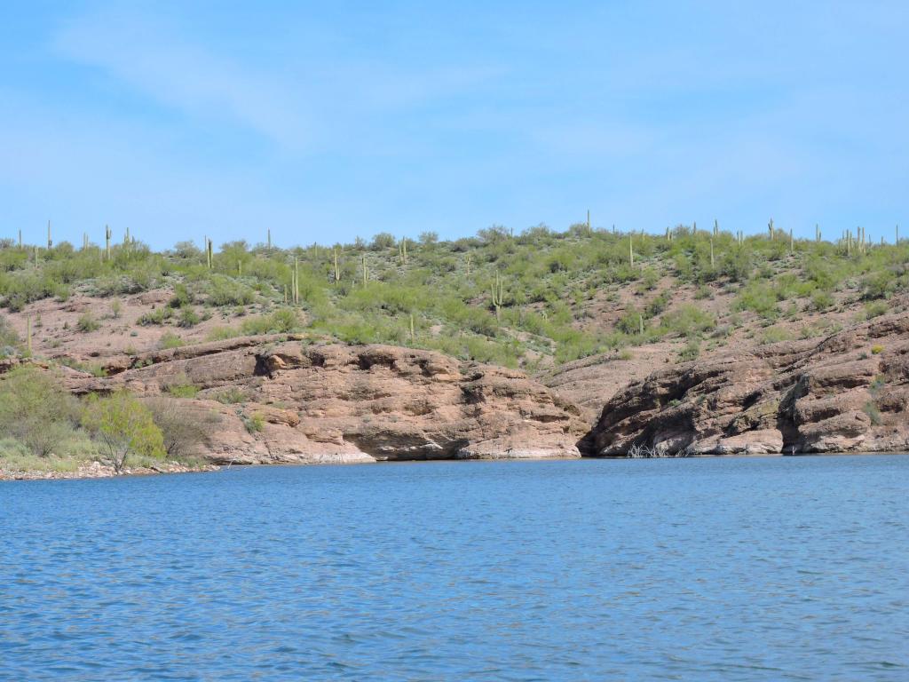
I explored a new section of the lake I hadn’t been on before. On prior trips we’d checked out the many coves on the NE area of the lake but today I went to the NW area. The rock sculptures were pretty cool in some of the areas. Here are a few photos of the rocks.
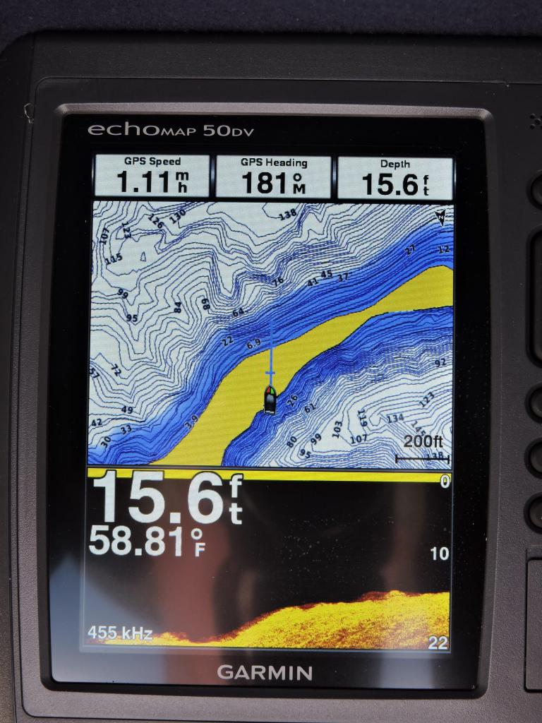
I made a few quick runs around the lake then pulled into a couple of coves to see how this thing did mapping shallow water. I also found that I could switch the positions between the plotter and the Down Vu on the screen. Here are the results:
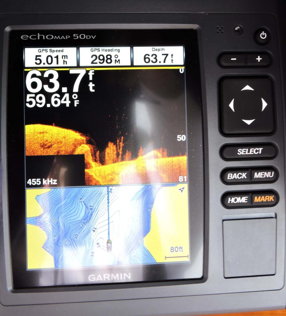
I thought this was pretty cool to be able to see the trees on the bottom in 65' of water. If you're fishing and looking for a place where fish might hang out, this would be the ticket.
This show shows the bottom structure, even in 50+ feet of water.
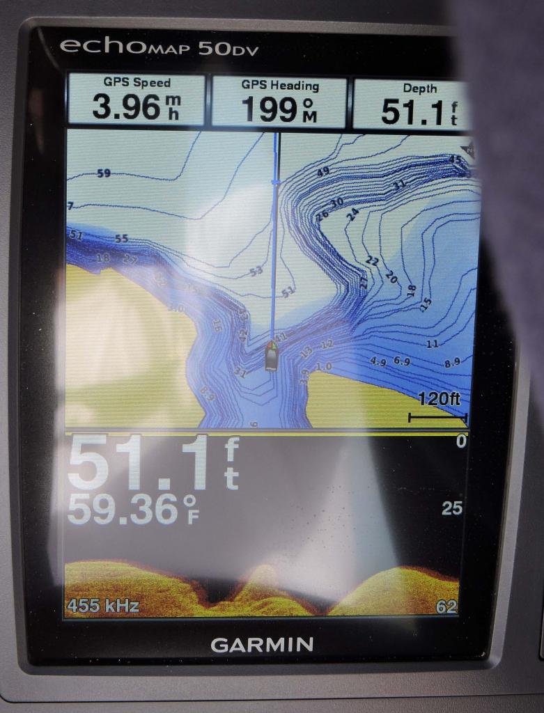
This shows the bottom contours over a drop off to a flat bottom area.
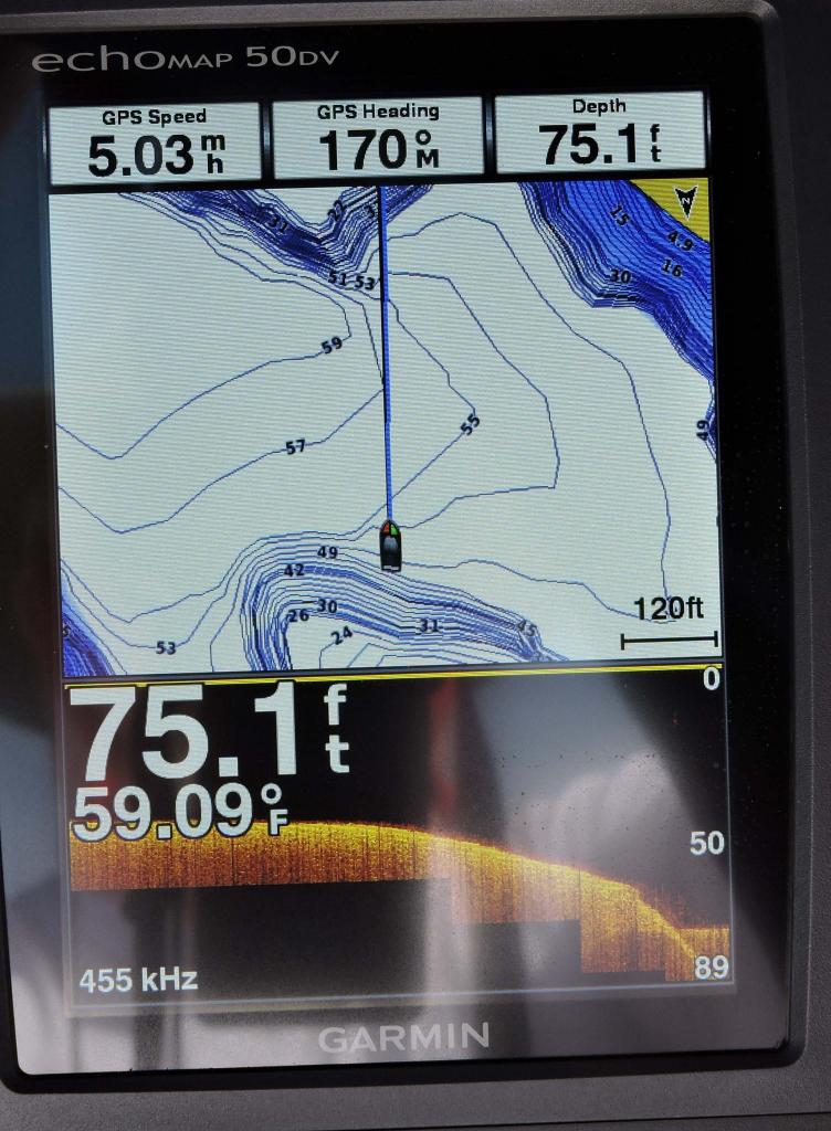
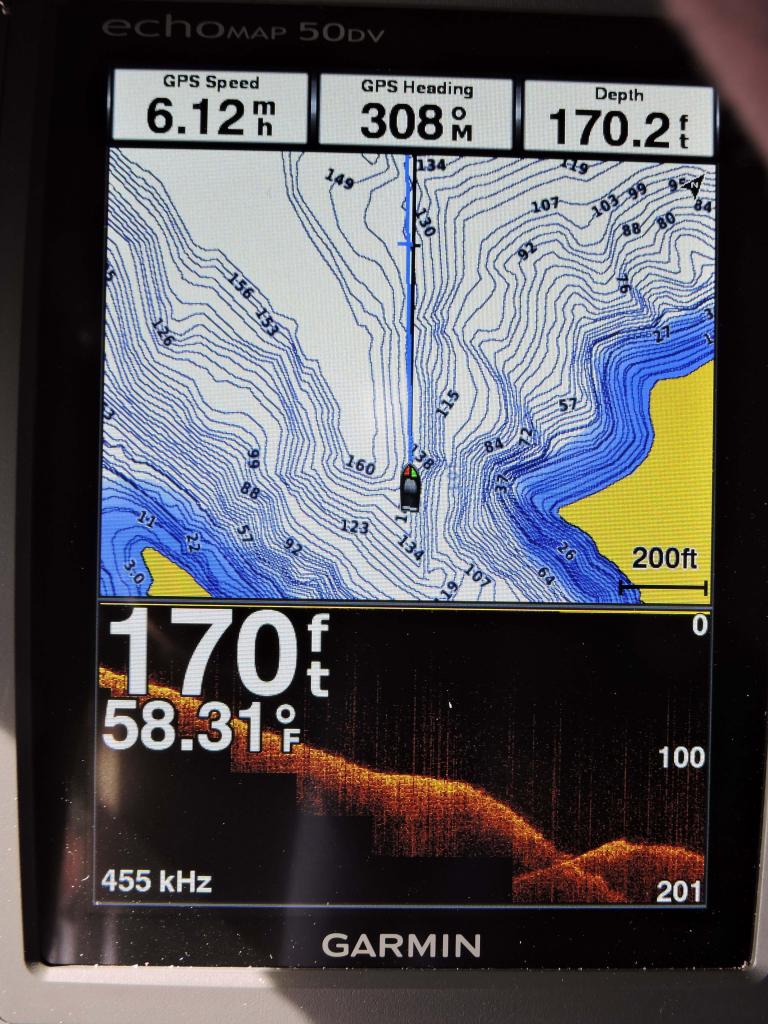
This shot shows the bottom contours even down to 170' of water. Pretty cool.
I was out about 2 weeks ago and got familiar with it but the photos I took that day didn’t come out well. The screen wasn’t clean and the sun was shining real bright. I could see the screen OK in the sunlight but the photos didn’t come out well because of the dirty screen.
So today I hit Lake Pleasant again to take some better photos, and yes, I cleaned the screen. The day was just about perfect—high 70’s, just a slight breeze, a high, thin overcast but lots of boats on the water.
I did some fast runs to see how the Down Vu was able to keep up with my boat speed, and it did well. Most of the photos I took were done at slow speed o keep the boat and camera from bouncing too much. I also used a sweatshirt as a sun screen. I could see the screen OK in the sun but it didn’t photograph well, hence the sweatshirt over the unit to block the sun.
I explored a new section of the lake I hadn’t been on before. On prior trips we’d checked out the many coves on the NE area of the lake but today I went to the NW area. The rock sculptures were pretty cool in some of the areas. Here are a few photos of the rocks.
I made a few quick runs around the lake then pulled into a couple of coves to see how this thing did mapping shallow water. I also found that I could switch the positions between the plotter and the Down Vu on the screen. Here are the results:
I thought this was pretty cool to be able to see the trees on the bottom in 65' of water. If you're fishing and looking for a place where fish might hang out, this would be the ticket.
This show shows the bottom structure, even in 50+ feet of water.
This shows the bottom contours over a drop off to a flat bottom area.
This shot shows the bottom contours even down to 170' of water. Pretty cool.