Reply
 
Thread Tools Search this Thread Display Modes
 
Old 07-10-2012, 04:38 PM   #1
Member
 
City: Southfield
Join Date: Apr 2012
Posts: 6
Comprehensive, fullly integrated, state of art, coastal navigation equipment?

What components are essential to a comprehensive, fully integrated, state of the art, coastal navigation system for a 52' Trawler?


For planning purposes, let's consider any and all options as if money were not an issue!


Financial reality can later be applied as appropriate!


Thanks for sharing your dreams and critical thinking!


Yer Ole Sea Daddy
Still Full of Sap!
Still Green!
Yer Ole Sea Daddy is offline   Reply With Quote
Old 07-10-2012, 04:58 PM   #2
Guru
 
Moonstruck's Avatar
 
City: Hailing Port: Charleston, SC
Vessel Name: Moonstruck
Vessel Model: Sabre 42 Hardtop Express
Join Date: Nov 2008
Posts: 8,276
[QUOTE=Yer Ole Sea Daddy;93496]What components are essential to a comprehensive, fully integrated, state of the art, coastal navigation system for a 52' Trawler?

[/QUOTE

Here is my list. Essentials are a paper chart, pencil, compass with deviation table, time piece, dividers, and parallel rules or course plotter.

Very nice to have are chart plotter, radar, depth finder, AIS, VHF radio, SSB radio, autopilot, and good search light.

Others I'm sure will add to this.

I don't go without the things on my essential list. I don't have an SSB or AIS.
__________________
Don on Moonstruck
Sabre 42 Hardtop Express
When cruising life is simpler, but on a grander scale (author unknown)
https://moonstruckblog.wordpress.com/
Moonstruck is offline   Reply With Quote
Old 07-10-2012, 06:53 PM   #3
Guru
 
swampu's Avatar


City: Biloxi, MS
Vessel Name: Cajun Rose
Vessel Model: Biloxi Lugger
Join Date: Jul 2011
Posts: 1,384
One thought about the radar is the sirus or satalite radar. With my garmin unit on my center console the sat. radio (sirus,xm) offer a weather service that overlays on your chartplotter the local doppler radar. If you cruise at 9 knots and don't cruise in the fog it might be a way to save a few duckies.
swampu is offline   Reply With Quote
Old 07-10-2012, 08:04 PM   #4
Scraping Paint
 
City: -
Join Date: Oct 2007
Posts: 13,745
I think Don's list is on the money. While it's not necessary these days to have or use the analog method of navigation--- paper charts, etc.--- having them and more importantly, knowing how to use them will make electronic navigation that much more intuitive and simple.

And if the electricicals on your boat ever stop holding hands, the manual analog methods will become your only choice unless one's definition of self-reliance is to get on the radio or mobile phone and ask others to help you.

We have all the stuff Don lists in his first paragraph and my wife and I know how to use it although we don't on any sort of regular basis.

As to the second paragraph, well, we have a radar/plotter, another big stand-alone plotter down and a smaller stand alone plotter for up top, three VHF radios (one down, one up, and one handheld), a depth sounder/knotmeter/etc. unit with a repeater up above. The boat has a loud pair of air horns as well as an electronic "horn" as part of the loud hailer/intercom system.

We recently added an iPad with a charting application on it, not for navigation because this particular app doesn't really do that, but for being able to zoom in and out and move rapidly around the charts for this area without having to page through chartbooks and such. Zooming and panning around to get the big picture on the chart plotters is too slow-- the iPad app is outstanding for this.

We don't have an SSB radio, we don't have AIS (so far have seen no real value in it for where we boat), we took the autopilot off the boat when we bought it, and we don't have a nice remote-controlled searchlight. We do have a hand-held light that can be plugged into one of the 12vdc outlets mounted on the outside of the main cabin and I think it's a good idea to have some sort of illumination device.

But I think the minimum electronics one would want for navigation are a depth sounder, a radar, a VHF radio, and a GPS plotter.
Marin is offline   Reply With Quote
Old 07-11-2012, 05:13 AM   #5
Guru
 
Aquabelle's Avatar
 
City: East Coast, Australia
Join Date: Jun 2012
Posts: 935
Are you familiar with the ActiveCaptain cruising website? (If not, one of the very best web resources for cruisers: https://activecaptain.com/) Its founder, Jeff Seigel, has just been through a complete electronics replacement and helm upgrade. This is a guy who really, really knows his stuff and I get the strong sense he didn't just go out and buy the most expensive of everything. He did, however chose predominantly Garmin gear & when he explains why, it makes a lot of sense...even to a Furuno-dominant owner like me. You can read all about his selection criteria at https://activecaptain.com/newsletters/2012-01-25.php: see if his needs & wants match up with yours. Then you can read about what he chose at https://activecaptain.com/newsletters/2012-02-22.php
Aquabelle is offline   Reply With Quote
Old 07-11-2012, 06:59 AM   #6
Guru
 
rwidman's Avatar
 
City: North Charleston, SC
Join Date: Sep 2010
Posts: 4,869
I installed two Garmin 5208 networked plotters (upper and lower helms) and a GSD22 depth sounder, also networked. This is all I need for my use. Someday I will replace my VHF with one with a built in AIS receiver and connect it to the plotters.

It's not "state of the art" any more. It was when I bought it but Garmin has newer models out now.
rwidman is offline   Reply With Quote
Old 07-11-2012, 10:27 AM   #7
Moderator Emeritus
 
ksanders's Avatar
 
City: SEWARD ALASKA
Vessel Name: DOS PECES
Vessel Model: BAYLINER 4788
Join Date: Feb 2011
Posts: 6,263
My approach on our coastal Cruiser is based on redundancy and ease of use.

We use a Furuno (but you can pick your brand) navagation suite. We have:

Two 10" displays. Each display has its own GPS sensor/antenna. Each display has its own chart chip.

This gives us 100% position and charting redundancy. There is no single point of failure.

We also have a 4KW open array radar which is tied to one of the displays. We have no redundancy on our Radar.

For depth we have a Furuno black box sounder. This sounder goes on the network, and is available to either display. We carry but do not have installed a brand new black box sounder in case of failure. We have two identical transducers installed for redundancy.

The network depends on linksys layer 2 switch for sounder data. We carry a spare switch.

For instant backup and object avoidance we have an Interphase Foward Looking Sonar.

This type of setup (again, pick your brand) provides 100% redundancy of your basic functions of Position, charting, and depth. There is nothing that can go wrong with this system that will put you in a situation where you do not have these critical functions.

For communications we have a VHF, and a handheld VHF, and a KVH tracphone. The KVH gives us satellite internet at around 2 MB/s and voice anywhere in the world. With this we can download weather data and or communicate with the rest of the world.

I do not carry paper charts for everywhere I cruise. I do not miss them. I can bring up the same charts that my nav system uses on my laptop to do route planning.

Oh, as far as autopilots go, pick one you like. We have a Simrad unit. It works fine. It will follow a route from the plotters, or it can steer a course based on either its own compass or based on heading data over the network.
ksanders is offline   Reply With Quote
Old 07-11-2012, 11:25 AM   #8
Curmudgeon
 
BaltimoreLurker's Avatar
 
City: Stoney Creek, MD
Vessel Name: Moon Dance
Vessel Model: 1974 34' Marine Trader Sedan
Join Date: Oct 2007
Posts: 2,775
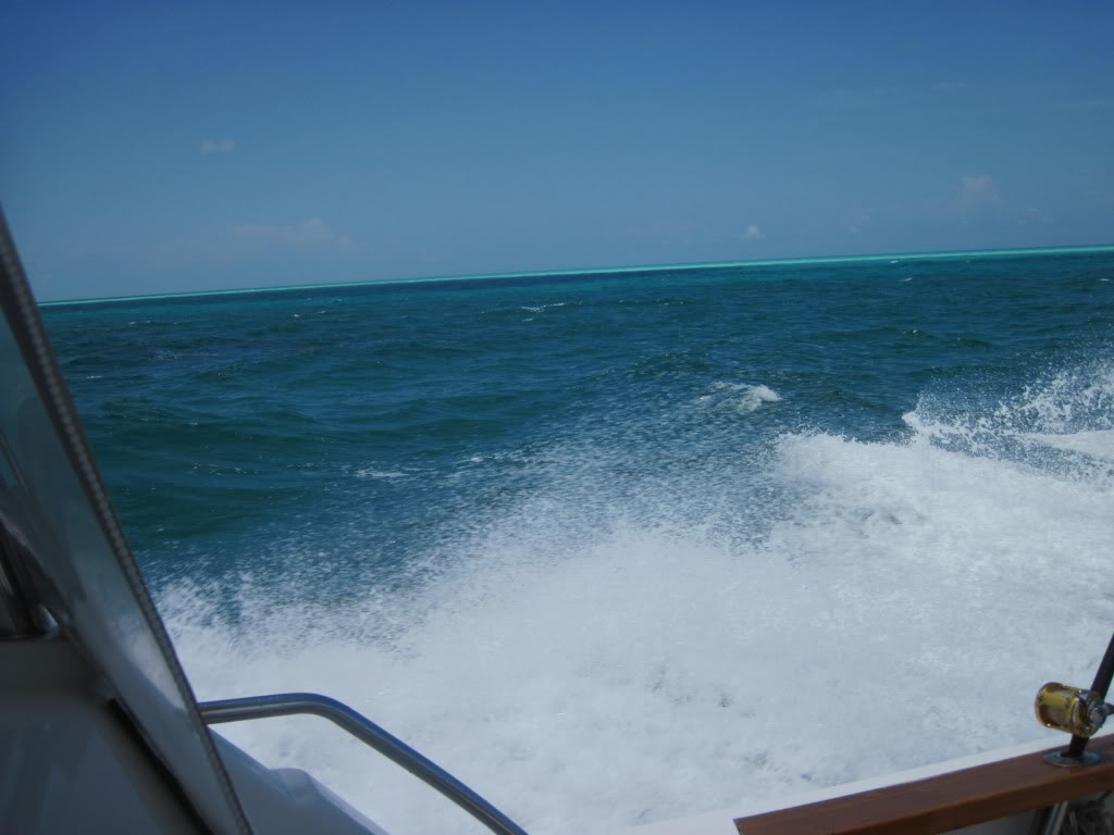
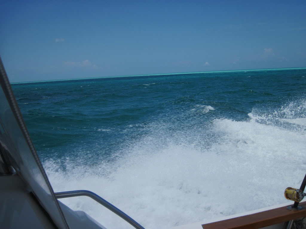
I'm a lightweight. I'm never out of sight of land, all I have to do is look around.
BaltimoreLurker is offline   Reply With Quote
Old 07-11-2012, 08:06 PM   #9
Guru
 
rwidman's Avatar
 
City: North Charleston, SC
Join Date: Sep 2010
Posts: 4,869
Quote:
Originally Posted by BaltimoreLurker View Post
I'm a lightweight. I'm never out of sight of land, all I have to do is look around.
But it all looks the same, 2 ft deep or 200 ft deep.
rwidman is offline   Reply With Quote
Old 07-11-2012, 08:16 PM   #10
Master and Commander
 
markpierce's Avatar
 
City: Vallejo CA
Vessel Name: Carquinez Coot
Vessel Model: penultimate Seahorse Marine Coot hull #6
Join Date: Sep 2010
Posts: 12,559
Quote:
Originally Posted by BaltimoreLurker View Post
I'm a lightweight. I'm never out of sight of land, all I have to do is look around.
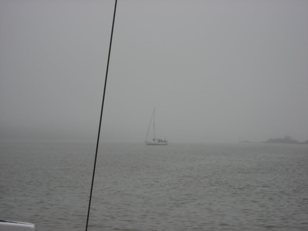
But what might be lurking out there?

__________________
Kar-KEEN-ez Koot
markpierce is offline   Reply With Quote
Old 07-11-2012, 08:19 PM   #11
Guru
 
Moonstruck's Avatar
 
City: Hailing Port: Charleston, SC
Vessel Name: Moonstruck
Vessel Model: Sabre 42 Hardtop Express
Join Date: Nov 2008
Posts: 8,276
Quote:
Originally Posted by rwidman View Post
But it all looks the same, 2 ft deep or 200 ft deep.
Well, not quite the same. If you will look at the light green section of water at the top edge, you will see where the depth transitions from about 1700' to about 12'.

__________________
Don on Moonstruck
Sabre 42 Hardtop Express
When cruising life is simpler, but on a grander scale (author unknown)
https://moonstruckblog.wordpress.com/
Moonstruck is offline   Reply With Quote
Old 07-11-2012, 08:52 PM   #12
Scraping Paint
 
City: -
Join Date: Oct 2007
Posts: 13,745
I liked the illustration Mark gave awhile back about how shoal water affects the spacing of the waves in a wake. Good tip.
Marin is offline   Reply With Quote
Old 07-12-2012, 05:40 AM   #13
FF
Guru
 
FF's Avatar
 
Join Date: Oct 2007
Posts: 22,553
fully integrated, state of the art


One fuse goes and its SEA TOW time!

Not till after the boat can happily be operated with no electrical system , is it toy time.
FF is offline   Reply With Quote
Old 07-12-2012, 09:43 AM   #14
Guru
 
rwidman's Avatar
 
City: North Charleston, SC
Join Date: Sep 2010
Posts: 4,869
Quote:
Originally Posted by FF View Post
fully integrated, state of the art


One fuse goes and its SEA TOW time!

Not till after the boat can happily be operated with no electrical system , is it toy time.
Nope, just carry spares of everything.
rwidman is offline   Reply With Quote
Old 07-12-2012, 09:44 AM   #15
Guru
 
rwidman's Avatar
 
City: North Charleston, SC
Join Date: Sep 2010
Posts: 4,869
Quote:
Originally Posted by Moonstruck View Post
Well, not quite the same. If you will look at the light green section of water at the top edge, you will see where the depth transitions from about 1700' to about 12'.

In some cases you can see the difference. In some, you cannot. In the dark, it's really difficult.
rwidman is offline   Reply With Quote
Old 07-12-2012, 10:10 AM   #16
Moderator Emeritus
 
ksanders's Avatar
 
City: SEWARD ALASKA
Vessel Name: DOS PECES
Vessel Model: BAYLINER 4788
Join Date: Feb 2011
Posts: 6,263
Quote:
Originally Posted by FF View Post
fully integrated, state of the art


One fuse goes and its SEA TOW time!

Not till after the boat can happily be operated with no electrical system , is it toy time.

Thats not necessarily true on a well designed, well built boat.

On my boat we have a main DC system which is a house battery bank that can be charged from three separate sources (150 amp inverter/charger, 40 amp charger, engine alternator.

We carry enough tools, supplies, etc... to even bypass the entire house bank if necessary.

From the DC main panel there are separate breakers for the port and starboard navigation system. From These feed sepaeate fuse panels for each system.

If you design your boats systems with fault tolerance in mind you can engineer out the single points of failure.

Back to the OP's question...

We did exactly what the OP is asking about. I'm a radio and electrical technician by trade, so I used those skills to design a fault tolerant system, with no thought of brand names, or costs.

It was only after that initial design was completed that I chose brand names and started piecing together my navigation package.

On our recent >1500NM inside passage voyage, one of the Furuno displays died. To us it was a non issue. We just went to split screen mode on the other display, and continued our voyage. We had a new display air freighted to my next major port to get back our redundancy. If we would been cruising locally we would have just sent the broken unit in for repair.

Now we have a spare display that I'll probably mount in the cockpit so that we can see the bottom while we're drift fishing.

The lesson here is that a component failure in a well designed system will not affect the voyage you're currently on. There are no ruined weekends because something quit working. There are no safety issues that suddenly come up. The voyage goes happily on.
ksanders is offline   Reply With Quote
Old 07-12-2012, 10:40 AM   #17
Guru
 
Phil Fill's Avatar
 
City: Everett Wa
Vessel Name: Eagle
Vessel Model: Roughwater 58 pilot house
Join Date: Oct 2007
Posts: 2,919
A lot depend your area and type of boating. Most long range boat have two of most things, and/you are not integrated, but each is independent of the other. The cheapest of course are bundles/integrated packages which many pleasure boat have. Furuno, Raymarine are the two oldest know that have the full package, radar, GPS, electronic charts, depth/fish finders, sonar, auto pilots, weather, ruder indicator. Others are Garmin, Lowrance, Standard, JRC that have most of the components. Furuno is the preferred with most commercial, and long range boats. Raymarine use to be Rayathone, is preferred with most pleasure and recently Garmin is comingon strong.

15 years ago Furno and Rayathone were the two that offered the components. We went with Rayathone as they were mfg in the US, well known, and had parts/service available in the PNW. Furuno was foreign made and did not have parts/service. Integrated/bundle package were not offered at that time, so the components are separate stand, which has pro and cons.

I am looking at purchasing a back up system to our 15 year olds electronics and will probable be a cheaper/bundled package, probable Raymaine to match the old electronics, with Fruno/Garmin second. However, if I was going to buy a new primary today, Furuno would be the first but still independant stand alone units. Since our radar has a 30 mile range, the new broad band radar with shorter range and better detail looks interesting, so the back radar up will probable be broad band.

Phil Fill is offline   Reply With Quote
Old 07-12-2012, 10:49 AM   #18
Moderator Emeritus
 
ksanders's Avatar
 
City: SEWARD ALASKA
Vessel Name: DOS PECES
Vessel Model: BAYLINER 4788
Join Date: Feb 2011
Posts: 6,263
Quote:
Originally Posted by Phil Fill View Post
A lot depend your area and type of boating. Most long range boat have two of most things, and/you are not integrated, but each is independent of the other. The cheapest of course are bundles/integrated packages which many pleasure boat have. Furuno, Raymarine are the two oldest know that have the full package, radar, GPS, electronic charts, depth/fish finders, sonar, auto pilots, weather, ruder indicator. Others are Garmin, Lowrance, Standard, JRC that have most of the components. Furuno is the preferred with most commercial, and long range boats. Raymarine use to be Rayathone, is preferred with most pleasure and recently Garmin is comingon strong.

15 years ago Furno and Rayathone were the two that offered the components. We went with Rayathone as they were mfg in the US, well known, and had parts/service available in the PNW. Furuno was foreign made and did not have parts/service. Integrated/bundle package were not offered at that time, so the components are separate stand, which has pro and cons.

I am looking at purchasing a back up system to our 15 year olds electronics and will probable be a cheaper/bundled package, probable Raymaine to match the old electronics, with Fruno/Garmin second. However, if I was going to buy a new primary today, Furuno would be the first but still independant stand alone units. Since our radar has a 30 mile range, the new broad band radar with shorter range and better detail looks interesting, so the back radar up will probable be broad band.
Hey Phil fill

Today, Furuno repairs all equipment at their Camas Washington facility. Thats also where you get technician support over the phone from. When my display died their tech went through a couple of hours on the phone trying to bring it back to life. that was great customer service, even though the unit was several years old.

You might re-think integration. That way you do not need space for quite so many displays. We run a 2 display network, and might add a third. The cool thing is that way we can put any data on any display. If a display dies, we just shift the data to a different display, or even split screen a display.

Prople get into trouble with integrated systems when they only buy one display. That display dies and all functions die with it. With a multi display system that is not the case.
ksanders is offline   Reply With Quote
Old 07-12-2012, 11:19 AM   #19
Guru
 
Aquabelle's Avatar
 
City: East Coast, Australia
Join Date: Jun 2012
Posts: 935
If starting with a 'blank page' today, the first decision is probably around whether to be PC/iThing based or MultiFunction Display (MFD) based. Only a couple of suppliers of core equipment bridge these two platforms (eg with Furuno, gear connects to an ethernet hub to which a laptop/PC running charting software can be connected...providing both redundancy and superior functionality). Garmin has picked up on the whole wireless and iThing phenomenon and this is now so robust it would have to be seriously considered.

Radar used to be compulsory for any serious cruising vessel. I think these days, there is an alternative if you are not boating in areas that are frequently fog-bound, and that is the FLIR-style thermal/low-light imaging camera (this would replace the traditional searchlight too). I'm not in a foggy area and if I were doing my electronics over, I'd put the radar/seachlight $$ towards one of these.

A DSC VHF radio...with gps connected or integrated.....should be regarded as essential/compulsory now.

AIS makes sense if you are boating amidst significant commercial traffic...but get a transponder, not just a receiver if you want to be safe.
Aquabelle is offline   Reply With Quote
Old 07-12-2012, 12:15 PM   #20
Master and Commander
 
markpierce's Avatar
 
City: Vallejo CA
Vessel Name: Carquinez Coot
Vessel Model: penultimate Seahorse Marine Coot hull #6
Join Date: Sep 2010
Posts: 12,559
Quote:
Originally Posted by Marin View Post
I liked the illustration Mark gave awhile back about how shoal water affects the spacing of the waves in a wake. Good tip.
Note change of angle of wake. The angle point demarks shallow versus deeper water. Probably caused by the difference in current or the effect of difference in water depth affecting wave characteristics. Most of the lower reaches of the Napa River are about 2 feet deep at MLLW tide compared to the natural channel between 10 and 20 feet.

__________________
Kar-KEEN-ez Koot
markpierce is offline   Reply With Quote
Reply

Tags
electronics, navigation

Thread Tools Search this Thread
Search this Thread:

Advanced Search
Display Modes

Posting Rules
You may not post new threads
You may not post replies
You may not post attachments
You may not edit your posts

BB code is On
Smilies are On
[IMG] code is On
HTML code is Off
Trackbacks are Off
Pingbacks are Off
Refbacks are Off


» Trawler Port Captains
Port Captains are TF volunteers who can serve as local guides or assist with local arrangements and information. Search below to locate Port Captains near your destination. To learn more about this program read here: TF Port Captain Program


All times are GMT -5. The time now is 04:10 AM.


Powered by vBulletin® Version 3.8.8 Beta 4
Copyright ©2000 - 2024, vBulletin Solutions, Inc.
Search Engine Optimization by vBSEO 3.6.0
Copyright 2006 - 2012