C-Map NT C-cards for British Columbia

The friendliest place on the web for anyone who enjoys boating.
If you have answers, please help by responding to the unanswered posts.

RCook

Guru
Commercial Member
Joined
Oct 6, 2007
Messages
841
Location
Poulsbo, WA
Vessel Name
Dream Catcher
Vessel Make
Nordic Tug 37-065
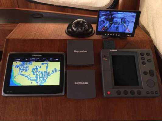
New-to-me 2002 Nordic Tug 37 has a Raymarine 631 chartplotter. I plan to use Coastal Explorer as primary chartplotter, but would like to have chart cards for the 631 as backup.

Currently have: NA-C801 Dixon Entrance to Icy Bay (covers SE Alaska). NA-C701 Olympia to Port Neville (also described on eBay as Olympia to Lasqueti Island). NA-C621.5 Puget Sound to Cracroft Island. Strange overlap...

Have seen on eBay NA-C705 Banks Island to Sumner Strait - which would not cover all of the north coast of BC, and yet goes up through a good part of SE AK.

I have not been able to find a chart card catalog which lists the C-Map NT or NT+ cards and what they cover. Does anyone know what NT or NT+ card(s) would cover BC from Port Neville up to Prince Rupert? Anyone have one lying around that they no longer need?

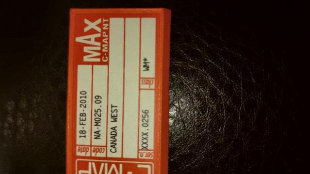
Does this work?
It's entire West Coast of BC

ForumRunner_20160515_191803.jpg
 
Some years ago I filled in some blanks at Captains Charts in Seattle. Fast and they burn them right there. We've got all of them from Mexico to Icy Strait. Call and they will ship. When I get to our vessel in a few days I will forward you missing info but I'd guess Captains could do same.

Congrats on NT.
 
Get hold of Jeppesen, they do the Cmap cards. I just updated my Standard Horizon. If I recall correctly, you get a year's subscription and they send the updates as they are published. They will tell you if they can help you.
 
Congratulations on your 37. To really enjoy the boat spend a few bucks and bite the bullet to an up grade. Raymarine A9 fits perfectly
No external gps antenna
Complete charts with unit
Super fast operation
Very intuitive operation
Nema connect to autopilot.
37-058
Escapade
ImageUploadedByTrawler Forum1463615724.372479.jpg
 
The NT+ cards are available through Jeppesen as noted above by Xsbank, I picked up 2 more cards a few months back to cover the blank spots on our trip. However, after using the $50 version Navionics app for the IPAD and another adapter cord to hdmi, we now use the iPad for primary and Raymarine for secondary.

Best of luck on your new boat, get out there and use it!
 
Best of luck on your new boat, get out there and use it!
Thanks! Sure plan to - heading north in ~ten days. This summer will be the 12th straight we've spent 2.5-3.5 months cruising the Inside Passage.
 
We're in Cortes Bay now, day 50 and another 130 or so to go. Maybe we will see ya up here.
 
Back
Top Bottom