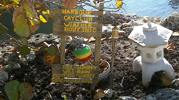
What do you use for weather?

The friendliest place on the web for anyone who enjoys boating.
If you have answers, please help by responding to the unanswered posts.
Several like NOAA, and the Canadian version. But for open water we use WindyTY.com
 
That's what the actress said to the archbishop. ?


Sent from my iPad using Trawler Forum
 
The NWS over the course of the summer changed all their Alaska websites with a less than stellar result. On the mobile web site (providing text forecasts for the bandwidth challenged), the NWS still refers to the forecast zones, e.g., PKZ036 is Clarence Strait, which matches the way the forecasts and weather is broadcast on VHF radio. The main web pages don't mention forecast zones or even refer to the name commonly used to talk about forecasts, again, using Clarence Strait as an example. Frankly, this smells like a nationwide standardization effort by NWS, designed by someone inside the beltway who has never had to worry about a marine forecast. The worst consequence of this effort was I lost access to the satellite image that told me the most about weather in Alaska. It's gone, where I don't know.

So to answer your question, I don't know at this point, because the NWS has broken what used to work pretty well and Sirius XM doesn't update reliably and the wind forecast is full of errors. I like Windyty, but when cruise ships are in during the summer, their isn't a lot of bandwidth left to retrieve it. That's why I am a big fan of text. If the NWS breaks that again (it was broken for about 3 weeks in the summer with the transition to the new websites), I am going to ask my Senators to send the money to someone else who understands the need.

Tom
 
I have found Windfinder to be fairly accurate 3-5 days out and darn good within 3 days.
 
Windyty is interesting, but how to you really know what the wind velocity is? The color coding is awkward at best. And there's no info on gusts.

I use it on my IPad, I tap on the location I'm looking for information, then follow the prompts for all the info you might want. Took me a little bit of time to figure it out, but it's my go to for offshore weather. Not too good for inside stuff.
Good luck.
 
Forgot, it will give you wind, wind direction and speed, wave height, direction,and time span between. Also swell, height , time span and direction.
 
Fishweather Wind forecast maps.
Weatherbug for lightning maps and weather radar.
NOAA marine coastal text forecasts for big picture synopsis and the same general info you get off VHF WX channels without having to wait.
NOAA Tides Online for real time tidal observations and predictions.
 
Near shore or inshore local TV will show a radar picture ,

Further offshore a short wave radio will output WEATHER FAX info to a computer.

This is great fun when in use as its always nice to know where the 15meter waves are in the winter .
 
The NWS over the course of the summer changed all their Alaska websites with a less than stellar result. On the mobile web site (providing text forecasts for the bandwidth challenged), the NWS still refers to the forecast zones, e.g., PKZ036 is Clarence Strait, which matches the way the forecasts and weather is broadcast on VHF radio. The main web pages don't mention forecast zones or even refer to the name commonly used to talk about forecasts, again, using Clarence Strait as an example. Frankly, this smells like a nationwide standardization effort by NWS, designed by someone inside the beltway who has never had to worry about a marine forecast. The worst consequence of this effort was I lost access to the satellite image that told me the most about weather in Alaska. It's gone, where I don't know.

So to answer your question, I don't know at this point, because the NWS has broken what used to work pretty well and Sirius XM doesn't update reliably and the wind forecast is full of errors. I like Windyty, but when cruise ships are in during the summer, their isn't a lot of bandwidth left to retrieve it. That's why I am a big fan of text. If the NWS breaks that again (it was broken for about 3 weeks in the summer with the transition to the new websites), I am going to ask my Senators to send the money to someone else who understands the need.

Tom
Tom and SE Alaska Cruisers:

We too were adversely affected by NWS website changes this summer. After submitting several emails complaining about the changes, NWS directed me to a new link that has a text based forecast for all SE inside, and another link for SE outside waters. The new format looks a lot like the old one. They are:

http://forecast.weather.gov/product...K&product=CWF&format=txt&version=1&glossary=0

And

http://forecast.weather.gov/product...G&product=CWF&format=txt&version=1&glossary=0

Alex
MvWildBlue.com
 
I used Windyty first time this summer where I had net access in SE Alaska and liked it.

Glen
 
Wifey B: We were looking at about half a dozen different forecasts earlier this evening for Lake Michigan. You could easily tell those pulling from NOAA and a couple of others were very close to each other. But what we figured out is that most probably we can expect 3' to 10' with perhaps some up to 13' tomorrow. We had 3-4', 6-10', 7-10'. We'll see what it's really like when we get up tomorrow morning. I've seen hurricane forecasts way different, but not such a hodgepodge of waves and seas. I'm guessing it's a Lake Michigan thing. :ermm:
 
Windyty is interesting, but how to you really know what the wind velocity is? The color coding is awkward at best. And there's no info on gusts.

In South East Alaska, Windy works well enough to trust it. Yes, in the confines of the narrow inlets there is a lack of indications, however, common sense applied to the direction, velocity color, gust intensity have proven in my use, very close.
We use Windy and the North Coast B.C. North Coast East Dixon Entrence Canada marine forecast with full faith.

Al-Ketchikan
 
The weather channel on my i-pad and several channels on my VHF.
 
my own, trained knees.. 100% accurate for rain or wind from west... ;)

PD: good just for local weather...
 
Last edited:
Being new to the East Coast and living aboard, We've found Sailflow to be most accurate. They nailed it with Mathew.
 
I used Windyty first time this summer where I had net access in SE Alaska and liked it.

Glen


I just d/l'ed this app the other day and it's fantastic! Haven't yet used it in conjunction with going out on the boat, but it certainly looks great for instant visualisation of wind vs map. I can see myself using this app a lot for searching out suitable anchorages.
 
Not failed yet!.
 

Attachments

  • IMG_20170403_165954.jpg
    IMG_20170403_165954.jpg
    196.9 KB · Views: 107
Last edited:
Back
Top Bottom