As always the headlines are to get attention. Right now, Accuweather's is "Tropical Storm Erika to Lash Florida After Delivering Deadly Blow to Caribbean". Yet if you read the article it's filled with "if" and "could" and "should". I like weather.com's headline better. It's simply "TRACKING ERIKA: The Storm Could Change in the Coming Hours" Now that sums it up pretty much as I don't know.
You are using an out of date browser. It may not display this or other websites correctly.
You should upgrade or use an alternative browser.
You should upgrade or use an alternative browser.
Tropical Storm Erika
- Thread starter jwnall
- Start date
The friendliest place on the web for anyone who enjoys boating.
If you have answers, please help by responding to the unanswered posts.
If you have answers, please help by responding to the unanswered posts.
OP
OP
jwnall
Moderator Emeritus
Chris Parker mentioned that possibility or at least a TD. I hope it goes that way.
It could very well fizzle out, and certainly the indicators are pointing in that direction right now. Let us most fervently hope that it does! However, the fat lady has not as yet sang, so we shall see.
Edit:
And coincidentally, my SO has just informed me that she wants to watch "The Perfect Storm" tonight. Not because she cares squat about Erika, but because she lusts after George Clooney. Go figure.
Last edited:
Gulf Comanche
Guru
- Joined
- Dec 16, 2007
- Messages
- 1,045
- Location
- U.S.A.
- Vessel Name
- Old School
- Vessel Make
- 38' Trawler custom built by Hike Metal Products
Last paragraph in most recent NOAA storm discussion:
Although this would normally be an appropriate time for a tropical
storm watch for portions of southern Florida, following typical
timelines, we have elected to wait until we see what's left of
Erika after it passes Hispaniola. There is a significant chance
that no watches or warnings for Florida will be required.
Sounds good, then I remember Andrew moving across Florida into the Gulf and tearing Baton Rouge a new one in '92.
Here's the 5 pm projected path and what the various models say. A TS to a TD, back to a TS and then a TD. Looks like lots of rain to me. ")
edit: The model run was at 5 pm but they were run at 2 pm.
edit: The model run was at 5 pm but they were run at 2 pm.
Attachments
![210014W5_NL_sm[1].gif](/data/attachments/40/40544-956c2cb976acdfddc55804e3d55fa2b9.jpg)
![at201505_model[1].gif](/data/attachments/40/40545-a23afe82bed0ec066e1e0d146be50718.jpg)
Last edited:
N4712
Guru
- Joined
- Apr 22, 2013
- Messages
- 3,607
- Location
- U.S.A
- Vessel Name
- Oliver
- Vessel Make
- Nordhavn 47 Hull# 12
Wifey B: You can plan it...figured you'd be out in your dusky.
Right now it's 89 degrees and sunny. We're just getting back from West Palm. Couldn't let a good day go to waste.
Rofl! Think I'll stick to dry land over the dusky! But may sit it out in the boat because of we loose power in leaving anyways. No AC doesn't work for me.
Deckape
Senior Member
New river was very busy today with large yacths going to safe harbour. Marina bay is FULL as well as all the other up river marinas. Looks like rain and squalls late Saturday thru Sunday. Will remove all canvas and tie across the canal by late Saturday. Be safe and let's look to the east.
stubones99
Guru
The water rose over 4' in some places due to central florida draining their water catchment basins into the Indian River. After Hurricane Charley, they lowered their standing water table and put the load on Brevard County residents. Many of them found that their docks had been built assuming that the posts would always have weight on them, and once the water rose to the dock planking, the docks started to float away. Many lost docks or had major repair as a result of the flooding. The harbor in Melbourne was under water, 4+ inches over the docks, and since fenders float, that caused even more damage to boats that rubbed against the pilings or submerged docks in the storm. Having Hurricanes Jean and Francis within a week or so also made the matters worse for all those with boats.
siestakey
Guru
- Joined
- Jul 7, 2013
- Messages
- 1,815
- Location
- USA
- Vessel Name
- Steppin Stone IV
- Vessel Make
- Marine Trader Kelly Trawler 46
I thought we were getting a break over here on the Gulf side of FL.., but who knows now. I've got Tide Minders on pilings that will take care of surges up to maybe 5 ft. And if it's anything beyond that, I'll throw out the anchors and stay aboard.
Larry
Hush see what you did!
Tropical Storm ERIKA
FF
Guru
- Joined
- Oct 12, 2007
- Messages
- 22,552
So far the winds are 50MPh, a lot less than a good thunderstorm.
BIG Rain in FL? wow !!! what an unusual happening.
Its a slow news summer , so a rain shower is big news.
BIG Rain in FL? wow !!! what an unusual happening.
Its a slow news summer , so a rain shower is big news.
![115808W5_NL_sm[1].gif](/data/attachments/40/40547-593065be647090eec93fa7bc562c5566.jpg)
OP
OP
jwnall
Moderator Emeritus
Peter Ray's posting for the morning of Saturday, 8/29/15
Friends, Erika is coming. The peninsula of Florida will only get some squalls and the east cost of Florida and the USA - nothing.
FORECAST: Tropical Storm (TS) Erika is just off the southeastern tip of Cuba moving NW at 20 mph. Maximum wind winds are 40 mph. As TS Erika moves through Cuba it will weaken into a tropical depression, and the Lower Florida Keys should be prepared for a storm that is with msw of about 40 mph and gusts up to 60 mph and rough seas. Then entering the warm Gulf, Erica will strengthen to a Tropical Storm and might even get to a Category 1 hurricane. The Big Bend area (including Cedar Key and South of Tallahassee should be prepared for a storm surge, magnitude of which will depend in part on the timing relative to the tides. At this point as Erika moves up the coast, landfall looks to be along the Gulf Coast. Probably Sunday afternoon or night I will know where. Just have to wait for it to clear Cuba. Again, its exact path will depend in part on its strength.
DISCUSSION: Cuba will really be hard on Erika as it is on all storms because of the central mountains. But the Gulf waters are near their maximum temperature and most hospitable. Erika is barely a TS now, and actually probably really is a Tropical depression. All depends on whether anything survives Cuba. The forecast is based on the assumption that Cuba does not "wipe out" Erika.
If you have coastal relatives along the Panhandle, and want to be cautious, I would take care of them. As mentioned, if Erika goes that far west, it could become a hurricane. I will know that tomorrow in the afternoon, and that would give you 4 days notice. Rain and some gusts is in Tallahassee's forecast for Wednesday. Will NOT interfere with the first FSU game.
NEXT FORECAST: THIS EVENING, Saturday night, Then Sunday Morning and as often
as new data is available as Erika approaches land.
Peter Ray
Steve
Guru
Looks like it is headed for Apalachicola / Carrabelle with St Marks on the "bad" side. Lots of rain, winds forecast not to be too strong. Arrival Wed.
Still lots of time for change in direction or force.
Take care
Still lots of time for change in direction or force.
Take care
OP
OP
jwnall
Moderator Emeritus
Looks like it is headed for Apalachicola / Carrabelle with St Marks on the "bad" side. Lots of rain, winds forecast not to be too strong. Arrival Wed.
Still lots of time for change in direction or force.
Take care
Yup. I'm hoping that Cuba will kill it, but if it does not, then it will probably get into the warm waters of the Gulf and strengthen. Still too early to tell, but I suspect that you are right on the money as to where it is headed if it survives Cuba.
siestakey
Guru
- Joined
- Jul 7, 2013
- Messages
- 1,815
- Location
- USA
- Vessel Name
- Steppin Stone IV
- Vessel Make
- Marine Trader Kelly Trawler 46
Yup. I'm hoping that Cuba will kill it, but if it does not, then it will probably get into the warm waters of the Gulf and strengthen. Still too early to tell, but I suspect that you are right on the money as to where it is headed if it survives Cuba.
Agree we are leaving Thomasville right above you and headed for the boat in Sarasota in a hour
We spent last weekend at st. George Island near apalachicola and some of the beach are sure small and close to the houses on the plantation
Tropical rainstorm
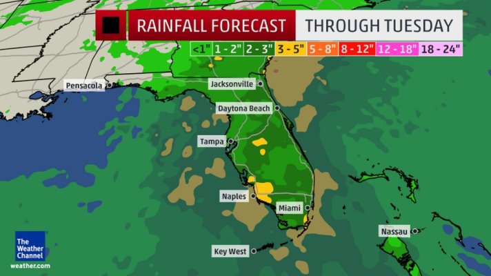
That's all it is now. For us in South Florida, just another day. 25 mph winds with gusts to 32. A half inch of rain during the day tomorrow, another half tomorrow night. Yes, we prepared for worse, but it's also another example of why the fear others have of hurricanes in South Florida is far greater than the fear those of us who live here have. Seas 4-6' tomorrow and back to 2' by Tuesday.
As to Peter Ray, I'd never heard of him before and wondering why his predictions of note? I did google him. Is this the same Peter Ray who was accused (not to my knowledge ever convicted) of all the sexual harassment at FSU from 1996 to 2002?
I'm just curious as I'd never heard of him or followed him before.
Attachments
OP
OP
jwnall
Moderator Emeritus
As to Peter Ray, I'd never heard of him before and wondering why his predictions of note? I did google him.
I'm just curious as I'd never heard of him or followed him before.
Peter Ray is an FSU meteorologist who kind of specializes in hurricanes. I don't know that his predictions are any better or any worse than anyone else, but he is always more specific about what is coming to my area (since he lives here also). And so I am on his mailing list, and just post his predictions here for whatever they may be worth. IMO, no one should rely upon just one source of information, however -- better to use several sources. I religiously check the National Hurricane Center website twice a day during the hurricane season, and consider them the best source of information. But, as I said, Peter Ray is more specific to my area, and so I get his newsletter also.
Last edited:
Erika dissipated at 9:30 am. Yahoo!
OP
OP