Tidal analysis using spreadsheets

The friendliest place on the web for anyone who enjoys boating.
If you have answers, please help by responding to the unanswered posts.

JDCAVE

Guru
Joined
Apr 3, 2011
Messages
2,905
Location
Canada
Vessel Name
Phoenix Hunter
Vessel Make
Kadey Krogen 42 (1985)
Have any of the physicists on the forum taken the time to develop a tidal algorithm using information from reference and secondary ports?

This is what I am asking about:

"R. de Levie, Tidal analysis on a spreadsheet, Am. J. Phys. 72 (2004) 644-651.

Abstract available here:
Tidal analysis on a spreadsheet - ResearchGate


Jim
Sent from my iPad using Trawler Forum
 
I've got AyeTides on the iPad and another program embedded in the Coastal Explorer. It's just the modeller in me that wants to explore my own models. I've since found the above "NZ" site that gets me close but I want more functionality and to make it more user friendly.

The physicist I used to work with did some pretty whizzy modelling of time series data including river heights, tidal cycles and fish flux dynamics, using "Fast Fourier Transforms". But that's a bit beyond a spread sheet tool.


Jim
Sent from my iPad using Trawler Forum
 
Dang, I read that first sentence on the first link and realized it's way beyond my simple minded little brain.

I'll stick with the tide tables or what I have on my phone.
 
It's beyond my simple pea brain too. However, I managed to get the calculator working fine, but it's "brute strength" and isn't smart. I'd like it to react and update with changing inflection points (High low tides) and changing times. I'm surprised there aren't spread sheet templates on the internet for these calculations.


Jim
Sent from my iPad using Trawler Forum
 
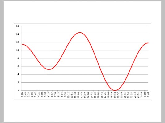
Forgot the graph...
ImageUploadedByTrawler Forum1427160963.483908.jpg


Jim
Sent from my iPad using Trawler Forum
 
What's the point?

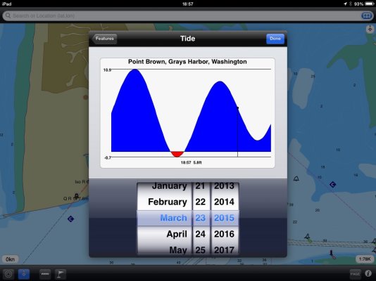
Good question. Aside from the desire to do something oneself just for the challenge, it seems a lot of work just to get to the same place I can get to on my iPad with a couple of screen taps and then slide the timeline to see what the tide will be at any point during the 24 hour period.
 

Attachments

  • image.jpg
    image.jpg
    114.9 KB · Views: 71
What's the point?

Good question. Aside from the desire to do something oneself just for the challenge, it seems a lot of work just to get to the same place I can get to on my iPad with a couple of screen taps and then slide the timeline to see what the tide will be at any point during the 24 hour period.

Because I wanted to. I felt the learning experience was worth it. Sure, I have 3rd party software as well, but I wanted a tool to explore the CHS Canadian Tide and Current Tables in more detail and I was unable to find a spreadsheet template for this purpose on the internet. Also, I have a sense that the 3rd party software may use Alaskan tidal stations for reference to predict Central Area Tides and Currents, rather than the CHS reference stations.

I now have a working model that is robust to changes in inputs. No, I didn't use anything fancy such as rigorous time series analysis. Such an analysis is only useful with large historical time series (50-100 years of tidal records). So I developed a simple model for a single day, using the daily tide tables published by CHS.

The model:
h = h1 + (h2 - h1)[(cosA + 1)/2],
where A = π([(t - t1)/(t2 - t1)] + 1) radians
(Australian Hydrographic Service).
h1 = height from tide table at time t1
h2 = height from tide table at time t2
h...hn = incremental height at time t....tn (to be calculated between h1 and h2)

The model can also be used for currents by substituting tidal height with current in knots (+/-). The prediction model for currents shows some bias in estimates of “time of slack water”, with deviation of +/- 2-15 minutes, with increasing bias with increased time interval between peak current. This is probably due to the model’s inability to capture the correct asymmetry inherent in CHS predictions. The prediction model for tidal height appears to be reasonable for most purposes.

Jim
 
In many places the tidal predictions based on astronomy are sufficiently altered by environmental conditions ....fiddling too much with predictions might be a nice hobby...but useless for navigational purposes.

The predictions will give a ballpark and that's as good as it will get.

Some places with large tides and currents may be a better area for tweaking.
 

Latest posts

Back
Top Bottom