Punta Gorda Seawalls

The friendliest place on the web for anyone who enjoys boating.
If you have answers, please help by responding to the unanswered posts.
..
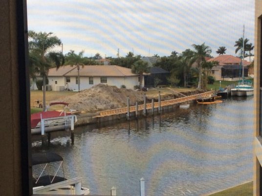
It was the extreme low water that exacerbated the problem in Irma. The high winds pushed all the water off shore and the canals went virtually dry which removed the pressure of the water that holds the seawall in place at the bottom. When the older seawalls were installed they not were required to be driven as deep as the newer ones are.

Many of the canals were at the lowest water level remembered and you could walk out on the harbor in front of my condo for several hundred feet and not step in water.

My uncle lives on a small river near Jacksonville. Decades ago he bought swamp land, literally, and built a pole house along the river which has higher land. Think of the NC beach houses built on stilts. He has a three story house but the ground level structure is minimal, basically stairs and utility room to get the the second floor. The second floor is well off the ground. Irma pushed water up the river and flooded out his first floor, which was expected, but the water was so high it got into the second floor of the house.

I saw photos/video of the flooding in his area and since most of the houses were not pole construction, houses were flooded to the roof lines. At least some of his house was above water.

Unreal that Irma was sucking water out of some areas and pushing huge amounts of water hundreds of miles away. Scary power that is. :hide:

Later,
Dan
 
Why are so many people trying to come here and not Cuba or North Korea?
pretty low bar comparison there

There are fewer and fewer countries where people are desperate enough to come here.

In the developed world we're more and more a sad joke, and way we're heading the bottom 70% of our citizens have a much lower standard of living than in the rest of the world, even places we used to call third world.

Everyone now knows our system does not look out for the interests of the common people, only the wealthy.

Many don't even have an interest in visiting as tourists anymore our police-state border processes are now downright hostile.
 
John61

Not to get into a pissing contest but I believe you are wrong. I have traveled extensively and compared to most of the world we have very few “poor” people.
 
Only sort of. They dont pay federal income taxes. An important difference when asking for federal money.

While many don't pay federal income tax, some folks do. When I was a federal investigator stationed in PR, I paid federal taxes. All Puerto Ricans also pay social security taxes and medicare taxes.

Puerto Ricans also have served in the U.S. military for more than 100 years. My father-in-law, for example, is a partially disabled Korean War veteran.

Folks living in PR, do not get to vote in the Presidental elections not do they have any voting representatives in Congress.

For folks who may not be aware of Puerto Rico's role in U.S. history, the island was a colony of Spain, claimed by Columbus in 1493. In 1897, Spain ceded political and administrative autonomy to the island (although the Governor was still appointed by Spain). In 1898, the short Spanish-American war happened and under the treaty of Paris, Puerto Rico was ceded to the United States, in spite of the autonomy granted the year before. In 1917, all Puerto Ricans became U.S. citizens, just in time to be drafted for WWI.

It's pretty dire times for Puerto Rico. Many of the folks who can leave the island are leaving, and may never return.

Jim
 
pretty low bar comparison there

There are fewer and fewer countries where people are desperate enough to come here.

In the developed world we're more and more a sad joke, and way we're heading the bottom 70% of our citizens have a much lower standard of living than in the rest of the world, even places we used to call third world.

Everyone now knows our system does not look out for the interests of the common people, only the wealthy.

Many don't even have an interest in visiting as tourists anymore our police-state border processes are now downright hostile.

Well John, since you don't talk about your (non) boat, maybe you could enlighten us on all the foreign travels you've done. Remember, the "wealthy" class you disparage are all too often the boat owners to whom you provide battery guidance.
 
I've lived 85% of my adult life overseas, more than half of that in what you would call third world conditions, 12V electric only, no indoor plumbing, often no running water, average family cash income under $400 a month.

Many such communities had a much higher quality of life than the average American, certainly their middle classes getting over $1000 a month did.
 
Only sort of. They dont pay federal income taxes. An important difference when asking for federal money.

Apparently PR is the new haven for the new crypto currency millionaires. Favorable tax status, cheap land after the Maria Hurricane..
 
Unreal that Irma was sucking water out of some areas and pushing huge amounts of water hundreds of miles away. Scary power that is. :hide:
Dan

This i how it works:

Charlotte Harbor, the body of water that surrounds the west side of Punta Gorda, is about 25 miles long and about 5 miles wide at the northern end near PG. This is very similar to Pamlico Sound in NC where we used to live.

When a hurricane passes to the west of Charlotte Harbor, the counter clockwise wind pushes the water up the harbor and floods the north end where PG is located. That is where Irma was originally forecast to go. But IRMA actually went to the east of Charlotte Harbor and those counter clockwise winds pushed the water south and drained all of the canals in PG. Residents here tell me that after it went way down it came back up about four feet above normal levels as the eye passed and the wind direction changed.

Punta Gorda was lucky that Irma took the track it did. If it went west as originally forecast then you could have seen a ten foot surge in PG which would have flooded most homes in Punta Gorda Isles. That is why we just bought a second floor condo unit with hurricane impact glass on all windows.

This phenomenon is true for all long and narrow bodies of water anywhere in the world.

Oh and BTW we pay taxes to a city taxing district to cover the canal wall repairs. I doubt those taxes are sufficient though and I suspect that authority is borrowing money for the repairs.

David
 
I've lived 85% of my adult life overseas, more than half of that in what you would call third world conditions, 12V electric only, no indoor plumbing, often no running water, average family cash income under $400 a month.

Many such communities had a much higher quality of life than the average American, certainly their middle classes getting over $1000 a month did.

John; you have described both my first cruising boat and my last trip to a "dorm" in the mountains of N. Vietnam. I just read where the avg income there is close to $150/mo. I'm not in great position to determine quality of life over a couple week business trip, but it seemed to be OK. In the center of my nearest big city in NY, that OK vib would not be true.
 
Come on folks let’s stayed focused here. We’ve had couple complaints plus a few posts have been deleted. Your call.
 
I've lived 85% of my adult life overseas, more than half of that in what you would call third world conditions, 12V electric only, no indoor plumbing, often no running water, average family cash income under $400 a month.

Many such communities had a much higher quality of life than the average American, certainly their middle classes getting over $1000 a month did.

What countries were these 85%?
 
I have watched the crews rebuilding the sea walls about 200 yards from our condo's lanai in Punta Gorda Isles for the last week or so, and thought I would give you a report on their progress. Long and probably nerdy, so forgive me.

The rig that does the work is a big barge, a big crane and a washout pump. The crew cuts the top cap with a diamond saw at the beginning of the damaged section and then uses a clam shell bucket to pull out each damaged panel which is about 10-12' long by 5' wide. After the panel is out they use the bucket to dig a trench about 4-6' deep behind the former panel.

Then they drop a new panel in place and use a big washout pump to get the panel down another 4-5' into the canal bottom. All of this has been quite time consuming and so far they have averaged about 15 linear feet of panels a day. All of this equipment and a crew of 4-5 is expensive and that is why it costs so much.

Then they put tie back anchors into the soil behind the panels and weld re bar pieces from the anchors to the panel. They haven't gotten to this point yet, but they will back fill behind the panels and then form and pour the top cap that ties it all together.

A couple of observations:

This section of sea wall failed when the Irma soaked soil pushed the tops of the panels into the canal that was almost empty of water due to Irma's winds. One thing that may have helped cause the failure or actually caused it was that some of the existing tied back rods were corroded through. I can see the corroded ends sticking out of the soil in the back of the trench.

But another section of panels on my side of the canal failed when the soaked soil pushed the bottoms of the panels into the canal and the top was held in place by the tie backs.

So, these new panels can also fail in 30-40 years when their rebar tie backs corrode and another Irma comes through. Why don't they also tie back the bottom of the panels. This would take more work certainly but probably less than 10% of the whole job now.

Also why don't they use better material for the tie backs. Interestingly the section of canal that failed from the bottom has different looking tie backs that are fine and held the top in place. Why not use that style?

And finally why replace the existing panels that are 100% still good? Only the top cap has cracked and failed. They could just jack hammer out the cap, dig out the back side and replace the tie backs top and bottom, use the tie backs to pull the panels up straight again, backfill and form and pour a new cap. That would cost a lot less than the current total replacement as it would only take a small backhoe to dig out the backside, a crew of maybe three and no big crane and wash pump.

But bureaucracy being what it is .....

David
 
David are the new panels longer than the old ones? There was talk that the new panels would go deeper into the ground.
 
No the new panels are approximately the same length as the old and if anything maybe a foot shorter.

But it really doesn't matter. The tie backs hold them in place and the concrete poured top cap keeps them in line. They would have to be sunk twice as deep for it to make any difference in side bearing capability and even then they probably wouldn't resist any better than the tie backs do now.

Like I said those rebar tie backs will eventually fail again though just like the old ones did.

David
 
Epoxy coated rebar would help a lot for longevity.
 
This i how it works:

Charlotte Harbor, the body of water that surrounds the west side of Punta Gorda, is about 25 miles long and about 5 miles wide at the northern end near PG. This is very similar to Pamlico Sound in NC where we used to live.

When a hurricane passes to the west of Charlotte Harbor, the counter clockwise wind pushes the water up the harbor and floods the north end where PG is located. That is where Irma was originally forecast to go. But IRMA actually went to the east of Charlotte Harbor and those counter clockwise winds pushed the water south and drained all of the canals in PG. Residents here tell me that after it went way down it came back up about four feet above normal levels as the eye passed and the wind direction changed.

Punta Gorda was lucky that Irma took the track it did. If it went west as originally forecast then you could have seen a ten foot surge in PG which would have flooded most homes in Punta Gorda Isles. That is why we just bought a second floor condo unit with hurricane impact glass on all windows.

This phenomenon is true for all long and narrow bodies of water anywhere in the world.

Oh and BTW we pay taxes to a city taxing district to cover the canal wall repairs. I doubt those taxes are sufficient though and I suspect that authority is borrowing money for the repairs.

David

Hello David,
We were looking in the same area with the same concerns. We set a limit (just our personal goal) of being able to survive a Cat 3 or less but could not figure out how anywhere in Punta Gorda would be OK. It did not look like sea walls would make much difference with that amount of surge.
 
Deano:

The rebar is green colored. Is that epoxy coated?

Smitty:

I totally concur. That is why we picked a second floor condo unit built in 2004 with hurricane impact glass. Most homes in PGI have a ground floor elevation of 8-9' above MSL. As Irma approached the forecast at one time was for PG to get a 10-11' surge which would have flooded almost every ground level home in PGI. Fortunately the storm changed course and PGI got water blown out not in.

Sea walls don't help with storm surge. The tops are only about 3-4' above MSL and the roads are at maybe 6-7' elevation. Lots of ways for water to get into the interior of PGI once the level gets to 8'.

As an aside, we are considering moving here permanently in a few years and my wife wants a house not a condo. I don't see how to be able to survive your Cat 3 storm (with the right/or wrong) track unless you had a floor elevation of 11'+. You would have to build new to get that and as far as I have seen a new house will cost at least $100K more than an existing one.

David

Yes - that is what we discovered as well. Between the chance of storms hitting that area and the results that are likely to happen it is hard to find a reasonable place that would fit the goal.
 
Hello David,
We were looking in the same area with the same concerns. We set a limit (just our personal goal) of being able to survive a Cat 3 or less but could not figure out how anywhere in Punta Gorda would be OK. It did not look like sea walls would make much difference with that amount of surge.

I would suggest looking at these storm surge maps.

http://noaa.maps.arcgis.com/apps/MapSeries/index.html?appid=d9ed7904dbec441a9c4dd7b277935fad&entry=1

And the FEMA Flood Zone maps:

https://msc.fema.gov/portal/search?AddressQuery=punta gorda, fl#searchresultsanchor

11' sounds beyond a CAT3 in most areas. However, you can check. The damage from IRMA in that area wasn't the inflow as much as the outflow. Other areas encountered different.

Doing research, you might be surprised that some areas you'd think would be at great risk are only at moderate and areas you might think would be moderate are at great risk even from smaller storms.


Yup - I believe we got these links from you a couple of years back.
They are easy to use and supply good information.
 
Yup - I believe we got these links from you a couple of years back.
They are easy to use and supply good information.

Our home changed zones about the time we bought it. The cost of flood insurance dropped dramatically. We're just off the ICW and above the 100 year flood zone. As to an outflow like some got from Irma, I'd say extremely low probability for us but guess it is possible. We are 3 miles and a lot of bends and turns from an inlet.
 
That NOAA storm surge prediction map is very hard to use, at least for Punta Gorda. It lists the storm surge height above ground, not the height above MSL. But looking at a large area that I know is about 2' above MSL, the PG nature park, it looks like a Cat 2 could drive the surge to 11'+ above MSL in the Punta Gorda Isles area. The chart shows nothing less than 3' above ground in all of PGI in a Cat 2 storm.

But it all depends on wind strength (the Cat value), the storm track and duration. The NOAA chart doesn't correct for the later two values, but from the values I see, I suspect it is worse case.

David
 
Our home changed zones about the time we bought it. The cost of flood insurance dropped dramatically. We're just off the ICW and above the 100 year flood zone. As to an outflow like some got from Irma, I'd say extremely low probability for us but guess it is possible. We are 3 miles and a lot of bends and turns from an inlet.

We are several miles from a narrow pass and our canal emptied to mud. The narrow spots must have been roaring rapids when the canals drained and refilled.
 
That NOAA storm surge prediction map is very hard to use, at least for Punta Gorda. It lists the storm surge height above ground, not the height above MSL. But looking at a large area that I know is about 2' above MSL, the PG nature park, it looks like a Cat 2 could drive the surge to 11'+ above MSL in the Punta Gorda Isles area. The chart shows nothing less than 3' above ground in all of PGI in a Cat 2 storm.

But it all depends on wind strength (the Cat value), the storm track and duration. The NOAA chart doesn't correct for the later two values, but from the values I see, I suspect it is worse case.

David

It is designed to be worst case. Ours is less than 3' for CAT 4 and 3-6' for CAT 5 and that is consistent with FEMA's 100 year flood data and everything historical I've been able to gather.
 
That NOAA storm surge prediction map is very hard to use, at least for Punta Gorda. It lists the storm surge height above ground, not the height above MSL. But looking at a large area that I know is about 2' above MSL, the PG nature park, it looks like a Cat 2 could drive the surge to 11'+ above MSL in the Punta Gorda Isles area. The chart shows nothing less than 3' above ground in all of PGI in a Cat 2 storm.

But it all depends on wind strength (the Cat value), the storm track and duration. The NOAA chart doesn't correct for the later two values, but from the values I see, I suspect it is worse case.

David

I believe above ground is the same as above MHSL with this tool....
This is a cut and paste of the very long and detailed description under the key area where it says "How this map works"

Storm surge is defined as the abnormal rise of water generated by a storm, over and above the predicted astronomical tides. Flooding from storm surge depends on many factors, such as the track, intensity, size, and forward speed of the hurricane and the characteristics of the coastline where it comes ashore or passes nearby. For planning purposes, the NHC uses a representative sample of hypothetical storms to estimate the near worst–case scenario of flooding for each hurricane category.
 
I thought using only king piles, deadmen and iron tiebacks went obsolete for high end seawalls years ago.
Backyard pools and rusted ties made it so. Much better to use batter piles and stronger caps than what they did in the 50’s.
 
Here is a progress report and pic of the seawall repair being done right across from our condo in Punta Gorda:

It took the crew three weeks to get all of the old concrete panels out and replaced with new ones. They tied the new ones back with green, epoxy coated rebar, but did nothing to mitigate the seawall collapsing from the bottom outward as happened in other sections of damaged seawall.

They stopped work on this area for 3-4 days after that and then started the form work late last week. These forms were built from scratch from lumber and I hope that they will reuse some of them. It took them about a week to form it up. I don't see why they don't use fabricated custom metal forms as they have many thousands of feet to go.

Then yesterday they poured concrete to form the cap. This was a fairly efficient job. It took only one concrete truck and a trailer pumper which pumped concrete into the forms. I don't know what they will do when they are working in back of a house or condo. Maybe they will use a long hose from the street or lots of wheelbarrow trips. The cap looks deeper and wider than the original which should give it more resistance to spot cave ins.

So today they pulled the barge and crane away. I presume that they will use equipment from the shore to backfill once the forms are stripped. Or maybe the crane will return and do it.

They did pull out one section of concrete owner dock and about a dozen wooden piles associated with the dock. I suspect it will be the owner's responsibility to replace this dock even though it wasn't damaged in the storm.

David
 

Attachments

  • PG condo seawall repair progress.jpg
    PG condo seawall repair progress.jpg
    127.1 KB · Views: 60
Last edited:
We are buying a house in Punta Gorda I'm trying to find out if Punta Gorda maintains all seawalls, if not how do I find out which areas they do maintaine?
Thank you
 
Back
Top Bottom