Pdxstriper
Veteran Member
- Joined
- Nov 27, 2019
- Messages
- 99
- Location
- United States
- Vessel Name
- Hot Tuna
- Vessel Make
- 2002 American Tug 23 #24
Hi,
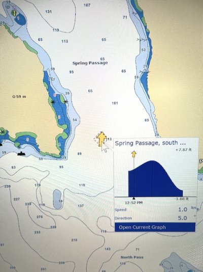
Below is a screen shot showing Arrows indicating Current flow thru passes. I used this feature on Nobletec 10+ years ago. I could 'play' the time forward to, for instance, see what direction and magnitude at some point in the future (ie the arrows got bigger for times of greater flow, reduced in size for less flow) . Very useful.
So my question... I am shopping for new PC-based nav software. Wondering which other packages have this feature. This screen shot is from OpenCPN so it obviously does. I hear great things about Coastal Explorer. Does CE have such a feature? Others?
Thanks,
Pete