Forkliftt
Guru
- Joined
- Oct 6, 2007
- Messages
- 2,450
- Location
- USA
- Vessel Name
- KnotDoneYet
- Vessel Make
- 1983 42' Present Sundeck
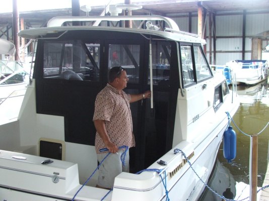
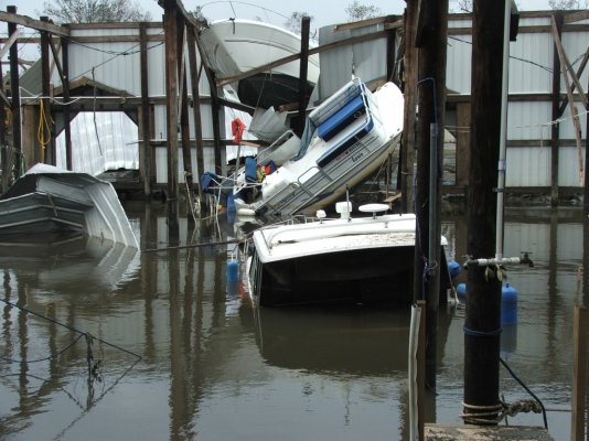
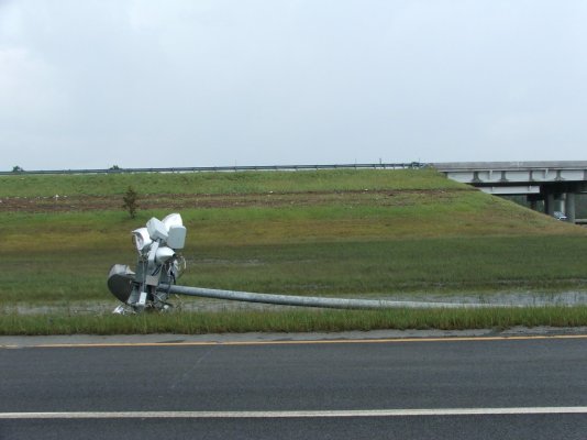
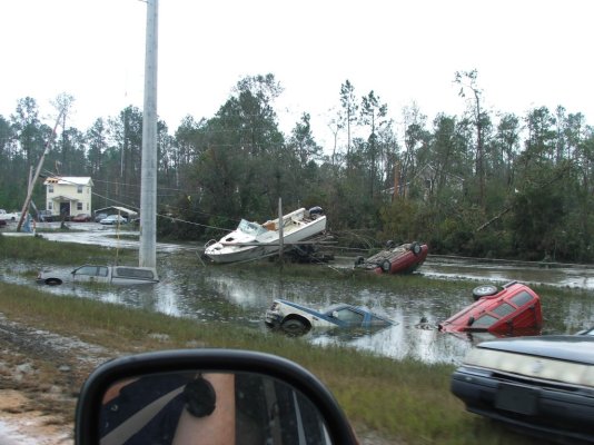
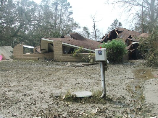
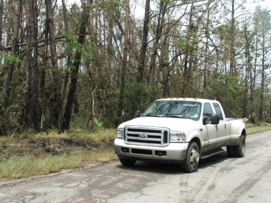
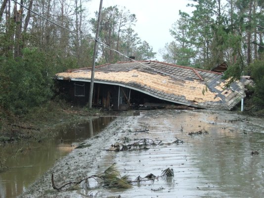
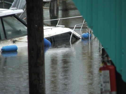
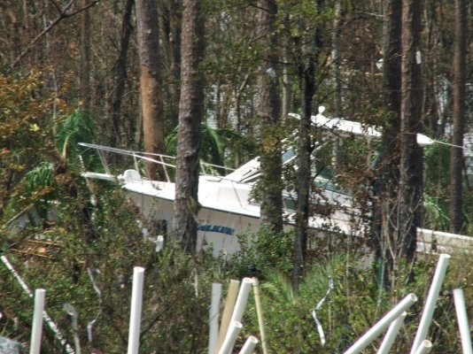
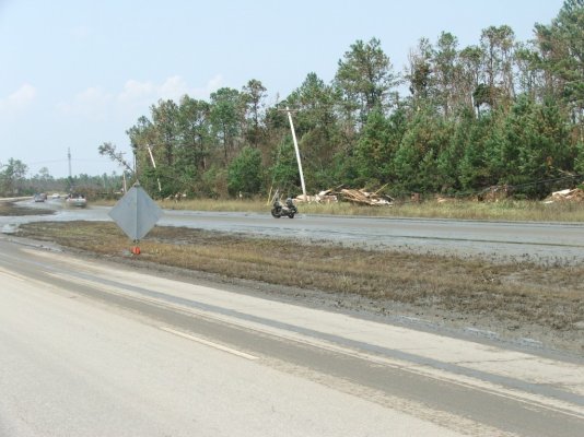
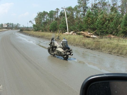
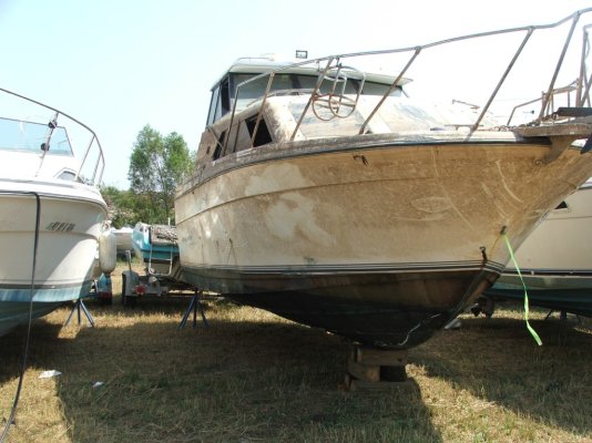
I have been wanting to share some of my personal pictures of Hurricane Katrina online. About 7 months before the storm we had moved our Bayliner from Madisonville, LA to Bay St. Louis to save on time and fuel when going out to the barrier islands. "What do you guys do when a hurricane comes near here?" I asked. "Why, everyone comes to this marina- this is the best hurricane hole around!"- I was assured. Believe me- nothing was spared. Notice the water mark at I12 and Hwy. 603. That is a little over 5 miles inland from the coast. We were able to get past closed highways, etc. for these pics just 2 days after the storm. No one at home had electricity, very little news was available. The concern we heard over and over was the Levee System in New Orleans might fail.*This Gulf Coast region will be forever changed. Antebellum homes , highways and 200 year old Live Oak trees were washed away. The force of a lot of moving water seems to be unstoppable.
Steve
Steve
Attachments
-
 dscf0295.jpg185.9 KB · Views: 107
 -
 dscf0372.jpg221.8 KB · Views: 74
 -
 dscf0342.jpg139 KB · Views: 119
 -
 dscf0346.jpg202.7 KB · Views: 80
 -
 dscf0350.jpg326.1 KB · Views: 101
 -
 dscf0355.jpg340.3 KB · Views: 74
 -
 dscf0356.jpg308.8 KB · Views: 108
 -
 dscf0385.jpg149.5 KB · Views: 73
 -
 dscf0386.jpg259 KB · Views: 110
 -
 dscf0401.jpg223.3 KB · Views: 80
 -
 dscf0404.jpg214.4 KB · Views: 111
 -
 dscf0528.jpg200.4 KB · Views: 82