Do you cruise without paper charts?

The friendliest place on the web for anyone who enjoys boating.
If you have answers, please help by responding to the unanswered posts.
I always have both. My 10" tablet is a nice sized display but my parallel rules are just too big.

I agree that multiple devices provides a pretty good backup but I like having paper. When I am teaching US Sailing basic and bareboat cruising classes, we spend 90% of the time using paper and the depth sounder. I keep my andoid devices out of sight so I can have a quick reference and easily check their fixes.
 
I use both, but wish soundings weren't decades old.

 
At the flybridge I have 2 SH displays, a cp300 7" and a cp500 12". I zoom in very close on the 300 to get all the detail and pull way back on the 500 to get a large overall view. Both have AIS and the 500 has radar. I keep my iPad with garmin BlueChart and the Active Captain overlay near me at either helm. I also have onboard the corp charts for the Illinois and upper Mississippi rivers, I use them occasionally for planning a trip but much less now that I have the iPad. My only charts when I started boating on the river was my iPhone with navionics charts, it's hard to get lost on the river as long as you stay between the buoys and can read the mm on the day marks. I add the electronics after deciding to stay on the river, mostly for safety if I got caught out at night or fog. The majority of people I've run into on the rivers usually only have a dependable depth finder.
 
We don't use paper charts anymore at all.
Did on our last boat and stored most of them under the berth pad.
 
NO. For good reasons. Have plenty of electronic stuff but a paper chart is a good overview good planer view good backup and helps avoid the mistakes that are too easily made due to improper scale use with electronics. So I navigate with plotter checked with overlay radar-AIS-depth finder and a paper chart to my left for confirmation.
 
I have not used paper charts in about 10 years. we run the east coast and are generally on inland waters or at most 25 miles off the coast. . We use Coastal Explorer and it is much easier to get the big picture on the computer. You can zoom out, pan North, South, East and West, then zoom in for detail. It is much easier and quicker than switching paper charts. IMHO. We also have an iPad running navionics sonar charts. (We also have Garmin BlueCharts on an ipad just for reference to Active Captain, but that is very intermittent use) Coastal Explorer and Navionics are much much better at updating their cartography as soon as the LNTM come out. Garmin lags behind by 6 months or more. We headed south 2.5 weeks after Matthew. CE and NAvionics had almost all of the updates to the ICW inlet crossings in a matter of weeks. Garmin charts did not have the updated navigation aids until after the first of this year. (Nobletec still has not updated theirs!) I once counted how many charts there are along the Atlantic coast. I think I came up with 220. There are three different USCG districts along the east coast with weekly Notice to Mariners. How any recreational cruiser can keep their charts up to date is beyond my comprehension.
 
Just a tidbit. I have heard that Canada insists a boat needs charts of the area you are in. Does anybody know if that is true and if electronic fills the requirement?
 
Between my Chartplotter and running Garmin Bluecharts on my ipad, I am starting to venture beyond my paper charts. I could buy more chartbooks for Southwest Florida, the keys and South East Florida but not sure if it is really needed. Just wondering if others chart electronically only?

Old School in me says its a No No.

John P


Absolutely not! My vessel is equipped with 3 different redundancy electronic chart systems and I still carry paper charts opened to the relevant position. Is it over prepared, possibly. However I have been hit by lightning which everything electronic was effected. It also keeps your paper skills sharp and forces you to always keep track of where you are.
Just one captains perspective with many of thousands of miles under my keel!
 
Just a tidbit. I have heard that Canada insists a boat needs charts of the area you are in. Does anybody know if that is true and if electronic fills the requirement?

Most vessels of any kind in Canada have an obligation to carry and use official charts and publications and to keep them up to date. The chart carriage regulations are listed in the Canada Shipping Act, 2001 of the Charts and Nautical Publications Regulations, 1995.

CHS paper charts meet the requirements of the chart carriage regulations.

CHS digital charts meet the requirements of the chart carriage regulations under certain circumstances:
CHS Electronic Navigational Charts (ENCs) meet the requirements provided they are used with an Electronic Chart Display and Information System (ECDIS).
CHS Raster Navigational Charts (RNCs) meet the requirements only if paper charts are carried and used as a backup.
 
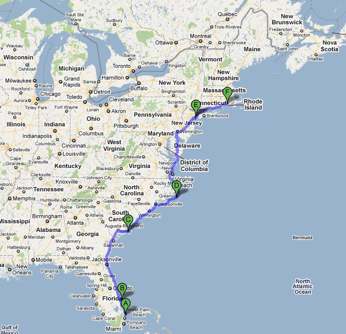
Map_1_Florida+to+Rhode+Island.jpg


Close enough...
 
Anyone that says they are "well experienced" or "have a bazillion miles under my keel".......

I would think coastal navigation is something they can do in the back of their head along with following electronics if they go out.

It is just so easy unless you make it hard.

Beginners, different story, but once the "old timers" have done a route a few times...it really should be no big deal with a few notes here and there.
 
I see a place for both electronic and paper charts on a small boat, and this may seem like a strange answer, but I prefer paper.

Electronic for latest updates, lower cost, real-time positioning, radar overlay and local cruising.

However, when it comes to getting the overall picture, seeing the TSS in relation to your course, planning between ports, and when ocean cruising, then nothing compares to the 4 foot wide "picture" that a paper chart provides.

Even on my 20ft fisherman, when the dang Lowrance went down I pulled out the paper Port of Doha and Approaches chart to get home around all the shoals in the area.

Finally...
There is also the romanticist, dreamer's aspect of plotting courses with parallel rules, scaling distances with a brass divider and crossing the ocean (or bay) like Columbus did half a millennium ago.
 
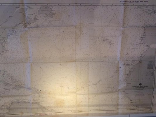
Mako, I don't think Columbus had a chart on that voyage until he got home. Also I haven't seen many boat's that have a Nav station which could accommodate a large chart like this.IMG_1286.jpg
 
Just a tidbit. I have heard that Canada insists a boat needs charts of the area you are in. Does anybody know if that is true and if electronic fills the requirement?

This was extensively discussed a couple of years ago on another forum. The short anwler is "NO".

"• If the vessel is equipped with a big-ship Electronic Chart Display and Information System (ECDIS), and backup computers and power supply;
• If the master and owner of a boat less than 100 tons has adequate local knowledge. "

The above is excerpted from the link below and dates back to 1995.

The Future of Paper Charts
 
Mako, I don't think Columbus had a chart on that voyage until he got home.View attachment 61091

Uhhh, that was obviously a rhetorical sorta illusional sorta emotional comment. Perhaps you are more literal and less romanticist.

I haven't seen many boat's that have a Nav station which could accommodate a large chart like this.

Fits fine on my tiny center console... when folded.
 
To go up the coast, then over to Catalina and back...we don' need no stinkin' charts.:rofl:
 
Paper charts are a must for us. Sure we have multiple electronic charting devices, but having a full sized chart in my lap when navigating new areas can't be beat. Commercial operators are just now being able to use electronic charts only, but require a lot of back up abilitys and training.
 
I guess there's a difference between have and use. I have them from decades of using them, but don't use them as the electronic charts are easier and more up to date. Whether or not you need them somewhat depends on where you cruise also. Where I charter off the mid Atlantic, a total electronics failure means I head West or close to my reciprocal course toward the inlet. Then stay 2 miles off the beach heading North or South to an inlet. Finally, follow the channel markers in. Trying that in the back bays of SWFL will likely have you hard aground in no time.

Ted
 
Use both, I still follow up with "X"'s on my paper charts and in the "paper" logbook on pssages out of sight of land.
Remember electronics are a "aid to Navigation" The U,S, navy has now reinstituted Celestial and Chartwork. Too many brown outs on warships..
Twice at sea during ocean races I've been on board as Nav and we've had a small fire behind the chart table.
I carry a sextant on board and use it occasionly, more to keep my eye in than to Navigate, but the skill is still maintained, should there be a problem.
 
I already have the paper Chartkit Books for the most regions I cruise so I bring the one I'm using up to the flybridge and open it up to the day's area. I make notes on them, anchorages, radio stations etc. I have lots of folding charts too, I do the same with them. Now, if I had to pick one or the other it would surely be the electronic nav. system.
 
Most of my boating experience in the past 50 years has been in the same, very familiar waters. I have used modern electronic charts on my own boats for the past decade. Even so, I always have "reasonably current" paper versions of charts for these same waters. I have mixture of paper charts, I have chart books, individual charts, and commercially printed versions of charts. There is almost always a paper chart, opened to the waters I am in, open on my chart table.

I could do without them, but prefer to have them available. Electronics can and do fail. I have an iPad and my Android phone that can be used as backup to my RM Nav suite, but in my opinion, paper charts are a better backup.

I generally am not a Luddite and have been in my callow youth an early adopter, but still find value in the paper charts.
 
My observation is that the spread somewhat depends on where and how you boat, overall experience, and comfort with electronics reliability and what is truly needed to back them up.
 
I'm old and have been using paper charts for 50+ years. I like raster charts and dislike vector charts for the lack of land info. I run a laptop and desktop, one with TZ Navigator and the other with OpenCPN as backup. One on internal battery and one on the inverter. I like backup. In Canadian waters , Canadian chart regs require vector charts use. Using raster requires you carry paper as backup. Considering raster is scanned paper, this doesn't make sense to me.
 
Charts are mandatory in Canada if your vessel is over 100 tons.
 
No they are not.

(2)*The master and owner of a ship of less than 100 tons are not required to have on board the charts, documents and publications referred to in subsection (1) if the person in charge of navigation has sufficient knowledge of the following information, such that safe and efficient navigation in the area where the ship is to be navigated is not compromised:

(a)*the location and character of charted

(i)*shipping routes,

(ii)*lights, buoys and marks, and

(iii)*navigational hazards; and

(b)*the prevailing navigational conditions, taking into account such factors as tides, currents, ice and weather patterns.
 
Back
Top Bottom