ASD 2019 Alaska Cruise

The friendliest place on the web for anyone who enjoys boating.
If you have answers, please help by responding to the unanswered posts.
Dave,
We both, ASD and Pairadice, stayed in Comax last trip, and yes it is a nice spot with a great restaurant right above the marina.


That is a GREAT restaurant! One year we were there during a community festival and that was fun. The next time we happened to catch a great Saturday market at the park right next to the marina. Nice staff, good facilities. They found a spot for us on a weekend rafted up next to an old wooden fishing boat on the commercial docks. Climbing up and over it was good exercise.
 
SC, Have you had the buns at Meyers Chuck AK? Our all-time favorites.

We've heard same, but alas normally depart from there before the AM bun run commences.

In Skagway last year we really enjoyed the AM pastries at the Sweet Tooth Café. And the rhubarb pie!
 
Dang Tom, if you hit all those hot spots and pick up cinnamon buns at each of them you're gonna need to add some flotation to ASD before you head back south.

:dance: :eek: :dance: :eek: :dance:
 
Left Sucia yesterday. Lots of wind during our stay 35-40 mph. Rocna and chain held great!

We are in Montague Harbor. A little disappointed as the bus to the pub doesn't start until the end of May. We will be leaving this morning for Dodd Narrows and Nanaimo. On to Pender Harbor tomorrow.

Clear Customs was less than 5 minutes. Pot was their main concern. So far enjoying the trip north, slow and easy.
 
Thanks for letting us follow along, you certainly are living the life!


Safe travels.
 
You sure have incredible weather to cruise. Flat as a pancake out there this morning.
 
Looking out on Georgia Strait this morning, you should be pulling Kay across to Pender on a water ski. Like a mirror.
 
The Salish Sea (Georgia Strait) off Denman Island at 8:30 last night. Hope you guys have same great weather all the way north.......:thumb:
 

Attachments

  • Texada.jpg
    Texada.jpg
    95.8 KB · Views: 56
Sucia to Garden Bay

We left Friday harbor after 2 days tied to the dock. The generator gremlin did not show its ugly head. We love Friday harbor but it was time for a change. Kay like Sucia, so the plan was to dock up in Fossil Bay. We figured on a Monday there should be lots of room. As we passed by it appeared the dock was full. We found out later that you need to come into the bay to look. There were two spots open.

Instead, we anchored up in Echo Bay in 26 feet and I added 140 feet of rode. Good thing we did as the winds came up that evening and we were tight on the rode. Several other boats were anchored up to include a National Geographic ship. They are also headed to Sitka. It would also appear I have done my good deed for this trip. I was on the bow with my evening cigar and scotch when I saw this nice dinghy float by with no one in it. I saw the boat it came from, so I lowered my dinghy and rescued it for its owner who was chasing it with a kayak.

The next day we took the dink over to Fossil Bay and hiked the trail to Jones Point. It was gorgeous. It so happened that at the dock were some friend we had met from Texas last year. Al and Susan from the MY Kaos. Their plans had them in the San Jauns most of the summer.

On May 8th we pulled the anchor and headed to Montague Harbor. On the way we cleared Canadian Customs with just a phone call and it took less than 5 minutes. Gotta love Nexus cards. We anchored out in 20 ft and took the dink to shore so we could find out the bus schedule for the Hummingbird bar. We were disappointed to learn that it doesn’t start operations until Memorial weekend. Oh well we had a great early dinner at the restaurant.
The next stop is Nanaimo and the Castle Island anchorage. Our first current rapids was Dodd Narrows. We timed it just right to cross over at slack tide. On the other side there were a ton of crab pots. One poor guy got his stabilizers wrapped up in one. The Port sent some folks out to assist him and we saw him a few hours later. This is one of our favorite places because of the Dinghy Dock restaurant. The anchorage was calm and lot of room to anchor. Had a great dinner with beers. That evening as Nanaimo lite up the evening no better place to be but the bow of ASD with a cigar and scotch watching folks going back and forth.

Today, the 10th we are heading across the northern end of the Straits of Georgia to Pender Harbor and Garden Bay. We will tie up to the dock for a few days and give ASD a nice bath and Kay can get some laundry done.
On our way across there is a military training area called Whiskey Gulf (WG). Today the area was closed to traffic. How do I know, I called them and asked. So I plotted a route around the area as they tend to get a little crabby if you trespass on the area when it is closed. It amazes me how folks (idiots) seem to think the rules don’t apply to them. Most of them are sail boats!! I even passed a sail boat that was headed straight into the area. I blew my horns and tried to to raise him on the radio. About 15 minutes later a helicopter buzzed the idiot. The sail boat finally answered the radio. The chopper told him to head magnetic north to take him out of the area. He didn’t know which way was NORTH!!! Idiots….

The seas are flat and no wind! We have the dock to ourselves, so far.
 

Attachments

  • IMG_4493.jpg
    IMG_4493.jpg
    113.4 KB · Views: 62
  • IMG_4495.jpg
    IMG_4495.jpg
    57.5 KB · Views: 62
  • IMG_4536.jpg
    IMG_4536.jpg
    65.8 KB · Views: 55
  • IMG_4542.jpg
    IMG_4542.jpg
    43.3 KB · Views: 62
  • IMG_4567.jpg
    IMG_4567.jpg
    107.6 KB · Views: 59
  • IMG_4565.jpg
    IMG_4565.jpg
    199.3 KB · Views: 56
  • IMG_4568.jpg
    IMG_4568.jpg
    107.8 KB · Views: 66
The Whiskey Gulf area is used almost exclusively by the nuclear submarines out of Bangor Washington.

Also, I think you will be well served by your spring timing. Last summer our BC forest were ablaze and I think the same thing is going to happen this year. Last summer in August it was so bad I needed radar between Vancouver Island and Denman Island on a clear day much as it is today. But the area was covered in forest fire smoke.

If you encounter BC cable ferries such as between Vancouver Island and Denman, you will notice twin lights on either side of the ferry birth. When these lights are green you can cross the cable location, when they are red, you can't. Dumbest system to save money. The ferry plugs up the surrounding area as it transits so much and the lights don't turn green until a complete transit has occurred.
 
Last edited:
Well of course, the weather is awesome and were not there! I’m beginning to think the weather gods hate us.
Enjoy your trip my friend, toasting ya with an AA here at home.
 
Well of course, the weather is awesome and were not there! I’m beginning to think the weather gods hate us.

The weather Gods like you, they are wondering where the heck you are. They put on a show for you, and where you at?
 
This makes me do envious.
It will be at least a month before I'll be in Seattle, but then, it's North to the Future.

I look forward to seeing all these great Pac NW and BC places.
 
The Whiskey Gulf area is used almost exclusively by the nuclear submarines out of Bangor Washington.


Also by the Orions from Comox. Used to be a lot of P-3s from Whidbey until the US Navy retired all those aircraft.


My little brother was a diver at the Keyport Torpedo Laboratory; spent his summers in Nanaimo/WG, recovering run-out torpedoes.
 
If you encounter BC cable ferries such as between Vancouver Island and Denman, you will notice twin lights on either side of the ferry birth. When these lights are green you can cross the cable location, when they are red, you can't. Dumbest system to save money. The ferry plugs up the surrounding area as it transits so much and the lights don't turn green until a complete transit has occurred.


That ferry surprised the heck out of me a few years ago. I had never seen anything like it and didn’t recognize the chart markings. Fortunately, I noticed the red lights and finally figured out that it was a cable ferry in time to stop short of the crossing.
 
That ferry surprised the heck out of me a few years ago. I had never seen anything like it and didn’t recognize the chart markings. Fortunately, I noticed the red lights and finally figured out that it was a cable ferry in time to stop short of the crossing.
Outer Sydney has some ferries like that, which we call punts. Moored and un/loading,the cables are slack and you can safely pass over them,though I keep to the center. Apart from collision risk, cables get raised as the punt operates, they can be shallower than your keel, and then.. :facepalm::eek:
 
The Whiskey Gulf area is used almost exclusively by the nuclear submarines out of Bangor Washington.

Also, I think you will be well served by your spring timing. Last summer our BC forest were ablaze and I think the same thing is going to happen this year. Last summer in August it was so bad I needed radar between Vancouver Island and Denman Island on a clear day much as it is today. But the area was covered in forest fire smoke.

If you encounter BC cable ferries such as between Vancouver Island and Denman, you will notice twin lights on either side of the ferry birth. When these lights are green you can cross the cable location, when they are red, you can't. Dumbest system to save money. The ferry plugs up the surrounding area as it transits so much and the lights don't turn green until a complete transit has occurred.

Thanks for the info. I believe there are cable ferries just south of Comox....
 
Last edited:
Well of course, the weather is awesome and were not there! I’m beginning to think the weather gods hate us.
Enjoy your trip my friend, toasting ya with an AA here at home.

I lived here for 30 years and this is the BEST summer ever!!!! LOL:thumb::D
 
Prideaux Haven

Nice 6 hour ride from Pender Harbor to Prideaux. Rain in the next few days. Heading to Dent Rapids this morning for a 1 PM crossing, then to Shoal Bay. Then to Port McNeil.

We are having so much fun!!! Hey Crusty "BEST" summer ever!!!:D
 

Attachments

  • IMG_4602.jpg
    IMG_4602.jpg
    106.7 KB · Views: 76
  • IMG_4614.jpg
    IMG_4614.jpg
    99 KB · Views: 78
  • IMG_4640.jpg
    IMG_4640.jpg
    109.9 KB · Views: 96
We will be doing a Desolation Sound trip next month, last time there was over 20yrs ago. Really looking forward to it, thanks for sharing!
 
We usually get rain in and around this time frame. This coming weekend hosts Victoria day which signals campers to go camping, boaters to go boating, etc. If you are going to stay a day or two during this weekend, best to get there on Thursday unless by then you are into the Broughons, then you're okay. To translate Victoria Day into American - Victoria Day = Memorial Day, not celebrating the same thing, but both kick off summer style vacationing. Victoria Day is always the weekend before.
 
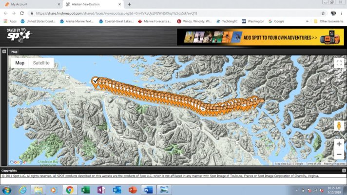
Pender Harbor to Port McNiell

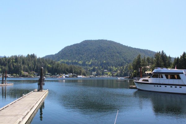
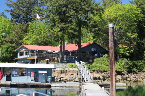
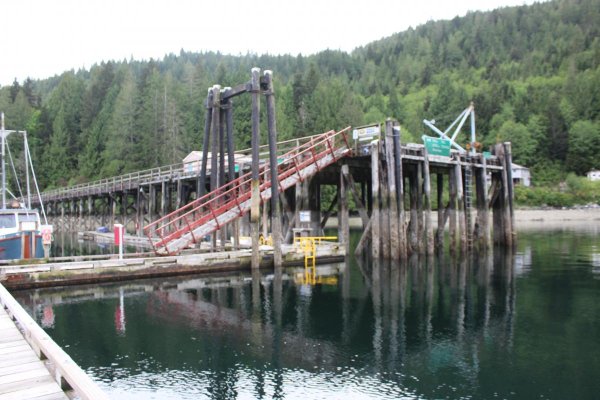
On our travels to the north, we are staying at places we have been before in 2016 and 2017. We have anchored in most places and used a dock in others. Docking allows us to hook up to electric to top off the batteries, access to fresh water to do laundry and wash the salt off the boat. We have done both at Pender Harbor. Garden Bay disappointed us. The dock was not in very good shape with moorage fees at over $80 a night! Not that I think it is overly high, but for this price you expect some kind of services such as trash, someone to meet you at the dock etc. The restaurant at the head of the dock offered a plain western menu (Hamburgers, wings ). The new owners are Asian and an Asian menu would have been great.

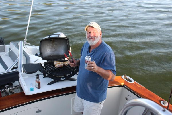
As is always the case you meet new folks along the way. This was the case with Brad and Teresa Clarke. Brad made a commit about my scotch and cigar and that got him an immediate invite. Brad got his choice of a cigar and a glass of Monkey Shoulder. Brad was familiar with this brand of scotch! We were invited to breakfast the next morning at their home which we attended!! We plan to visit again on our way back!

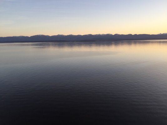
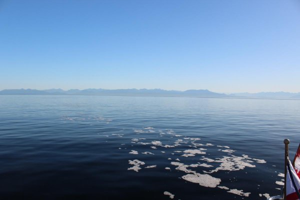
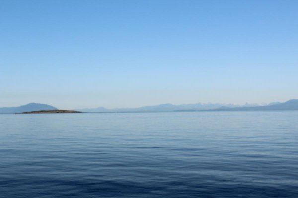
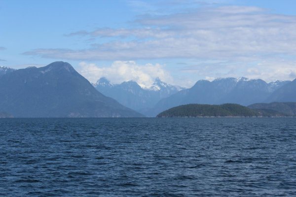
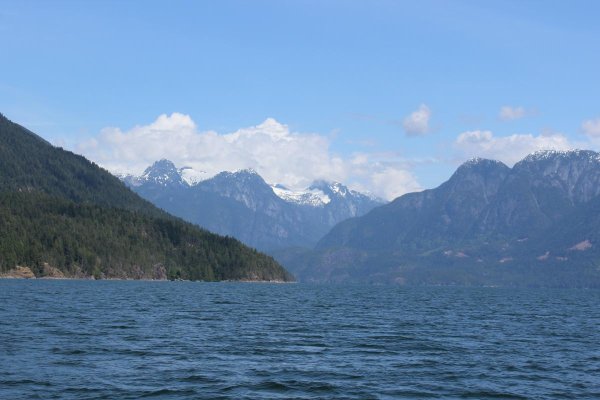
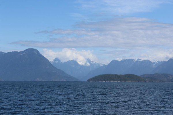
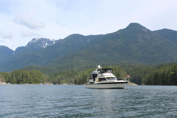
The next day we steamed to Prideaux Haven in Desolation Sound. We had discussed visiting Princess Louisa again, but decided to push north. During the summer months this anchorage is super crowded! They have chains secured to the wall and stern tying is mandatory. When we arrived, there were only 3 boats and we had the place to ourselves. This is one of our favorite anchorages due to the view. This is the first place you see huge mountains. The next object was the 3 rapids, Yuculta, Gillard and Dent. All need timing. For us 1:06 PM was slack. Up here its all about current, not tide. Because of modern electronics we were able to time our arrival perfectly!!!The crossing of the rapids to Shoal Bay was a non-event, well almost.

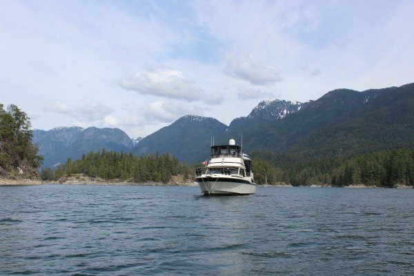
As we entered Yuculta this big 80 foot plus yacht passed us 20 feet on the starboard!!! I laid on my train horns. The name of the boat is “Mixer” out of Sitka, AK. We will be having words. He also shut his AIS off so he would not be required to report in to the Vessel Traffic Services system. Yeah, we will be having words. I should have called him on Channel 16.

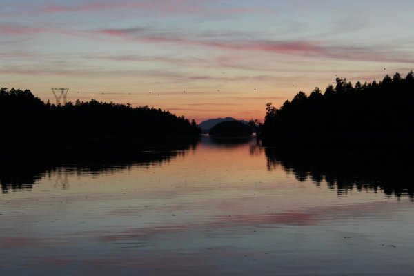
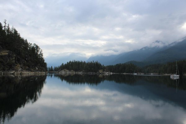
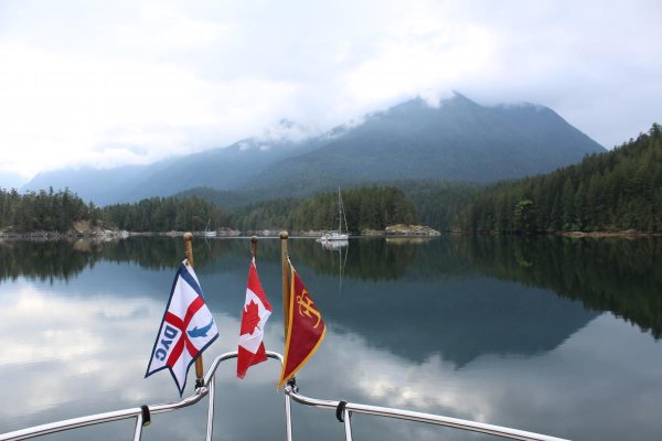
Shoal Bay we a big surprise! I expected the government dock to be crowded! We had the dock all to ourselves. Around 5 PM we wondered up to the wine shack. This is the place boaters gather for happy hour. Mark and Cynthia own the lodges and cabins. We witnessed Mark mowing the grass. Cynthia must be home and driving the whip!! Mark stopped and had a beer and yes Cynthia arrived home the day before, therefore he was working!!

The next day, May 14th was cloudy and raining. Wow!! First rain since we started this trip. We had to close all the windows. Oh well the boat needed a fresh water rinse. The run from Shoal Bay to Port McNeill is 80 miles, about a 8 hour cruise.

Port McNeill is a fuel stop for us and restock of ship stores before heading across Cape Caution and Northern B.C. As we were approaching the Port McNeill area, Kay had mentioned she had not seen any whales or critters. About that time some white sided pacific dolphins (or porpoises) showed up to give us a quick show. Hope we see lots of critters.

We are currently on a weather hold until Friday May 17th for the run around Cape Caution.

Numbers so far from Neah Bay to Port McNeill:

Total Fuel: 244 gallons

Total Miles: 642

Total Cost: $969.00

Price per Gal: $3.97

MPG: 2.6

Burn: 6.8 GPH
 

Attachments

  • IMG_4580.jpg
    IMG_4580.jpg
    83.1 KB · Views: 73
  • IMG_4565.jpg
    IMG_4565.jpg
    199.3 KB · Views: 72
  • IMG_4601.jpg
    IMG_4601.jpg
    89.8 KB · Views: 67
  • IMG_4639.jpg
    IMG_4639.jpg
    120.3 KB · Views: 61
  • IMG_4679.jpg
    IMG_4679.jpg
    64.8 KB · Views: 64
  • IMG_4683.jpg
    IMG_4683.jpg
    72.1 KB · Views: 58
  • IMG_4725.jpg
    IMG_4725.jpg
    131.5 KB · Views: 58
  • Map.jpg
    Map.jpg
    189.7 KB · Views: 65
Haulin Ass, Bud! Makin good time not dragging us.
Give Miss Kay a hug from us.
 
Haulin Ass, Bud! Makin good time not dragging us.
Give Miss Kay a hug from us.

I drank an AA today in your honor.

Looks like the best weather window will be Friday morning to Cross Cape Caution. Long day....93 miles to Pruth Bay......
 
I drank an AA today in your honor.

Looks like the best weather window will be Friday morning to Cross Cape Caution. Long day....93 miles to Pruth Bay......

Give yourselves a break and pull into Millbrook or Fury after you round the horn. Easier on the crew.:thumb:
 
I drank an AA today in your honor.

Looks like the best weather window will be Friday morning to Cross Cape Caution. Long day....93 miles to Pruth Bay......


If you want a head start on Cape Caution, anchor up in Miles inlet it's just a little SE of Slingsly Miles is absolutely bomb proof not to mention one of the prettiest places on the coast. The only caveat is heading toward Caution if slingsly is in full ebb you will get some rollers in front of the channel, otherwise you're 15 miles from caution. Once past caution if the weather is snotty you can swing in to Smith Inlet. about 4 miles in is Fly Basin another great anchorage.....
 
I drank an AA today in your honor.

Looks like the best weather window will be Friday morning to Cross Cape Caution. Long day....93 miles to Pruth Bay......

Just kick up the kitties, might just be the shortest time yet now that were not with ya. Enjoy it, 9-12 am looks pretty good.
 
Last year leaving Pruth we had a great display of a humpback feeding on the south side of the channel. There was also a channel marker floating free which made us first timers check the charts and guidebooks a little more carefully.
 

Latest posts

Back
Top Bottom