Tour of SFO Vessel Traffic Services

The friendliest place on the web for anyone who enjoys boating.
If you have answers, please help by responding to the unanswered posts.

FlyWright

Guru
Site Team
Joined
Apr 15, 2008
Messages
13,731
Location
California Delta
Vessel Name
FlyWright
Vessel Make
1977 Marshall Californian 34 LRC
If you've ever wondered about the services provided by USCG VTS, here's your chance to get in on a tour of the operations and communications centers on Yerba Buena Island.

I'm organizing a tour of the facility for all interested Trawler Captains in Feb 2015. I've posted a thread for signups here on the SF Bay and CA Delta Cruiers Social Group. This can be an opportunity to learn about the services available to us and how to best utilize the services of VTS in our daily operations among the large commercial vessels operating in the Bay and Delta.

If you're interested, please visit the linked thread, post your preferred day of the week and stay tuned for additional details. They can accept small groups for these tours so we'll need to limit this to local Trawler Forum boat operators only. No SO's or kids this first time around.
 
We have finalized the plans for this tour and briefing for this Saturday, 2/28 at 1000. If anyone is interested in participating, please check out the link above and PM or email me to be included in this briefing. We currently have 8 people interested with room for a couple more captains.
 
We had a very interesting tour of the San Francisco Vessel Traffic Services branch of the USCG on Yerba Buena Island yesterday. There were eight of us for the tour and briefing which lasted about an hour.

After signing in, we entered the VTS Ops Center which is a single room about 1000 sq ft (rough guess...maybe 32x32). There are several large video monitors set up in stations around the room, each with 5-6 screens with various displays of video cameras, AIS A overlaid on a NOAA chart, AIS B on a NOAA chart, raw radar returns of the Area of Responsibility (AOR) as well as other relevant data.

One specialist handles offshore traffic and another handles the bay and river traffic. There are other positions for coordination and supervision with a max staffing of about 5 or 6 specialists and supervisors.

The AOR extends from about 30 miles outside the Golden Gate and inland as far as the ports of Stockton to the east and Sacramento to the north and Dumbarton Bridge to the south. CWO Warren Weatherford briefed us on the mission, tools and methods used by VTS to provide both security and safety for the public recreational and commercial traffic in the AOR.

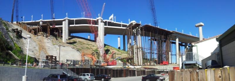
Their focus is on security and commercial traffic services. They provide advisories of other known traffic along a ship's course and any Notices to Mariners or No Wake zones in the area. If there are temporary restriction to travel in an area, for example bridge construction or destruction as we're seeing now on the Bay Bridge or SAR operations, they will pass along this information for those on the frequency.

We wanted to know if their services were available to recreational boaters transiting the area and were told yes, we are welcome to check in for traffic, notice and weather advisories or, workload permitting, tracking services during periods of low visibility. It doesn't hurt to ask and if it's too busy, they'll advise.

Some of their capabilities were predictable and others had a certain "Wow" factor. The Class A AIS display was expected and we learned that to eliminate some of the unneeded clutter (like fishing fleets out at sea), they utilize filters to thin the targets to what they need. Many of these targets are color coded to provide immediate awareness to mission, petroleum products cargo, etc. A separate display showed the Class B AIS targets in case someone checks in for services with just Class B AIS.

A third display I was hoping they'd have was the raw radar which allowed them to see the radar returns on all traffic in the bays and straits as far east as Carquinez Strait. East of that point, the terrain shielding restricts the radar coverage.

The most impressive (to me) capability was the live video coverage with fully controllable cameras. We were there on a crystal clear day that was perfect to demonstrate this capability. They can pan and zoom these cameras which are strategically placed around the bay area. We saw a camera near the north end of the Golden Gate bridge zoomed in on a vessel passing the city front probably 3-5 miles away. It was a very impressive demo of their live video capability which is used for positive ID as well as SAR ops. So if I check in on the freq requesting trip traffic advisory services and have no AIS, they can correlate my position report with my boat description, confirm it's me (maybe by reading the transom name) and now they have positive ID on me. This video capability covers much of the SF and San Pablo Bays and extends as far east as Carquinez Strait. This eastern stretch of video coverage is provided from a camera near the mouth of Mare Island Strait. Other cameras in the SF Bay provide the western coverage.

Unlike Air Traffic Control where pilots on IFR flight plans are directed with specific headings, courses, altitudes and speeds, the commercial traffic is provided advisories of traffic in the area which might be a conflict and it's up to the Captains to work out their own collision avoidance maneuvers. They also provide up to the minute advisories on area ops of interest to local boaters, commercial and recreational alike.

I'm sure I'm leaving out lots of specifics and hope others on the trip with fill in the gaps. We were prohibited from taking photos so I asked for some unclassified photos to be sent to me for posting on this thread. They should arrive next week and I'll put them up when I get them.

In the meantime, here's what I have from our Day on the Bay.

(L-R Ray Muldrew - Giggitoni, Steve Ornoski, Matt Neumann - Pineapple Girl Guy, Al Kroeger - FlyWright, Mark Neumann, Richard Webber - Britannia, Mark Pierce, Bob Mills - remwines) There are some cutouts behind Ray and Bob...Ray's not carrying his weapon.

img_312474_0_c28439e9e467df0b2d8fad2215c8062a.jpg


View of the Bay Bridge construction and destruction from USCG Sector SF.

img_312474_1_08643596dca80fc7ebc2e5c26a05aaad.jpg
 
Last edited:
Very interesting, Flywright. So they do monitor Class B AIS. I thought they would. I have contacted VTS for Victoria Traffic in BC, here and they said that RB's were welcome to contact them for traffic information and also to communicate on the VTS Channel with commercial traffic when necessary to ensure safe passes. This something I do with BC Ferries inside Active Pass. Ferry traffic often doesn't reply on 16.


Jim
Sent from my iPad using Trawler Forum
 
Thanks Al for organizing the visit. It was great to meet the folks who operate VTS. Being able to see the faces behind the microphones makes it way less intimidating to give them a call. They were very clear that they're happy to give us information all day long. If we tell them our planned route out of or into the bay they'll tell us everything we might encounter en route. They're on Channel 14 inside the bay and 12 outside the Golden Gate (and inland to Sacramento and Stockton.)

We had a nice lunch afterwards on Treasure island - it was fun to meet some of the local trawler forum folks. Hopefully I'll get to joint them on a cruise sometime soon.

Very interesting, Flywright. So they do monitor Class B AIS. I thought they would. I have contacted VTS for Victoria Traffic in BC, here and they said that RB's were welcome to contact them for traffic information and also to communicate on the VTS Channel with commercial traffic when necessary to ensure safe passes. This something I do with BC Ferries inside Active Pass. Ferry traffic often doesn't reply on 16.


Jim
Sent from my iPad using Trawler Forum

They monitor AIS class B on a separate screen that's running Rose Point software. Class B doesn't show up on their integrated display that shows class A as well as overlays from all the radars they are operating. So in practice I suspect they won't "see you" unless you call them. Most likely they would be able to track you on their radar though - using ARPA like tracking.

Richard
 
Another detail I forgot to mention for the SFO locals, they use Ch 12 on the outside of the Gate and Ch 14 in the bays and rivers. They also monitor Ch 13 and 16 at most if not all work positions.
 
Brittania implies that Channel 12 is used inland to Sacramento & Stockton, and Al says Channel 14 in the bays and rivers - did I misread, or, is one in error?
 
Brittania implies that Channel 12 is used inland to Sacramento & Stockton, and Al says Channel 14 in the bays and rivers - did I misread, or, is one in error?

I made that assumption because the operator that was handling the traffic outside the bay was also handling the traffic on the rivers. The other operator was handling the bays. I assumed that the former was only listening to 12 and the latter to 14. I think I'm wrong about that - though I don't know how they divide up the radio traffic.

Richard
 
I can ask for a clarification on that. I thought it was as you described, Richard, but then thought I heard and saw otherwise there in the room. Hopefully others who were there will chime in on the line of demarcation for the freq's.

I know about 1 1/2 months ago, I was passing through Carquinez Strait with Giggitoni following in Mahalo Moi. The fog was so thick when we exited Mare Island Strait that we couldn't see the Carq Bridge until we looked straight up! I called VTS on Ch 12 for advisories and got a timely reply. That would seem to support Richard's understanding.
 
Interesting writeup. Thanks for taking us along with you on the visit.
 
Colregs is the line! About the location of the Golden Gate bridge. Channel 12 outside and channel 14 inland. The operators did say that they would take a call from the other sector if the other operator was busy at the time of the call.
 
Last edited:
Colregs is the line! About the location of the Golden Gate bridge. Channel 12 outside and channel 14 inland. The operators did say that they would take a call from the other sector if the other operator was busy at the time of the call.

That is my understanding also. As well as they don't continually monitor class B AIS. I'm also under the impression that there are additional filters, so even if one has a class A, you'll not be necessarily tracked.
 
That is my understanding also. As well as they don't continually monitor class B AIS. I'm also under the impression that there are additional filters, so even if one has a class A, you'll not be necessarily tracked.

I think they may take a look at a class A (when it is visible on the screen), zoom in with the cameras all over the Bay and tune it out when they discover that the target is only a smaller pleasure boat. Just a thought.

One of my favorite demos of the day was from one of the operators when we mentioned the nesting ospreys on top of a light standard near the south entrance to Mare Island Strait. He said, "this one", and proceeded to zoom in on the unsuspecting bird until all we could see was frame-to-frame feathers on the monitor. Way cool.
 
I think they may take a look at a class A (when it is visible on the screen), zoom in with the cameras all over the Bay and tune it out when they discover that the target is only a smaller pleasure boat. Just a thought.

I don't think they'd bother. But they may/can automatically filter out particular vessel types as well as those under a certain length or tonnage.
 
Last edited:
I think the amount of effort they're willing to exert to provide positive ID is dependent upon the relative risk they believe you pose. If it's low visibility and you're transitioning the main channel, they'll want to know. If it's clear and a million miles vis on a slow weekday afternoon, they might not be concerned enough to feel the need to establish positive ID.

That's not anything I heard directly, but just a hunch based on past experiences.
 
That is my understanding also. As well as they don't continually monitor class B AIS. I'm also under the impression that there are additional filters, so even if one has a class A, you'll not be necessarily tracked.

That's how I remember it, too. The Class B is there for their reference, but not in their primary scan.

They filter out non-essential or uninteresting Class A targets to reduce clutter. It's kind of like ATC radars that are filtered so they don't display all visual rules traffic during instrument rules operations. I presume if a non-displayed vessel checks in, they could select to display it on their "scope".
 
I had a great experience with SF VTS. We were bringing our boat up from Oakley CA to the Columbia River and when we left Sausalito I contacted SF VTS, told them my plans, no AIS and my current position. We then told them when we entered into the outbound lane and when we got to the outer buoy. We then turned north to the north outbound lane. We were told to contact them when we got to Pt. Reyes. They took our boat information, cell numbers, and destination then told us they would pass this up the coast to the other USCG stations. Made us feel a little better. Sector Columbia River knew we were coming….
 

Latest posts

Back
Top Bottom