You are using an out of date browser. It may not display this or other websites correctly.
You should upgrade or use an alternative browser.
You should upgrade or use an alternative browser.
Just a little BC moment
- Thread starter OFB
- Start date
The friendliest place on the web for anyone who enjoys boating.
If you have answers, please help by responding to the unanswered posts.
If you have answers, please help by responding to the unanswered posts.

Nightsky
Senior Member
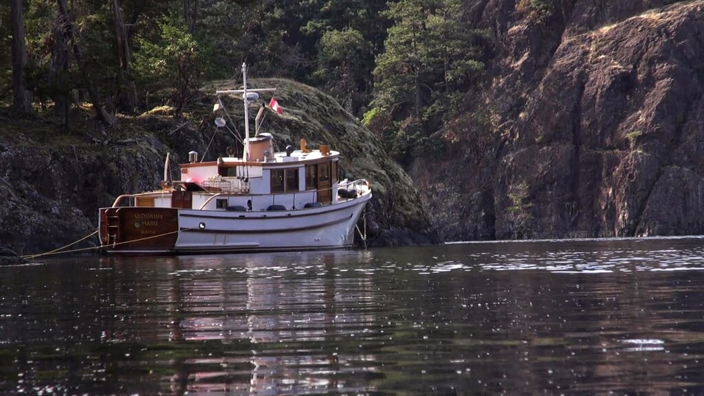
I noticed the Kishi boat works in your profile. My first boat was a Kishi built, double-end troller built in 1939. I wonder if it is the same family. Don't imagine there were many boat builders by that name.

OP
OP
OFB
Guru
- Joined
- Mar 30, 2012
- Messages
- 638
- Location
- Canada
- Vessel Name
- Invader no1
- Vessel Make
- Kishi Boat works
Yach delivery
Yup running other folks boats around just rocks.
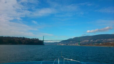
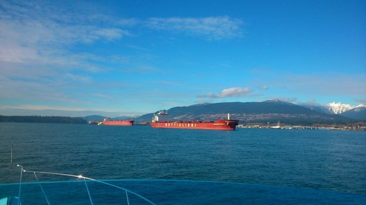
BC moment.
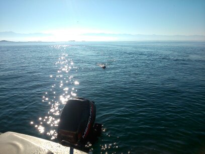
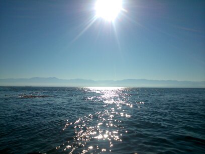
Now there have got to be some other folk with some BC moments caught on camera. A picture or two.
Please share I just started thread I believe has a ton of potential. Even in the rain , wind , deep water, lack of moorage , etc etc,
Grin
Yup running other folks boats around just rocks.
BC moment.
Now there have got to be some other folk with some BC moments caught on camera. A picture or two.
Please share I just started thread I believe has a ton of potential. Even in the rain , wind , deep water, lack of moorage , etc etc,
Grin
Attachments


MurrayM
Guru
MurrayM
Guru
It surprises me how many people anchor, then take off the next morning without stepping ashore. Maybe it's a holdover from our sea kayaking days, but to get a real feel for an area exploring ashore is a must.
We found clam gardens in Rescue Bay, near Klemtu. First Nations people on this coast would chuck rocks aside to level off areas on a beach which would allow higher concentrations of clams in a small area...like the seafood aisle at a supermarket.
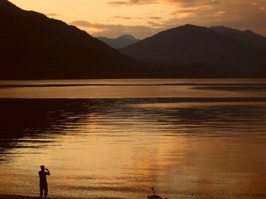
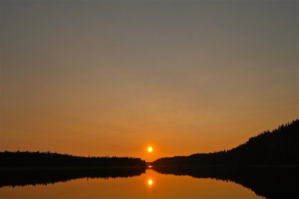
Also, when you head back to the boat at sunset afterwards, you can take cheesy photo's of your boat...especially when forest fire smoke thickens the air.
We found clam gardens in Rescue Bay, near Klemtu. First Nations people on this coast would chuck rocks aside to level off areas on a beach which would allow higher concentrations of clams in a small area...like the seafood aisle at a supermarket.
Also, when you head back to the boat at sunset afterwards, you can take cheesy photo's of your boat...especially when forest fire smoke thickens the air.
Attachments


MurrayM
Guru
Here's Zain (our Pyrenees Lab mix) checking out a First Nations salmon weir in Kakushdish Harbour near Shearwater & Bella Bella on BC's central coast.
People would herd salmon up against the shore, then keep them there as the tide dropped below the level of the weir...easy pickings after that!
That's the "entrance notch" to Kakushdish highlighted by the setting sun through forest fire smoke. We left the next morning at first light, near low tide, to get some miles in before the winds kicked up; a real challenge for my situational awareness abilities!
Attachments

Nomad Willy
Guru

Doug
Senior Member
- Joined
- Aug 15, 2009
- Messages
- 266
- Location
- Victoria, BC Canada
- Vessel Name
- Timeless
- Vessel Make
- CHB 34

MurrayM
Guru
Hi Eric,
We haven't been to Monckton Inlet yet. Looking forward to doing the "Outside" Inside Passage (as we call it) one day to Kitkatla. Wee bit more exposure out there.
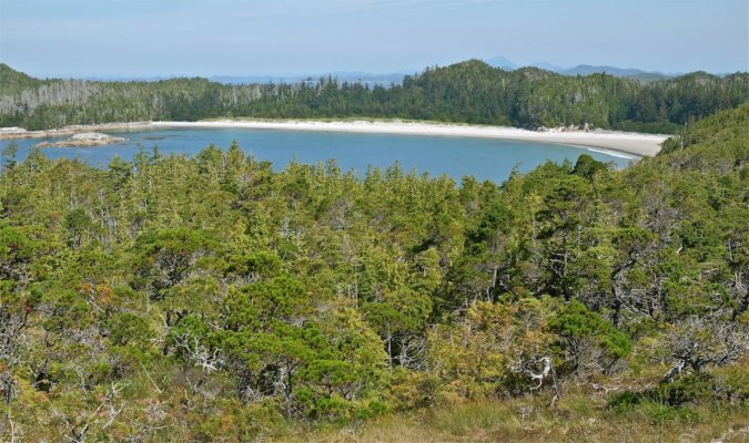
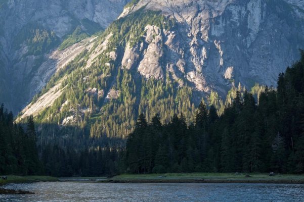
This summer we went to Calvert Island on BC's central coast; a real jewel.
First photo is of the anchorage at Pruth Bay on Calvert Island. There's a research institute there which allows people to tie dinghy's to their dock, and free use of a short trail to the exposed west coast.
Second photo is of the first beach you reach on the trail, taken from a side trail to an overlook. There are seven beaches in total, all linked by trails. We stayed five days and plan to stay longer next time.
We haven't been to Monckton Inlet yet. Looking forward to doing the "Outside" Inside Passage (as we call it) one day to Kitkatla. Wee bit more exposure out there.
This summer we went to Calvert Island on BC's central coast; a real jewel.
First photo is of the anchorage at Pruth Bay on Calvert Island. There's a research institute there which allows people to tie dinghy's to their dock, and free use of a short trail to the exposed west coast.
Second photo is of the first beach you reach on the trail, taken from a side trail to an overlook. There are seven beaches in total, all linked by trails. We stayed five days and plan to stay longer next time.
Attachments


MurrayM
Guru
Bear on the shore of Potts Lagoon in the Broughtons.
Quite the hero pose

- Joined
- Oct 6, 2007
- Messages
- 841
- Location
- Poulsbo, WA
- Vessel Name
- Dream Catcher
- Vessel Make
- Nordic Tug 37-065
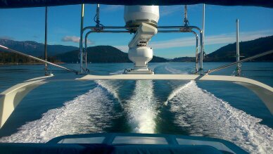
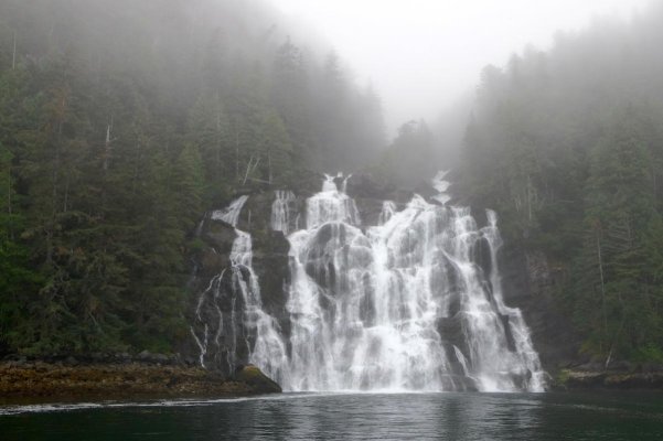
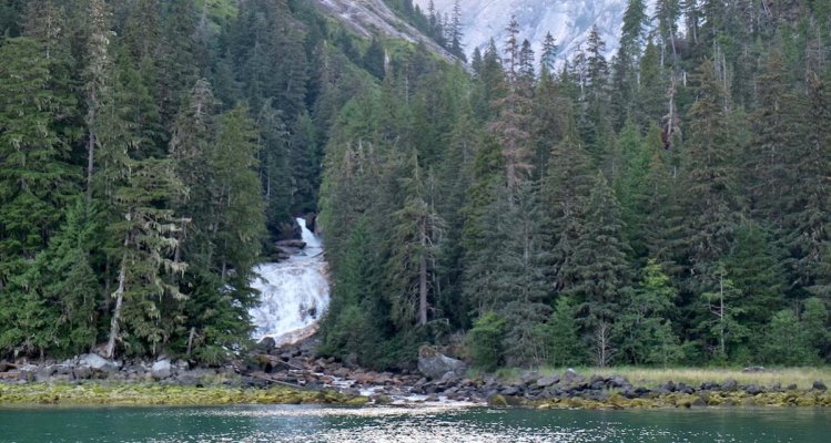
Falls near Bottleneck Inlet, and our friends on Toot Sweet, May 2017:

Khutze Inlet, late August 2017
Handfield Bay, September 2017

Khutze Inlet, late August 2017
Handfield Bay, September 2017
MurrayM
Guru
Falls near Bottleneck Inlet, and our friends on Toot Sweet, May 2017
Khutze Inlet, late August 2017
Handfield Bay, September 2017
Niiiiice
Bottleneck Inlet now on our must visit list. Thanks!
MurrayM
Guru
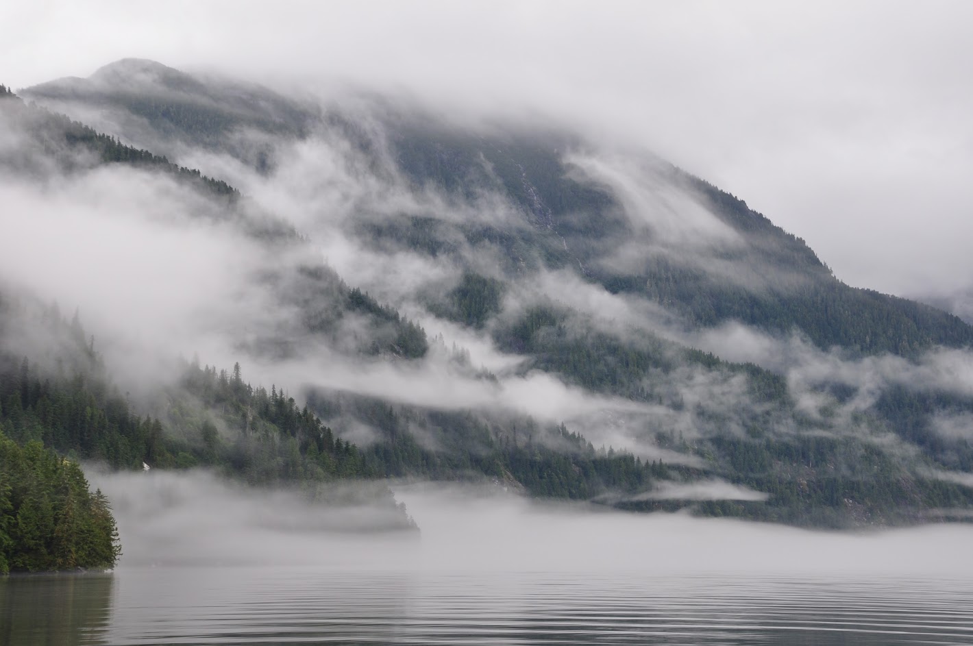
Gardner Canal, off Douglas Channel, north coast BC.
About 1/2 way up 60 mile long Douglas Channel is 60 mile long Gardner Canal. Most people don't venture into Gardner Canal as they pass by on the "Inside Passage Treadmill" but there is lots to justify the 180 mile detour.
Photo 1) Around point on the right, Gardner Canal still has 30 miles to go.
Photo 2) Typical shoreline and glacial melt green water.
Photo 3) Entering Brim River "Bay".
Photo 4) Waterfall from anchor.
Photo 5) Brim River Valley at sunset from anchor.
Photo 6) Badger at anchor in front of Brim River estuary.
Attachments


Last edited:
- Joined
- Oct 6, 2007
- Messages
- 841
- Location
- Poulsbo, WA
- Vessel Name
- Dream Catcher
- Vessel Make
- Nordic Tug 37-065
Wow - guess I need to make it up there!
MurrayM
Guru
Wow - guess I need to make it up there!
Three hot springs (Bishop Bay, Europa, and Weewanie) are in the area as well.
Sabre602
Senior Member
- Joined
- Oct 19, 2017
- Messages
- 442
- Location
- United States
- Vessel Name
- Kingfisher
- Vessel Make
- 37' converted gillnetter/crabber
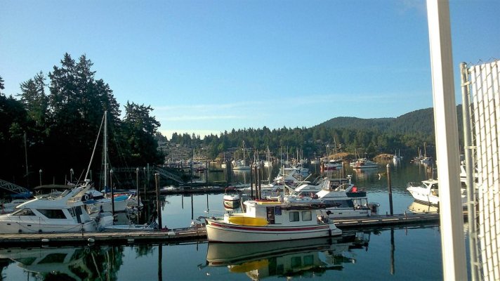
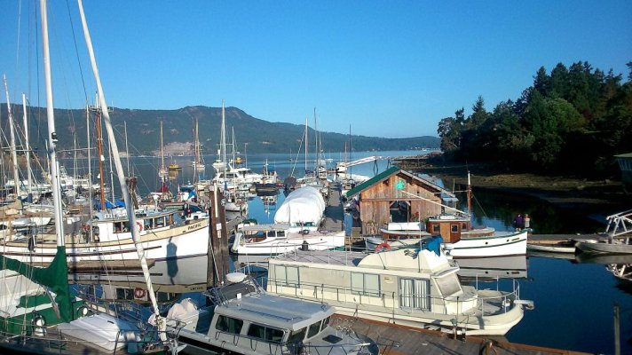
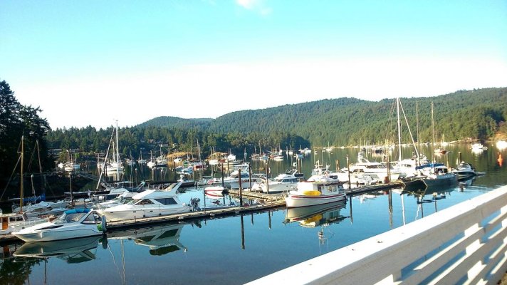
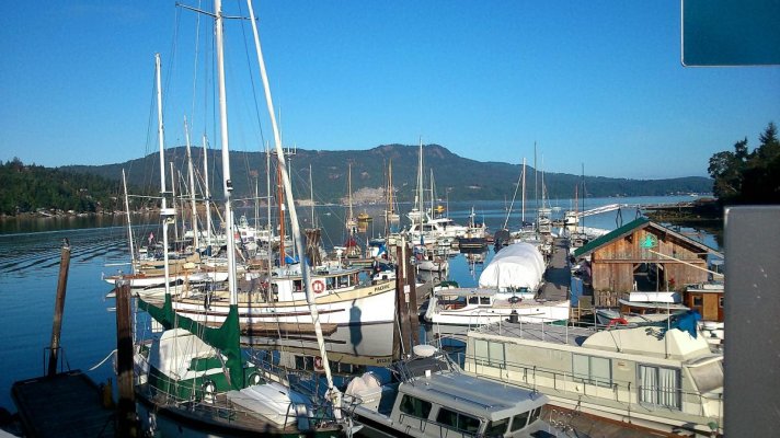
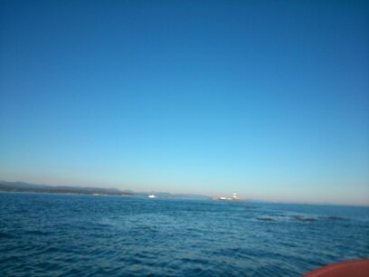
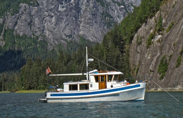
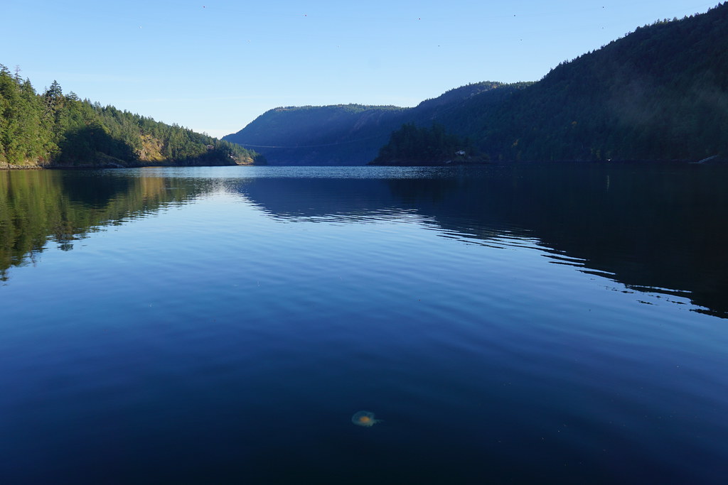
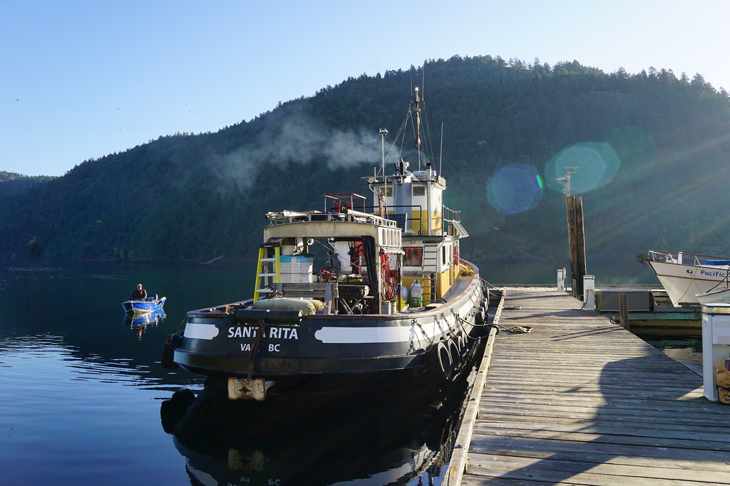
Goldstream Boathouse marina, way down at the southern end of Saanich Inlet...

...and the view up the inlet. See the jellyfish?
The locals are very friendly and have some really beautiful boats...


...and the view up the inlet. See the jellyfish?
The locals are very friendly and have some really beautiful boats...
Ken E.
Guru
- Joined
- Nov 12, 2016
- Messages
- 1,977
- Location
- United States
- Vessel Name
- Hatt Trick
- Vessel Make
- 45' Hatteras Convertible
Richard.....We were in Handfield with you, farther back into the bay. I also remember Toot Sweet rounding Cape Caution about when we did, on the way down. Thanks for posting the pictures.
_________________________
Ken. Hatt Trick
_________________________
Ken. Hatt Trick
- Joined
- Oct 6, 2007
- Messages
- 841
- Location
- Poulsbo, WA
- Vessel Name
- Dream Catcher
- Vessel Make
- Nordic Tug 37-065
Hi Ken,
We did see you at Handfield. Also anchored in Dry Pass on the west side of PofW, IIRC. Met you first at Port McNeill, spring 2016, on our way toward rounding Cape Caution on our first trip north in Dream Catcher. And yes, she does roll some.
We did see you at Handfield. Also anchored in Dry Pass on the west side of PofW, IIRC. Met you first at Port McNeill, spring 2016, on our way toward rounding Cape Caution on our first trip north in Dream Catcher. And yes, she does roll some.
QB
Senior Member
- Joined
- Dec 25, 2011
- Messages
- 228
- Location
- USA and Canada
- Vessel Name
- Skookum Maru
- Vessel Make
- Ed Monk design #1924
OP
OP
OFB
Guru
- Joined
- Mar 30, 2012
- Messages
- 638
- Location
- Canada
- Vessel Name
- Invader no1
- Vessel Make
- Kishi Boat works
I have to spend more time farther up the coast. Some spectacular spots , thanks for the share guys.
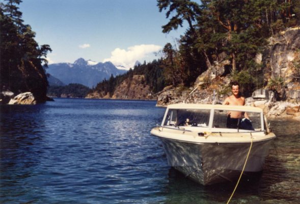
As a kid spent a lot of time playing in Sannich inlet. Skiing in todd inlet and fishing .
Love the pics. Keep em coming please. I cant be the only guy enjoying them.
As a kid spent a lot of time playing in Sannich inlet. Skiing in todd inlet and fishing .
Love the pics. Keep em coming please. I cant be the only guy enjoying them.
Attachments


Similar threads
- Replies
- 95
- Views
- 6K
- Replies
- 25
- Views
- 4K
- Replies
- 93
- Views
- 8K