You are using an out of date browser. It may not display this or other websites correctly.
You should upgrade or use an alternative browser.
You should upgrade or use an alternative browser.
Finally Heading South
- Thread starter O C Diver
- Start date
The friendliest place on the web for anyone who enjoys boating.
If you have answers, please help by responding to the unanswered posts.
If you have answers, please help by responding to the unanswered posts.
O C Diver
Guru
- Joined
- Dec 16, 2010
- Messages
- 12,868
- Location
- USA
- Vessel Name
- Slow Hand
- Vessel Make
- Cherubini Independence 45
WOW! My charts won't support that route. Was it max tide when you did it?
Actually, there is a channel, but it's blocked from the satellites because of proximity to the sub base.
Ted
Wayfarer
Guru
- Joined
- Aug 29, 2014
- Messages
- 2,228
- Location
- USA
- Vessel Name
- Sylphide
- Vessel Make
- Kingston Aluminum Yacht 44' Custom
Nope, not Ohio class, no wing (or whatever it's called) on the conning tower.
Ted
Fairwater planes, which I've just now learned have the advantage of allowing the depth of the ship to be controlled without inducing the same pitch that a bow plane would. Makes sense.

menzies
Guru
Nope, not Ohio class, no wing (or whatever it's called) on the conning tower.
Ted
Interesting. There are non listed as stationed in Kings Bay. Most up in New London (Groton), with a few here and there like Hawaii.
O C Diver
Guru
- Joined
- Dec 16, 2010
- Messages
- 12,868
- Location
- USA
- Vessel Name
- Slow Hand
- Vessel Make
- Cherubini Independence 45
Interesting. There are non listed as stationed in Kings Bay. Most up in New London (Groton), with a few here and there like Hawaii.
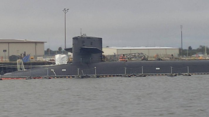
Too be honest, I don't know that it was a Virginia class sub. It was absent the Fairwater plane and appeared smaller than the Ohio class. It was tied up right at the front of the base which seems odd as their usually well inside or out in the Degaussing station. Maybe an unintended stop.
Ted
fryedaze
Guru
- Joined
- Sep 4, 2011
- Messages
- 1,722
- Location
- USA
- Vessel Name
- Fryedaze
- Vessel Make
- MC 42 (Overseas Co) Monk 42
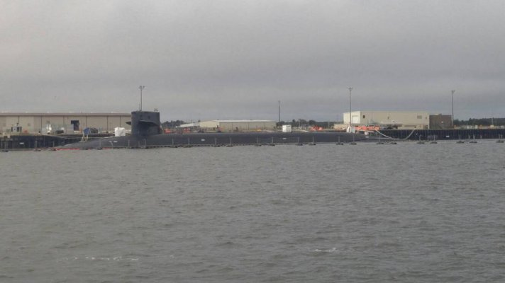
This is at the dock today.Too be honest, I don't know that it was a Virginia class sub. It was absent the Fairwater plane and appeared smaller than the Ohio class. It was tied up right at the front of the base which seems odd as their usually well inside or out in the Degaussing station. Maybe an unintended stop.
Ted
I didn't have the stones to do your short cut[emoji33]


O C Diver
Guru
- Joined
- Dec 16, 2010
- Messages
- 12,868
- Location
- USA
- Vessel Name
- Slow Hand
- Vessel Make
- Cherubini Independence 45
This is at the dock today.
I didn't have the stones to do your short cut[emoji33]View attachment 110328View attachment 110329
Well either a different sub or I need to make an appointment with the optometrist.
Wrong tide state for the short cut? You definitely need a high tide.
Ted
fryedaze
Guru
- Joined
- Sep 4, 2011
- Messages
- 1,722
- Location
- USA
- Vessel Name
- Fryedaze
- Vessel Make
- MC 42 (Overseas Co) Monk 42
Tide was +2' and rising. Just can't bring myself to trying without a route or charts that don't show land.[emoji27]Well either a different sub or I need to make an appointment with the optometrist.
Wrong tide state for the short cut? You definitely need a high tide.
Ted
Similar threads
- Replies
- 18
- Views
- 2K
